Warangal Fort: Kakatiya Capital and Fortified Complex in India
Site at a Glance
- Rating
- 4.4
- Popularity
- Very High
- Country
- India
- Primary era
- Medieval
- Eras represented
- Medieval, Early Modern
- Civilizations
- Delhi Sultanate
- Site type
- Military
- Remains
- Fort
On this page18 sections
History
Warangal Fort is a medieval fortified complex in Warangal, India, developed by the Kakatiya dynasty as the capital of its kingdom. The fort appears to have existed by at least the twelfth century, when an earlier brick structure began to be replaced with stone. Its principal defensive and temple complex took shape during the reigns of Ganapatideva, Rudrama Devi, and Prataparudra II, before the city became the target of repeated campaigns by the Delhi Sultanate.
Kakatiya Capital
Warangal had earlier been ruled by the Rashtrakuta dynasty in the eighth century and by the Western Chalukya Empire in the tenth century. It came under the sovereign Kakatiyas in the twelfth century and served as their capital. Ganapatideva, who ruled from 1199 to 1262, replaced the earlier brick fortification with stone. His daughter Rudrama Devi completed the construction and strengthened the defenses during her reign, which ended in 1289. Her grandson Prataparudra II added further height, gateways, bastions, and circular earthen defenses.
The Kakatiya rulers successively expanded the fort with square projecting defensive structures called bastions, higher walls, and additional earthen enclosures. Prataparudra II also became closely associated with the fort’s resistance to the Delhi Sultanate, a group of Muslim-ruled dynasties based in Delhi that expanded into the Deccan.
Delhi Sultanate Sieges
In 1309, Malik Kafur, the general of Sultan Alauddin Khalji, besieged Warangal. The siege lasted more than six months before Prataparudra II agreed to a truce. Malik Kafur took the Koh-i-Noor, a historically famous diamond, and other treasures to Delhi, departing in March 1310 with booty carried by about 2,000 camels.
The historian Amir Khusrow described the defenses during the campaign as an outer hardened-mud fortification with a deep ditch and an inner stone fortress surrounded by a moat. His account corresponds to the two inner defensive circles that survive at Warangal. In 1318, an army of Qutbuddin Mubarak Shah, commanded by Khusro Khan, attacked again. The besiegers built an earthen ramp about 450 feet, or 140 metres, across the moat, breached the stone walls, and forced Prataparudra II to agree to an annual payment of horses and elephants.
Conquest and Later Rule
In 1320, Sultan Ghiyath al-Din Tughluq sent his son Ulugh Khan against Warangal because Prataparudra II had refused to recognize Tughluq authority and pay tribute. Internal dissension caused Ulugh Khan to retreat to Devagiri, but he returned after four to six months. His next campaign began in 1323 with 63,000 mounted soldiers. After a five-month siege, the defenders had been reduced to a few thousand troops. Food had also been distributed to the population during an earlier celebration of victory. When Sultanate forces massacred people outside the fort, Prataparudra II surrendered and opened the gates.
After the conquest, Sultanate troops plundered and destroyed the capital inside and outside the stone wall. Temples, royal enclosures, water tanks, palaces, farmlands, and other major structures were affected, and the great Swayambhu Shiva Temple was ordered destroyed. Prataparudra II was sent toward Delhi and died on the banks of the Narmada River. Tradition holds that he took his own life in 1323.
The city was renamed Sultanpur, and imperial coins were minted there from 1324 to 1332. The Delhi Sultanate held the city until 1335, when a union of 72 local Nayaka chieftains took control. The Musunuri Nayakas, a fourteenth-century Telugu ruling house, later governed the fort. It subsequently passed to the Bahmani Sultanate, a later Deccan Muslim kingdom, the Qutb Shahi dynasty of Golconda, and the Nizam of Hyderabad, the hereditary ruler of Hyderabad under the Asaf Jahi dynasty.
A mosque was built beside the fort by Tughluq authorities after the 1323 conquest, but local Nayaka chieftains demolished it in 1335. Between the fifteenth and seventeenth centuries, the fort was modified further, especially through the addition of barbicans, or outer defenses protecting entrances, to the four stone-wall gates and to entrances in the outer earthen wall.
Modern Recognition
The former site of the great Shiva temple remains an archaeological zone, where excavations have revealed small shrines and votive lingas, symbolic representations of Shiva used as religious offerings. The original four-faced Shiva linga is worshipped in a separate shrine south of the fort complex. The Archaeological Survey of India lists the ruins as a Monument of National Importance, and Warangal Fort has been included on UNESCO’s Tentative List of World Heritage Sites since India’s submission on 10 September 2010.
The Kakatiya arch has also been incorporated into the official emblem of Telangana, created when the state was formed through the bifurcation of Andhra Pradesh.
Remains
Warangal Fort is organized through three concentric circular defensive walls. The inner stone circle forms the central fort, while two earthen rings extend around it. An east-west road crosses the fort area, where some habitation remains, and the central archaeological zone contains the ruins of the great Shiva temple, its four entrance portals, a large water tank, and other surviving structures.
Defensive Circles
Inner Earthen Wall
The first defensive circle was built during Rudrama Devi’s reign as an earthen embankment about 1.5 miles, or 2.4 kilometres, in diameter. A moat approximately 150 feet, or 46 metres, wide surrounded it. Eighteen stone steps follow the gradual inner slope of the embankment and provided access to the ramparts from different parts of the fort. In 1318, Prataparudra II used these steps to reach the rampart and bow toward Delhi while wearing a qaba, a long outer robe.
Stone Fortification
The second circle is a fortified stone wall about 0.75 miles, or 1.21 kilometres, in diameter. It was built from very large dressed granite blocks fitted closely without mortar and formed the central fort of the Kakatiya capital. Rudrama Devi raised the wall to 29 feet, or 8.8 metres, from the earlier structure built under Ganapatideva. Forty-five large rectangular bastions project toward the moat, each measuring approximately 40 to 60 feet, or 12 to 18 metres, on a side.
Outer Earthen Ring
The third defensive ring is an earthen wall approximately 12.5 kilometres, or 7.8 miles, in diameter. It encloses the present city of Warangal and forms the widest of the fort’s three circular defenses.
Temple Archaeological Zone
Four Stone Portals
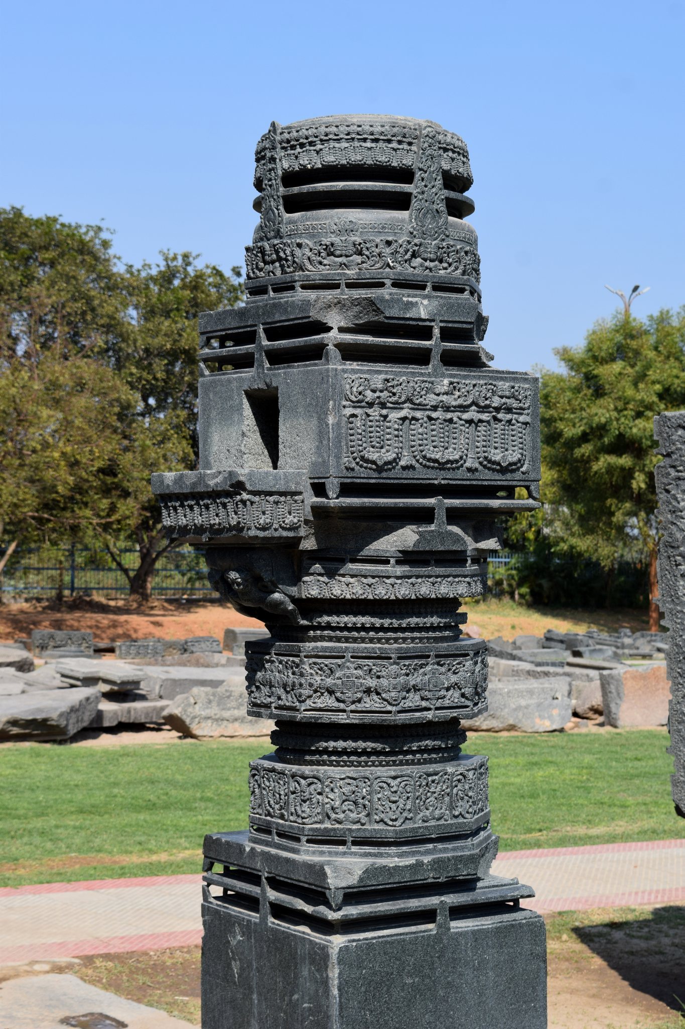
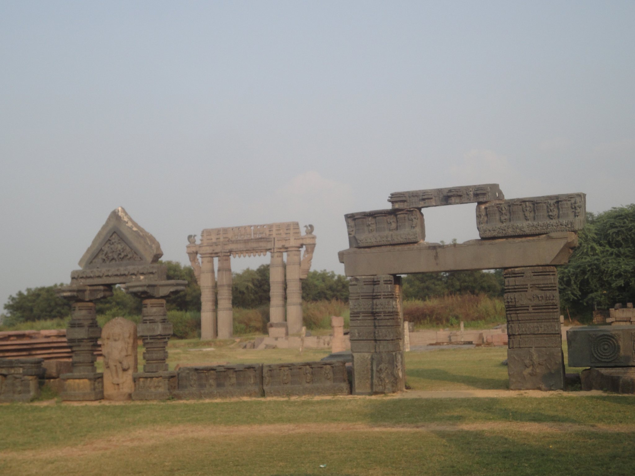
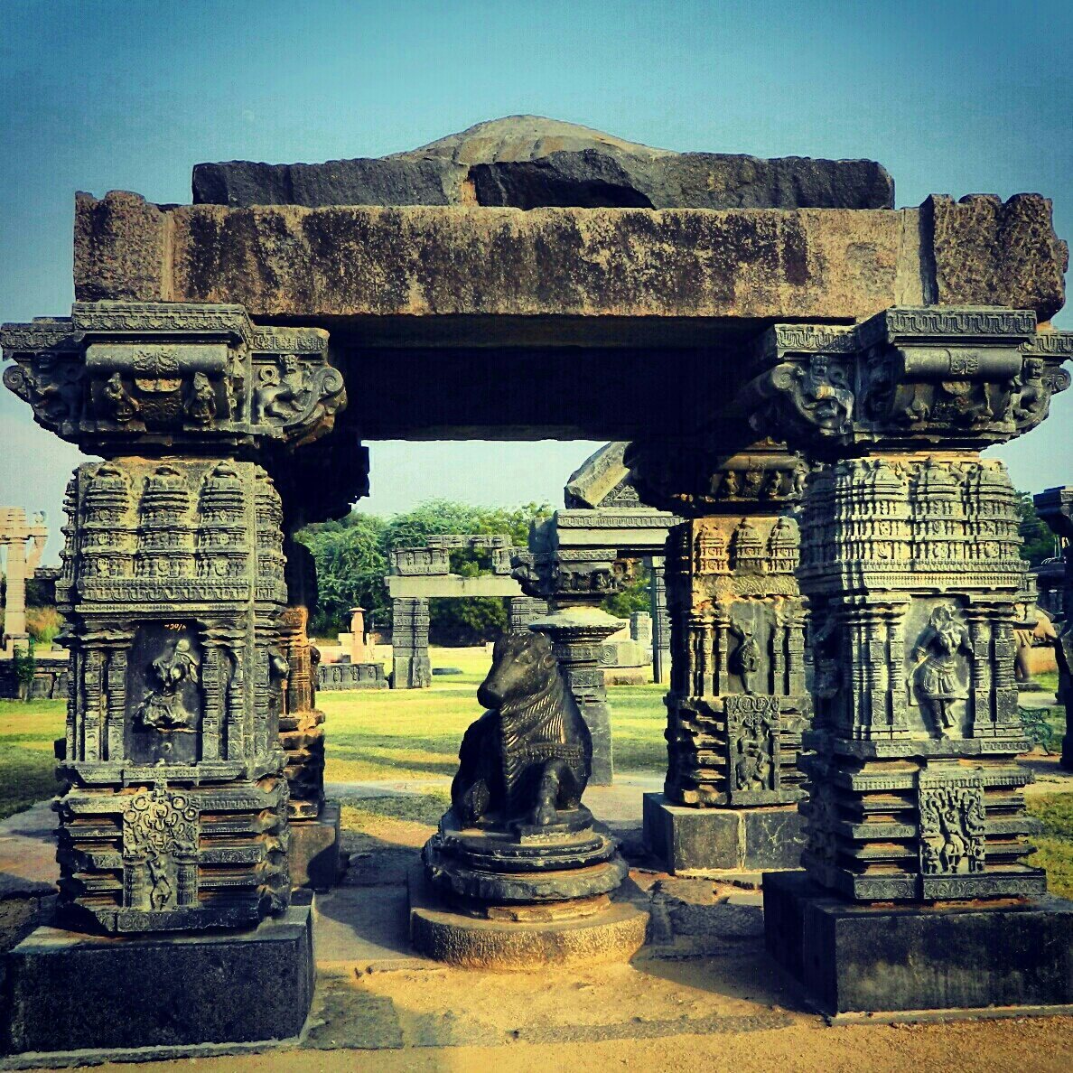
The central zone contains four freestanding entrance portals, locally called charkamou. Each portal is about 10 metres, or 33 feet, high and has twin pillars with angled brackets supporting a massive lintel. Lotus buds, looped garlands, mythical animals, and birds with foliated tails cover the stonework. The carvings do not include religious symbols, a feature associated with their preservation during the Muslim invasions. The northern and southern portals stand about 480 feet, or 150 metres, apart, while the eastern and western portals are about 433 feet, or 132 metres, apart.
Shiva Temple Remains
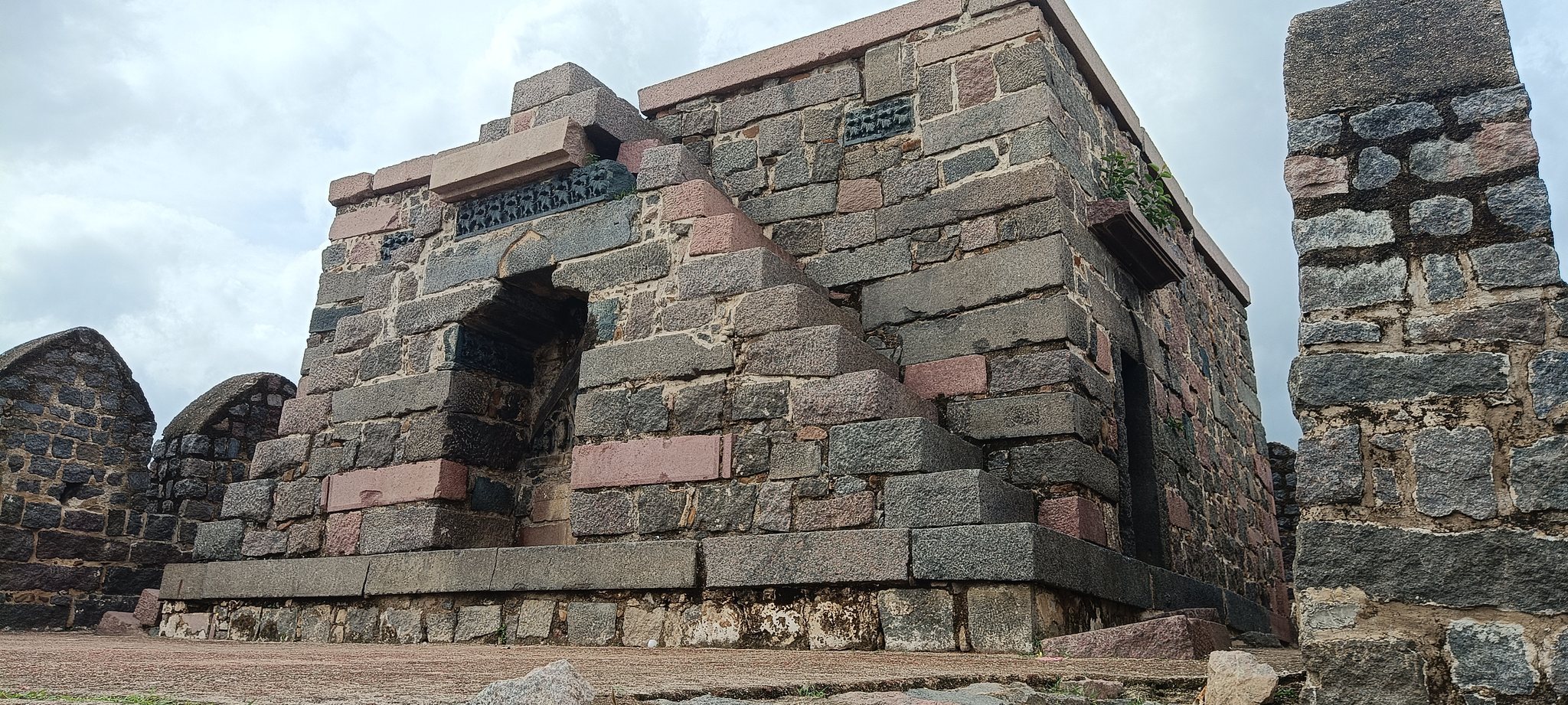
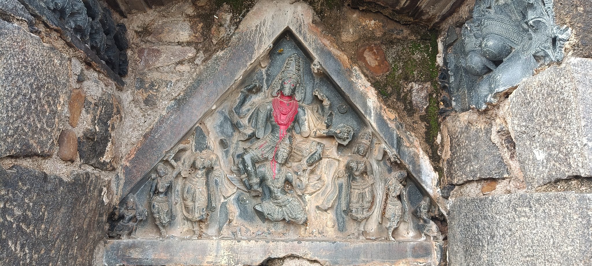
The Shiva temple itself was destroyed, leaving scattered wall slabs, brackets, ceiling panels, and standing pillars. Some architectural pieces are displayed in an outdoor museum. Several pillars were reused by the Bahmani Sultanate in an incomplete mosque. The temple’s original deity was a four-faced Shiva linga, which is now installed in a separate shrine south of the fort complex and continues to receive worship.
Water Tank and Orugallu
A large water tank occupies the southern quarter of the archaeological zone. A distinctive natural rock rises above the water, and a small temple has been built over it. The rock is called Orugallu, meaning “single rock,” and gave Warangal its name.
Later Buildings and Smaller Shrines
Kush Mahal
About 150 metres, or 490 feet, from the archaeological zone stands the Kush Mahal, a rectangular public hall built by the Delhi Sultans in the fourteenth century. Its massive sloping walls contain six arched openings on each side. A timber roof was originally supported by five transverse stone arches, and steps at the northeastern corner lead to the top of the building.
Linga Gudi
In the northwestern part of the second defensive circle, outside the central fort, is Linga gudi, a group of three small temples. Their linga deities have been removed and lie scattered nearby.
Granaries and Inscriptions
The complex also contains additional temples, water ponds, and three large granaries near the south gate. Numerous Telugu inscriptions appear on the main temple wall, on pillars, on a stone outside the fort, and at other locations. Many record gifts made by a Kakatiya king.