Sutter’s Fort: A Mexican-Era Fort and Agricultural Colony
Site at a Glance
- Country
- United States
- Primary era
- Modern
- Eras represented
- Modern
- Civilizations
- Unclassified
- Site type
- Military
- Remains
- Fort
On this page11 sections
History
Sutter’s Fort is a reconstructed historic fort in Sacramento, California, United States, begun in 1841 by John Sutter as the fortified center of his agricultural and trading colony. The colony, Nueva Helvetia, began in 1839 under Mexican rule. The fort later served migrants entering California and figured in the events surrounding the 1848 Gold Rush.
Founding Nueva Helvetia
Sutter reached Yerba Buena from Sitka on July 2, 1839, then travelled to Monterey to complete Mexican immigration formalities and seek a land grant from Juan Bautista Alvarado, governor of Mexican Alta California. He presented himself as a Catholic, denied pursuing British, Russian, or United States interests, and said he wished to settle apart from Mexican communities. After returning to Yerba Buena on July 7, he sold his ship and continued by riverboat up the Sacramento River toward the American River.
On August 13, 1839, Sutter and a reduced party established Nueva Helvetia, meaning New Switzerland. European carpenters and other workers joined the settlement, and Hawaiian laborers were among its first residents. It became the first non-Indigenous community in California’s Central Valley. Sutter became a Mexican citizen on August 29, 1840. On June 18, 1841, Alvarado granted him 11 square leagues, the maximum permitted by Mexican law, covering about 197 square kilometres, or roughly 50,000 acres.
The colony relied on ranching and crops including wheat, as well as the work of Indigenous Californians and Hawaiians. Sutter imposed a strongly unequal labor system: some workers served voluntarily, while others faced coercion and harsh conditions comparable to enslavement or serfdom. By autumn 1840, about 20 Europeans and many Indigenous people worked for him.
The fort and migration
Construction of the fort began in 1841 and took about four years to reach its developed form. Sutter said it was intended to protect against Indigenous raids and rival Californians. It also served as the colony’s center, accommodating agricultural operations and workshops.
The settlement received foreign visitors interested in California’s prospects. French and United States expeditions arrived in 1841, followed by a Swedish scientific expedition in 1842. U.S. Army officer and explorer John C. Frémont, accompanied by guide Kit Carson, reached Nueva Helvetia on March 6, 1844. The party remained until March 24 to rest and replenish its supplies. Sutter maintained commercial and social ties with visitors from abroad and considered whether his territory might separate from Mexico under the protection of another power.
The fort also became a stopping place for people travelling into California. Many migrants on the California Trail and the route south from Oregon through the Sacramento Valley passed through it. California Trail travellers crossed the Sierra Nevada by Donner or Carson Pass. Acting as a Mexican official, Sutter issued passes valid in California and elsewhere in Mexico. The site is associated with the Donner Party, a group of emigrants stranded in the Sierra Nevada during the winter of 1846, as well as with the California and Siskiyou trails.
In 1845, California’s territorial government offered to purchase Nueva Helvetia, hoping to control this important passage and limit growing migration from the United States. Sutter refused, a decision he later regretted.
War and transfer of control
The Mexican-American War, a conflict between Mexico and the United States amid disputes over expansion and the annexation of Texas, began on May 13, 1846. Californians of Spanish descent pursued independence through the Junta of Monterey, while American settlers proclaimed the California Republic at Sonoma on June 14. Frémont’s force stayed at Nueva Helvetia in mid-June and left a small garrison at the fort. It defeated the Junta’s forces in July, and the United States flag was raised at the fort on July 11.
On May 24, 1847, half a company of the First Regiment of New York Volunteers entered the fort, and Sutter relinquished command. That year, the old Coloma Road opened between the fort and Coloma. James W. Marshall travelled along it to report his discovery of gold to Sutter, and thousands of miners later used the road. From 1849, California’s first stage line, operated by the California Stage Company, also ran along it. James E. Birch founded the company.
The Gold Rush and decline
On January 24, 1848, Marshall found gold at Sutter’s Mill, Sutter’s sawmill at Coloma. Four days later, he met Sutter privately in the fort’s main building and showed him the gold. The resulting rush drew many workers away from the colony, leaving crops unharvested and shop work unfinished. The main building became a hotel that earned Sutter $500 a month in rent, and he also leased land.
Sutter faced additional financial pressure when the Russian-American Company demanded the remaining payment for his purchase of Fort Ross. In October 1848, he gave his son, Johann August Sutter Jr., power of attorney. His son sold land around the fort, helping establish Sacramento, with Peter Burnett acting as Sutter’s agent. Sutter leased the entire fort in March 1849. It was largely deserted by the 1850s, in poor condition by 1855, and by about 1865 all but the main building had fallen into ruin.
Preservation and interpretation
When Sacramento sought to demolish the deteriorated property, the Native Sons of the Golden West bought it in 1891. Repairs and restoration, supported by state funds and private donations, were substantially complete by April 1893. The fort was rededicated on April 26 and transferred to California. The state legislature had approved money for its reconstruction and upkeep.
The museum’s focus shifted from general displays of nineteenth-century pioneer objects toward interpreting Sutter’s settlement. California’s parks department took responsibility in 1947 and later oversaw a further reconstruction based on a fort plan published by Heinrich Künzel in 1848. The state historic park interprets pioneer life around 1840, with particular attention to school groups. From 2020, the presentation of California’s colonization history was under discussion, and Indigenous representatives took part in developing a new interpretation. Sutter’s Fort became a National Historic Landmark in 1961, a designation for sites judged nationally important in United States history, and joined the National Register of Historic Places, the federal list of historic properties, in 1966. The associated landing place was listed as California Historical Landmark No. 591 in 1957; the Coloma Road location is landmark No. 745.
Remains
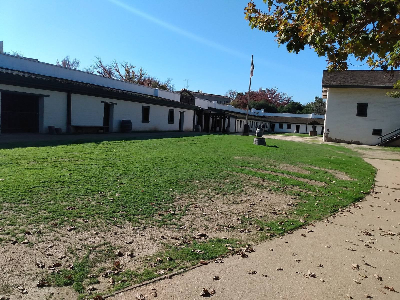
The reconstructed fort presents an adobe-walled compound on level ground near the confluence of the American and Sacramento rivers. Its buildings and work areas were organized within the enclosure, which stood near the colony’s landing place and river routes.
River setting
The 2.35-hectare site lies east of present-day central Sacramento, about 20 feet (6.1 metres) above mean sea level. The ground slopes down north toward the American River and west toward the Sacramento River, and rises gradually to the south and east. Sutter’s Landing, on the American River, is associated with his arrival in August 1839 and served as a base camp before construction of the fort.
Walls and defensive towers
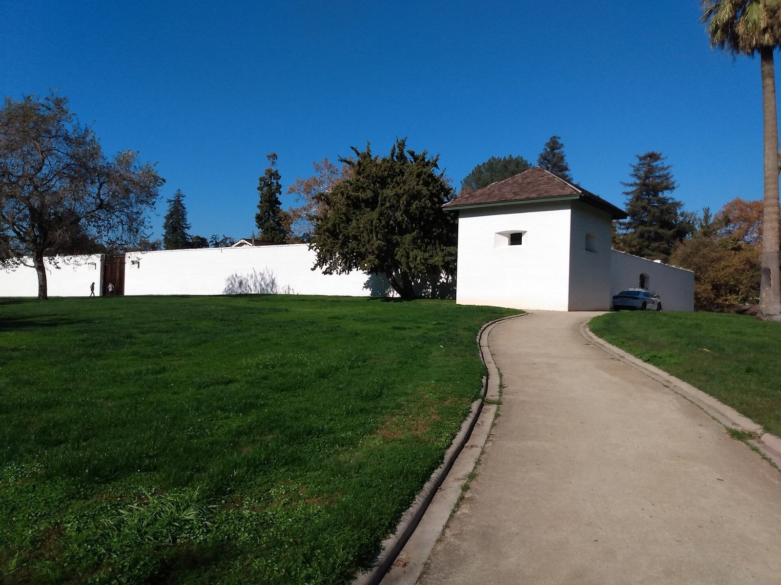
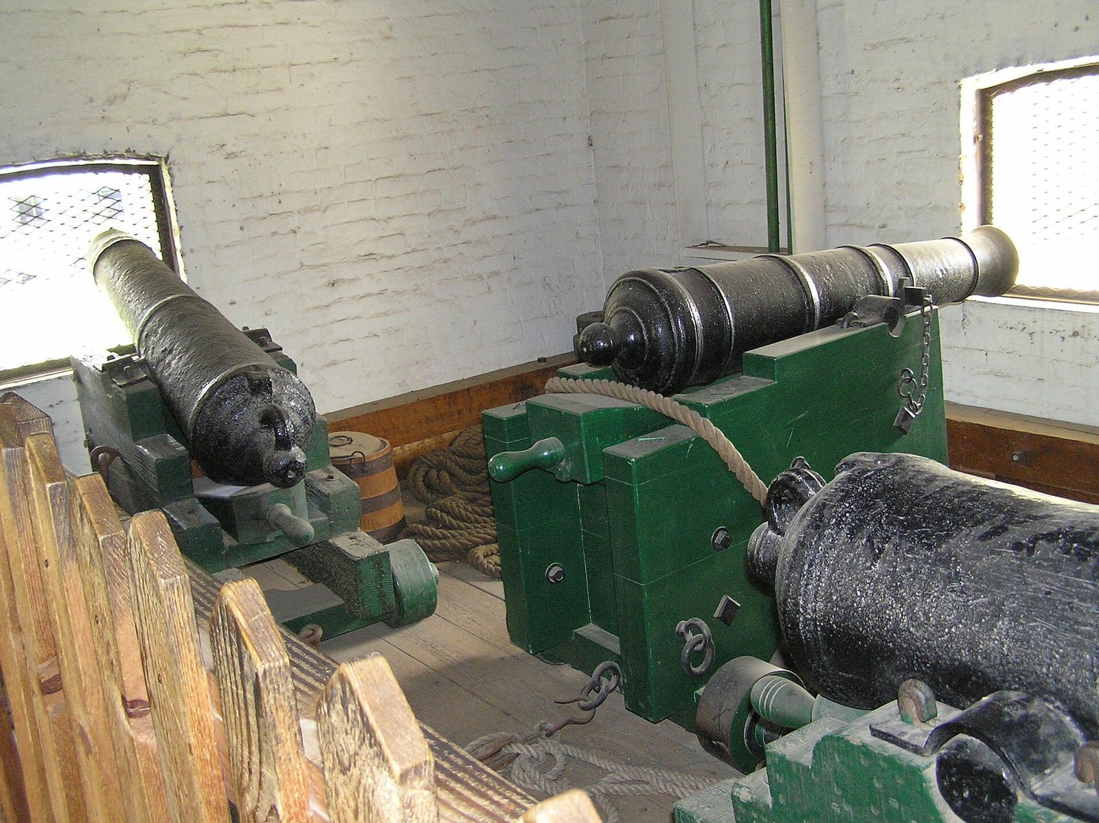
The original enclosure covered about 7,000 square metres. Its walls were made of adobe, sun-dried earthen brick, about 0.76 metres thick and roughly 5.5 metres high, with gates on the north, south, and west sides. Two projecting defensive towers stood at corners; their walls were 1.5 metres thick. Each held two cannons designed to fire nine-pound balls and two for six-pound balls. The fort had 12 cannons in total.
Main building
Built between 1841 and 1843, the main building was an air-dried adobe structure of roughly two storeys, with oak-board ceilings and interior walls. It is the only original structure surviving within the reconstructed state historic park.
Settlement and work buildings
An earlier one-storey adobe building with three rooms served Sutter and the workshops, while Hawaiian settlers initially lived in grass huts. Within the later enclosure, barracks for a force of 150 Indigenous people, residences, and workshops were arranged along the inside of the perimeter wall. The working complex also included a mill, bakery, wool-blanket manufactory, and tannery.