Shahr-e Sukhteh: An Ancient Urban Settlement in Iran
Site at a Glance
- Popularity
- Very High
- Country
- Iran
- Primary era
- Bronze Age
- Eras represented
- Stone Age, Bronze Age
- Civilizations
- Unclassified
- Site type
- City
On this page19 sections
History
Shahr-e Sukhteh is an ancient urban settlement in Iran, on river-deposited land near the former mouth of the Helmand River at Hamun Lake. It emerged around 3550 BC during the Late Chalcolithic, the later part of the Copper Age, and continued into the Bronze Age. Its inhabitants were associated with the Helmand culture, an archaeological culture of Bronze Age communities in the Helmand region. The settlement’s four main periods lasted until about 2300 BC, and its history reflects changing trade connections, craft production, and organized urban life.
Period I, about 3550–3000 BC
In its earliest period, the settlement had connections with southern Turkmenistan, Kandahar, the Quetta and Bampur valleys, and early cities in Khuzestan and Fars. Around 3000 BC, local potters began reproducing styles associated with Turkmenistan. Pottery also arrived from the Kech-Makran and Iranian Baluchistan regions, as well as from Mundigak in present-day Afghanistan.
A major fire around 3000 BC destroyed much of the settlement. The name Burnt City grew from ash deposits around the site. Colonel Beit, a British officer who visited Sistan during the Qajar dynasty, was among the first to mention the place and attributed the ash to a conflagration. Industrial kilns and later fires lit by nomadic visitors have also been proposed as sources of some of the ash. Archaeologist Massimo Vidale proposed that the city passed through four cultural stages and burned three times before its abandonment.
Period II, 3000–2600 BC
During Period II, Shahr-e Sukhteh maintained links with early centers in the Indus Valley and with Bampur, while its ties with Mundigak appear to have been particularly close. Lapis lazuli from Badakhshan, a region in northeastern Afghanistan known for the stone, is thought to have reached the city through Mundigak. Goods formerly brought from Mesopotamia and western Iran had disappeared by the end of Phase 4 of this period.
The city was rebuilt in Phase 6, although some houses that had been destroyed were not reconstructed. The settlement expanded during Phases 6 and 5, alongside developments in pottery production. In Phase 4, larger buildings were erected and pottery became more standardized. The inhabitants also developed specialized crafts, including pottery and jewelry making, stoneworking, weaving, and producing mats, baskets, and fishing nets.
Farming and the surrounding wetlands supported a varied economy. Plant remains include wheat, barley, hemp, melon, and grapes. Animal remains include fish, birds, and crustaceans, while goat, gazelle, and sheep together account for 99 percent of the animal remains. Water birds, pheasants, ducks, and geese were eaten, and some water birds may have been kept. Thousands of stone arrowheads point to regular bird hunting. By the third millennium BC, the settlement also had an organized civic system and government, alongside a shared religion.
Periods III and IV, 2600–2300 BC
During Period III, the city continued to exchange goods with Mundigak, Bampur, and centers in the Indus Valley. Some archaeologists identify connections between Shahr-e Sukhteh’s first three periods and Mundigak’s third and fourth periods. In Period IV, contacts appear to have focused almost entirely on Bampur and Kandahar.
Radiocarbon dating, which estimates the age of material by measuring radioactive carbon, revised the estimated abandonment date from about 1800 BC to around 2300 BC. A phase of abandonment in Area 33 dates to about 2450–2350 BC. Vidale interpreted it as the final phase of intensive urban occupation across the settlement, though activity in that area does not by itself establish when all activity at the site ended. The cause of the city’s final decline remains uncertain. Neighboring incursions and a change in the Helmand River’s course have both been proposed, but neither is established as the cause.
Limited occupation of the Burnt Building continued during Period V, around 2100–2000 BC. This may have been an isolated survival rather than a continuation of the former urban system. Archaeologists Maurizio Tosi and Raffaele Biscione considered the building to have been destroyed by a major fire around 2000 BC.
The site’s cultural classification remains debated. Many researchers associate it with the Bronze Age Helmand culture; others connect it with the contemporaneous Jiroft culture of southeastern Iran. Ezzatollah Negahban classified it among sites associated with Elam, an ancient civilization centered in southwestern Iran. A hypothesis proposes that people moved from the north to the Helmand delta around 2900 BC, with some later migrating toward the Punjab after the river changed course. The further suggestion that these migrants founded the Indus Valley cities of Mohenjo-daro and Harappa remains unproven. Shahr-e Sukhteh pottery has been compared with material from the Punjab and Shahdad, and its designs have been described as closer to those examples than to Mesopotamian pottery.
Rediscovery and archaeological study
Aurel Stein investigated the site in the early twentieth century, including during a visit in 1937. An Italian team led by Tosi excavated there from 1967 to 1978. Work resumed in 1997 under the Iranian Cultural Heritage and Tourism Organization, with Seyed Mansour Seyed Sajjadi leading the team. Excavations in 2018 and 2019 in Areas 26, 33, 35, and 36 helped establish a revised chronological sequence of the site’s layers, published in 2022. An excavation team led by Sajjadi also recovered a Proto-Elamite accounting tablet in 2021. Proto-Elamite was an early writing tradition associated with southwestern Iran, before the later Elamite script.
UNESCO added the site to the World Heritage List in June 2014 under the name Shahr-i Sokhta. It is also listed as Iranian national heritage.
Remains
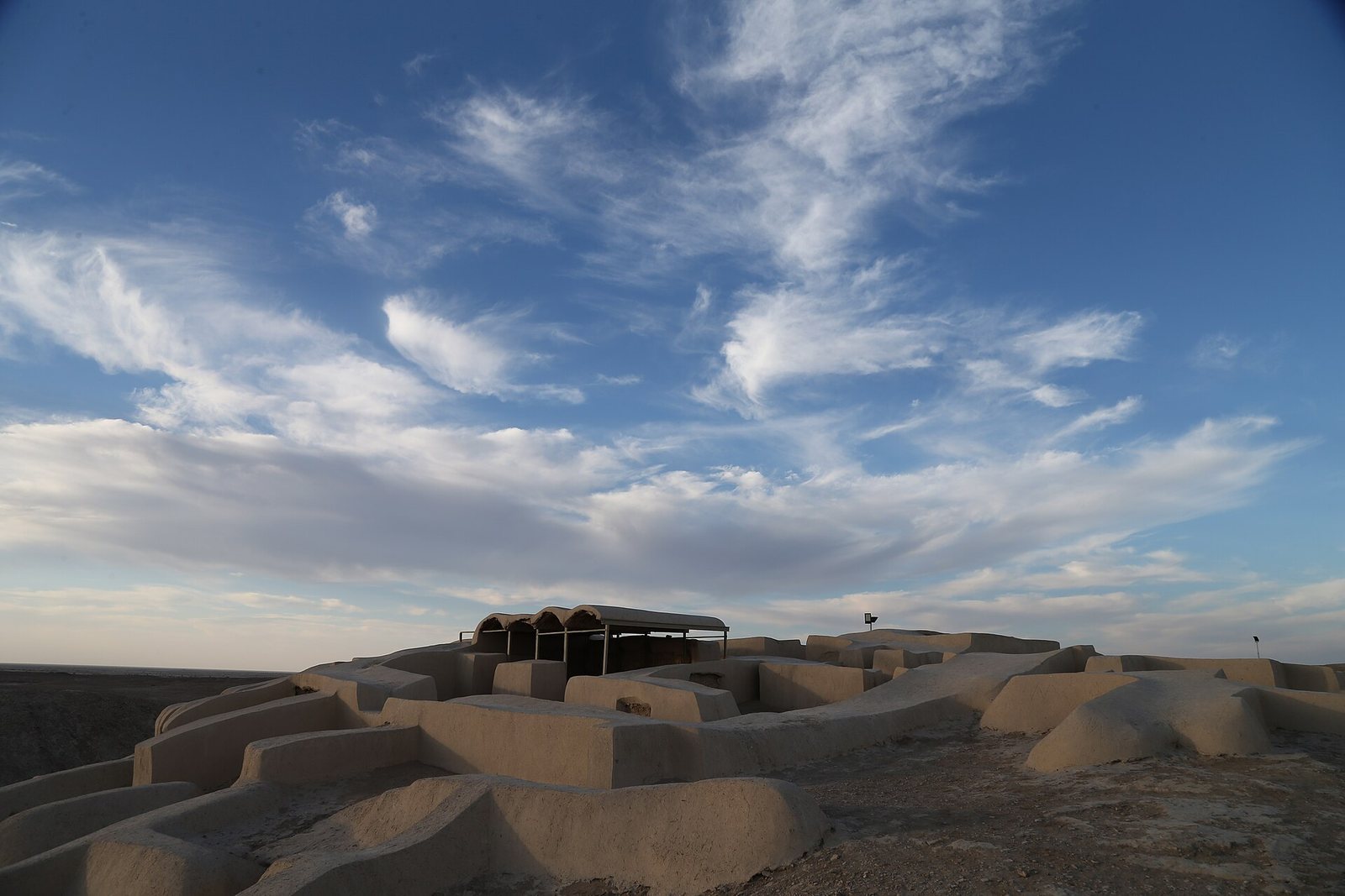
The archaeological area covers about 200 hectares, with a maximum built area of roughly 120 hectares; an earlier estimate put the site at 151 hectares. The remains rise about 18 metres above the surrounding ground. The settlement had five main sectors, including residential quarters, a central area, craft and monumental districts, and a cemetery. Large buildings with massive surrounding walls form part of the evidence for its successive urban phases.
Urban layout and infrastructure
Settlement sectors
The Eastern Residential Area occupies the settlement’s highest ground, north of the Burnt Building. The Great Central Area, also called the Central Quarters, lies within the broader urban layout. Craftsman Quarters occupy the northwest, with the Monumental Area to their east; the cemetery lies in the southwest. Deep depressions separated the Central Quarters from areas to the west, south, and east.
Water supply and drainage
Ceramic pipes found in streets and houses formed part of the water supply and sewage system. Channels and waterways identified around the settlement are thought to have carried water toward nearby farmland. The Helmand and its branches watered fertile river plains, while the larger ancient Hamun Lake and surrounding marshes provided a wetland setting. Reeds gathered there were used for baskets, mats, and roofing, and local trees supplied fuel for pottery and jewelry production.
Buildings and production areas
Residential and central buildings
Rooms in the Eastern Residential Area and Central Quarters preserve evidence of the fire around 3000 BC, including burned plaster, ash, and charred roof beams. Some Period I pottery was found in the Eastern Residential Area. In Area 33, the House of the Architect and the Eastern Building belong to a layer dated to 3000–2850 BC. The House of the Courts dates to 2850–2620 BC, followed by a layer of less formal occupation dated to 2620–2600 BC. Building 33, between the Central Quarters and the Monumental Area, dates to 2600–2450 BC.
Monumental and palace buildings
Several high mounds in the Monumental Area represent separate architectural buildings. Large buildings with massive encircling walls were built during Period II Phase 4 and continued into Period III. The Burnt Palace, also known as the Burnt Building, is associated with Period IV. In Area 26, a long passage between two buildings contained semi-columns, shallow columns projecting from a wall or support, uncovered during excavations in 2014 and 2015. Vidale interpreted the arrangement as part of a palatial complex.
Crafting areas
Processing workshops discovered in the western quarters in 1972 contained large concentrations of flint, lapis lazuli, and turquoise, an unusual grouping for the region. Pottery kilns were found in the northwestern part of the site, near and around the Monumental Area, although most vessels were made outside the settlement.
Cemetery and burials
Burial ground and practices
The cemetery occupies nearly 25 hectares in the southwest. Estimates place the number of graves between 25,000 and 40,000. Most burials belong to Periods I and II, with fewer from Periods III and IV. Fourteen test excavations covering about 2,300 square metres uncovered 310 graves. Some bodies were wrapped or dressed in textiles, which also served as bedding or coverings. Pottery appears in almost all the graves, alongside offerings made of stone, wood, or textile. Multicolored pottery found in cemetery contexts may have been used in religious rites; its production place remains disputed, with both importation and local manufacture proposed.
Personal objects and evidence of illness
A woman’s burial, grave 6705, contained an artificial eye a little over 2.5 centimetres across. Its lightweight body is thought to have been made from bitumen paste, with a thin gold surface marked by a central circle interpreted as the iris and by radiating lines. Small holes on either side held a gold thread, and traces of thread in the eye socket suggest that she wore it during life. Her skeleton dates to about 2900–2800 BC, and her height is estimated at about 1.8 metres, above the average for women at the site. Her grave also held pottery, decorative seals, a leather bag, and a bronze mirror. An abscess was observed beneath her brow, and impressions of organic material from her eyelid remained on the eye.
A gold-and-lapis-lazuli necklace from a grave was made with gold sheets less than a millimetre thick, rolled into cylinders and arranged between lapis beads. Examination of 60 skeletons found that 55 percent were children younger than nine. A contagious disease has been proposed as the cause of numerous child and adolescent deaths during one period. One skull showed evidence of brain surgery. It belonged to a 13-year-old girl whose enlarged skull led researchers to suggest hydrocephalus, an abnormal buildup of fluid in the brain that can enlarge the skull. Bone healing indicates that she survived for several months after the operation. Her cause of death is unknown; she was buried in a shared grave with 13 other people.
Artifacts and craft materials
Pottery, textiles, and everyday production
A ceramic goblet dated to about 3178 BC bears a sequence of images showing a goat approaching a plant. Some archaeologists regard the sequence as the earliest known example of animation. The goblet is held at the Museum of Ancient Iran in Tehran. Other finds include a ceramic dough mixer and a seal, both about 5,000 years old, as well as a marble cup and a decorated piece of Bronze Age leather. Archaeological evidence includes 12 kinds of plain and multicolored woven fabric, along with fishhooks, stone vessels, inlay work, and mats. Reeds from the marshes provided material for baskets and mats as well as roofing.
Games and pottery traditions
A complete board game from the excavations has 27 geometric pieces and four different dice. It is identified as the earliest known complete example of a game of twenty squares. The board has been reconstructed, and possible rules have been proposed. The Central Quarters also include the House of the Jars, where archaeologists found a Kot Diji-style jar, a vessel associated with an early Harappan pottery tradition named for a site in present-day Pakistan.