São Miguel das Missões: A Jesuit Guaraní Reduction in Brazil
Site at a Glance
- Popularity
- Very High
- Country
- Brazil
- Primary era
- Early Modern
- Eras represented
- Early Modern, Modern
- Civilizations
- Spanish
- Site type
- City
On this page22 sections
History
São Miguel das Missões is an archaeological site in the Brazilian municipality of the same name, preserving a Jesuit Guaraní reduction first founded in 1632 and re-established in 1687. Jesuits, members of the Catholic Society of Jesus, organized reductions as settlements for Indigenous communities and religious instruction. The surviving Baroque church, an elaborate European architectural style, was built chiefly between 1735 and 1750. São Miguel became the most important and populous of the Seven Towns of the Missions, a group of Jesuit settlements in what is now southern Brazil.
First foundation and destruction
The first São Miguel was established in Spanish territory in the region called Tape, east of the Uruguay River. It formed part of the Jesuit Province of Paraguay, the order’s regional administrative unit, and belonged to a group of eighteen Tape reductions founded from 1626 onward. Jesuit priests Cristóvão de Mendoza and Pablo Benevidez established São Miguel in 1632, primarily to spread Catholic teaching.
In 1637, Portuguese colonial raiders known as bandeirantes, many of whom sought Indigenous captives, destroyed the settlement. Survivors crossed the Uruguay River and settled near Concepción, in Paraguay, where they built a new church. A tornado nearly destroyed that settlement in 1642, after which it was rebuilt. Bandeirante attacks had also devastated fifteen other reductions, and the remaining settlements were attacked in 1638.
The Battle of M’Bororé in 1641 temporarily halted the raiders. Political change followed the end of the Iberian Union, which had joined the Spanish and Portuguese crowns, interrupting plans to establish further reductions. The founding effort resumed in 1682.
Re-establishment and growth
São Miguel was re-established in 1687, apparently at a different location. The reductions served both religious and political aims: while evangelization remained central, Spain also valued them as frontier settlements as Portugal extended into Spanish territory. Free-ranging cattle provided another resource. São Miguel managed a ranch that developed into a major Jesuit cattle-breeding center, while its farm produce and manufactured goods supplied other Spanish towns in the Province of Paraguay.
By 1690, the priests’ residence and about one hundred dwellings were well advanced, and the population exceeded 4,000. At its height, the settlement approached 7,000 people. In 1697, some residents moved to a nearby community under the direction of Jesuit missionary Anton Sepp; that settlement became the reduction of São João Batista. São Miguel had a church by 1700, although plans were already under way for a larger building.
The reductions developed artistic and economic life that combined European and Indigenous elements within a strongly European Christian framework. Religious services used elaborate symbols and festive, theatrical forms that Jesuits considered effective for teaching Catholic doctrine. The feast of Saint Michael was celebrated with particular ceremony, described by Jesuit priest and composer Domenico Zipoli. Construction of São Miguel’s new church marked the settlement’s high point and the beginning of its decline.
War and decline
The 1750 Treaty of Madrid arranged for Spain to transfer the Seven Towns to Portugal in exchange for Colonia del Sacramento, a Portuguese settlement in present-day Uruguay. Indigenous resistance to the transfer led to the Guaraní War of 1750–1756. São Miguel’s corregidor, a local magistrate, Sepé Tiaraju became a prominent Guaraní political and military leader. At the same time, the Jesuits faced opposition in Europe and accusations that they encouraged resistance to civil authority and sought an independent American empire.
São Miguel had been abandoned when Portuguese forces occupied it without resistance in 1756. The priests’ residence and church were found burning. The church fire appears to have been confined to the sacristy, and visitors soon afterward still described decoration inside the building. The Jesuits were expelled from America in 1768; Pope Clement XIV suppressed the Society of Jesus in 1773.
Secular administrators, assisted by members of other religious orders, brought people back to São Miguel and undertook limited repairs, but its earlier prosperity did not return. A new war between the Iberian powers led Portugal to invade and conquer the region in 1801. In 1828, Uruguayan leader Fructuoso Rivera plundered the churches of the Seven Towns, carrying away sixty cartloads of precious objects and religious art. The Indigenous people who remained were dispersed.
Abandonment, protection, and living heritage
Abandonment and damage followed. Lightning struck the church in 1886, ruining its roof and bringing down the galilee, its covered entrance porch. Stones were taken for building material, and people searching for a legendary Jesuit treasure damaged the walls.
The state declared the area a Historic Site in 1922. Between 1925 and 1927, authorities marked out a protected zone and stabilized the ruins, initially concentrating on the church. In the 1930s, workers dismantled and rebuilt the unstable tower; because its stones were not returned to their exact original positions, the restored structure differed in appearance. In 1938, Brazil’s federal heritage institute, IPHAN, listed the site and began clearing vegetation and consolidating ruins. Later work included clearing the plaza in 1948, strengthening walls from 1954 to 1958, and consolidating the school, workshops, and infirmary in the 1970s.
A 1978 urban plan established a buffer zone and limited encroachment, but the municipality revoked it in 1988, allowing parts of the protected land to be sold and occupied. An agreement reached in 1994 led to a plan to clear occupied areas, carried out from 1995 and completed in 2008. The protected area around the fountain was also enlarged. São Miguel became part of a UNESCO World Heritage inscription in 1983, extended in 1984, alongside the Argentine mission ruins of San Ignacio Miní, Nuestra Señora de Santa Ana, Nuestra Señora de Loreto, and Santa María la Mayor. It is also part of Brazil’s National Historic Park of the Missions, which includes the remains of São Lourenço Mártir, São Nicolau, and São João Batista. In 2015, IPHAN registered São Miguel as Brazilian Cultural Heritage for its connections with Guaraní history and spirituality.
The present-day city grew around the reduction. Nearby Guaraní communities regard the ruins as sacred and as part of their collective memory and identity. Mbyá, one of the Guaraní peoples, know the site as Tava Miri, meaning Sacred Stone Village. An inventory of Mbyá cultural references, way of life, and relationship with the ruins began in 2004. The missions also contribute to regional identity in Rio Grande do Sul; missionary music emerged in the 1960s as a protest against military dictatorship and cultural homogenization. Some local residents have felt increasingly excluded from decisions as official and technical regulation of the heritage site has expanded.
Remains
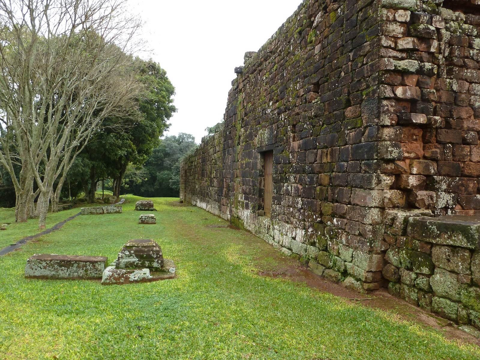
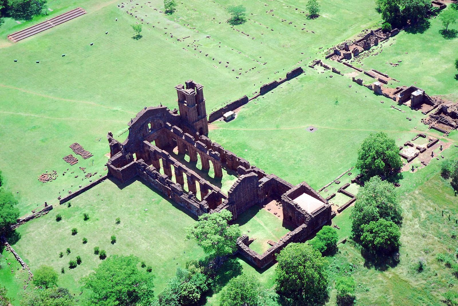
The archaeological site covers 38 hectares and preserves the church, parts of the settlement’s planned layout, dwelling foundations, and remnants of other buildings. A plan drawn by a Portuguese officer in 1756 shows a large rectangular plaza, with Indigenous dwellings mainly to the north and the church complex, cemetery, workshops, and garden to the south. Warehouses and service buildings lined the sides, while a broad north–south avenue divided the plan into two halves and ended at the open space before the church. The drawing does not correspond exactly to the archaeological remains. Sandstone masonry, tiled roofs, and timber-framed dwellings formed parts of the settlement’s built fabric.
Settlement plan and dwellings
Plaza and avenues
The plaza served as a place for ceremonies, meetings, celebrations, and the administration of justice. The 1756 plan depicts large residential pavilions divided into modules and surrounded by covered verandas. Clay tiles covered the roofs. The broad avenue linking the settlement’s northern and southern sides led toward the church esplanade, while straight streets separated the dwellings. Foundations of Indigenous houses survive within this organized layout.
Indigenous dwellings
At the time of abandonment, the dwellings were single-storey buildings with sturdy wooden frames and walls of wattle-and-daub or adobe, sun-dried earthen brick. Covered verandas had tiled roofs supported by square stone pillars, and some beams were carved. A dwelling module usually housed one family and sometimes two, with a doorway facing the church. The houses changed over time and were more rudimentary in the settlement’s earlier years.
Church complex
Church exterior and tower
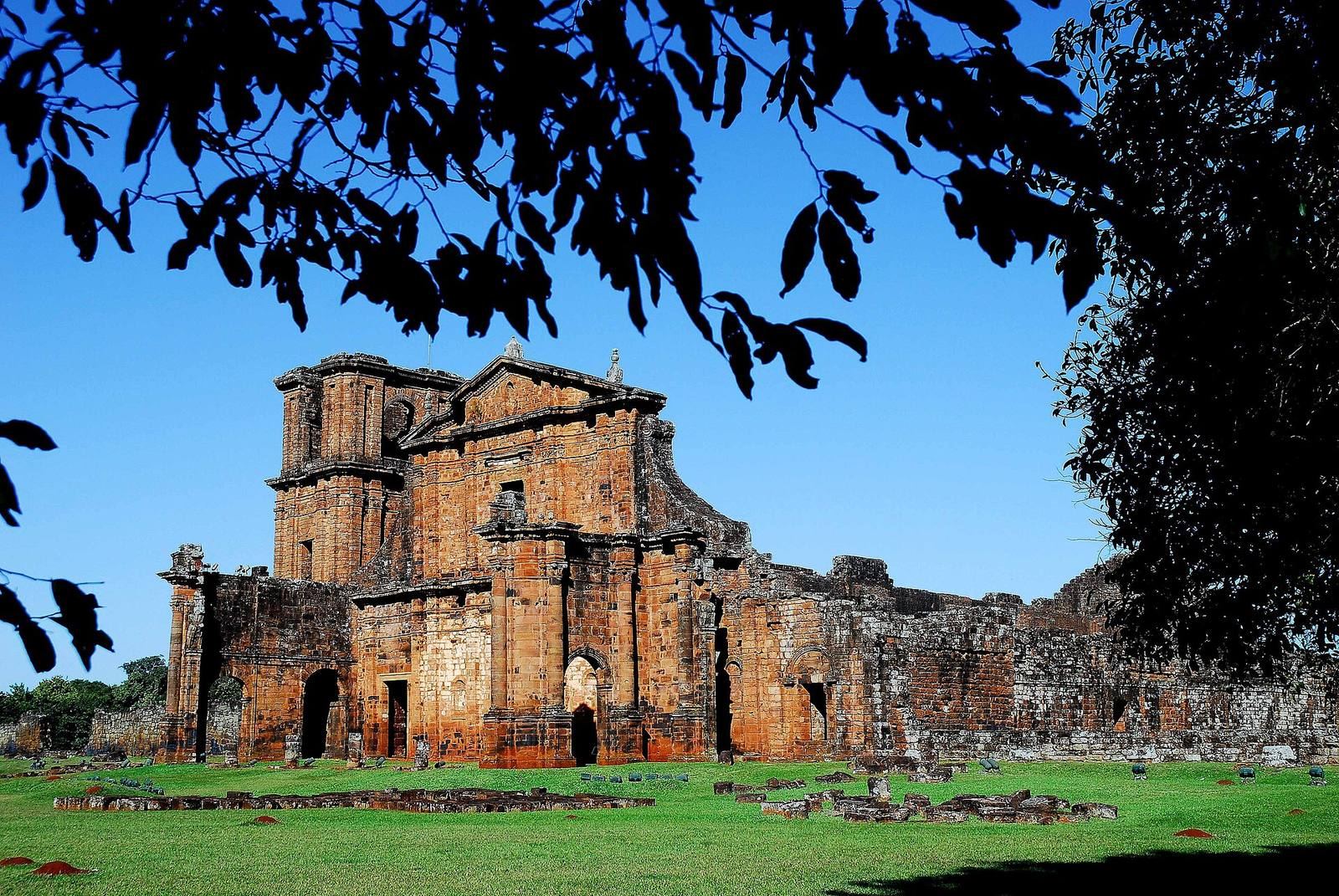
The sandstone church is the most intact and prominent surviving structure. Its construction is dated chiefly to 1735–1750, though work may have begun around 1720. The building was well advanced by 1744, while its carpentry and roof still required completion. It stood on a platform approached by six broad steps. A large galilee, or covered entrance porch, extended in front of the façade. Seven round arches rested between pilasters, shallow wall projections resembling columns, made of white and red stone. Their capitals combined features of two classical column styles, and their slight curve corrected for visual distortion. The porch had a triangular upper façade, three rectangular entrances, carved reliefs along its cornice, and six statues of apostles.
Above the porch, the church façade rose to a second level with a central niche for a statue of Saint Michael. A further triangular upper section, called a pediment, was topped by a cross. A massive square tower stood beside the church. An arch opened at its base, and two levels rose above it; the upper level had an arched opening for six bells. A tent-shaped roof and iron cross crowned the tower. It measured about 14 metres high and 8 metres wide. The porch appears to have been added after the church was completed: it rested against the adjoining wall rather than being joined into it.
Interior and decoration
The church was originally coated inside and out with a pale local clay. Three long interior divisions were separated by stone arches beneath a vaulted wooden ceiling with exposed beams. A dome covered the crossing of the church, beneath a hipped roof. The wooden dome was rebuilt in brick and lime between 1762 and 1768. The eleven altars included one in the area around the main altar, four at the crossing, and six in the side divisions. Gilded and brightly painted carvings, statues, and paintings decorated them, with a large statue of the archangel Michael on the high altar. Carved capitals included artichoke leaves in place of conventional acanthus, while apepu, a type of bitter orange, appeared among the façade motifs. Lightning caused a fire in 1789.
Priests’ compound and working areas
Cloister and garden
East of the church, a covered passage around a courtyard served the priests’ residence and connected it with the church, a workshop courtyard, and the plaza. A sundial stood in the courtyard. Rows of connected, tiled rooms opened onto the open space, and a broad veranda rested on stone columns. One room served as a dining hall; its basement probably functioned as a wine cellar. Another veranda faced the orchard and garden behind the residence. The cultivated area measured about 274 by 68 metres and included fruit trees, sugar cane, vegetables, herbs, and flowers. Earlier descriptions mention a water-lifting wheel for irrigation.
Workshop courtyard
A second courtyard, about 63 metres square, contained warehouses, workshops, and a fortified building with a prison. A punishment stock, a wooden restraint, and other structures also belonged to this group. Nearby stone remains may have formed visitor lodging, where people could stay for no more than three days, but they may instead have belonged to a butcher’s shop or stable. The site also preserves some wall bases associated with workshops, the priests’ residence, and other buildings.
Cemetery and communal buildings
Cemetery
The cemetery lay west of the church and was arranged with straight, crossing paths. A large cross stood at its centre. Another cross, about three metres high, had mother-of-pearl inlay and gilded bands. Separate areas were set aside for men, women, boys, and girls. Priests and Indigenous leaders were buried inside the church. A chapel at the rear of the cemetery served for wakes.
Cotiguaçu
Beyond the cemetery, outside the settlement’s regular plan, are remains of the cotiguaçu, a large, cloister-like residence for widows, orphans, and women whose husbands had temporarily left the settlement for work.
Waterworks and outlying remains
Fountain and water system
Excavations revealed an underground water system built of sandstone. It included a fountain and paved circular tanks. The fountain stands about one kilometre from the church and has sculpted faces, called mascarons, as decoration. Earth and vegetation had covered it before IPHAN rediscovered it in 1982; it was restored in 1993 and survived in good condition.
Peripheral structures
Remains beyond the main complex include two small chapels used for votive purposes, bread ovens, and quarters for enslaved people. Fragmentary stone columns found apart from the central complex may have belonged to punishment stocks.
Museum and movable remains
A museum beside the ruins brings together movable objects associated with the missionary heritage of the region. Brazilian architect Lúcio Costa designed the building, drawing inspiration from Spanish buildings of the period and from the settlement’s Indigenous dwellings. Its collection includes Brazil’s largest group of missionary statuary, as well as relief fragments, baptismal fonts, and one of the church’s large bells. A large missionary cross beside the museum was brought from a cemetery in Santo Ângelo on Costa’s direction; it was not part of the original reduction.
A tornado struck the region in April 2016, causing superficial damage to the ruins and severe damage to the museum. Eighty-three collection pieces were also badly affected. The museum was evacuated and its objects temporarily moved to a nearby building. The museum structure was restored in 2017, while restoration of some collection pieces continued.