Pueblo Antiguo de Huaquis: A Highland Settlement in Peru
Site at a Glance
- Rating
- 4.9
- Popularity
- Very Low
- Country
- Peru
- Primary era
- Medieval
- External website
- Open
- Eras represented
- Medieval, Early Modern, Modern
- Civilizations
- Spanish
- Site type
- City
On this page13 sections
History
Pueblo Antiguo de Huaquis is a highland settlement on Huamanchurco Hill in Peru, occupied from about the tenth century until the twentieth century. Built and inhabited by the Yauyos, it served religious, administrative, and domestic purposes during the Late Intermediate Period, an Andean era before the expansion of the Inca state. Its location on a difficult-to-reach cliff provided defensive visibility during centuries of competition over land and water, although the steep terrain also made access and the supply of water difficult.
Yauyos Settlement and Inca Expansion
The Yauyos occupied Huaquis from approximately the tenth to the fourteenth century, with their presence continuing into the fifteenth century. The settlement specialized in agriculture and textile production and participated in an exchange network with other Yauyos communities. Some of these communities practiced silverworking or pottery. The Yauyos controlled springs and lagoons that supplied irrigation to the valleys of coastal peoples, making their highland territory part of wider economic and political relationships.
Between 1438 and 1468, the Inca general Capac Yupanqui led expeditions that expanded the Tahuantinsuyo, the Inca imperial state. The Yauyos were annexed without resistance and formed an alliance with the Inca. They remained on their lands, received benefits from the Inca state, and supported later expansion wars. After the defeat of the lord of Collique, they received the coca-growing lands of Quives, where coca was cultivated for the state.
Colonial Reorganization
In 1534, the Yauyos territory was divided into five Spanish repartimientos, colonial divisions used to organize Indigenous populations, tribute, and labor. Mancos and Laraos were among them. Around 1573, the corregidor Diego Dávila Briceño carried out the policy of Viceroy Francisco Álvarez de Toledo, concentrating Indigenous communities in colonial settlements called reductions. These settlements helped the colonial government collect tribute, administer labor, and promote Christian evangelization.
Many Yauyos communities were moved to lower and more accessible locations, but Huaquis remained on its original site. It became part of the Laraos repartimiento and was reorganized as the reduction of San Agustín de Guaquis. The settlement was also known as Huaquis. Its buildings and institutions were modified to serve Spanish colonial administration.
During the colonial period, Huaquis belonged to the Yauyos corregimiento, an administrative district governed by a Spanish official. It shared a curato, or ecclesiastical jurisdiction served by a priest, with San Francisco de Guanta, Santo Domingo de Atún Larao, and San Francisco de Vitis. Mancos and Laraos were organized into three Dominican doctrines, areas established for Christian teaching and conversion by members of the Dominican order.
Evangelization suppressed or prohibited earlier Andean ceremonies, healing practices, rituals, and worship of huacas, sacred beings, places, objects, or natural features. These practices continued for decades and sometimes incorporated Christian elements. During the seventeenth century, the area between Huaquis and Huañec became a refuge for people who had left other reductions in order to maintain them.
An ecclesiastical proceeding from 1621 records the imprisonment of three Huaquis healers, Cristóbal Curis Anampa, Domingo Parian, and Inés Cancho Molloc. A priest accused them of idolatry, and the proceeding also describes their healing practices.
Republican Period and Abandonment
The Province of Yauyos was created in 1821. Huaquis remained administratively connected to Laraos until 1901, when it became part of the newly created district of Carania. In 1915, it became an annex of Huancaya.
During the nineteenth century, Huaquis developed more slowly than neighboring colonial settlements. Its steep terrain, difficult access, limited basic services, and lack of an immediately available water source restricted development. The settlement’s pre-Hispanic origins also required continuous maintenance of existing structures and limited major alterations to its residential area.
The population numbered 278 people in 1877. Between 1909 and 1919, residents gradually moved to the newly founded settlement of Miraflores. The relocation reflected Huaquis’s difficult living conditions and the desire for a settlement suited to contemporary developments. Huaquis ceased to be a residential settlement in 1919.
The move to Miraflores led residents to dismantle many old houses and reuse their furnishings and building materials. The community continued to visit Huaquis afterward. House patios were used for drying food, while the plaza served for festivals and for gatherings to clean the Patuishinca irrigation canal.
Pueblo Antiguo de Huaquis was declared Cultural Heritage of the Nation in 1999. The settlement also lies within the Nor Yauyos-Cochas Landscape Reserve, a protected natural area in Peru.
Remains
Setting, Layout, and Construction
The settlement stands at approximately 3,750 meters above sea level on Huamanchurco Hill, also identified on the National Map as Cullune Punta. It lies between the right bank of the Cañete River and the left bank of the Miraflores River. The architectural complex covers about 7 hectares and includes a church, large buildings, public spaces, domestic compounds, and connected agricultural terraces.
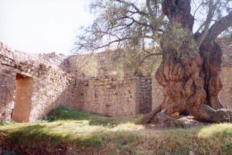
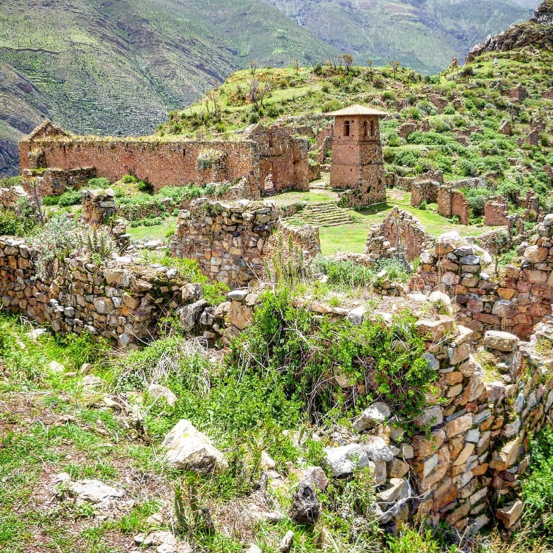
Most structures were built with unworked stone bonded with mud mortar. Houses and other buildings occupy terraces linked by passageways and paths across a slope of almost 40 degrees. Two principal streets divide the settlement into four neighborhoods. The east-west street begins at Huairona Plaza, extends for approximately 371 meters, and is mostly paved. The north-south street begins at the settlement’s highest point, descends through a series of steps, and extends for about 98 meters.
Religious and Colonial Buildings
Church and Bell Tower
Huairona Plaza has an irregular shape, with the colonial church and its detached bell tower on the south side. The church contains an altar, a sacristy east of the altar, and an upper choir reached by a staircase in the northwest corner. The altarpieces had plaster floral decoration and red lines, while reddish ochre decoration covered the walls.
The separate bell tower held three bells used to summon people to Mass and to assemblies. The church’s wooden roof beams and entrance gate were later removed and reused in the church built at Miraflores.
Colonial Hospital
A rectangular building southwest of the plaza and west of the church served as the colonial hospital. Wood-fired kitchens occupied its western side and were used to prepare food for patients. During the republican period, local inhabitants later used the building as a cemetery.
Prison
West of the hospital stood an elongated prison with two levels. Its arrangement allowed men and women to be held separately.
School Buildings
A three-part building with a large patio stands on a small rise northwest of the plaza. Constructed during the republican period, it served as the boys’ school. Before this separate building was erected, boys studied in a building near the plaza, probably the former colonial hospital. Girls attended lessons in Huairona Plaza, seated on the steps of the church atrium, the church’s open forecourt.
Residential Compounds
Residential compounds vary in size, but most contain two or three rectangular rooms arranged around an elongated patio. The rooms had pitched roofs of ichu grass, a high-altitude Andean grass, supported by wooden beams. Small windows and a single entrance served each house.
The ground floor was used as a dining room, kitchen, and bedroom. The upper level, positioned near the roof, stored dried food, provisions, and other products. Patios contained a small animal enclosure and a tendal, a drying area where food was spread in the sun. Potatoes, mashua, and oca were dried there, and some compounds also included an enclosure for guinea pigs.
Agricultural Terraces
The mountain slopes around Huaquis were shaped into agricultural terraces. On Huamanchurco Hill, the terraces begin approximately 400 meters above the settlement and descend toward the Cañete River. The agricultural area known as El Gran Maizal consists of irregular, curved terraces covering approximately 40 to 50 hectares.