Or Qapi: The Crimean Fortress Guarding the Perekop Land Passage
Site at a Glance
- Popularity
- Medium
- Country
- Russia
- Primary era
- Early Modern
- Eras represented
- Early Modern
- Civilizations
- Crimean Khanate, Ottoman
- Site type
- Military
- Remains
- Fort
On this page13 sections
History
Foundation and defense
Or Qapi was a Crimean Tatar fortress near the modern settlement of Perekop in Russia, built in 1509 under Khan Mengli I Giray of the Crimean Khanate, a state centered on Crimea and ruled by the Giray dynasty. The fort guarded the only overland entrance into Crimea, a narrow passage between the peninsula and the mainland. Before its construction, the khan of the Great Horde, a successor polity of the Golden Horde, twice tried to invade through the passage, in 1500 and 1501.
Or Qapi formed part of a defensive system that also included the fortresses of Arabat and Yeni-Kale, protecting the khanate from attacks from the north and east. The wider program of building new defenses and strengthening older ones continued at Perekop into the eighteenth century. Ottoman Sultan Bayezid II sent craftsmen from Kaffa and Mangup to work on the fortifications. The fortress also served as a wartime residence for the Crimean khan, and Crimean Tatar troops assembled there before campaigns to the north alongside a permanent Ottoman garrison of janissaries, Ottoman infantry soldiers.
During military operations in the area, the kalga-sultan, the khan’s designated heir, came from Kaffa. The fort’s commander, the or-bey, was expected to belong to the Giray dynasty and ranked fourth in the khanate’s hierarchy, below the kalga-sultan, the Nureddin-sultan (the second heir), and the Giray princes. The vizier, head of the clergy, ministers, and beys ranked below him.
Attacks and reconstruction
In 1575, Cossack forces led by Bohdan Ruzhynskyi crossed the Sivash, a shallow lagoon separating Crimea from the mainland, with part of their cavalry. They seized a gate and let in the main force, which captured the fortress, killed its Crimean Tatar garrison, demolished the castle, and burned the town. In 1608, Zaporizhian Cossacks broke into Perekop despite resistance from 1,400 janissaries and cannon fire; they captured guns and breached the defenses. In 1663, Cossacks led by Ivan Sirko captured the places described as the large city and the small city.
During the Russo-Turkish War of 1735–1739, a conflict between the Russian and Ottoman empires, Russian troops and Zaporizhian Cossacks took Or Qapi and later withdrew from it in both 1736 and 1738. On June 17, 1736, Russian field marshal Burkhard Christoph von Munnich stormed the fortifications, leaving the Tatar fortress in ruins. General Lacy captured it again in 1738, dealing a grave blow to the Crimean Khanate’s independence. Khan Qirim Giray rebuilt the fortress in 1754. Russian troops and Ukrainian Cossacks captured it in July 1771 in a decisive assault led by General Dolgorukov, after which the fortress was destroyed.
Trade and settlement
Perekop’s position made it a commercial gateway as well as a military stronghold. The main overland trade route into Crimea branched north toward Ukraine, Poland, and Russia and joined the Chumak route, used by traveling merchants and for salt transport. The gates served as a customs checkpoint, and travelers needed special permission to enter or leave Crimea. Merchant caravans and diplomatic missions often waited to pass through.
Captives taken in raids across territories now in Ukraine, Poland, Belarus, and Russia passed through Perekop; many were sent onward to Kaffa, one of Europe’s major slave markets. Salt from lakes several kilometers to the southwest was regarded as among Europe’s best and drew many merchant and Chumak caravans. Trade and travel supported nearby settlements with bazaars and services for travelers. Their residents included Muslim Crimean Tatars and Christian Greeks and Armenians. Armyansk, historically called Armenian Bazaar, and the village of Perekop are later settlements associated with the former suburbs.
Later destruction
The remains suffered further damage during the Russian Civil War and the Second World War. During the latter conflict, German and Soviet forces repeatedly changed control of the site.
Remains
The defensive line and fortress
Main fortress
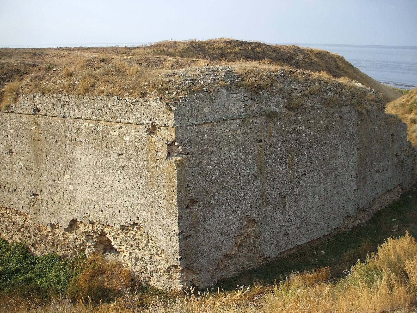
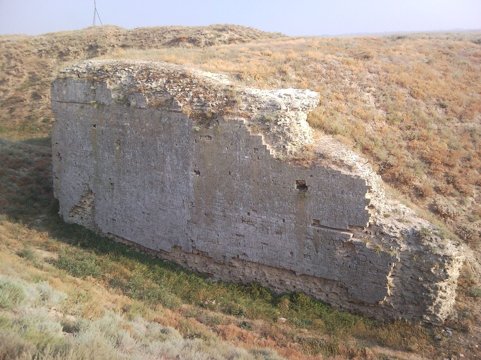
The defensive line ran for about eight kilometers between the Karkinitsky Gulf and the Sivash, and may later have continued across the Sivash and the Lithuanian Peninsula. Or Qapi had a pentagonal plan, with earthen walls faced in strong stone and quadrangular towers. A single gate with a drawbridge stood on the northern side, while several gates opened on the southern, Crimean side. The ruined fortress and town lie near modern Perekop, with earthen ramparts among the surviving remains. The fortress’s artillery numbered more than 100 guns.
Ferah Kermen
Ferah Kermen, a section of the defensive line beside the Karkinitsky Gulf about three kilometers west of Or Qapi, guarded the sea entrance to the land passage. Its remains include the massive stone base of a tower that controlled approaches from the sea.
Fortified town and suburbs
Perekop comprised a middle city, a main city, and a suburb, corresponding to an inner citadel, an outer fortress, and an outlying settlement. A moat enclosed the suburb. The former suburbs included bazaars, bathhouses, and caravanserais, roadside inns for travelers and merchant caravans.
Historical depictions
Evliya Chelebi’s description
Ottoman traveler and writer Evliya Chelebi described the fortress as 23 arshins high, using a historical unit of length. He gave its perimeter along the ramparts as 3,000 paces and counted 800 alternating raised sections and gaps along the parapets, as well as 20 tall quadrangular towers. He noted red-tiled roofs on the towers and board roofs on some smaller towers, and wrote that the towers could be seen from a five-day journey across the steppe.
Beauplan and Witsen
French military engineer and cartographer Guillaume Le Vasseur de Beauplan described the town in a book published in 1651. He noted a moat partly filled with water, 20 feet wide and 6 to 7 feet deep, along with a low rampart about 6 to 7 feet high and 15 feet wide. He also described a stone castle within a larger enclosure. The town lay 300 paces from the eastern shore, while a moat extended toward the sea on the western side. Beauplan estimated that it contained no more than 400 hearths. In 1692, Dutch statesman and mapmaker Nicolaas Witsen published an image of the fortified town showing its layout, buildings, and surroundings.