Negombo Fort: A Dutch Colonial Fortress in Sri Lanka
Site at a Glance
- Rating
- 3.3
- Popularity
- Low
- Country
- Sri Lanka
- Primary era
- Early Modern
- Eras represented
- Early Modern, Modern
- Civilizations
- British, Dutch
- Site type
- Military
- Remains
- Fort
On this page10 sections
History
Negombo Fort is a Dutch colonial fortress in Negombo, Sri Lanka, rebuilt in 1672 on a strategic strip between a lagoon and a sea inlet. First established by the Portuguese to defend Colombo, it became a Dutch military and commercial center before much of the fort was demolished for a prison in the nineteenth century.
Portuguese and Dutch conquest
The first Portuguese fort at Negombo was a weak square enclosure with two redoubts, or smaller enclosed defensive works, and five guns. Dutch forces under Philip Lucasz captured it in February 1640. The Portuguese later recovered the position, strengthened its defenses, and held it until Dutch troops commanded by François Caron recaptured it in 1644.
After the second Dutch conquest, the fort was reinforced. The Dutch East India Company, known as the VOC, controlled Dutch military and commercial operations in parts of Asia, including Ceylon. In 1672 it rebuilt Negombo as a smaller but stronger pentagonal fortress instead of retaining the earlier square plan.
The fort also stood amid the struggle between the VOC and Raja Singha II, the king of Kandy, the principal independent Sinhalese kingdom in the island’s interior. Raja Singha II wanted Negombo transferred to his control, but the VOC refused because his forces had not taken part in the war. Hostilities followed. In 1646, a Kandyan army defeated a VOC force near Negombo, carried hundreds of soldiers to Kandy, and sent the severed head of the VOC commander Adriaan van der Stel to the fort’s commander in a silk bag.
Portuguese efforts to recover Negombo continued. One claim relied on a truce between the Dutch States-General, the governing assembly of the Dutch Republic, and Portugal that came into effect in Ceylon in 1645. Governor Maetsuycker rejected the claim, and fighting resumed in August 1646. Dutch conquests at Colombo in 1656 and Jaffna in 1658 ended Portuguese control of Ceylon.
Trade, waterways, and British rule
Under Dutch rule, Negombo served as an important collection and transshipment center for cinnamon and other products before they were sent to Colombo. The fort formed part of a network of natural and constructed waterways through the lowlands between Puttalam and Kalutara. These channels carried agricultural and commercial goods and drained salt water from rice fields.
British forces occupied Negombo without opposition in February 1796, while the Netherlands was under French occupation during the First Coalition War. The Peace of Amiens, a treaty that temporarily ended hostilities between Britain and France, transferred all Ceylon to Britain in 1802. That same year, the British constructed a separate 14.5-kilometre canal between Negombo and Puttalam. Although commonly called the Dutch Canal, it is the Hamilton Canal and formed part of the wider waterway system associated with the fort.
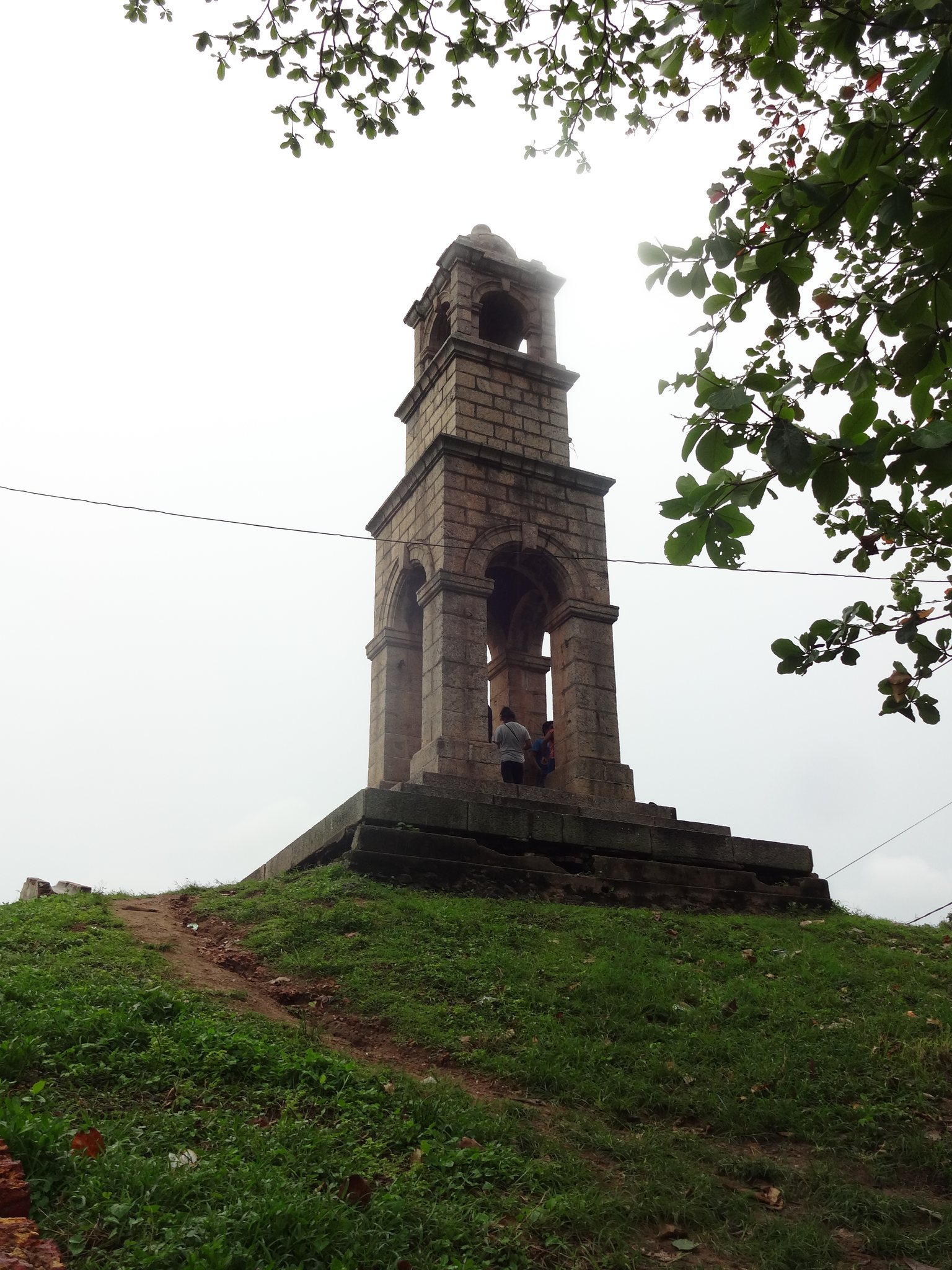
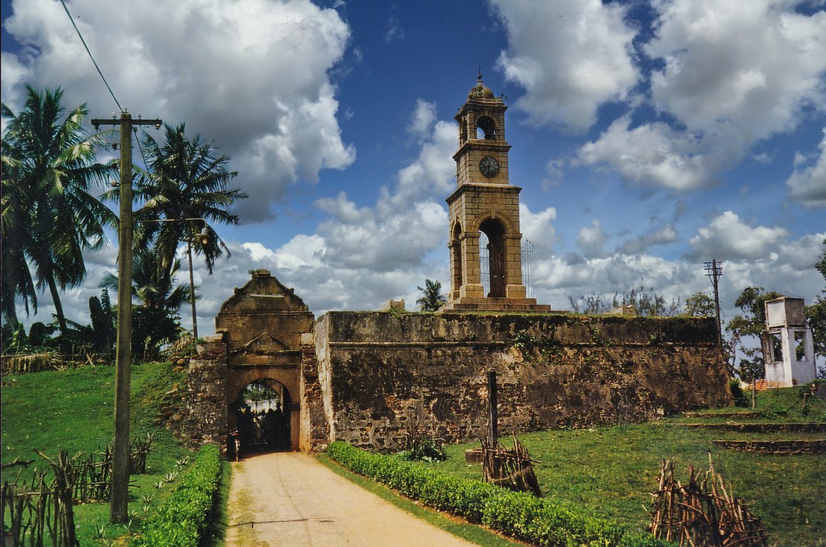
In the late nineteenth century, the British largely demolished Negombo Fort and reused its stones for a prison. The gateway and part of the eastern wall were retained, partly because a turret commemorating Queen Victoria had been built on the wall. The site continues to be used as a prison by Sri Lanka’s Department of Prisons, while the fort and its surviving remains remain under the control of the Government of Sri Lanka.
Remains
Negombo Fort occupied a narrow strip between a lagoon and a sea inlet. A moat surrounded the pentagonal fortress, whose four completed bastions projected from the walls to allow defenders to use flanking fire. The seaward bastions were called Hoorn and Enkhuizen, while the landward bastions were Delft and Rotterdam. A 1720 plan gives the positions different names: Vlaggepunt, Klokkepunt, Colombo Punt, and Nachtpost.
Gateway and eastern defenses
Main gateway
The main entrance was set in the eastern wall and approached by a drawbridge, a movable bridge crossing the moat. In the eighteenth century, a clock tower stood above the entrance. The surviving gateway is a recessed arch built with a granite slab bearing the date 1678, and it is topped by a high decorative gable.
Eastern rampart
A section of the eastern rampart survives with the gateway. Mounds at its northern and southern ends mark the positions of former bastions, while the wall also includes the turret associated with Queen Victoria. A bend in the northern wall may indicate the planned position of the fifth projected bastion in the fortress design.
Seaward and interior features
Water gate
A water gate was placed in the northwestern, seaward wall, linking the fort’s defenses with its position beside the lagoon and sea inlet.
Buildings within the fort
The interior contained barracks, gunpowder magazines, cinnamon warehouses, and a well. A wooden palisade stood immediately outside the walls. The present remains are described as being in good condition, although the prison construction removed most of the original fortification.