Great Zimbabwe: Capital of a Medieval Southern African Kingdom
Site at a Glance
- Popularity
- Very High
- Country
- Zimbabwe
- Primary era
- Medieval
- Eras represented
- Medieval
- Civilizations
- Kingdom of Zimbabwe
- Site type
- City
On this page18 sections
History
Great Zimbabwe is a historic city and archaeological complex in southeastern Zimbabwe, near Masvingo. Its builders were associated with the Gumanye people, regarded as ancestors of the Karanga, a Shona-speaking community. Major construction began in the eleventh century and continued into the fifteenth, although the surviving stone walls date no earlier than the thirteenth century. From that century, Great Zimbabwe served as a capital and political center of the Kingdom of Great Zimbabwe.
Early settlement and construction
Human activity in the area began before the stone city. Hunter-gatherer communities associated with the San were followed by farming communities linked to the Gokomere and Ziwa traditions of the early Iron Age. These communities cultivated the valley and worked iron. People were living at Great Zimbabwe by at least the fifth century AD, though the early history and continuity of settlement remain unsettled.
Archaeological phases include an early period around the fourth to seventh centuries, renewed settlement around the mid-twelfth century, and a principal period of growth dated about 1275 to 1450. A smaller settlement, particularly in the valley, is associated with about 1450 to 1550. These phases are classifications of archaeological evidence, not an uninterrupted sequence of occupation. They help explain why a long history of human presence does not amount to continuous growth of the city.
Political authority, trade, and decline
The king, known by the Shona title mambo, held political and religious authority in an ideology connecting rulers, ancestors, and Mwari, a central deity in Shona religious traditions. Tradition names Chigwagu Rusvingo as the first mambo, alongside other founding figures. The Hill Complex has also been interpreted as a residence for spirit mediums, religious figures who represented ancestral and spiritual forces and advised the state.
Farming and livestock keeping supported the city’s society and economy, with cattle especially important. The court managed herds that moved seasonally. Great Zimbabwe also became a center of gold working and long-distance exchange. Control of routes between the plateau’s goldfields and the Swahili trading centers on the East African coast contributed to its wealth. Regional trade included salt, cattle, grain, copper, gold, and iron goods. Gold and ivory moved through coastal intermediaries into Indian Ocean networks, while imports included glass beads and ceramics from China, Persia, and Syria.
Great Zimbabwe’s rise has been linked to the decline of Mapungubwe, an earlier political center near the Limpopo River, around 1300, to greater access to inland gold, or to both developments. From the early fifteenth century, falling international demand for gold and changing trade routes weakened the city’s position. Its decline has no established single explanation. Possible factors include pressure on farmland and water, depleted resources, and redirected trade; Shona oral tradition instead associates the decline with a shortage of salt.
A Shona tradition recounts that Nyatsimba Mutota, a member of Great Zimbabwe’s royal family, led part of the population north in search of salt and founded the Mutapa state. By the sixteenth century, political power had shifted north and west, including to Khami, a major center of the Kingdom of Butua. Great Zimbabwe was largely deserted, although occupation may have continued into the seventeenth century and farming communities remained nearby.
Portuguese accounts and contested origins
Portuguese writers described large stone buildings in the interior during the early sixteenth century. In 1506, Diogo de Alcáçova wrote of stone buildings associated with the ruler of Mwene Mutapa, though their identification with Great Zimbabwe is uncertain. In 1531, Vicente Pegado described the ruins as a fortress built of large stones without mortar and reported a tower more than 22 metres high. João de Barros published further descriptions in 1552 based on information from Swahili traders.
Early European interpretations connected the ruins with the biblical Queen of Sheba, King Solomon, or the gold land of Ophir. Europeans encountered the ruins during the 1860s, and Adam Render showed them to German explorer Karl Mauch in 1871. Mauch rejected African authorship and promoted biblical and Phoenician explanations. Later investigations supported by Cecil Rhodes and colonial authorities took place amid similar claims. These interpretations reflected racial prejudice and colonial interests. Archaeological agreement that Africans built Great Zimbabwe, and that its builders were ancestors of the Shona, emerged during the 1950s.
Archaeology, conservation, and cultural meaning
European antiquarians looted and dug destructively at the site from the 1890s into the 1920s, removing objects and damaging archaeological layers. David Randall-MacIver’s excavations in 1905 and 1906 argued that the structures and finds were African and medieval in date. Gertrude Caton-Thompson’s work in 1929, including at the Great Enclosure, Hill Complex, and Valley Ruins, further supported an African origin and medieval chronology. A research program begun in 1958 developed archaeological sequences, and later radiocarbon measurements strengthened the dating of occupation and construction to the twelfth through fifteenth centuries. Some earlier measurements produced much older results, but their age was uncertain because the wood could have been old or reused.
Great Zimbabwe was protected as a monument from 1892, and a 1909 report set out measures for its protection. Zimbabwe’s national museums and monuments legislation provides its legal protection, and the National Museums and Monuments of Zimbabwe is responsible for its care. UNESCO and the United Nations Development Programme became involved in conservation in 1981; UNESCO inscribed the site as a World Heritage Site in 1986. Restoration and reconstruction have also altered the ruins, while erosion, settling foundations, vegetation, and visitor activity have caused further damage.
Under white-minority rule in Rhodesia, government pressure and censorship sought to suppress recognition of Great Zimbabwe’s African origins. The site became an important symbol for African nationalist movements. After independence in 1980, the country took its name from Great Zimbabwe; its carved birds became national symbols, and a tower appears on the state coat of arms. The ruins remain a sacred landscape for local communities, who associate them with ancestors and Mwari and continue to hold ceremonies, including rainmaking rites, especially at the Hill Complex. Community criticism has also focused on archaeological disturbance of a sacred place and the lack of recognition for ancestral ownership and control.
Remains
Great Zimbabwe covers about 722 hectares on a plateau in the southeastern highlands, at roughly 1,140 metres above sea level. Granite hills, streams, slopes, and cliffs shape the setting and influenced building locations and routes. The principal stone-built groups are the Hill Complex, Great Enclosure, and Valley Complex, which were built and occupied at different times. Most stone buildings lie within these groups, while much of the wider settlement consisted of residences beyond the stone enclosures.
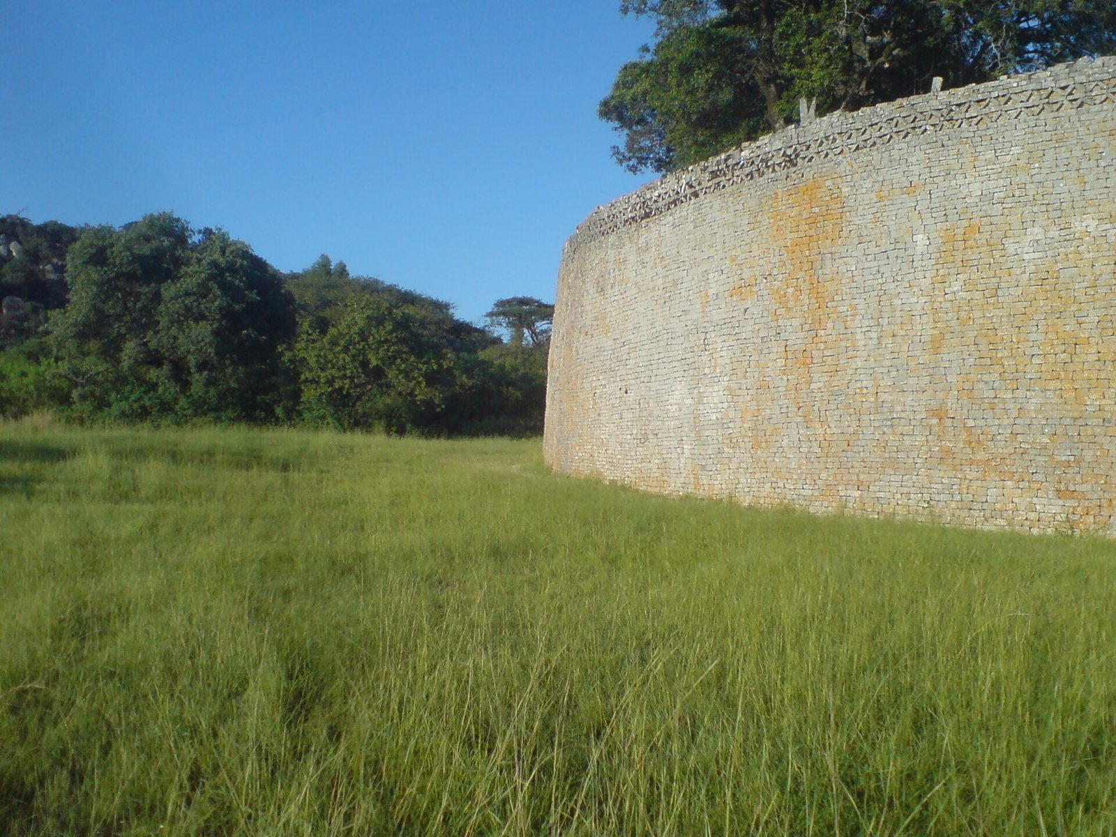
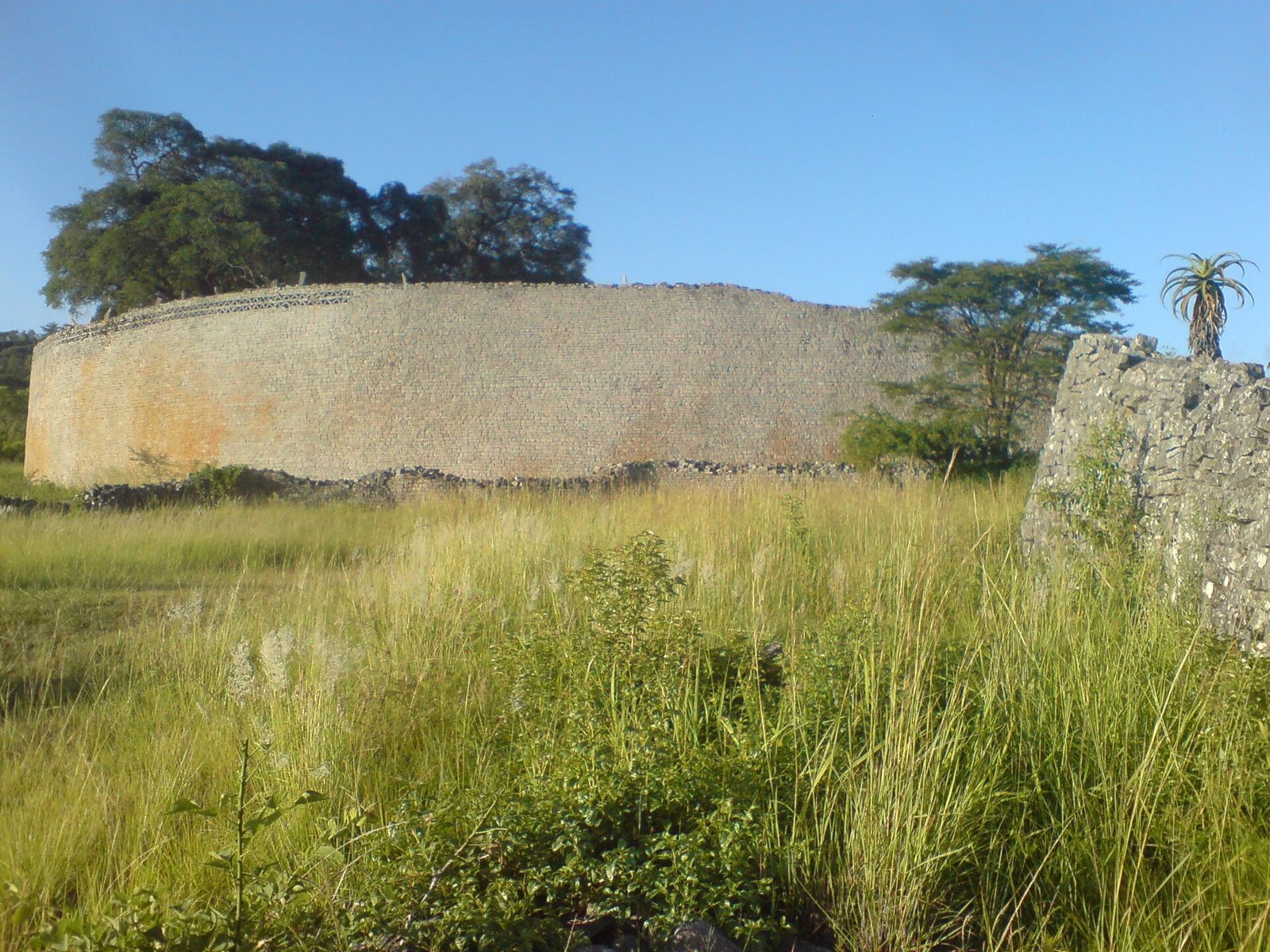
Walls were built without mortar, using granite quarried nearby and carefully arranged stone faces, with packed stone inside. Some walls stand freely with finished faces on both sides; others retain rubble or earth behind a single face. Builders laid foundations on rock or soil and sometimes used granite blocks or clay-based building material to level the ground. Archaeologists classify masonry styles as P, Q, PQ, and R, based chiefly on stone arrangement and finish. P-style walls date to about 1275 to 1350; Q-style construction followed and continued until the city was abandoned.
Hill Complex
The Hill Complex is the oldest major group of stone buildings. It occupies a hill above the valley, with eastern and western enclosures, a high balcony enclosure, and large natural boulders. A narrow, steep approach leads to the plateau, and at least three routes reached the hill from the west.
Western enclosure
The western enclosure’s original wall is about eight metres high and five metres thick. Towers and stone columns alternated along its upper edge. Two surviving columns and four present towers were reconstructed in 1916, along with part of the exterior wall; the reconstructed masonry is visibly distinguishable from the original. Huts once accumulated inside, with debris reaching eight metres deep in places, and some original occupation surfaces remain visible. Inner walls form passages similar to those in the Great Enclosure. The southern wall follows the cliff edge, while projecting rock forms parts of the northern and eastern boundaries. The original entrance near the cliff is now blocked for safety, and the present entrance belongs to the reconstruction.
Balcony and eastern enclosure
At the northeastern end of the plateau, a balcony stands about ten metres above the enclosure. Granitic and soapstone columns, some formerly as tall as four metres, stood there into the late nineteenth century. The eastern enclosure contains slots apparently intended to hold bird-topped stone pillars, though the original positions of the birds are uncertain.
Great Enclosure
The Great Enclosure is an elliptical complex in the valley, built from roughly a million stones. Its outer wall is about 244 to 255 metres long and reaches approximately 11 metres high. The northeastern section is especially carefully built, measuring about four metres thick near the top and up to six metres at the base. The northwest section is lower, thinner, and less finely worked. Inside the walls, courtyards held huts and houses made of earth and wood.
Walls, courtyards, and passage
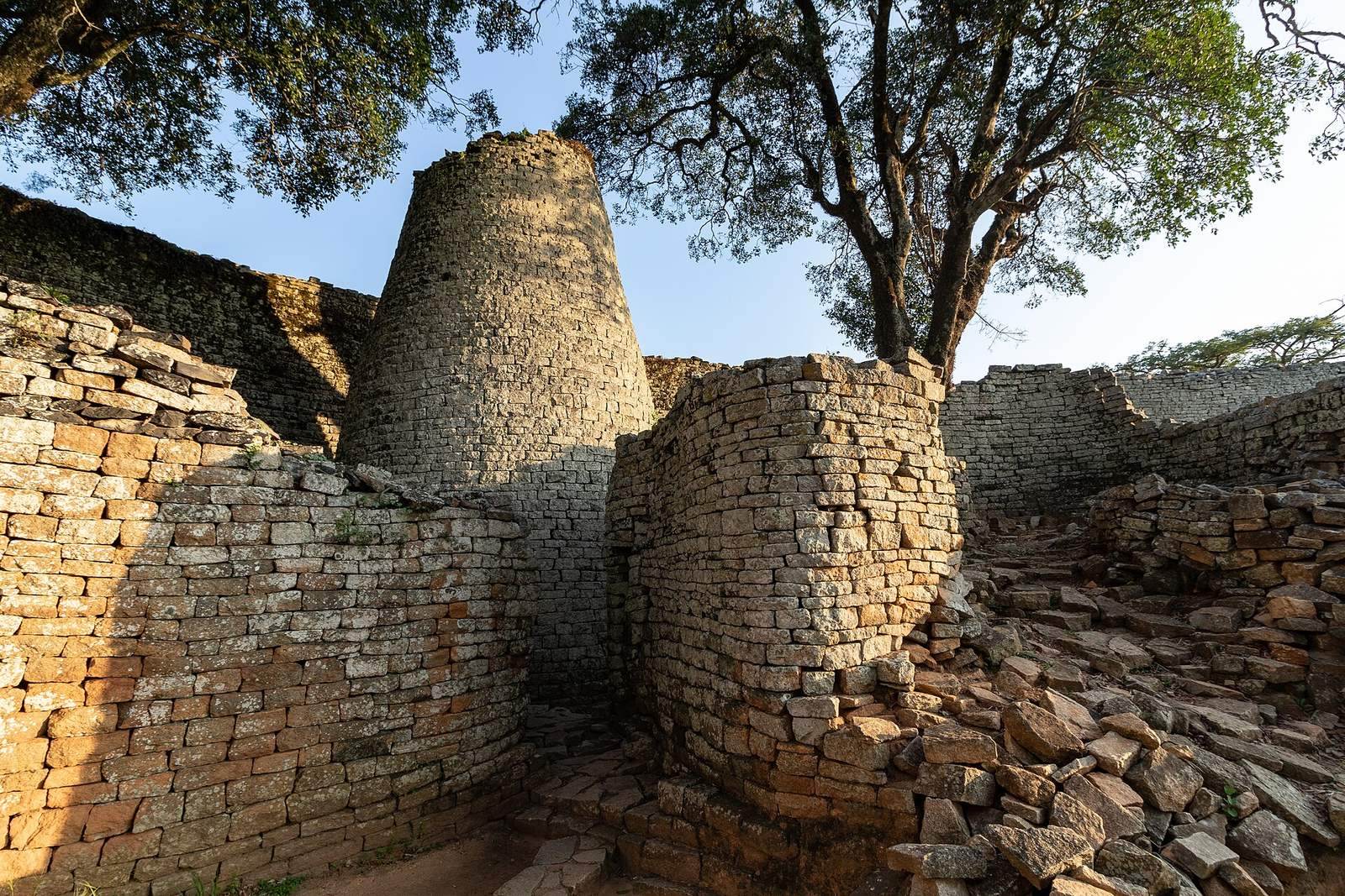
The complex includes an early circular enclosure, a central area, platforms, and an inner wall built about a century before the present outer wall. The early circular enclosure, immediately north of the central area, is identified as the earliest building in the complex and once held household huts. A narrow passage, more than 70 metres long and generally about 0.8 metres wide, runs between the inner and outer walls. It passes the area north of Enclosure 15 and approaches the space around the Conical Tower. Its arrangement has been interpreted as allowing movement through the complex while preserving privacy around the royal residential area.
Conical Tower
The Conical Tower stands between the walls, about nine to ten metres high, with a base about five metres across and a top roughly two metres wide. Stones turned at an angle formed a zigzag pattern of triangles along its upper edge. Archaeologists partly tunnelled beneath the tower in 1929 and found it solid, resting directly on the ground. Its purpose remains uncertain. A smaller tower stood nearby.
Valley Complex and domestic remains
The Valley Complex lies between the Hill Complex and Great Enclosure. Its Upper and Lower Valley Ruins were occupied in different periods. Smaller enclosures and walled routes cross the valley, including a long route running from the hill toward the Great Enclosure. The Render Ruins lie north of the Great Enclosure, while the Philips, Maund, and East Ruins are to its east.
Earth-and-granite buildings
Buildings made from clay mixed with granite grit, known as dhaka, stood near the stone complexes. Many now lie beneath soil, vegetation, or stone debris. Excavations have revealed floors, walls, and decorative patterns. Some buildings had two or more rooms, verandas, and floors at different levels; interior partitions could divide rooms without supporting the roof. Mounds beside stone structures are remains of collapsed buildings. Gravel floors appeared in hill enclosures during the third archaeological period and became common in stone buildings in the fourth. Some incorporated low benches, hearths, and pot stands.
Water features
Depressions across the site have been interpreted as reservoirs, wells, or springs. Some may have been used from the middle of the second millennium, and together they could have held more than 18,000 cubic metres of water.
Carvings, crafts, and traded objects
Zimbabwe Birds
Eight carved Zimbabwe Birds were recovered at Great Zimbabwe. Made from soapstone or micaceous schist, the figures are roughly 0.4 metres high and were mounted on stone pillars. Six came from the Hill Complex’s eastern enclosure. Their precise original positions and meaning are uncertain; interpretations include a bateleur eagle, a protective spirit, a good omen, or a divine messenger in Shona culture. Antiquarians removed several carvings. Willi Posselt took one from the eastern enclosure in 1889, James Theodore Bent removed five, and Richard Hall removed a broken bird from the Hill Complex in 1902. Several carvings were returned to Zimbabwe in 2003, while one remains at Groote Schuur in Cape Town.
Metalworking and exchange
Finds from the site include furnaces, clay containers, crucibles, slag, and tools used to heat and shape gold into wire, beads, and ornaments. Other metal objects include iron hoes, axes, chisels, knives, gongs, spearheads, copper ingots, and bronze ornaments. A group found in the Render Ruins in 1902 has been considered a possible royal hoard. It included iron tools and weapons, an iron gong, more than 20 kilograms of twisted wire, copper and bronze wire, many small glass beads, and Chinese celadon pottery of the thirteenth century. Glass beads and ceramics from China and Persia provide evidence of long-distance exchange. Pottery spans early material dated to the fourth through seventh centuries, later medieval wares, and Karanga pottery of the nineteenth century. The earliest three pottery groups have been found only in the Hill Complex.