Donets Gorodishche: A Multi-Period Fortified Settlement in Ukraine
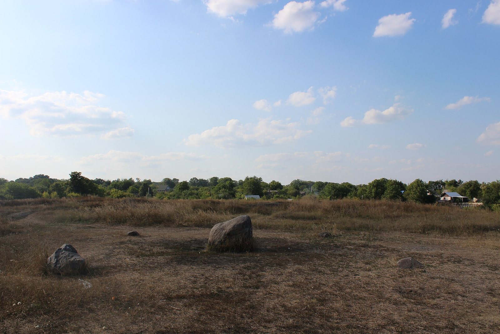
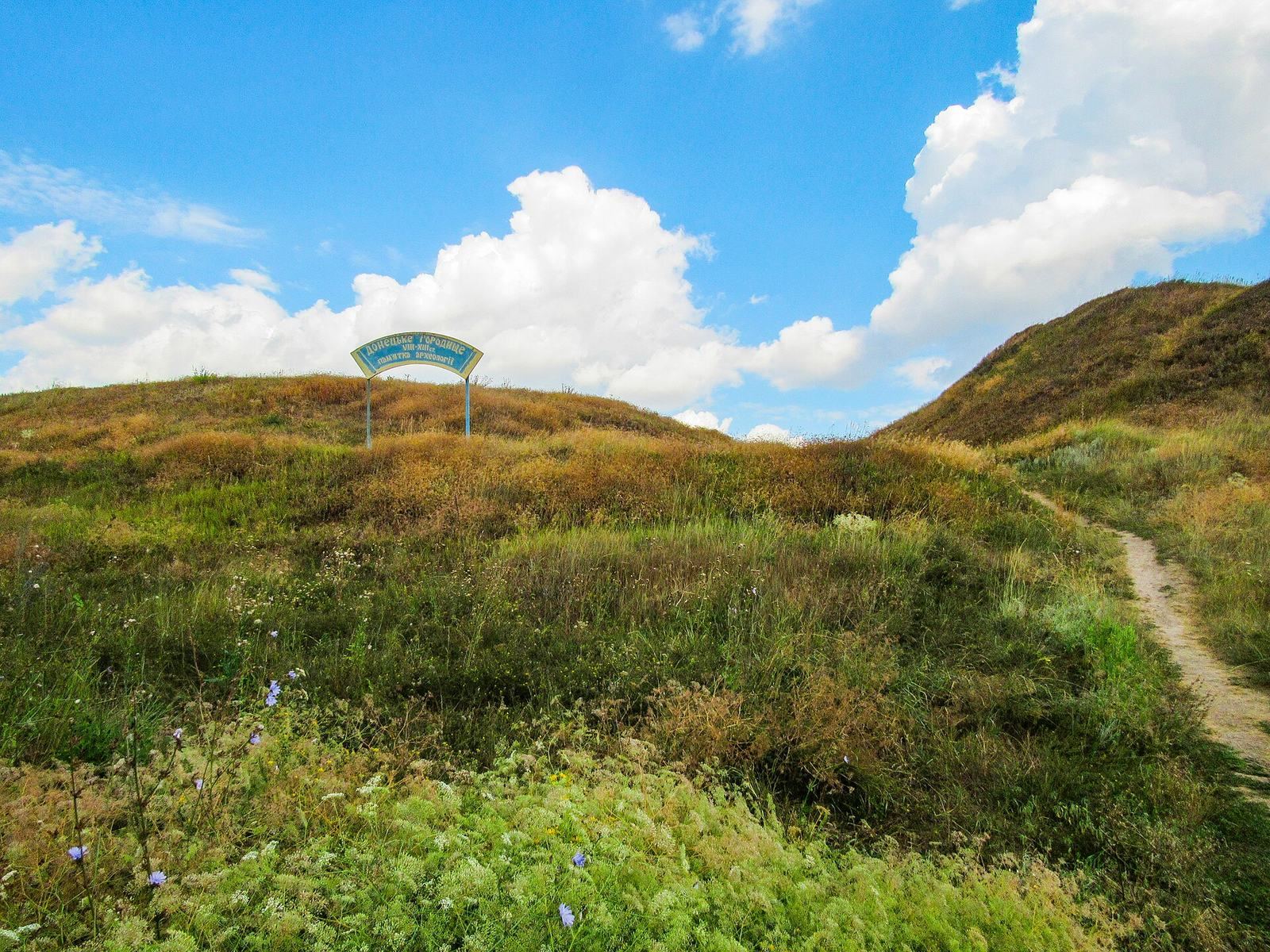
Site at a Glance
- Popularity
- Medium
- Country
- Ukraine
- Primary era
- Medieval
- Eras represented
- Bronze Age, Iron Age, Classical, Medieval
- Civilizations
- Kievan Rus, Scythian
- Site type
- City
On this page20 sections
History
Donets Gorodishche is a multi-period fortified settlement site on the Udy River in Ukraine. Its earliest known fortification dates to the sixth century BC, during the Scythian period, an era associated with Scythian peoples and material culture across the steppe and its forest-steppe margins. The site’s history extends from the Late Bronze Age to the Middle Ages, when it became an important town generally identified as Donets.
Late Bronze Age and Scythian settlement
The earliest layers are associated with the Timber-grave culture, an archaeological culture of the Late Bronze Age. In the sixth century BC, people built the first fortification, which extended across the citadel and suburb. The fortified settlement was occupied from the late sixth to the fourth century BC and is now understood as a refuge rather than a place of permanent residence. Farming, especially cultivation of arable land, was central to the community’s economy. Some researchers have proposed that its inhabitants were Melanchlaeni, an ancient people whose presence at the site remains uncertain.
Romny culture and frontier trade
Communities of the Romny culture lived at the site from the eighth to the tenth century. This early medieval culture is associated with the Severians, an East Slavic tribal union known from chronicles. The settlement lay within the Khazar sphere of influence, the political reach of a medieval state that controlled parts of the steppe north of the Black and Caspian seas. Its people farmed and also hunted and fished, while trading with eastern merchants and nearby Saltovo communities, including populations associated with the Alans.
By the tenth century, the settlement had developed into a town-like center for trade and crafts. Its destruction is thought to have followed a Pecheneg attack. The Pechenegs were a Turkic-speaking nomadic confederation bordering the Rus lands, and the attack has been linked to Sviatoslav’s eastern campaigns. In the twelfth century, new settlers arrived, and the site developed into the medieval town of Donets. Historian Vladimir Kuchkin proposed that Prince Vladimir Glebovich of Pereyaslav founded the town.
Medieval Donets
Most scholars identify Donets Gorodishche with the town of Donets mentioned in the Hypatian Chronicle under 1185, although another interpretation identifies it with the Cuman town of Sharukan. Donets was a trading and craft center whose inhabitants worked in metal, wood, stone, pottery, and bone. Its commercial connections reached eastern merchants and the Cumans, a Turkic steppe people who were both neighbors and adversaries of the Rus principalities. Some locally made bone goods were sold in surrounding districts, while imported materials and objects came from more distant regions.
The chronicle relates that Prince Igor Svyatoslavich, captured during his 1185 campaign against the Cumans, escaped and reached Donets on foot after eleven days. From there he continued to his own town of Novgorod-Seversky. His brother Vsevolod and son Vladimir were also captured, but Igor alone escaped. The chronicle places the episode under 1185; the escape is also dated to the summer of 1185 or 1186. Donets likely served as a Rus frontier town facing the Cuman steppe. Its political position is debated: one interpretation places it under an administrator or military governor answering to the prince of Pereyaslav, while another associates it with Kursk, a territory assigned within the Principality of Severia.
The Mongol invasion destroyed the town in the 1230s. Donets had limited defenses, and the Mongol forces are thought to have burned it to prevent its use as a base for attacks from behind. Some residents may have fled beforehand, while human remains with signs of injury leave open the possibility that others did not escape. The settlement later revived on a smaller scale, and part of the abandoned suburb became a cemetery. Glazed pottery with a red body, possibly dating to the thirteenth or fourteenth century, indicates renewed activity. Donets was finally abandoned in the fifteenth century.
Later references and archaeological investigation
A separate settlement arose several kilometers away at University Hill, in present-day Kharkiv. Investigations on Kvitky-Osnovianenko and Rymarska streets date that settlement to the thirteenth or fourteenth century; Kharkiv Fortress was built there in the seventeenth century. Donets itself appears in a Lithuanian list of towns dated 1432, alongside several districts associated with it. A Donets district also belonged to Putivl County in the Kyiv Voivodeship, an administrative province in the Polish-Lithuanian political system. Sixteenth-century documents record several forms of the town’s name. By the later sixteenth and seventeenth centuries, the site was uninhabited and described as a hillfort. In 1571, it was included in watch points and patrol routes established under Ivan IV to guard against steppe incursions.
The name Donets Gorodishche derives from an earlier name for the Udy River, the Donets or Little Donets. Some nineteenth-century historians identified the Udy with the ancient Don, while historian Boris Rybakov argued that the medieval Don or Great Don referred to the modern Seversky Donets and the lower Don. The river name has an Iranian origin associated with a word meaning river. A geographical description from 1627 places the site on the Udy, upstream from Khoroshevo Gorodishche and near the confluence of the Kharkiv and Udy rivers.
Investigation began with V. V. Passek in 1839. In 1877, part of the site’s edge collapsed into the river, exposing human skeletons. Early twentieth-century earthworks revealed traces of the suburb and a cemetery, followed by small excavations in 1902 and 1905. A. S. Fedorovsky led surveys in the 1920s and rescue excavations in the suburb in 1929, identifying craft-production areas. Later surveys and excavations included work by the Dnieper Left-Bank and North Donets expeditions, as well as Kharkiv State University teams led by B. A. Shramko between the 1950s and early 1960s. Rescue investigations followed in 1977–1978 and 2003.
Construction was allocated part of the suburb in 1954, and preparations for a planned memorial complex near the site damaged archaeological layers in the late 2000s. Donets Gorodishche and its suburb are protected in Ukraine as an archaeological and historical monument of national significance.
Remains
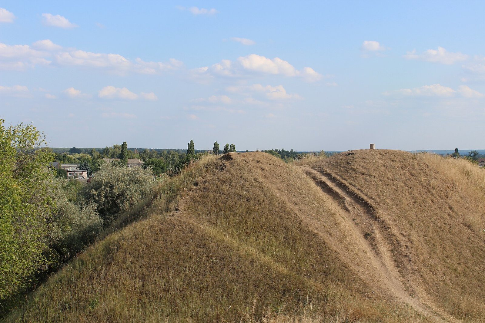
The site occupies a high promontory and comprises a partly preserved citadel and a long suburb, divided into settlement areas A, B, and C. The suburb extends about 1.5 kilometers toward Kharkiv. Erosion has gradually worn away the river-facing slope, making the citadel’s original dimensions difficult to determine. The surviving layout includes defenses from several periods, residential areas, craft installations, storage features, and evidence of food production.
Fortified areas and defensive works
Citadel and suburb
The earliest fortification crossed both the citadel and the suburb, which were not separated by a ditch at that time. The Romny-period settlement occupied a smaller area, concentrated in the citadel. Its promontory slopes were cut back to create steep faces between three and five meters high. The suburb’s remains include traces of a possible rampart that may have enclosed part of the settlement; road construction destroyed them in 1929.
Defenses through time
In the first quarter of the ninth century, a defensive fence of horizontal logs held between pairs of upright posts protected the Romny-period settlement. The medieval citadel later gained a timber wall made of adjoining compartments packed with clay and rubble. It measured 3.8 to 4 meters across, and an earthen ramp along its inner side gave defenders access to the battlements.
Romny-period homes and objects
Houses and settlement plan
The Romny settlement contained about 25 to 30 small, four-sided houses built partly below ground and supported by posts. They stood in a row with their fronts facing the river, beside a street running northwest to southeast. In one well-preserved house, excavators found traces of window openings, a wooden floor, and an entrance with steps lined in wood. Some houses had a small cellar beneath the middle of the floor. A clay oven stood in a corner, cut into the natural clay, with clay cones at its top to help retain heat. Additional buildings stood near the settlement’s southwestern edge, alongside storage pits and a single-chamber pottery kiln. The houses’ walls stood 45 to 65 centimeters inside the edges of their internal pits, which were 80 to 125 centimeters deep.
Pottery and domestic equipment
Handmade pottery from the settlement includes vessel fragments decorated with diagonal cuts, toothed-stamp marks, cord impressions, and occasional fingertip impressions. These patterns form zigzag or chevron bands. Other finds include clay frying pans, iron knives, a fishing hook, an arrowhead, an axe fragment, a steel saber, and small numbers of bronze, stone, bone, and horn objects. Wheel-made jugs belonging to an Alan variant of the Saltovo culture and a few fragments of Saltovo amphorae, handled vessels used to store or transport goods, show connections with neighboring communities.
Ironworking
Slag from furnaces used to make iron from ore indicates that metalworkers carried out the process locally, from smelting to the production of objects. This evidence complements the iron tools and weapons found in the Romny-period settlement.
Medieval town buildings and crafts
Houses and metalworking
Medieval homes included buildings above ground, rectangular houses set partly below ground and supported by frames and posts, and several log buildings within the fortification. Metalworking remains include iron slag, partly processed iron, iron-ore fragments, and a piece of a clay smelting vessel. Small anvils, chisels, dies, bronze stamps for ornament making, and casting molds point to a range of workshop activity. Iron products included nails, chisels, drills, sickles, knives, fire strikers, scissors, and arrowheads. Metalworkers used methods that added carbon to iron, joined pieces by hammering, and altered metal through heating and cooling.
Pottery kilns
Five two-chamber kilns were investigated. They fired fine, thin-walled vessels made on a wheel, mostly pots decorated with cut lines or waves. Other designs used carving or stamped marks, and some bases carry a trident-shaped sign. The wider range of finds includes jugs, bowls, mugs, small cups, and other vessels. Some fragments resemble pottery associated with the Black Hoods, Turkic-speaking groups connected with the Rus frontier.
Wood, stone, bone, and horn
Woodworking tools survive among the finds. Stone objects include slate spindle whorls, weighted devices used in hand spinning, whetstones, casting molds, toys, and millstones. Some millstones were made from zuevite, an impact-formed rock from the Southern Bug region. Bone and horn goods include knife handles, combs, buttons, gaming pieces, buckles, bow components, and quiver fasteners. Workshop remains show bone blanks being drilled and shaped on a bow-powered lathe, then decorated with steel engraving tools.
Food production and exchange
Crops and animal resources
Numerous storage and grain pits contained, in some cases, charred grain. Plant impressions on pottery and material from the pits indicate the cultivation of soft and hard wheat, oats, barley, millet, rye, buckwheat, peas, flax, and poppy. Iron sickles, fittings for wooden spades, and curved scythes were used in agriculture, while stone millstones ground grain coarsely. Animal bones show the keeping of horses, cattle, sheep, goats, pigs, chickens, and domestic geese. Wild-animal remains include elk, deer, bear, wild boar, hare, beaver, and several smaller mammals. Bird bones include ducks and other waterfowl, as well as capercaillie, heron, and eagle.
Fishing and wider connections
Fish remains include pike, perch, carp, sturgeon, catfish, bream, and other river species. Bone and metal hooks, a fishing spear, and clay weights for nets provide evidence of fishing equipment. Objects that reflect wider connections include glass and amber items, a bronze mirror from Central Asia, and imported medieval pottery with green or yellow glaze. Other finds include cross pendants made from bronze, slate, amber, and other materials, as well as a carved bone knife handle bearing the letter D.