Cabeza de Vaca: An Inca Administrative and Ceremonial Center in Peru
Site at a Glance
- Rating
- 4.2
- Popularity
- Very Low
- Country
- Peru
- Primary era
- Medieval
- Eras represented
- Medieval
- Civilizations
- Inca
- Site type
- City
On this page11 sections
History
Cabeza de Vaca is an ancient archaeological complex and former urban center in Corrales District, Tumbes Province, Peru. Occupied by the Incas during the pre-Hispanic period, it served as an important administrative and ceremonial center in the northern area. The site stood at the beginning of the Coastal Inca Road, the coastal branch of the extensive road system that connected territories incorporated into the Inca state, and also marked the start of a maritime route through the Gulf of Guayaquil for obtaining Spondylus, a large marine shell valued for its economic, symbolic, and ritual importance in the Andes.
An Inca administrative and maritime center
Archaeological literature also refers to the complex as Corrales, San Pedro de los Incas, Tumbes Antiguo, and Cabeza de Huaca. Its position connected inland administration with coastal movement and maritime exchange. The presence of Spondylus and other shell materials reflects the site’s relationship with the Pacific coast and the maritime route leading into the Gulf of Guayaquil.
Protection and modern interpretation
Cabeza de Vaca was declared Cultural Heritage of the Nation in 2000. Demographic, urban, road, and agricultural expansion has nevertheless severely affected the complex. The Qhapaq Ñan National Headquarters first undertook diagnostic research and investigation, then moved toward site enhancement with direct participation from local residents. This work included marking the archaeological area, covering and protecting excavation zones, and beginning an awareness campaign in nearby communities.
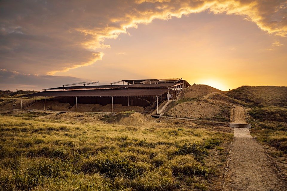
The opening of Huaca del Sol has been presented as a source of local identity and progress, while workshops and training have involved residents in the future management of the site. The Ministry of Culture administers the Cabeza de Vaca “Gran Chilimasa” Site Museum, which displays archaeological and photographic material, pottery, stone tools, weapons, and worked Spondylus. Its exhibitions explain the complex’s place on the Inca road, reconstruct aspects of ancient daily life, and include a room devoted to mollusc discoveries. In 2016, an image of Cabeza de Vaca appeared on a commemorative one-sol coin in the “Wealth and Pride of Peru” series for the Tumbes Region.
Remains
The archaeological area covers 69.39 hectares, approximately 5 km from the city of Tumbes and 6 km from the Pacific coast. Stone and adobe structures are distributed across the site alongside concentrations of pottery fragments, mollusc remains, stone-working debris, food refuse, animal bones, and stone tools. These remains define areas associated with administrative, religious, and productive activities, with differences in status among the sectors.
Monumental structures
Huaca del Sol
Huaca del Sol is the largest structure in the monumental area and in the Tumbes Region. It is a truncated pyramid made of adobe and arranged in three stepped levels. The term huaca refers here to an Andean sacred monument or place, represented by a large earthen structure.
Smaller huacas
A group of smaller huacas occupies the plain north of Huaca del Sol. Their plans measure no more than 40 by 30 metres, and their heights range from 1.5 to 3.8 metres. Together, these mounds form a distinct group within the wider archaeological area.
Shell-working area
A malacological workshop stands on a hill east of Huaca del Sol. “Malacological” refers to the study and working of molluscs and their shells. The surface contains large quantities of shell remains, including bivalves such as Spondylus, Anadara, and Ostrea, together with shells of Strombus, Conus, and Melongena. These materials relate the area to the processing of coastal shell resources.
Road and irrigation features
Cobbled coastal road
A cobbled road linked Huaca del Sol with the coastal zone between Playa Hermosa and the La Chepa estuary. Much of the road has been destroyed, but its former course represents a physical connection between the monumental area and the coast.
Irrigation canal
An irrigation canal crossed the archaeological area from east to west. Urban, road, and agricultural expansion have almost destroyed it, leaving the canal as a heavily affected element of the site’s former infrastructure.