Yarumela: A Formative-Period Ceremonial Center in Honduras
Site at a Glance
- Popularity
- High
- Country
- Honduras
- Primary era
- Iron Age
- Eras represented
- Bronze Age, Iron Age, Classical
- Civilizations
- Unclassified
- Site type
- City
On this page17 sections
History
Yarumela is an archaeological site in La Paz, Honduras, occupied by ancestors of the Lenca from about 1000 BC and later developed into a major Formative-period ceremonial center. The Formative is an archaeological period associated with early settled communities and increasingly complex societies in the Americas. Yarumela became the largest center in the Comayagua Valley during this period, in part because it lay on routes linking the Caribbean and Pacific coasts with Mexico and Guatemala.
Formative-period center
Around 400 BC, communities from the valley and nearby areas united in the Señorío de Yaruma, a chiefdom, or political community under chiefly authority. Yarumela became its capital. Near the end of the Preclassic, the period preceding the Classic in Mesoamerican chronology, the population was estimated at about 6,400. Yarumela was among the largest urban centers in what is now Honduras and, by the beginning of the Classic, was the country’s most populous settlement.
The site’s ceremonial activity reached its main phase during the Formative period. Its position between distant regions supported trade and gave Yarumela regional importance. The ceremonial center’s activity diminished around AD 200, although construction continued into the following decades.
Decline and later occupation
Yarumela declined from the third century AD, and the ceremonial center had ceased functioning by about AD 200–250. Possible causes include competition from other centers, conflict between chiefdoms, poor harvests, and ash from an eruption of San Miguel Volcano. People continued to settle and bury their dead at the site intermittently in later periods, including the Postclassic, which followed the Classic in Mesoamerican chronology.
Recording and archaeological research
Local people knew the area before foreign travelers arrived. In 1855, American traveler, diplomat, and ethnographer Ephraim G. Squier recorded its structures during a survey connected with a proposed interoceanic railway. He named the site after a small village upstream and described its structures as better preserved than they were on later visits.
Archaeologist Joel Canby’s 1949 excavation was the first substantial academic investigation at Yarumela. It helped establish the site’s early chronology, and its pottery was found to resemble material from early or Preclassic levels at Copán. Doris Stone’s surveys and surface collections in 1957 and 1972 further demonstrated the site’s importance for studying the Formative period. In 1966, Claude Baudez connected Yarumela’s pottery with material from northern Honduran sites such as Los Naranjos and Playa de los Muertos, placing communities in the valley within a wider settlement system.
Research beginning in 1980 examined pottery traditions, settlement, and architecture beyond the mounds. Excavations in areas without mounds were published in 1986, while work from 1988 to 1990 investigated early building plans and the development of social hierarchy and elite construction. Smaller-mound excavations explored how their residents related to people occupying larger structures and to communities outside the valley. Between 1985 and 1987, Boyd Dixon surveyed about a tenth of the Comayagua Valley, studying regional differences and the role of highland rivers in cultural exchange. Together, this research contributed to interpretations of Yarumela as a center within an increasingly settled and socially stratified society.
Vegetation growth and human activity led to the loss of some mounds. In 2019, the municipality, the Honduran Institute of Anthropology and History, and the national police restored Structure 102 and cleared and rehabilitated much of the site. The Institute and municipality began further restoration and investigation in 2025.
Remains
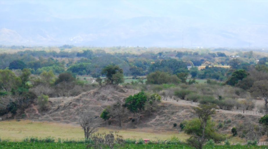
Yarumela covers roughly 30 hectares on an elevated, island-like plateau about 600 metres above sea level and roughly 10 metres above the surrounding land. The Humuya River, within the Ulua river system, bounds the site to the east; a large artificial ditch protected its western side. At least 15 mounds occupy the central area, and more than 60 structures have been identified across the site, nine of them visible in the archaeological park.
Central platform mounds
Structure 101
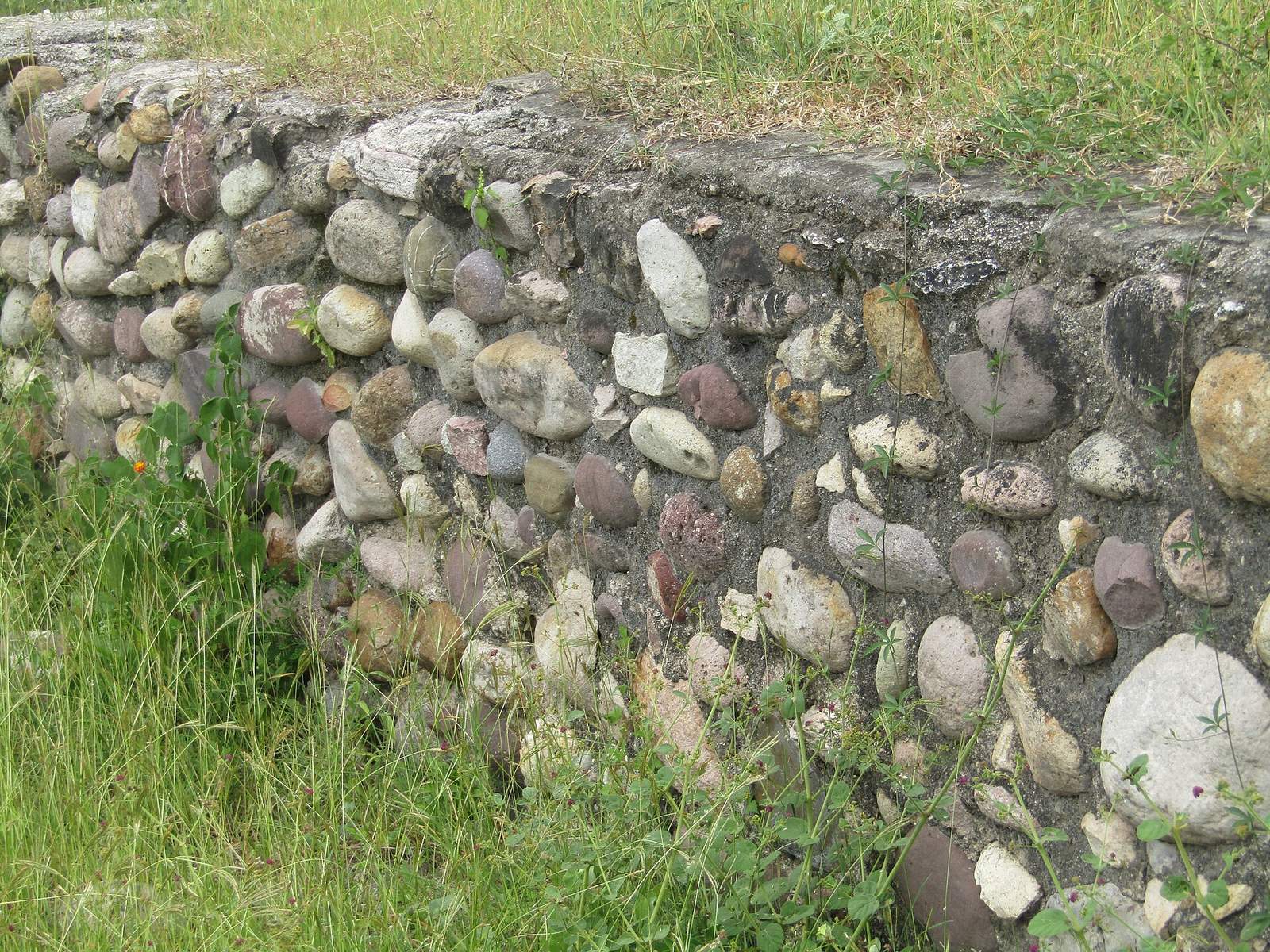
Known also as El Cerrito, Structure 101 is the principal mound in the central district. It reached about 20 metres high and had a base approximately 70 metres wide and 110 metres long, much of which was faced with river cobbles. When maintained, the mound could be seen from almost anywhere in the valley. Excavation revealed a deposit more than 60 centimetres thick containing material from the Late Formative, Classic, post-conquest, and modern periods. Below it were remains of single-storey buildings built over several decades and a Formative-period storage facility, possibly connected with an elite residence or ritual activity.
On the summit stood a thatched building supported by wooden posts, about 32 by 14 metres in size and facing east along the main plaza’s east–west axis. A limestone-finished court or veranda about 3.5 metres wide lay in front. Excavators also identified two plastered floors east of the platform and two small buildings positioned at right angles to the main structure, facing one another.
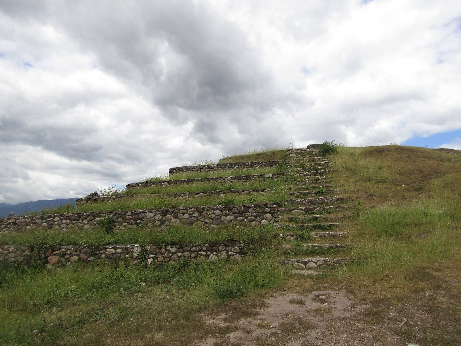
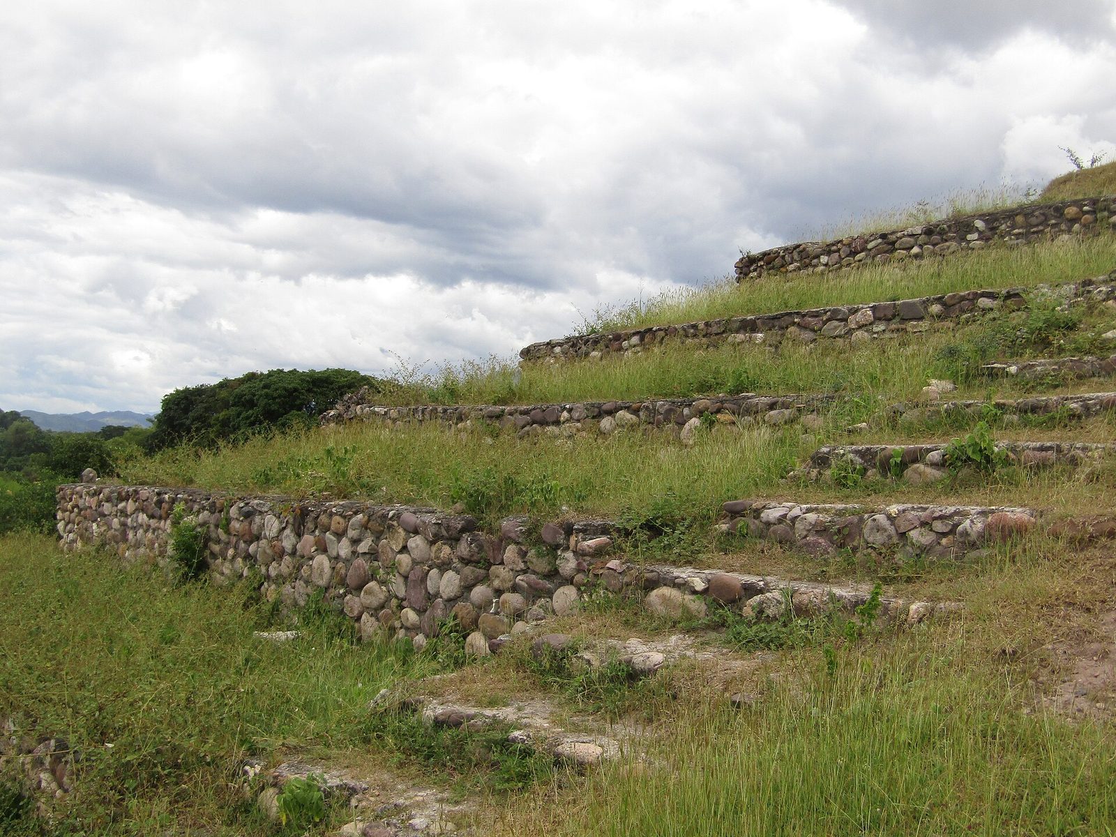
Two terrace-like levels mark the mound’s south side. A surviving wall there is about 1.2–1.6 metres thick and up to 1.6 metres high, with narrow layers of compacted sand and clay separating the surfaces. These may once have been finished with limestone plaster. Dixon proposed that a central stairway originally led to the summit and was removed after the colonial period.
A paved feature about 1.5 metres wide ran beside and behind the mound. It may have been a walkway or water channel; Dixon interpreted it as a Formative-period drain. A partly identified stone drain beneath the platform’s original floor may have led to a basin at its southwest corner. The mound also contains repeatedly renewed compacted-clay floors with thin layers of fine sand.
Structure 102
Structure 102 began as an earthen platform about four metres high during the Middle Formative period. It was enlarged in at least four stages and reached about nine metres by around AD 250. A later platform, faced with plastered river cobbles and fitted with a central staircase, covered the earlier structure. At the beginning of summer, shadows from Structures 101 and 102 align. This has been interpreted as marking the summer solstice and the start of the Lenca agricultural season.
Structure 104
Like Structure 102, Structure 104 is a platform mound about six to nine metres high, containing an inner earthen platform about three to four metres high with a limestone-finished surface. Charred, abandoned wall fragments above its lowest layer yielded radiocarbon date ranges of either 800–360 BC or 290–251 BC. A sample from the mound’s base suggests that construction began around the time of the earliest dated occupation.
Structure 103
Burned wall fragments dated to about 840–390 BC came from the foundations of Structure 103. The foundations also contained a Middle Formative human-figure vessel with a prominently rounded abdomen.
Structure 106
Structure 106, about three metres high, stands at the southwest corner of the main plaza. A row of postholes in clay beneath it indicates that groups of domestic buildings occupied this area before the mound was completed.
Other Late Formative buildings
Construction around the main plaza intensified during the Late Formative period, reducing its open area. Structure 105 used river cobbles and adobe, sun-dried earth used as a building material. Structures 108 and 109 had wattle-and-daub upper walls, made from a lattice of sticks coated with earth or clay. Structure 110 used large flat limestone slabs to cover a terrace. Earthen fill on Structures 101 and 104 was finished with plaster and may also have been protected with river cobbles. Charred material from Structure 108 yielded dates of 480–180 BC and 400–100 BC.
Early settlement and hearths
South of the main plaza, early Formative remains include hearth pits, postholes, and fragments of earthen walls. Together they indicate a wider area of compacted floors and wooden-post buildings with thatched roofs than was initially recognized. A charcoal sample dates to 1125–800 BC, while pottery associated with Hearth 2 spans the transition from the Early to Middle Formative. Several large rectangular hearths were identified in 1983; one charcoal sample dates to 1430–190 BC. Two more hearths, at a southern site above a lake left by an abandoned river bend, date to 1000–770 BC and 520–170 BC.
Pottery and excavated finds
Early and Middle Formative pottery
Early Formative pottery includes finely burnished shallow dishes, bowls, and jars with red rims. Some were decorated with cord-like clay additions or deep cuts. Figurines could be hollow or solid, and undecorated stone bowls also occur. Dixon noted formal similarities between some of this pottery and material from the Tronadora highlands of Costa Rica and the Ocós phase on Guatemala’s Pacific coast.
Middle Formative pottery continued earlier shapes and techniques while adding varied handles and attachments, including stirrup-shaped vessel spouts. Fine-clay ear ornaments known as napkin rings also became more common.
Late Formative pottery
Late Formative pottery includes Usulután-style vessels, decorated by applying pigment around areas protected from it, as well as coarser everyday wares that continued earlier forms and decoration.
Regional goods and food remains
Excavated objects include jade from Guatemala, shell ornaments made from species native to both the Pacific and Caribbean coasts, obsidian, a natural volcanic glass, from central Mexico, exotic ceramics, and fragments of marble bowls. Plant remains include maize, squash, and burned coyol palm, alongside plant material from beyond the immediate area. River shells, bones of wild animals, and agricultural tools made of obsidian and basalt add evidence of food use and daily work.