Moundville Archaeological Site: A Mississippian Political and Ceremonial Center
Site at a Glance
- Popularity
- Very High
- Country
- United States
- Primary era
- Medieval
- Eras represented
- Medieval, Modern
- Civilizations
- Unclassified
- Site type
- City
On this page16 sections
History
Moundville Archaeological Site is an Indigenous Mississippian cultural center in the United States, occupied from about AD 1000. The Mississippian tradition included settled communities, maize farming, political centers, and earthen mounds. By around AD 1150, Moundville had developed into a regional political and ceremonial center, the heart of the Province of Pafalaya. Its chiefdom, a ranked political system organized around leaders and subordinate communities, changed in size and purpose over the following centuries.
From settlement to regional center
Before Moundville’s rise, during the West Jefferson phase, people lived in scattered settlements, generally small in area. Communities moved seasonally between higher ground and the river, gathered wild plants, hunted, and increasingly grew maize toward the end of the phase. Marine shells point to connections with the Gulf of Mexico, although long-distance exchange was limited.
Around AD 1200, settlement patterns and material culture shifted sharply. Many nearby small settlements were abandoned, while a few centers and scattered farmsteads continued. Moundville became especially prominent, and its first two platform mounds were built during this period. It remains uncertain whether these changes developed within local communities or involved the arrival of new groups.
In the later Moundville I phase, a chiefdom took shape as leaders gained influence and more people moved into the town. The surrounding countryside became less populated. By about AD 1300, Moundville was the largest town in Alabama. Estimates place its population at roughly 1,000 at that time; estimates for its peak range from 1,000 to 3,000 people inside the enclosure and as many as 10,000 more across the river valley.
At least four subordinate centers supplied maize to higher-ranking places through a tribute system. Maize surpluses supported a dense population, exchange, and specialized crafts. Residents farmed and made pottery, stone objects, and embossed copper items, while materials from farther away reached the community through exchange.
Contraction and changing use
Around AD 1300, Moundville increasingly served religious and political purposes rather than functioning primarily as a residential town. In a later phase, its defensive enclosure was dismantled and much of the population moved back to small river settlements. A smaller elite community remained, while ceremonies became more elaborate and finely made grave goods accompanied burial. The site increasingly served as a cemetery.
From about AD 1300 to 1450, the settlement contracted and its mounds gradually ceased to be used. Former residents established single-mound settlements along the river, and people returned to Moundville to bury their dead among abandoned house groups. Mound building and burial practices continued elsewhere in the region. Moundville eventually lost its political and religious functions, but the reason for its depopulation is uncertain. Around 1540, when Spanish explorer Hernando de Soto traveled through the region, the site was largely abandoned. None of the villages he described can be securely identified as Moundville.
Excavation, preservation, and interpretation
Non-Indigenous attention to the site grew in the 19th century. Local planter Thomas Maxwell excavated there in 1840 and described 15 mounds and an enclosing earthwork. E. G. Squier and Edwin Hamilton Davis included Moundville in an 1848 Smithsonian Institution survey of earthworks. Nathaniel T. Lupton later mapped the site and excavated the mound now called Mound O. A federal team worked there in 1882, and a planned excavation by Edward Palmer the following year did not proceed after a landowner demanded payment. Findings published in 1894 from excavations at other mounds helped establish that Indigenous people had built these earthworks.
Clarence Bloomfield Moore’s major excavations in 1905 and 1906 brought Moundville national attention and contributed to the development of the idea of a Southeastern Ceremonial Complex, a grouping of related religious imagery and practices in parts of the Southeast. His field records and collections remained useful to later archaeologists, though his methods drew criticism. Moore removed many objects from the state, after which Alabama restricted the removal of antiquities and enacted a protective law in 1915.
In the mid-1920s, local advocates, including geologist Walter B. Jones, worked with the Alabama Museum of Natural History to acquire the mound land for preservation. Jones pledged his own home to help secure the purchase. The site became Mound State Park in 1933; park development began in 1938, and the name changed to Mound State Monument in 1939. Large-scale scientific excavation began in 1929 under Jones and archaeologist David L. DeJarnette. During the 1930s, the Civilian Conservation Corps, a federal work program established during the Great Depression, excavated at the site and built park roads and structures. By 1941, the work had uncovered more than 2,000 graves, remains of 75 houses, and thousands of objects.
The Jones Archaeological Museum opened in 1939 to display objects and interpret the ancient community, and also served as a teaching center. It was remodeled in 2010, and the University of Alabama maintains an archaeological laboratory at the park. The site received National Historic Landmark status in 1964 and was added to the National Register of Historic Places in 1966. Its name changed to Moundville Archaeological Park in 1991.
Archaeological interpretations of Moundville’s social organization have developed over time. In the 1960s and 1970s, Christopher Peebles used burial locations and grave goods to assess social rank. High-status objects found with young children led him to conclude that status could be inherited, while other interpretations have proposed a more complex structure than a simple hierarchy. Early 21st-century work by University of Alabama archaeologists John Blitz and Vernon Knight, their students, and researchers from the University of North Carolina refined the site’s chronology. Jim Knight also directed research focused on reconstructing the community’s history through written accounts and archaeological evidence. About 14 percent of the site’s total area has been investigated.
A 1980 break-in at the Erskine Ramsay Archaeological Repository resulted in the theft of 264 pottery vessels, about one-fifth of the Alabama Museum of Natural History’s Moundville collection. Three ceremonial bowls were returned anonymously in 2018. In 2021, a federal repatriation review committee found cultural connections between Moundville and seven tribes speaking Muskogean languages, a language family historically used in the Southeast. The tribes sought the return of 5,982 human remains and funerary objects. Archaeological evidence points to descendants dispersing into the Tombigbee and Alabama river regions, with Muskogee, Choctaw, and Chickasaw peoples identified as probable descendants. Human remains and many associated objects were returned to descendant tribes in 2024. Tribes from the surrounding region also organize an annual Moundville Native American Festival that includes ceremonies.
Remains
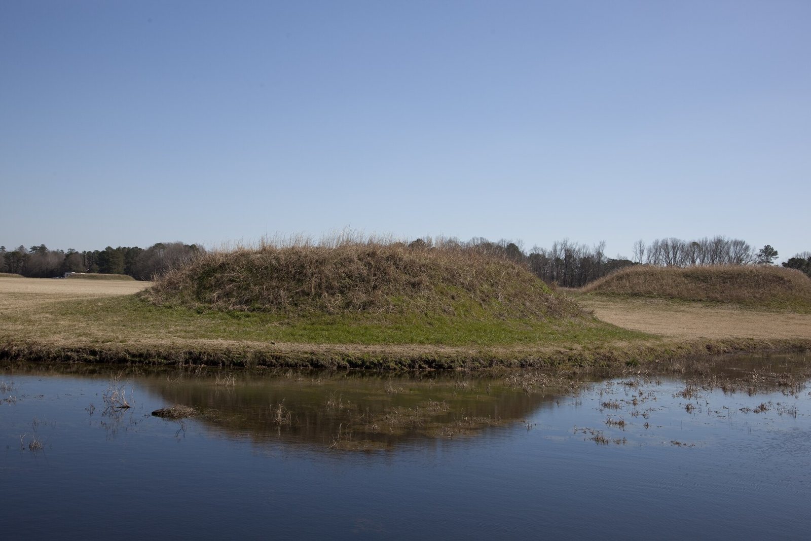
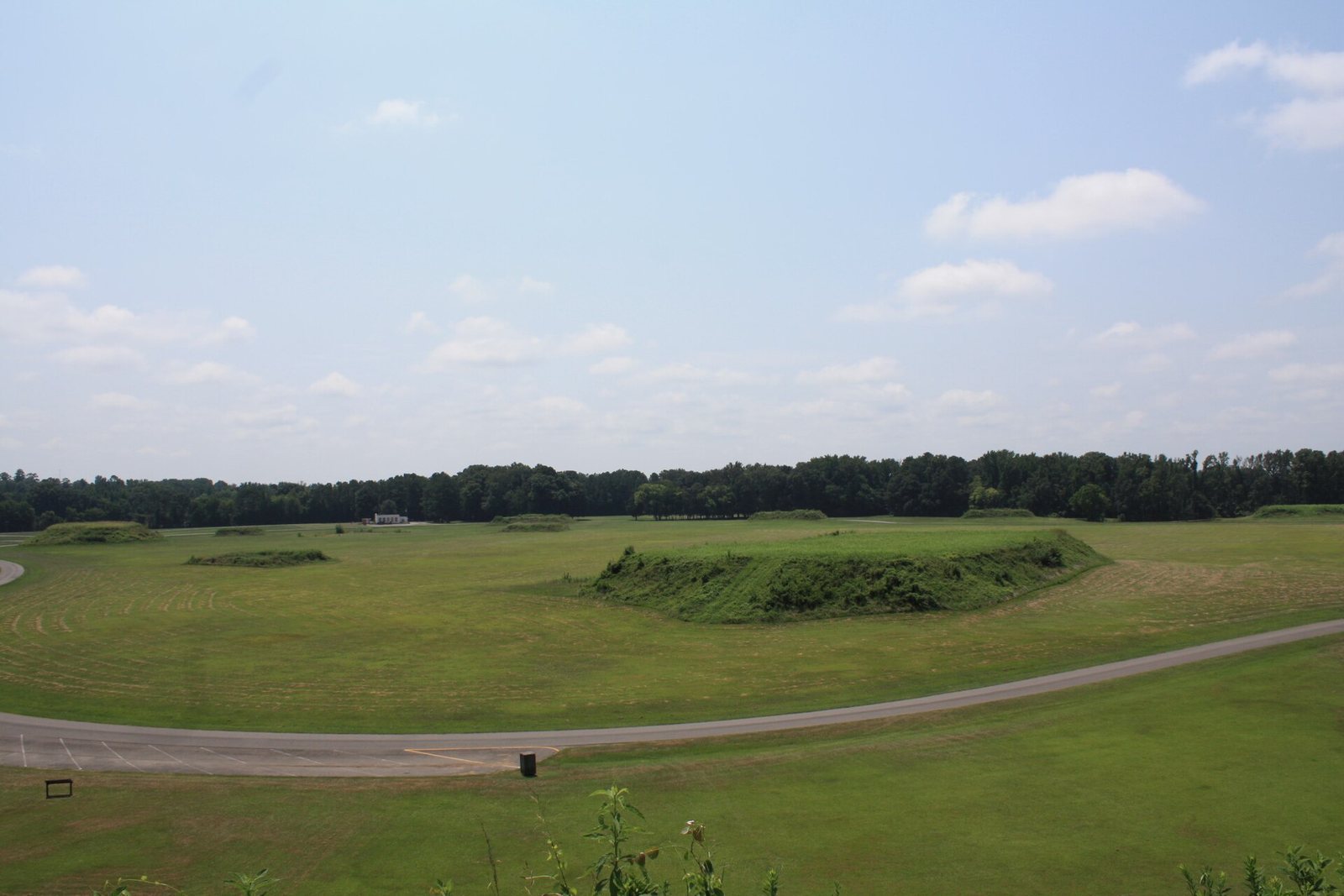
The park occupies 185 acres, while the ancient residential and political center covered roughly 300 acres at its height. Moundville stands on a bluff above the Black Warrior River, in a valley extending about 25 miles downstream from the fall line, where rivers descend from uplands toward the coastal plain. Rolling uplands and intermittent streams characterize the area, along with oak-hickory, maritime magnolia, and pine forests. Within the ancient center, 29 flat-topped earthen platform mounds surround a rectangular plaza.
Plaza and earthen mounds
Plaza and mound arrangement
The plaza was leveled and filled before the mounds were built around it. Construction soil came from nearby borrow pits, excavations made to obtain earth; some of these pits are now small lakes. Workers carried soil in baskets. The largest mounds stand along the plaza’s north side and generally decrease in size toward the south. Built in stages as flat-topped earthen pyramids, the mounds range from about 1 metre to nearly 20 metres high. Buildings on them served residential or ritual purposes, and some mounds also held burials. The largest residential and burial mounds stood in the north.
Mound A
Mound A occupies a central position in the plaza, though its function is uncertain. It was an early focus of the site plan. Structures once surrounded a small neighboring plaza, which was later covered with fill.
Mound B
Just north of Mound A, Mound B rises about 58 feet (18 metres) in a steep, pyramidal form and has two access ramps. Evidence also points to later residential use on Mound B.
Other mounds and residential areas
Mound X, a small mound in the southeast, was leveled as Moundville was established, and the palisade line crossed it. Mounds P and E, along with Mound B, have evidence of later residential use. Signs of people living off the mounds also occur in the southwest of Mound G.
Enclosure and buildings
Palisade
A wooden palisade, a defensive enclosure made of upright stakes, enclosed the central area on three sides and extended for about a mile. The river bluff protected the remaining side. The palisade and plaza were part of the planned center built in the early 13th century.
Houses and public structures
Residential buildings were grouped around the plaza and placed along its edges and the palisade. Excavation and remote surveys have located remains of hundreds of buildings in the plaza area, including small houses made from poles and thatch. Groups of about 10 to 20 houses were arranged around the plaza. One early Moundville I house was slightly sunken and had a clay platform, whose possible use as a bench remains uncertain.
Public buildings and areas interpreted as ball courts occupied the plaza’s northern end. Near the plaza edge, a bone-storage building and a sweat lodge, a heated enclosure for sweating that may have had ritual uses, are considered possible structures. Other features include borrow pits and smaller houses.
Burials and objects
Burial patterns and mound groupings
Most people were buried near their houses with simple grave goods, such as tools. Some people of higher inferred status were interred in smaller mounds with stone, copper, or shell objects. Copper axes accompanied some adults in the northernmost burial mounds; the copper and marine shells came from distant sources. Mounds C and D in the north have especially complex ritual and burial remains.
Researchers have interpreted the mounds as paired groups associated with ranked clans, with mound size and grave wealth generally decreasing from north to south. They have also identified east-to-west differences in mound pairings and pottery imagery. Vessels depicting frogs, bats, shells, or fish occurred in the east, while duck images appeared in the west.
Pottery and crafted objects
Locally made Hemphill-style pottery has distinctive engraved decoration and is mainly associated with burial practices. Many painted vessels came from outside the community, indicating exchange with other societies. Negative-painted pottery, made by leaving designs unpainted against a colored background, was associated with elite use at Moundville.
Objects found at the site include imported copper, mica, galena, marine shells, and stone, alongside locally made pottery, stonework, and embossed copper objects. A finely carved bowl of diorite, a hard igneous rock, depicts a crested wood duck. It was later donated to the Smithsonian Institution with more than 500 other pieces.