Obsidian Cliff: A Prehistoric Quarry in Yellowstone National Park
Site at a Glance
- Popularity
- Medium
- Country
- United States
- Primary era
- Stone Age
- Eras represented
- Stone Age, Bronze Age, Iron Age, Classical, Medieval, Modern
- Civilizations
- Unclassified
- Site type
- Economic
- Remains
- Quarry
On this page8 sections
History
Obsidian Cliff is a prehistoric Indigenous quarry in northwestern Yellowstone National Park, Wyoming, United States, where people have obtained volcanic glass for tools and ceremonial use for at least 12,000 years. Its stone circulated across North America and reached as far as Mexico and Guatemala, while study of the source contributed to scientific methods for dating and identifying archaeological materials.
Indigenous quarrying and exchange
Use of the source varied among archaeological cultures and periods. Clovis groups appear not to have used its obsidian regularly. Projectile points made from the cliff’s stone are associated with groups identified as Goshen (9000-8500 BC), Folsom (8800-8300 BC), and Hell Gap (8500-8000 BC), whose visits to Yellowstone were infrequent. These names refer to archaeological cultural designations.
The first sustained, intensive quarrying is associated with the Cody complex around 7000 BC, perhaps as people followed migrating bison. Quarrying continued during the Archaic period (8000-1000 BC), a broad archaeological period, and reached its greatest intensity in the Late Prehistoric period (1000 BC-AD 1000). People shaped the stone into arrowheads, spear points, knives, and other sharp-edged objects, as well as using it in ceremonies.
Worked obsidian and flakes from the cliff have been found in Colorado, Idaho, Illinois, Michigan, North Dakota, Ohio, Wisconsin, northeastern Washington, and southern Alberta and Saskatchewan. Beads have been found east of the Mississippi River, and movement of the material extended as far as Mexico and Guatemala. How it traveled these distances is unknown; routes using the Missouri, Mississippi, and Ohio river systems have been proposed.
Between about 200 BC and AD 400, thousands of pounds of the stone reached Ohio for ceremonial use by Hopewell communities. Hopewell was a prehistoric cultural tradition in eastern North America associated with ceremonies and long-distance exchange. Obsidian was used at Hopewell burial sites, and one site in Ohio yielded a mass weighing about 300 kilograms.
Oral traditions among the Shoshone, Blackfoot, Salish, and Kootenai recall women collecting cinnabar, a mineral used as a red pigment, and other resources at the cliffs, where they prayed. The Crow name for the place is translated roughly as Ricochet Mountain. Later Indigenous groups more often used obsidian sources near Jackson, Wyoming, which were closer and easier to reach, though Obsidian Cliff appears to have retained ceremonial use.
Park-era history and research
Yellowstone National Park has protected the cliff from irreversible human alteration since 1872. Philetus Norris, an American explorer and the park’s second superintendent, gave it the name Obsidian Cliff in 1878. Building a road through the hard rock proved difficult: dynamite did not open a route, and water-induced cracking eventually made it possible to complete one.
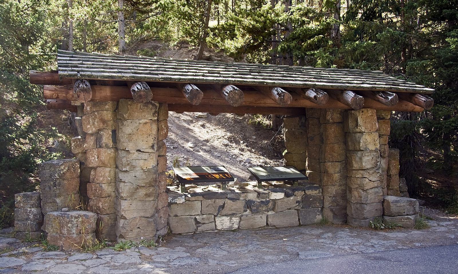
In 1931, the National Park Service built the Obsidian Cliff Kiosk as part of an effort to place interpretive exhibits along the Grand Loop Road. The kiosk entered the National Register of Historic Places in 1982 and is recognized as the first wayside exhibit in the National Park System. A wayside exhibit is an interpretive display placed beside a road or trail.
Field studies at the cliff began in 1986, when the National Park Service worked with archaeologists and geologists from the University of Montana. Their investigations connected the geological source with obsidian found at archaeological sites. Research on the cliff also contributed to obsidian-hydration dating, a method introduced in 1960 that estimates time from the hydrated layer growing on an obsidian surface.
Geochemical and geophysical investigations advanced techniques for identifying obsidian and other materials, including galena, turquoise, and flint. Atomic-absorption spectroscopy identifies elements by measuring light absorption, while X-ray crystallography analyzes crystal structures through X-ray diffraction. The 1988 Yellowstone wildfire cleared much of the vegetation and enabled further fieldwork.
On June 19, 1996, Obsidian Cliff was listed on the National Register of Historic Places and designated a National Historic Landmark. Its recognition reflects the long and widespread use of its obsidian, the source’s distinctive geological occurrence and composition, its practical and ceremonial uses, and the scientific methods developed through its study. A National Historic Landmark designation recognizes a place as nationally significant; the National Register is a broader federal register of historic properties.
Remains
The physical site centers on an exposed volcanic cliff, with prehistoric quarry workings distributed across the outcrop. A small interpretive shelter stands just north of the cliff. The quarry pits and trenches are cut into or occur alongside the natural source.
Geological form and obsidian
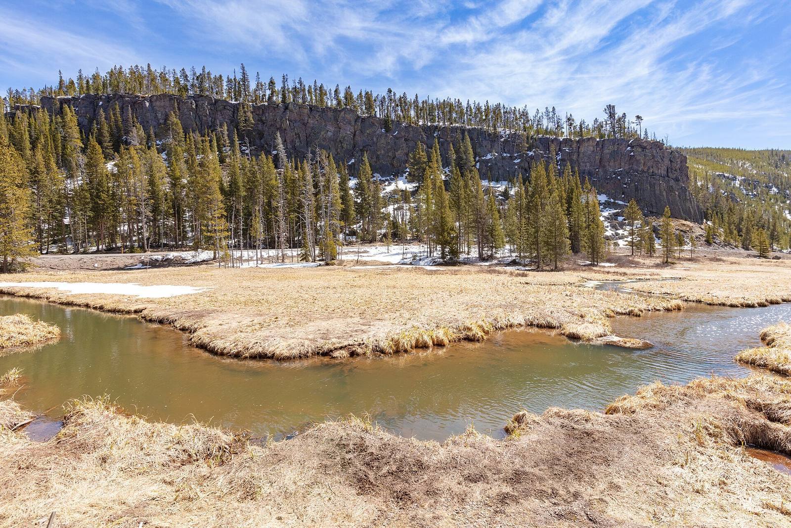
The cliff lies northwest of Yellowstone’s caldera and at the northern end of Beaver Lake, about 13 miles south of Mammoth Hot Springs. It is on the east side of the Mammoth-Norris section of the Grand Loop Road. The deposit covers about 14.5 square kilometers and extends for roughly half a mile. It stands at nearly 7,400 feet above sea level and rises more than 60 meters; the exposed face is about 30 meters above the surrounding ground, and the cliffs extend about 150-200 feet above Obsidian Creek.
The cliff formed about 180,000 years ago during the Pleistocene, the geological epoch before the Holocene that included repeated glaciations. A rhyolite flow, made of silica-rich volcanic rock, reached roughly 120-160 meters thick. It emerged from a vent about one kilometer east of the cliff and filled an existing valley in lava. The vertical columns in the flow are fractures formed as the rock cooled and crystallized.
One explanation for the obsidian is that the rhyolite contained very little water and had a composition that inhibited crystal growth, an interpretation supported by the columnar structure. Another possibility is that the lava cooled rapidly where it met a glacier. Obsidian is most abundant near the cliff’s base, while pumice is more concentrated higher up. Gray spherulite bands, rounded mineral-growth structures in volcanic glass, cross the lower face, where cavities and lithophysae, hollow structures formed within volcanic rock, are scarce. Higher up, the obsidian is less massive and contains lithophysae aligned with the flow. Its colors range from black to yellow-brown, purplish-brown, red, and olive green, sometimes with mottling. Its chemical composition and low water content help distinguish it from obsidian found elsewhere.
Quarry workings
More than 50 prehistoric quarries are spread across the cliff. Some are roughly circular pits up to half a meter deep; others are trench-like excavations reaching 35 meters long, 1.75 meters wide, and 1.5 meters deep. Hand-sized stones lie loose on the surface, and accessible blocks protrude from the cliff. The 1988 wildfire burned over nearly the entire cliff with varying intensity. It damaged the quarries and associated remains, fractured exposed obsidian through heat, and destroyed abandoned organic tools.
Glacial traces
Loose fragments produced by weathering cover the cliff top. They include Paleozoic quartzite, Quaternary basalt, and igneous fragments originating in Earth’s mantle. These materials indicate transport and deposition by glaciers during the last ice age, roughly 12,000-70,000 years ago. An ice sheet covered the cliff until about 13,000 years ago, when the outcrop became exposed.
Obsidian Cliff Kiosk
The kiosk is a small shelter for an interpretive exhibit. It follows the National Park Service Rustic style, a building style using natural materials and simple forms. National Park Service staff member Carl Russell designed the exhibit.