Hailongtun Castle: A Mountain Fortress of the Bozhou Yang Chieftains
Site at a Glance
- Country
- China
- Primary era
- Early Modern
- Eras represented
- Early Modern
- Civilizations
- Ming
- Site type
- Military
- Remains
- Castle
On this page19 sections
History
Foundations and the Southern Song fortress
Hailongtun Castle, on Longyan Mountain in Guizhou, China, was established in 1257 as a stronghold of the Bozhou Yang chieftains. Built under Yang Wen and Southern Song commander Lü Wende, it became an important medieval fortress in Guizhou. Its name comes from a pond also known as Longyan Water.
The Yang lineage entered Bozhou in 876, travelling through Luzhou and Hejiang before settling in its southern part. Yang Duan, associated with the family’s rise, built an early garrison settlement on Longyan Mountain and a horse-breeding settlement to the east. The mountain position helped his forces resist Nanzhao, a kingdom centered in present-day Yunnan. This early activity preceded the foundation of Hailongtun as a fortress by several centuries.
During the 1240s, as Mongol pressure on Sichuan grew, Yang Wen proposed a regional defense strategy. Mongol forces moved through Dali and advanced toward western Bozhou in 1253, after which Song military officials were assigned to the area. Song forces built Longyan City on Bozhou’s northern frontier in 1255. Two years later, Yang Wen and Lü Wende developed Hailongtun on Longyan Mountain, adapting its defenses to the terrain. The Song government provided funds, though the fortress was not then used in warfare. Bozhou was expanding and had become the Song’s largest indirectly administered prefecture in Guizhou, a frontier jurisdiction where local rulers retained substantial authority under imperial oversight.
Yuan rule and Ming-era conflict
After the Song capital fell in 1276, the Yang chieftains submitted to the Yuan, the Mongol dynasty that followed the Song. Bozhou entered Yuan territory peacefully in 1277, and Yang rule reached its height during the Yuan period.
Under the Ming, Bozhou’s administrative ties shifted between Sichuan and Guizhou. Yang Yinglong initially maintained relations with the Ming court and continued the family’s tribute. Rivalry between the provinces, disputes among chieftains, divisions within Bozhou, and factors connected with Yang himself contributed to growing tensions. In 1596, Yang rebuilt Hailongtun as his military headquarters, adding three tiers of walls and nine stone walls. His handwritten instructions at the fortress urged the defense of the state through strategic use of the terrain and described the site as a lasting foundation for his descendants.
Defeat, direct administration, and rediscovery
Ming forces besieged Hailongtun in April 1600 and broke through its defenses in June. Yang Yinglong burned the palaces and died by suicide with his wife; the fighting severely damaged the fortress. In 1601, the Ming abolished the Bozhou Pacification Commission, an office that oversaw a region governed through local chieftains. Bozhou was divided between the Zunyi and Pingyue military and civilian prefectures under Sichuan and Guizhou, respectively. Directly appointed officials replaced hereditary chieftain rule, a shift toward central government control.
The ruins remained concealed for centuries. Their location was confirmed during a survey in 1979, and the passes were recorded through photographs, drawings, and a report drawing on historical records. Hailongtun received provincial-level protection in 1982 and national-level protection in 2001. In 2015, UNESCO inscribed it as one of the three sites comprising the Tusi Sites World Heritage property. It became Guizhou’s second World Heritage property and Zunyi’s first World Cultural Heritage site.
Remains
Hailongtun’s layout combines inner and outer enclosures, with stone walls and gates fitted to steep mountain terrain. The site covers 1.59 square kilometres on Longyan Mountain, on the eastern branch of the Dalou Mountains where the Yunnan–Guizhou Plateau slopes toward the Sichuan Basin. Baisha Water borders the mountain’s northern foot, while a ravine to the south joins the water, which flows east. The foot of the mountain lies about 970 metres above sea level and its summit reaches about 1,350 metres. Cliffs surround much of the fortress; a ridge at its southwestern end connects it to the rear mountain.
Enclosures and eastern defenses
Walls and the eastern approach
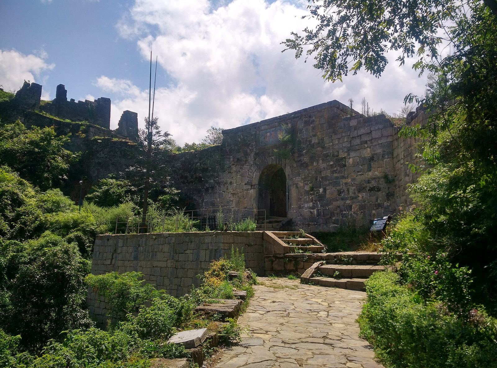
The inner and outer enclosures are defined by surviving walls extending about 5.6 kilometres. By the late Ming, the defended area had grown to the scale of a mountain city. The earlier horse-breeding settlement, about three kilometres to the east, formed part of the defensive system. Six fortified gates made up the eastern defenses. From outside inward, the approach passed the outer eastern wall, Iron Pillar Pass and Copper Pillar Pass, then followed an old uphill road and the Horse-Resting Platform toward the fortress.
Iron Pillar Pass, Copper Pillar Pass, and the stairway
Copper Pillar Pass stood at the foot of the right-hand hill, and Iron Pillar Pass at the foot of the left-hand hill. A straight wall joined the two gates and continued to the Thirty-Six-Step Ladder, the sole route to Feihu Pass. This stone stairway climbed at a slope of about 30 degrees. Its steps were about 2.8 metres wide and 0.5 metres high, with treads about 1.5 metres deep; the sloping run measured 51.5 metres.
Feihu and Feilong passes
Feihu Pass, a major gate halfway up the mountain, faced north. A cliffside road wound from it toward Feilong Pass, with a low protective wall along the exposed edge. Feilong occupied the northeastern corner of the main enclosure. Steep stone steps led toward its entrance, where a moat had to be crossed by bridge; a deep ravine lay to its left.
Chaotian and Feifeng passes
Feilong and Chaotian stood on relatively isolated ground surrounded on three sides by deep valleys. From Feilong, a route followed the eastern cliff behind a low wall and curved around the mountain to Chaotian Pass, which faced northeast, like the New King’s Palace. Walls connected its northern and southern sides to the wider defenses. Feifeng Pass, also called Taiping Pass, was the eastern approach’s final gate and Hailongtun’s main entrance, although its own defenses were comparatively light. Stone walls on its north, east, and west enclosed a courtyard with two terraces; a gate pierced the northern wall.
Western defenses
Houguan and Xiguan
Houguan’s gate stood in a saddle between two ridges and faced southwest. Beyond it, a vaulted passage through a high wall led to Xiguan. A raised stone stairway between the passage and the gate tower ended at an entrance that required a movable bridge.
Wan’an and the rear approach
Wan’an Pass, the last gate on the approach from the rear mountain, was set between steep cliffs. The arrangement of Wan’an with Xiguan, and Houguan with an earthen wall, created two successive barbican defenses. A barbican is a fortified outer gate structure that adds a defensive layer. Feilong, Chaotian, Feifeng, and Wan’an, together with walls along the summit, also formed the inner defensive line.
Western enclosure and shared defenses
The western defenses included a crescent-shaped enclosure and an earthen fortification as well as the three gates. Archers’ towers flanked the gates, and a deep moat surrounded the fortress. A broad stone wall, wide enough for horses to gallop along, may once have linked all the passes, though its existence is uncertain.
Palace district on the summit
Headquarters and palace enclosure
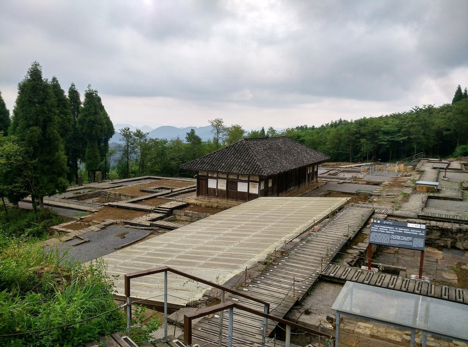
The administrative headquarters occupied a northwestern ridge at the summit. The New and Old King’s Palaces stood on separate ridges, each with lower ground to the front and higher ground behind. Together with their enclosing walls, the palace area covered about 1.8 hectares and was bounded by more than 500 metres of wall. The remains surviving after the 1600 battle belong to the Ming period.
New King’s Palace
The New King’s Palace faced northeast and comprised eastern, central, and western sections. The eastern section was approached from the southwest and rose across four stepped levels, arranged in three stairways of different widths. From the lowest level upward, the sequence was a main gate, ceremonial gate, main hall, and second hall. The halls were five bays wide, with a bay being a structural division across a building’s frontage; the ceremonial gate was three bays wide. The ordered sequence was associated with rank and an ambition to claim imperial status.
Memorial temple and western chamber
A temple for Buddhist rites intended to aid the souls of soldiers killed in the battle was built behind the New King’s Palace ceremonial gate around 1603. At the rear of the western section, a chamber stood on five successively raised platforms. A stone-built vaulted passage connected the different levels, and remains relating to the household life of the chieftains were found there.
Old King’s Palace
The Old King’s Palace occupied a central ridge that descends from southwest to northeast. Its construction is estimated to date to the Southern Song period, the southern regime of the Song dynasty.