Fortress of Santo António da Barra: A Coastal Fort in Brazil
Site at a Glance
- Country
- Brazil
- Primary era
- Early Modern
- Eras represented
- Early Modern
- Civilizations
- French, Portuguese
- Site type
- Military
- Remains
- Fort
On this page11 sections
History
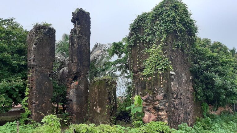
The Fortress of Santo António da Barra is a coastal fortification at João Dias Point in Brazil, overlooking the channel entrance to the port of São Luís. Its earliest form is associated with the fighting of 1614, although its builder is uncertain. French forces led by Daniel de La Touche, a corsair who headed colonial expeditions, are credited with the first fortification. Another attribution connects it to Portuguese officer Alexandre de Moura, who landed on 1 November 1615. The French apparently signed their capitulation at the fort the following day. It later became known as Fort Sardinha.
Early works and Portuguese rebuilding
In February 1689, São Luís’s municipal council sought Indigenous workers for construction at João Dias Point. Stoneworkers had left with Sergeant-major Antônio de Barros Pereira, a senior military officer, and a letter dated 18 February reported that he had halted work, though it was unclear whether he had authority to do so. The council arranged for stone to be carried to the site while it awaited instructions. A works director was referred to as Sardinha.
A Portuguese construction phase was under way by 8 October 1691, during the governorship of Antônio de Albuquerque Coelho de Carvalho. Work was hindered by shortages of engineers, masons, Indigenous laborers, materials, and lime from Portugal. Captain Pedro de Azevedo Carneiro drew a plan in 1692. The following year, four masons skilled in stonework were sent from Portugal to continue work on the fort’s projecting defensive structure, or bastion. Each received 500 réis per day.
Unstable foundations and failed rebuilding plans
An examination in 1715 concluded that repairs would not be effective. Even rebuilding with ashlar, carefully cut stone brought from Portugal, might not withstand the strong current. A royal order issued on 30 July 1716 directed that the fort’s guns and ammunition be removed to prevent their loss. Two circular plans for a replacement were drawn in 1718, but the proposed fort was never built.
In 1755, Governor Gonçalo Pereira Lobato e Sousa reported that much of the structure had collapsed. It stood on sandy, marshy ground, and wooden supports beneath it had rotted. Governor Joaquim de Melo e Póvoas began clearing the ruins in 1762 to make way for new construction, but abandoned the effort after the defensive walls collapsed twice.
Revolt and military decline
On 14 July 1824, artillery lieutenant Manuel Joaquim Gomes led a revolt against provincial president Miguel Inácio dos Santos Freire Bruce and established a “Temporary Junta” at the fort. Three days later, troops at Fort of São Luís do Maranhão and Fort São Marcos fired on it under orders from the provincial presidency. The powder house caught fire, and the rebels were driven away.
The fort was disarmed during Brazil’s Regency period, from 1831 to 1840, between the abdication of Pedro I and the rule of Pedro II. In 1871, its military command was discontinued. An Army employee responsible for the pyrotechnic laboratory operating there was assigned to watch over the site.
Protection and restoration
The fort’s remains entered Brazil’s national historical heritage register on 6 August 1975. The National Institute of Historic and Artistic Heritage, known as IPHAN, restored the structure between 1984 and 1991. Although an agreement with the state Culture Secretariat envisaged a military museum, the property was instead ceded to the Maritime Firefighting Group. Later alterations by the group were made without IPHAN’s authorization.
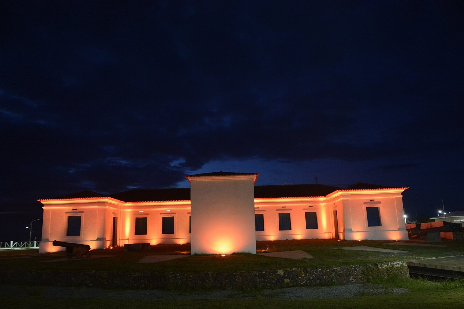
In 2012, a federal court ordered the Maranhão state government to submit a recovery plan after accepting a public civil action. A restoration project that included the surrounding area was announced in 2016 and completed in 2017. The restored fort was then put to museum use.
Remains
The surviving fortress is a ruin whose historic fabric was altered by later interventions and subsequently restored for museum use. Its recorded form includes a circular stone-and-lime artillery position, known as a battery, with service buildings on its level inner platform. The site lies between Ponta d’Areia beach and Tia Maria small beach, southwest of Fort São Marcos.
Early fortification
The earliest construction may have been a temporary earthwork reinforced with bundles of brushwood, called fascines. Another proposed form had walls made from woven branches coated with earth or clay. The surviving structure is a ruin, and later restoration adapted the site for museum use.
Stone battery and service buildings
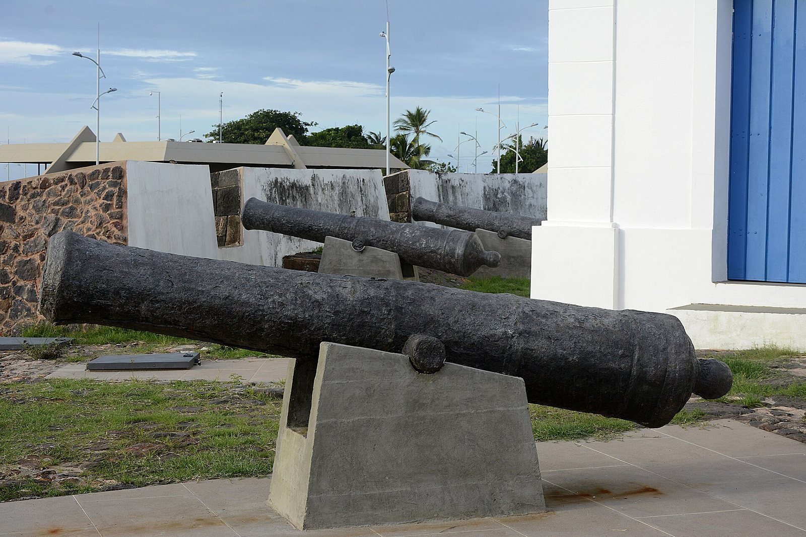
By the 1870s, the circular battery measured 23 braças in diameter. Braça and palmo were historical units of length whose precise values varied by standard. The stone-and-lime wall had a defensive notched top and stood 29 palmos above its foundation; it was 14 palmos thick, with a protective parapet measuring 9 palmos. Stone paved the inner platform, while slabs brought from Portugal covered the gun platform. A plan drawn after 1750 shows two one-storey masonry service buildings at the center. By the 1870s, the layout included a commandant’s house and troop barracks, as well as a store for artillery equipment and a gunpowder store. The mounted artillery comprised seven iron guns of calibre 32, thirteen of calibre 12, and one of calibre 9.
Museum collections
Traditional Maranhão vessels
The museum of traditional Maranhão vessels displays scale models representing 17 types of local craft. Master carpenters at the Shipyard School of IEMA, Maranhão’s state institute for education, science, and technology, made the models after completing a naval-modeling course. Examples include the Bião yacht; canoes named Benedito Leite, Nova Iorque, and Tasso Fragoso; a small craft from Viana; a dugout canoe; and vessels called Casco com proa de risco, Biana com Casario, Casquinho, Canoa Costeira, Igarité, Lancha de Tiom, Casco, Rabeta, Gambarra, and Biana. The Gambarra was used to transport animals.
The vessel forms reflect roughly 400 years of practical experience among local navigators. They were adapted to the tides, which can vary by as much as 7 metres, as well as to the waves and winds of the Maranhão Gulf.
Image and sound collection
The Museum of Image and Sound has a screening room for videos about Maranhão culture. Its small display includes older audiovisual equipment, among it cameras, projectors, and monocular viewers.