Fort Phil Kearny: A U.S. Army Post on the Bozeman Trail
Site at a Glance
- Country
- United States
- Primary era
- Modern
- Eras represented
- Modern
- Civilizations
- Unclassified
- Site type
- Military
- Remains
- Fort
On this page8 sections
History
Establishment and the Bozeman Trail
Fort Phil Kearny was a U.S. Army post near Piney Creek in the Powder River Country of the United States, established in 1866 to protect miners and settler caravans on the Bozeman Trail. The trail carried emigrants and prospectors north from the Oregon Trail toward Montana. The Army’s wider aims also included protecting railroad expansion and preventing violence. Fort Phil Kearny was one of three posts built along the route during the 1860s; Fort Reno lay to the south, while Fort C. F. Smith was established farther north.
Colonel Henry B. Carrington reached Piney Creek on July 13, 1866, chose the site, and began construction that day. Companies A, C, E, and H of the 2nd Battalion, 18th Infantry, carried out the work under his command. The fort was close to completion by December, after about five months of construction, and building continued in 1867. It was named for Major General Philip Kearny, a U.S. Army officer prominent in the Mexican-American War and the Civil War. Nebraska’s Fort Kearny, by contrast, was named for Philip’s uncle, General Stephen Kearny.
The post arose amid conflict over U.S. movement into territory used by Native peoples, including as hunting grounds. Lakota, Cheyenne, and Arapaho communities were allied in response to incursions from the east and earlier violence, including the 1864 Sand Creek massacre. Government and Native representatives began negotiations at Fort Laramie in June 1866 as Carrington’s expedition traveled north. Attacks on the fort began during its construction and continued frequently. In the post’s first months, they killed 154 people and led to the capture of about 700 cattle, horses, and mules.
Red Cloud’s War and the 1866–1867 fighting
Fort Phil Kearny and the surrounding area became an important setting in Red Cloud’s War, a conflict between the United States and Native nations, including Lakota, Cheyenne, and Arapaho groups, over military posts and travel routes. At its peak, the garrison included about 400 troops and 150 civilians. The soldiers served in infantry units of the 18th and 27th Infantry and in Company C of the 2nd Cavalry. Civilian workers included quartermaster staff and contractor employees.
On December 21, 1866, Captain William J. Fetterman and 80 men were drawn into an ambush north of the fort, beyond its view. Oglala Lakota, Cheyenne, and Arapaho warriors killed the entire contingent. Crazy Horse and his decoy group took part in the operation. In summer 1867, another decoy drew soldiers cutting wood several kilometres from the fort. They repelled successive attacks with Springfield Model 1866 breech-loading rifles until reinforcements arrived. The engagement became known as the Wagon Box Fight.
Winter shortages lowered morale, and Carrington was relieved of command and succeeded by Henry Wessells. Conditions became more settled in spring 1867, although civilian travel along the trail remained limited.
Abandonment and preservation
By 1868, supply problems and continued attacks had weakened the case for maintaining the route. The Union Pacific Railroad was extending west, and travelers heading for Montana’s gold fields could also use a route through present-day Idaho. After the 1868 Treaty of Fort Laramie, the Army abandoned the forts along the Bozeman Trail. Fort Phil Kearny was burned shortly afterward, apparently by Cheyenne parties.
The fort and the nearby Fetterman and Wagon Box battle sites were designated a National Historic Landmark in 1960. Fort Phil Kearny was added to the National Register of Historic Places in 1966 and is maintained by Wyoming as part of the Fort Phil Kearny State Historic Site. Archaeological work began in the second half of the twentieth century, and the fort has been partly restored.
Remains
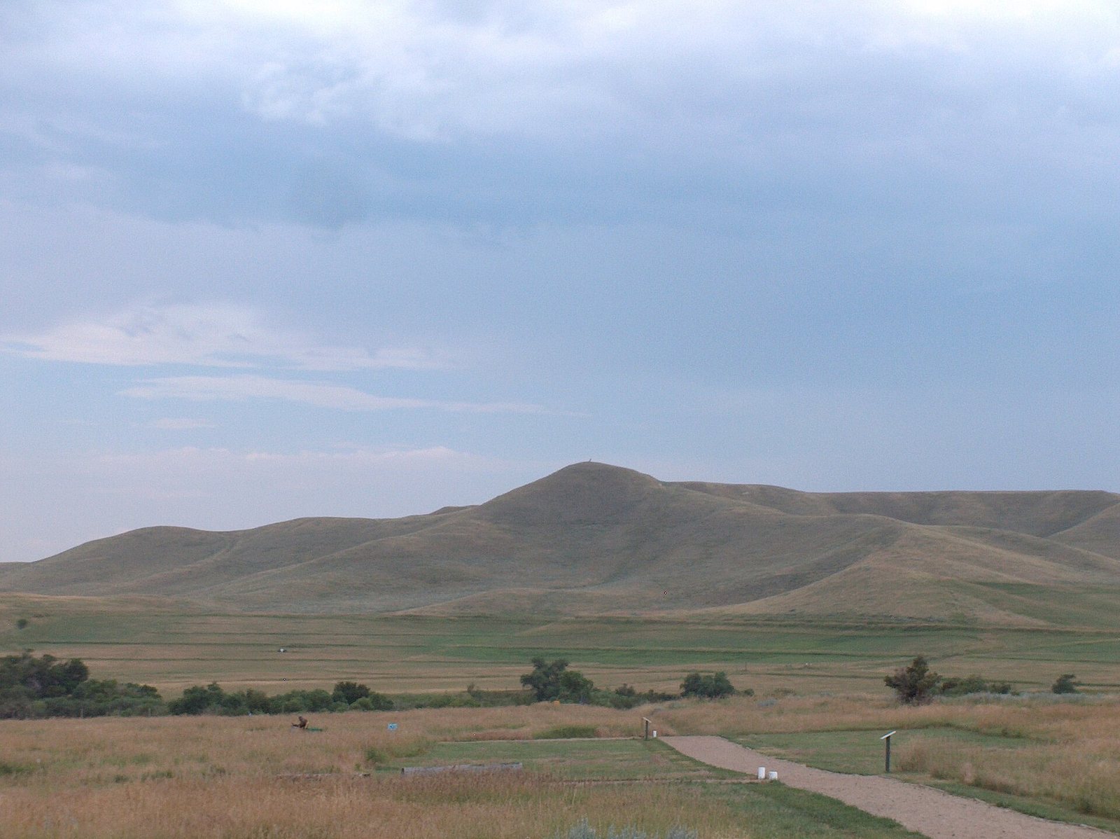
The fort stood about 4,700 feet above sea level on a plateau between Big and Little Piney, west of Little Piney Creek and east of the Bighorn Mountains. Timber in the surrounding area, including wood from the Bighorn Mountains, supplied its construction. The enclosure covered about 17 acres and had a roughly trapezoidal plan. It was the largest of the three stockaded forts on the Bozeman Trail.
Palisade and defenses
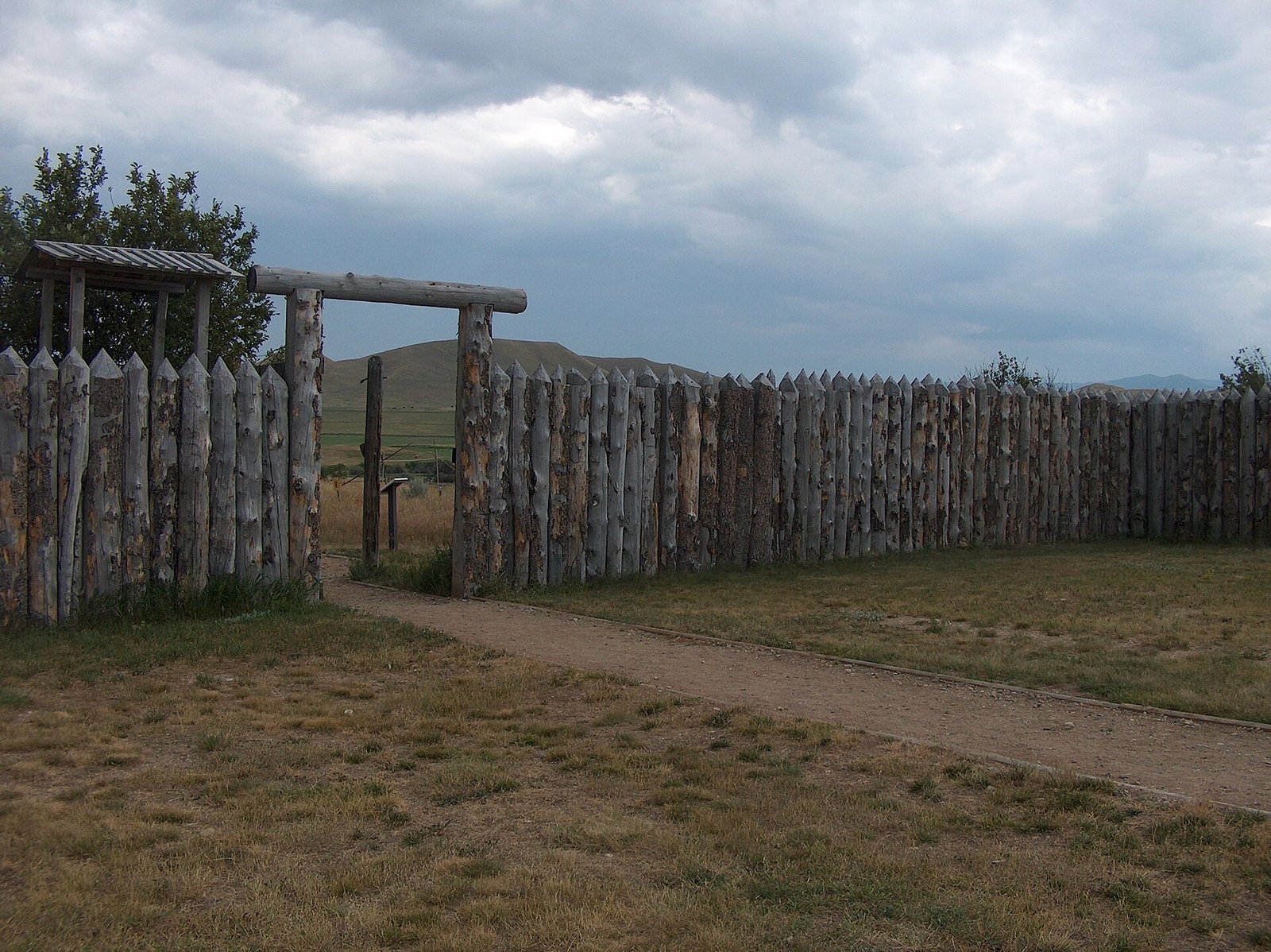
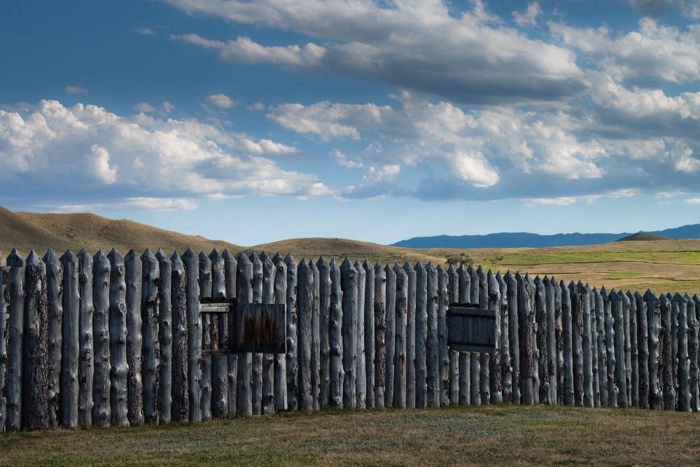
A defensive wall of upright logs enclosed the post. It stood about eight feet high and ran for roughly 3,900 feet. The northeast and southwest sides each measured about 1,496 feet; the northwest side was about 600 feet long, narrowing to about 240 feet on the southeast. More than 4,000 logs went into the palisade, which had openings for firing at intervals of roughly five logs. Guardhouses stood at opposite corners.
Interior buildings and archaeological remains
Within the enclosure were barracks, quarters for civilians and military personnel and their families, a chaplain’s and surgeons’ quarters, offices, stores, a warehouse, an armory, stables, a hospital, and a powder magazine. The warehouse also served as a social centre. Building work in 1867 used more than 606,000 board feet of lumber and 130,000 adobe bricks, a sun-dried earth building material. Archaeological remains mark the locations of the fort’s buildings. A cabin built by the Civilian Conservation Corps, a U.S. public-works program active during the Great Depression, is furnished to represent quarters for an officer’s wife and a non-commissioned officer.
Nearby battle areas
The associated historic site also encompasses the nearby Fetterman and Wagon Box battle areas, linking the surviving fort grounds with the locations of two engagements fought during its years of operation.