Mazagan: The Portuguese Fortified Port of El Jadida
Site at a Glance
- Country
- Morocco
- Primary era
- Early Modern
- Eras represented
- Early Modern, Modern
- Civilizations
- Alaouite, French, Portuguese
- Site type
- Military
- Remains
- Fortified Town
On this page13 sections
History
The Portuguese City of Mazagan (El Jadida) is a fortified port in El Jadida, Morocco, developed by Portugal during the sixteenth century. Its early Portuguese Renaissance military architecture reflects cultural exchange between Europe and Morocco.
Ancient and medieval identifications
The site’s ancient identity remains uncertain. It has been tentatively identified with Rusbis, a trading post associated with Hanno, a Carthaginian navigator linked to voyages along Africa’s Atlantic coast in the mid-fifth century BCE. Ancient references also connect the locality with Portus Rutilis, while a separate Roman-era identification has no certain name.
In the eleventh century, the geographer al Idrissi referred to the medieval port as Mazighan. Before the Portuguese arrived, a Moroccan watchtower called the Sheikh’s Tower, or El Brija, stood here. It had served as refuge for a Sufi, a practitioner of Islam’s mystical tradition, beyond the old town of Tit. The name Mazagan may come from a Berber expression meaning “the one with manes”; other proposed origins connect it with millstones or with Portuguese.
Portuguese occupation and fortification
Portugal’s claim to Mazagan followed a 1479 agreement with Spain concerning the West African coast, including the Kingdom of Fez, a premodern Moroccan polity centered on Fez. In 1486, the Portuguese crown placed the site under its authority. Portuguese presence began in 1502, when a storm drove Jorge de Mello’s ship ashore as a fleet returned from an unsuccessful attack on Targa. Twelve men stayed to hold the position while the rest went back to Lisbon to seek permission to remain.
In 1505, King Manuel I authorized Jorge de Mello and his companions to build a fort outside the old watchtower. The Portuguese returned in autumn 1513 and fortified the settlement between 1514 and 1517. Mazagan became a harbor for large ships and a base for the Portuguese fleet. Goods passed through it to Azemmour, while merchants traded grain, livestock, wax, leather, and woollen textiles. Its harbor and position on sea routes toward India and the Middle East, including a route linked to the gold trade, added to its strategic value.
Siege and Portuguese withdrawal
After Portugal lost Agadir in 1541, it withdrew from Safi and Azemmour but held Mazagan for its harbor and as a stronghold against the Saadians, a Moroccan dynasty. Major fortification work followed. The city resisted a powerful Saadian siege in 1562.
Portuguese rule ended in 1769 after a peace treaty with Sultan Mohammed III of Morocco. On 10 March, the Portuguese departed through the sea gate. They had mined the main entrance, and the explosion as Moroccan forces entered severely damaged the fortifications. The Marquis of Pombal ordered the population’s transfer to the Amazon region of Brazil. After a short stay near Lisbon, many settlers went to Brazil and founded a town also called Mazagan, now Mazagão in Amapá. The Moroccan city remained uninhabited for nearly half a century and became known as Al Mahdouma, meaning “the ruined.”
Rebuilding as El Jadida
In 1824, Sultan Abderrahman instructed the regional governor, Sidi Mohamed Ben Tayeb, to restore the old Portuguese city, strengthen its damaged defenses, and build a mosque. The city was rebuilt in 1832 and named El Jadida, meaning “the new.” During the French Protectorate, the name Mazagan returned; after Morocco became independent in 1956, the city again took the name El Jadida. In 2004, UNESCO inscribed the 7.5-hectare Portuguese City of Mazagan on its World Heritage List, recognizing its early Portuguese Renaissance military architecture and its evidence of European-Moroccan cultural exchange.
Remains
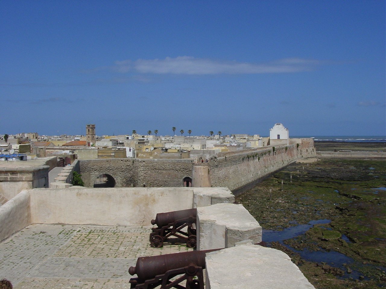
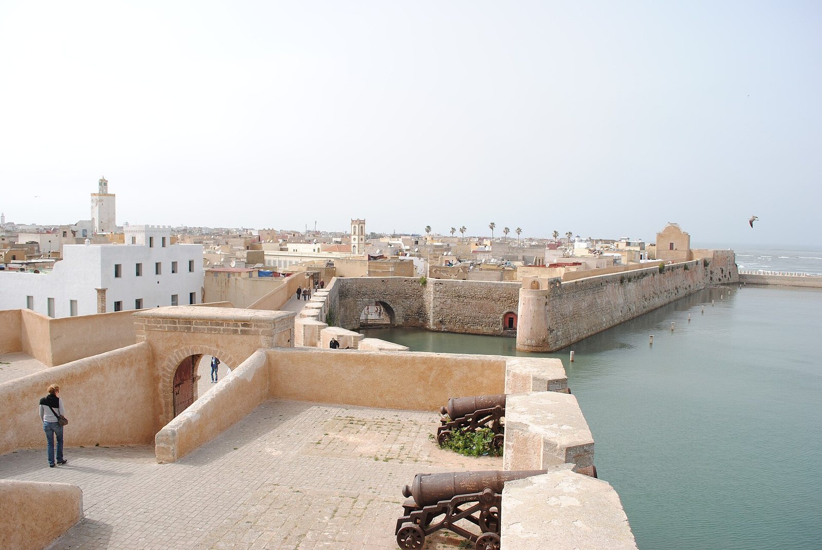
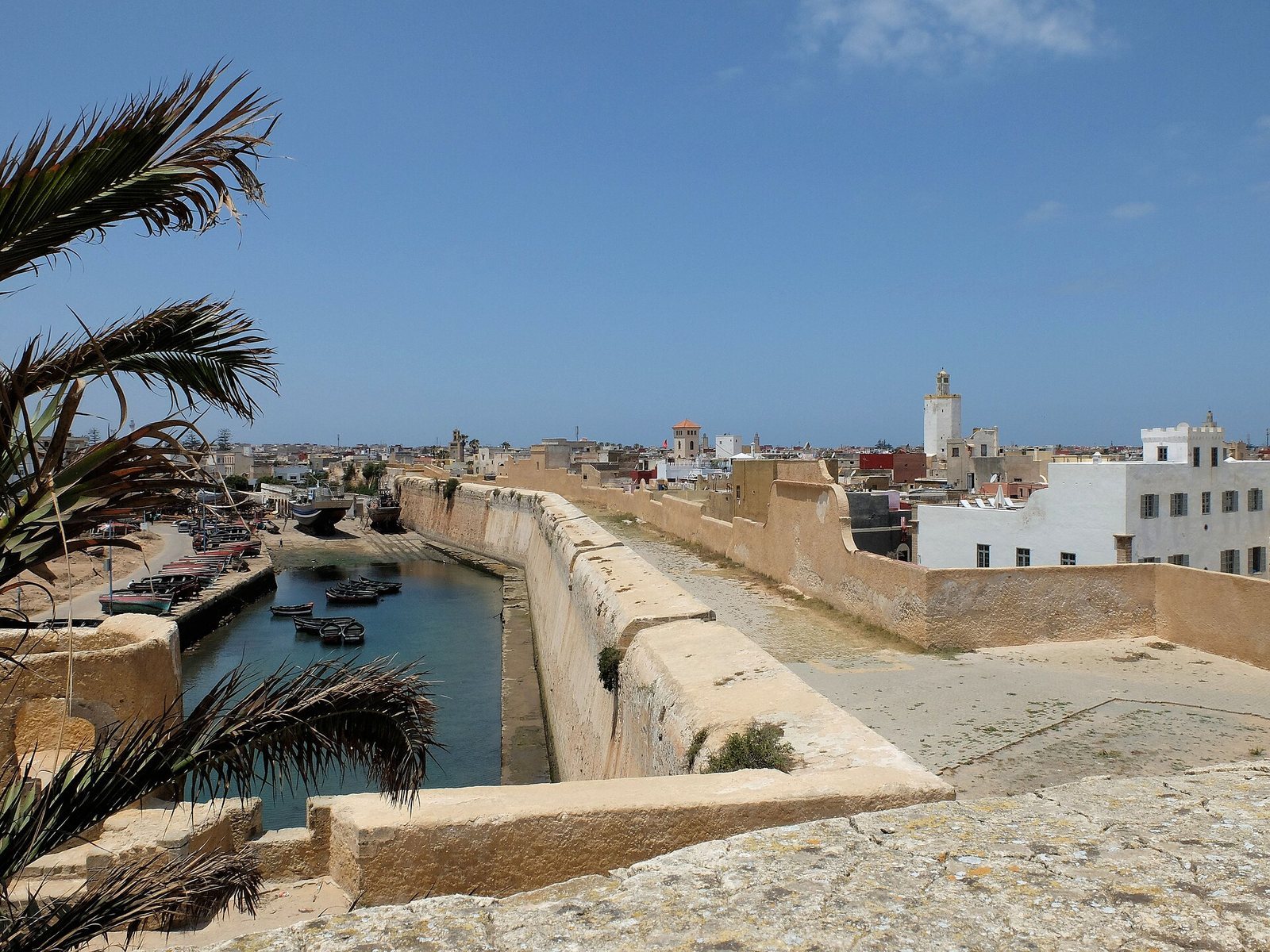
The fortress developed from a square citadel into a star-shaped plan, with defensive walls, bastions, gates, and a moat. Its massive, slightly sloping walls enclose the historic settlement.
Fortifications
Walls and bastions
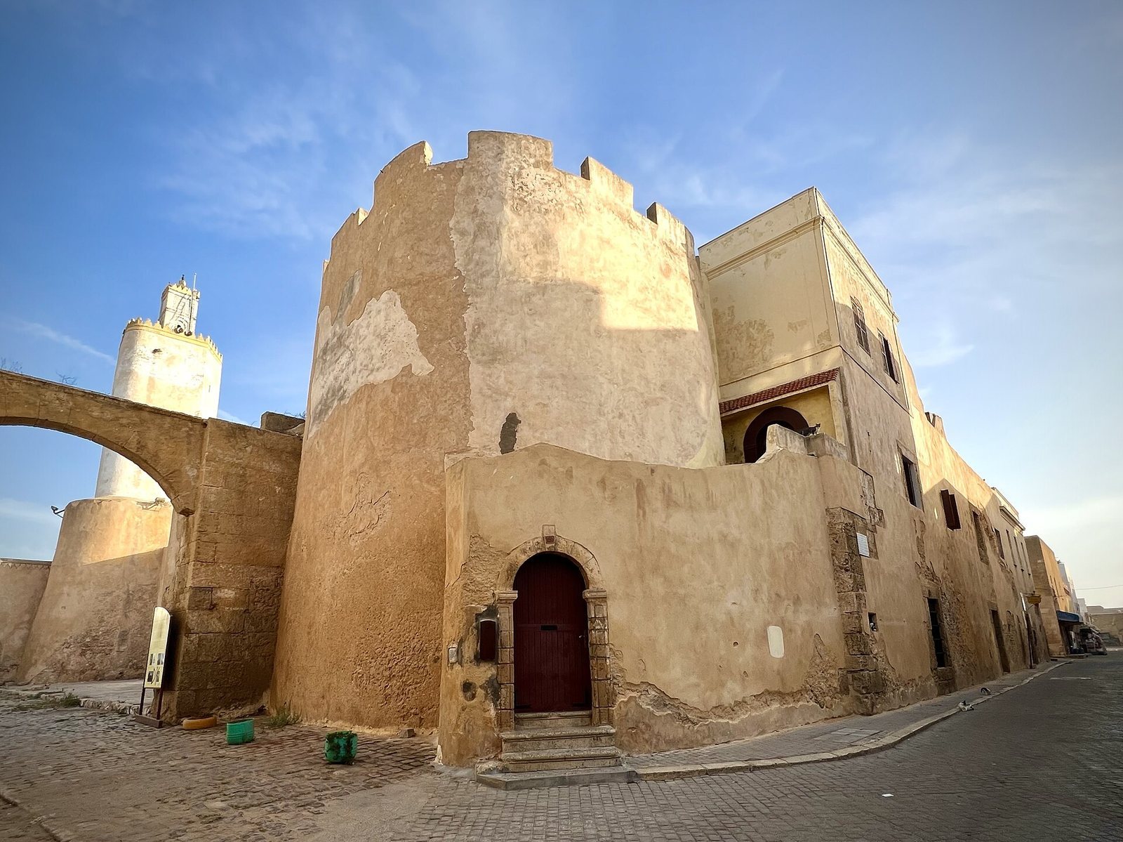
The star-shaped fortress measures about 250 to 300 metres along each side. Its double walls, packed with earth and small stones, average about 8 metres in height and 10 metres in thickness; the outer face reaches about 14 metres. A walkway about 2 metres wide runs along the wall tops. Four bastions, projecting defensive platforms, stand at the principal compass points: the Angel to the east, Saint Sebastian to the north, Saint Anthony to the west, and the Holy Spirit to the south. The fifth, the Governor’s Bastion beside the main entrance, is in ruins. Many Portuguese-era cannons remain positioned on top of the bastions.
Moat and gates
A moat about 20 metres wide and 3 metres deep once surrounded the fortress and held seawater. The sea gate on the northeast formed a small harbor with the rampart. The Bull Gate pierced the northwest wall, while a double-arched main entrance stood at the center of the south wall and was originally linked to land by a drawbridge. The two land gates had bridges that could be raised or lowered. During the French Protectorate, the moat was filled with earth and a new entrance was opened toward Rua da Carrera and the sea gate.
Urban buildings
The Portuguese settlement was divided into five quarters, each named for a notable Portuguese person. Its population was about 4,000, and it had four churches.
The underground cistern
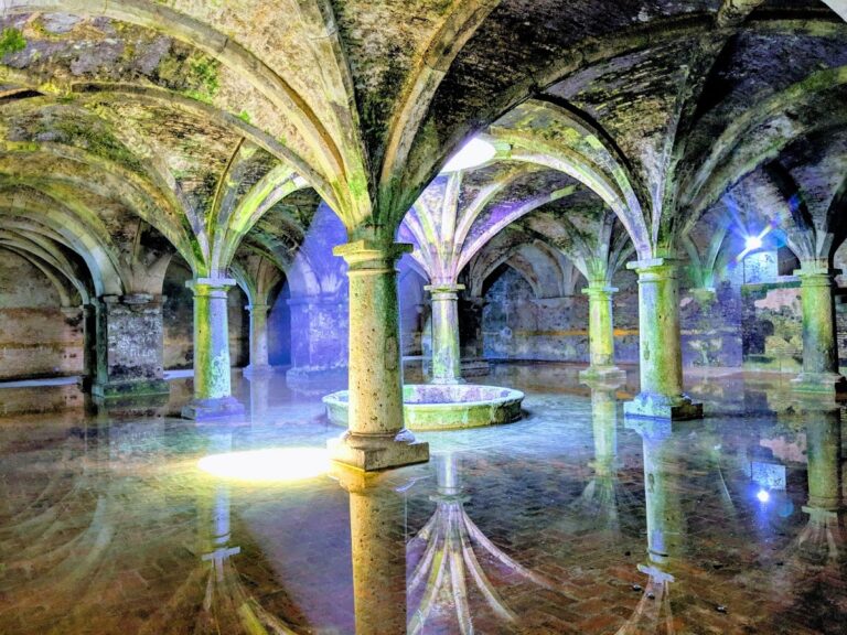
A large, vaulted hall formed part of the fort built in 1514. It probably first served as an arms room before being converted into a water reservoir. The square chamber measures 34 metres on each side, with six aisles supported by 25 columns and pillars. A large circular opening in the central bay admits daylight, which reflects from the water below.
Rua da Carrera and the Church of the Assumption
Rua da Carrera contains well-preserved buildings from the Portuguese period, including the Portuguese Church of the Assumption. The church was built in the Manueline style, a Portuguese style associated with the reign of Manuel I.
Mosque
A mosque was built as part of the nineteenth-century restoration of the city.