Bilär: A Capital of Volga Bulgaria
Site at a Glance
- Popularity
- High
- Country
- Russia
- Primary era
- Medieval
- Eras represented
- Medieval
- Civilizations
- Golden Horde
- Site type
- City
On this page22 sections
History
Bilär was a city of the Volga Bulgars at Bilyarsk in the Republic of Tatarstan, Russia, founded in the tenth century. It became a major political and trading center of Volga Bulgaria, a medieval state in the Middle Volga region, and served as a capital before the Mongol conquest.
Foundation and growth
The earliest archaeological material from Bilär dates to the tenth century. A tradition linked to the travel writings of Ibn Fadlan, a tenth-century Arab traveler and writer, places the city’s foundation in 922, during the rule of Almush. In 920, Almush asked the Abbasid caliph al-Muqtadir in Baghdad to send scholars to teach Islam and builders able to construct a fortified city. A delegation came from Baghdad, and Volga Bulgaria adopted Islam as its state religion in 922. The conversion is associated with Bilär.
Afterward, Almush and his followers travelled east to a river some scholars identify as the Small Cheremshan, where they stayed for about two months. Bilär’s development took place in two broad phases, from the early tenth century to the first half of the eleventh, and from the second half of the eleventh to the first third of the twelfth. These phases are marked by successive layers of soil and debris created through human activity.
The city expanded chiefly through denser building within its existing area. Its residents included merchants, craftspeople, farmers, and livestock keepers, while fishing also helped supply food. Craft production took place in both the inner and outer city. Bilär’s greatest prosperity came around the beginning of the thirteenth century. Estimates of its population in the twelfth and thirteenth centuries vary, with some reaching 70,000 to 100,000.
Capital and regional center
Bilär, Bulgar, and Nur-Suvar served as capitals of Volga Bulgaria at different times during the twelfth and thirteenth centuries. Trade routes connected the city with Rus, the medieval sphere of East Slavic principalities, and the Baltic region, as well as western Europe and Scandinavia. Other routes linked it with Central Asia, Persia, India, China, Byzantium, and the Caucasus.
Russian chronicles first mention Bilär in 1164, calling it the Great City. Relations with Rus involved both commerce and warfare. After Bulgar merchants were plundered and appeals for intervention failed, Bulgar forces raided Gorodets and Murom and reached Ryazan in 1183. The following year, Vsevolod III, ruler of Vladimir in northeastern Rus, led an expedition against Bilär. His forces besieged the city for ten days but withdrew without capturing it.
Mongol conquest and later settlement
In 1236, during the Mongol invasion of Volga Bulgaria, forces led by Batu Khan looted and burned Bilär. The city lost its former political power, and its monumental buildings were destroyed. It was rebuilt on a smaller scale under the Golden Horde, the political order that followed Mongol expansion across much of Eurasia, and became a minting center. Settlements were also attempted at other locations; a later settlement elsewhere is known as post-Mongol Bilär. Coins from Bilär and its surroundings include examples dated as late as 1431.
In the sixteenth century, streltsy, firearm-equipped Russian troops, settled at the ancient city. A church there was used in the forced conversion of people from nearby Tatar, Chuvash, and Moksha villages. Stones from mosques and gravestones were reused in barns and cellars. A Russian village grew over part of the old city, retaining a modified form of Bilär in its name. It served as a district center during the Soviet period, until the surrounding area was divided among several districts in the 1960s.
Archaeological study and later interpretation
Interest in Bilär’s ruins dates to the eighteenth century, when Nikolai Rychkov prepared an early plan and description. V. A. Kazarinov surveyed the ruins and nearby archaeological remains in 1881. P. A. Ponomarev and M. G. Khudyakov began excavations in the inner city in 1915 and 1916 but left the work unfinished. A. S. Bashkirov carried out another excavation in 1928.
Systematic research began in 1967 under Alfred Khalikov, with later investigations led by Fayaz Khuzin and others. Bilär is part of the Bilär State Historical, Archaeological, and Natural Museum-Reserve and is designated a federal-level cultural heritage site in Russia. Some researchers consider the medieval Bashkir Bulyar tribal group to have originated, or formed in part, from people who came from Bilär.
Remains
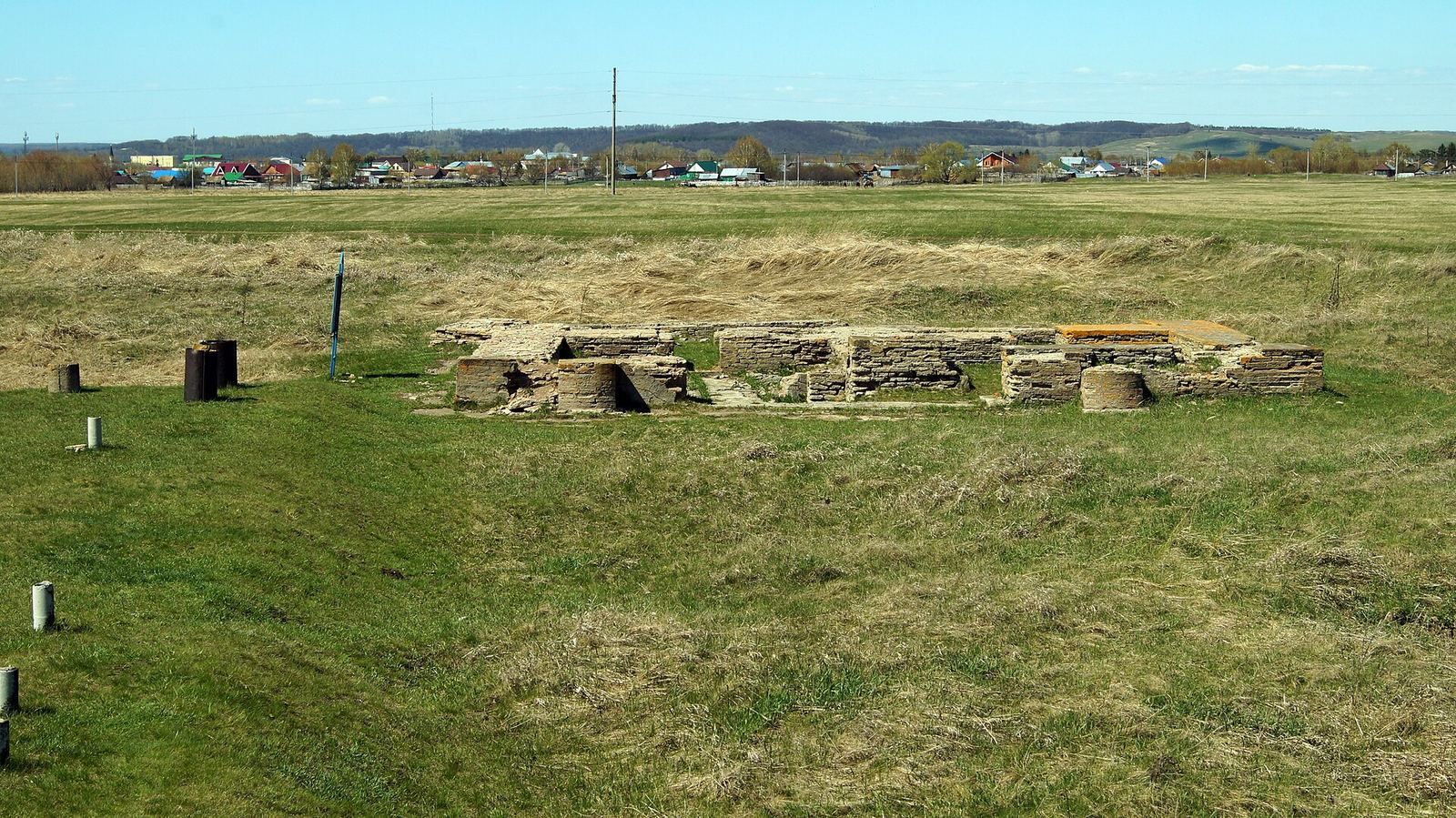
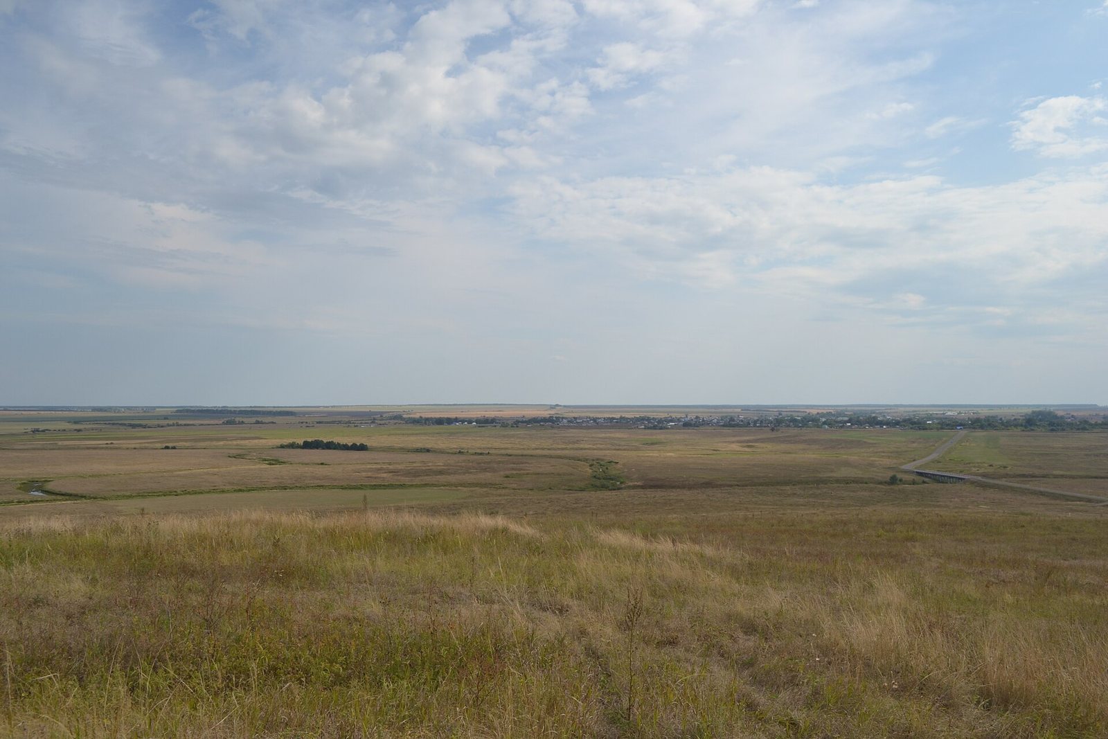
Bilär occupied a level plateau sloping toward the Small Cheremshan River. Two streams that feed the river cross the site. Its roughly square plan follows the cardinal directions and comprises four nested zones: a citadel, inner city, outer city, and surrounding settlement. Earth ramparts and ditches formed the main defensive system, with the outer lines especially well preserved in the eastern part of the site.
Urban plan and fortifications
Citadel and inner city
The citadel is conventionally placed at the center of the inner city and reconstructed as an oak-walled enclosure of about 20 hectares. The inner city itself was roughly square. Its area measured about 1,306,000 square metres with the defenses and 1,160,000 without them. Two rampart lines protected it. The principal line extended about 4,800 metres, while a second line, incomplete in places, ran about 5,400 metres. The ramparts stood 3 to 4 metres high and carried additional wooden structures. Stream channels formed part of the defenses on the southwest and northeast sides.
Outer city and surrounding settlement
Three rampart and ditch lines enclosed the outer city. Their approximate lengths were 9,125 metres for the inner line, 9,400 metres for the middle line, and 10,200 metres for the outer line. The outer city covered about 4,896,000 square metres including its defenses and 3,741,000 without them. The full fortified area measured about 6,202,000 square metres with defenses, or 4,901,000 without them. With the surrounding settlement, the complex extended across about 8,000,000 square metres. The settlement spread around the city, with suburban cemeteries to the northwest and southwest.
Mosque complex and cemetery
Timber mosque
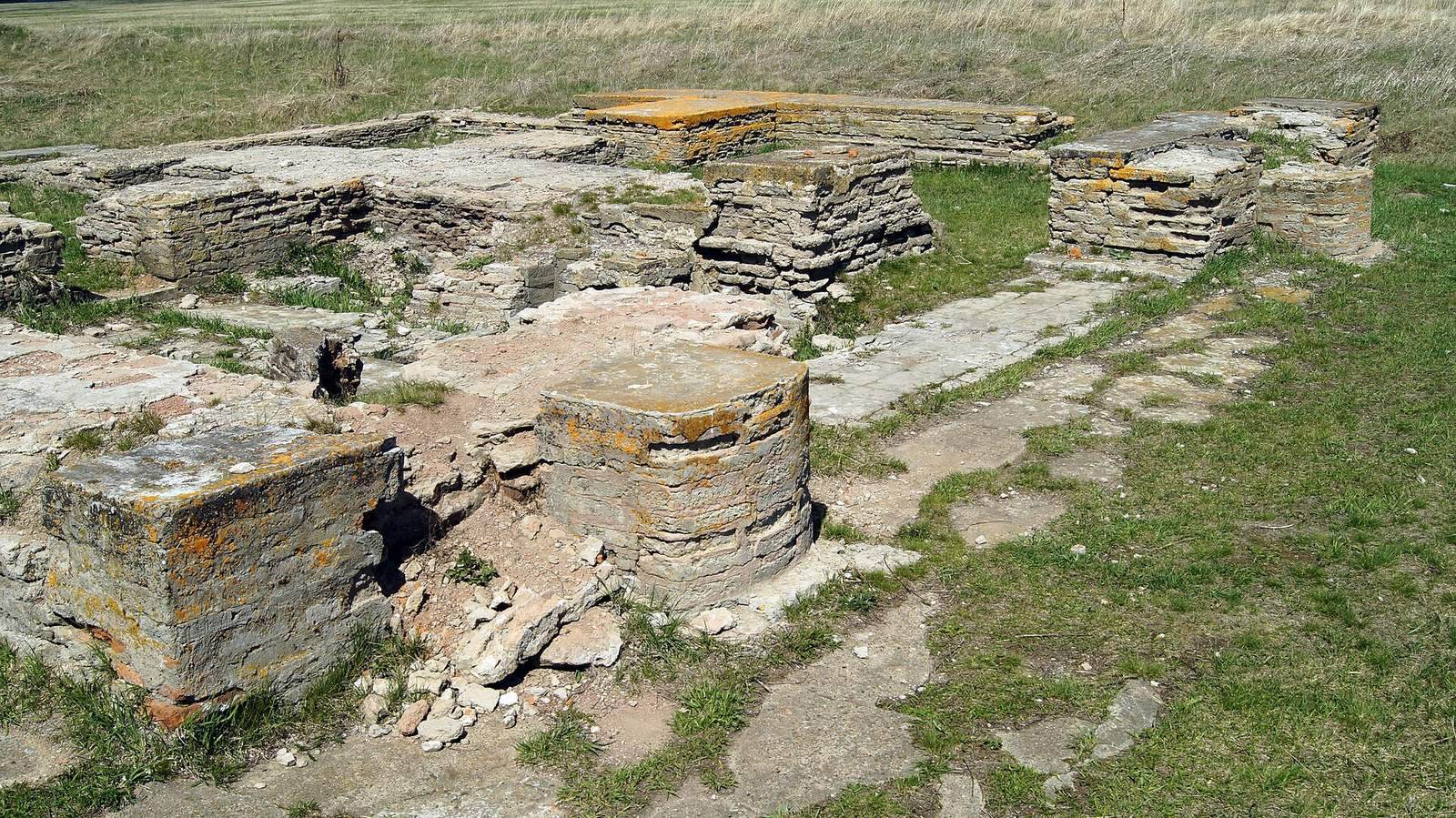
The main mosque complex stood within the area identified as the citadel. Its timber section, built during the city’s founding period, was rectangular and measured approximately 44.5 to 48 metres by 30 to 32 metres. The entrance faced northeast, while the mihrab, a niche showing the direction of prayer, faced southwest toward Mecca. More than 650 postholes mark the building, its floor, and its supports. They were 0.5 to 1.5 metres deep and 0.5 to 0.8 metres across, and some held decayed wood. A roughly square pit toward the southwest may have collected water and points to the possibility of an open courtyard.
Stone mosque
A stone section was added on the southeast side in the mid-tenth century. It measured about 41 to 42 metres by 26 metres, with walls up to one metre thick. Its surviving foundations form bands of lime and rubble. Twenty-four column pits, each about 2 metres square and 1 to 1.5 metres deep, indicate a hall with six rows of four columns. Strip foundations connected the rows. Six rectangular foundations for side supports projected from the outside of the southeast wall, and a 2.75-metre-wide mihrab niche was found inside the southwest wall. Together, the timber and stone sections provided at least 2,000 square metres of interior floor area.
Minaret
A rectangular foundation pit for a minaret, a tower associated with a mosque, lay 1.2 to 1.5 metres northeast of the mosque. Measuring 9 by 8 metres, it extended three metres below the ancient ground level. Broken white stone and architectural fragments filled the pit, while regularly spaced holes in its compacted base mark oak piles. Earlier observers described mosque walls, columns, a portal, and a red-brick-and-stone tower. In 1769, Rychkov described the tower as 5 to 7 arshins high, an arshin being a historical unit of length, and suggested it may have been faced with green and bluish glazed tiles.
Bilär Cemetery IV
An early-tenth-century cemetery known as Bilär Cemetery IV lay east of the mosque. About 50 graves were examined. Some were brick tombs, and the burials followed Muslim rites. The cemetery’s central location, special burial structures, and paired graves are unusual. The graves are thought to have belonged to members of the elite.
Central building
The building conventionally called the house of the feudal lord stood near the center of the site, within the presumed citadel and as part of the mosque complex. Excavated in 1971 to 1973, it survives at foundation and lower-wall level. Its foundations extended 1.2 to 1.3 metres into the construction pit. Walls 1 to 1.2 metres thick were built from square bricks, partly dried and fired, measuring 26 by 26 by 5 centimetres. Silty-clay mortar contained a small amount of lime or alabaster.
The roughly square main building measured 11 metres on each side. A substantial partition divided it into four connected rooms, each averaging about 16 square metres. The partition may have supported an upper floor with a dome-shaped roof. The lower rooms had repeated plaster finishes and lime tiles near the floor. Their brick flooring was 10 to 11 centimetres thick and covered by a 5 to 6-centimetre layer of lime-cement mortar.
The entrance was on the southeast side and had two openings. Rectangular-based pilasters, each about 1 by 0.8 metres, probably framed it in a U-shaped arch. A porch foundation lay in front, and a path paved with broken bricks and stones led toward the mosque. Near the western corner, the southwest wall widened into a projection with an opening about 0.9 metres wide. Postholes in this area may indicate supports for an upper-floor balcony or a covered gallery connecting the building to the timber mosque.
A curved annex on the northwest side contained two rounded rooms, an entrance to the upper floor, and a stove connected to underfloor heating. The stove measured 2.5 by 2 metres and included a firebox and heat-storage chamber. Two flue channels, 35 to 45 centimetres wide and up to 9 metres long, joined a branching heating system extending about 300 metres in total. The northeast kitchen annex measured 3.6 by 3 metres and contained a brick stove, a stone roasting stove, and a well.
The building is thought to date to the second half of the tenth century and was destroyed in 1236. Human skeletal remains lay beneath its collapsed walls. Finds inside included pottery and glass vessels, ornaments of glass and non-ferrous metal, and iron household objects. Its purpose remains uncertain; it may have housed a mosque attendant or served as a public bath.
Other buildings and production areas
Caravanserai
A large brick building conventionally identified as a caravanserai, a roadside inn for merchants and travelers, stood outside the inner city beyond its southern corner, near the eastern gate. A local name used in the nineteenth and early twentieth centuries called the place a fort, reflecting an additional defensive system. Investigations found walls and foundations, a well pit, a brick-paved courtyard, and a palisade, as well as later ramparts and a ditch around the building.
Bath
A brick building identified as a bath stood in the northern part of the citadel, 180 to 200 metres north of the mosque complex. Aerial photography revealed it in 1973, and it was excavated in 1979 to 1981. Its position in the sequence of archaeological layers indicates that it was built no earlier than the eleventh century. The roughly square plan measured 10.4 by 11.6 metres, followed the cardinal directions, and used standard Bulgar bricks measuring 26 by 26 by 4.5 to 5.5 centimetres. The building had underfloor heating and two sections.
Well No. 1
Well No. 1 lay between the mosque complex and the central building. It was in use during the twelfth century and was restored and conserved in 1973 and 1974.
Pottery quarter
The pottery quarter occupied 80,000 to 100,000 square metres in the outer city. A stream bounded it on the west, the inner rampart on the north, an old road on the east, and a small ravine on the south. Its location took account of prevailing winds and nearby deposits of potter’s clay and sand. Excavations revealed several kiln designs. Specialized bricks for the kilns, the separation of workshops from homes, and the area’s size indicate extensive pottery production.
Alchemical workshop
An expedition from Kazan University uncovered an alchemical workshop, considered the oldest found in Europe. Alchemy was a premodern practice concerned with the transformation and properties of substances.
Finds and material evidence
Finds from Bilär include swords, daggers, spears, battle axes, maces, flails, bow components, and projectile points, as well as pieces of mail and lamellar armor made from joined plates. Two bone pieces served as guards for the thumb or left hand when using a bow. Horse equipment includes bits, harness fittings, and stirrups. Agricultural tools include coulters, ploughshares, mouldboards, and blades. Iron fishing hooks and equipment used with nets also reflect food-gathering activities. Excavated household objects and ceramic material are held at the Bilär historical and archaeological museum.
Scientific excavation of the mosque complex began in 1971, with further investigation from 1972. Conservation took place between 1976 and 1981 and again in 1997.