Oppidum Závist: A Celtic Fortified Settlement in Czechia
Site at a Glance
- Popularity
- High
- Country
- Czechia
- Primary era
- Iron Age
- Eras represented
- Bronze Age, Iron Age
- Civilizations
- Celtic
- Site type
- City
On this page20 sections
History
Oppidum Závist, a Celtic fortified settlement with earlier prehistoric phases, lies in Dolní Břežany, Czechia. Its principal Celtic phase began around the middle of the second century BCE, during the La Tène period, the later Iron Age period associated with Celtic communities, and continued beyond the middle of the first century BCE. At the transition to this phase, Závist was among Bohemia’s most important settlements, alongside Vladař in western Bohemia.
Prehistoric and Hallstatt settlement
The upland was occupied during the Eneolithic by communities associated with the Funnel Beaker and Řivnáč cultures. Settlement continued in later prehistory with the Knovíz culture. It was probably unfortified until the later Knovíz, or Štítary, phase, when substantial defenses were built. A major fire destroyed them, and the hill was then unoccupied for a time.
Settlement resumed in the later Hallstatt period with the Bylany culture. Four or five houses stood in the area later used as the acropolis, the fortified high point of a settlement. They have been tentatively interpreted as residences for people with both political and religious authority.
Early La Tène settlement
As the Iron Age moved into its early La Tène phase, Závist became a major center with contacts extending to western Europe, Greece and Etruscan communities of pre-Roman Italy. A fire shortly after 400 BCE ended this phase. The settlement was rebuilt, but it was abandoned again after a relatively brief period.
The Celtic oppidum
A much larger Celtic settlement developed from around the middle of the second century BCE. Estimates put its population at about 1,000 to 3,500 people. It may also have offered refuge to as many as 40,000 people from surrounding settlements. Its position near long-distance routes supported extensive exchange. Connections reached from southern Germany and present-day Switzerland to France and Spain, as well as the eastern Alps, the Balkans and the Black Sea region. Contacts with Greece and Etruria are also indicated.
Farming was a major part of the late La Tène economy, although some food may have come from the surrounding countryside. Crops included several kinds of wheat, with smaller amounts of barley, rye, peas and vetch; oats, millet and lentils were also grown. People raised cattle, pigs, horses, sheep and goats. Hunting was an uncommon source of food but provided materials for other uses. Crafts included ironworking, pottery, the manufacture of coin blanks, textile work and leatherworking. Trade brought in technically demanding goods, food, some pottery and ceramic materials, and sharpening stones made of quartz-rich sandstone.
An undated military action ended the oppidum’s final fortification phase in a fire. The site then lost its former importance and was eventually abandoned.
Later use and changing interpretations
Use of Hradiště was intermittent during the Roman period and the Migration Period. Slavic settlement is indicated from around the seventh century, followed by further use marked by burials in the ninth and tenth centuries, including a small cemetery dating to the first half of the tenth century. The name Závist comes from a forester’s lodge below Hradiště, near a stream once called Zalužanka.
The earliest known written reference, in Václav Hájek of Libočany’s 1541 chronicle, presented the site as the residence of Maroboduus, king of the Germanic Marcomanni, and linked it to Kazín, a legendary settlement in Czech tradition. In 1681, Bohuslav Balbín described stone heaps with mortar traces, houses, a castle and cellars, which he attributed to the Boii, a Celtic people. Later writers offered different explanations: Karel Vladislav Zap proposed a camp of Emperor Sigismund’s army, Ludvík Šnajdr again connected it with Maroboduus, and Emanuel Šimek interpreted it as an early medieval political and economic center of the Slavník dynasty.
Archaeological research and conservation
František Beneš published the first scientific description and a simple plan in 1864; Jan Erazim Vocel discussed the site in 1868. From 1943 until the end of the Second World War, František Prošek investigated the surface, identified Závist as a Celtic oppidum and prepared a detailed plan and system of place names. Preparations for excavation began in the 1950s under Jaroslav Böhm, and excavation started in 1963 under Jan Filip. Libuše Jansová led the work from 1963 to 1973, followed by Karla Motyková-Šneidrová. Miloš Čižmář directed investigations in the eastern outer enclosure and at Šance. A 3,796-square-metre excavation in the northwest part of the eastern enclosure, carried out from 1973 to 1976, examined remains from several periods. Long-term excavation at Závist ended in 1989.
The remains have been protected as a National Cultural Monument since 1989. The site opened to the public in 1990 with excavated building foundations exposed. Plans to preserve and present the acropolis led to the announcement that the remains would be buried. They remained uncovered at least until 2003, by which time they were badly damaged; a thick gravel layer was laid over them in 2004. A presentation project begun in 2021 proposed a compacted grey-white surface and colored concrete markers above the buried foundations. Work also began on a summit observation tower designed by Martin Rajniš. A proposed second-stage design by Josef Pleskot drew criticism for its effects on the monument and surrounding landscape. The Institute for Archaeological Heritage Care of Central Bohemia supported the project as a response to neglect, while the Czech National Committee of ICOMOS opposed it.
Remains
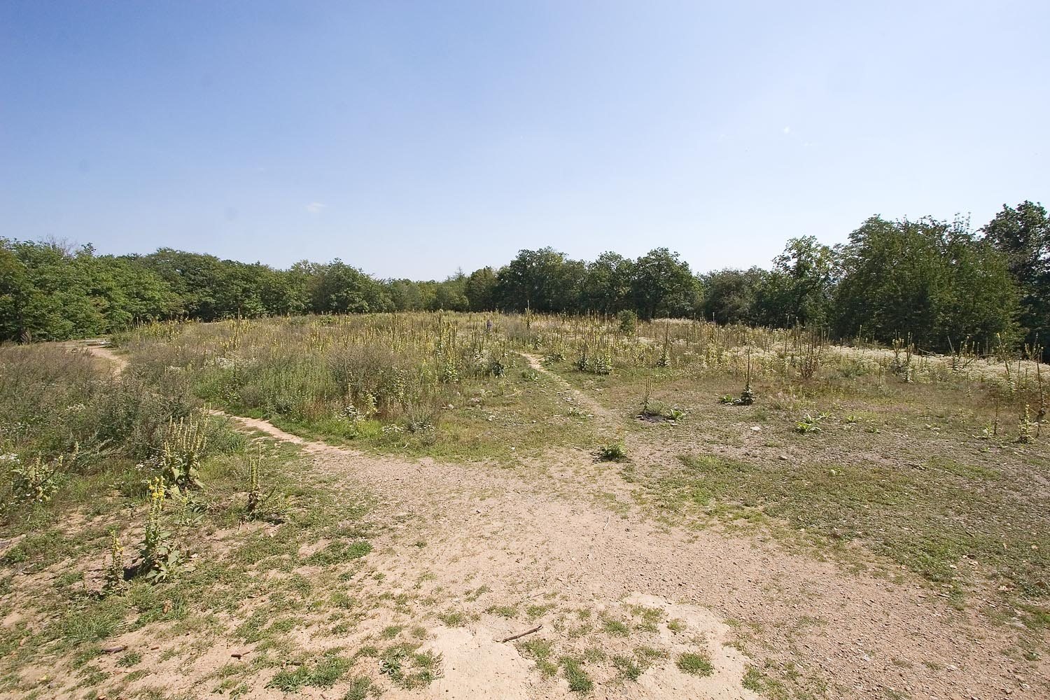
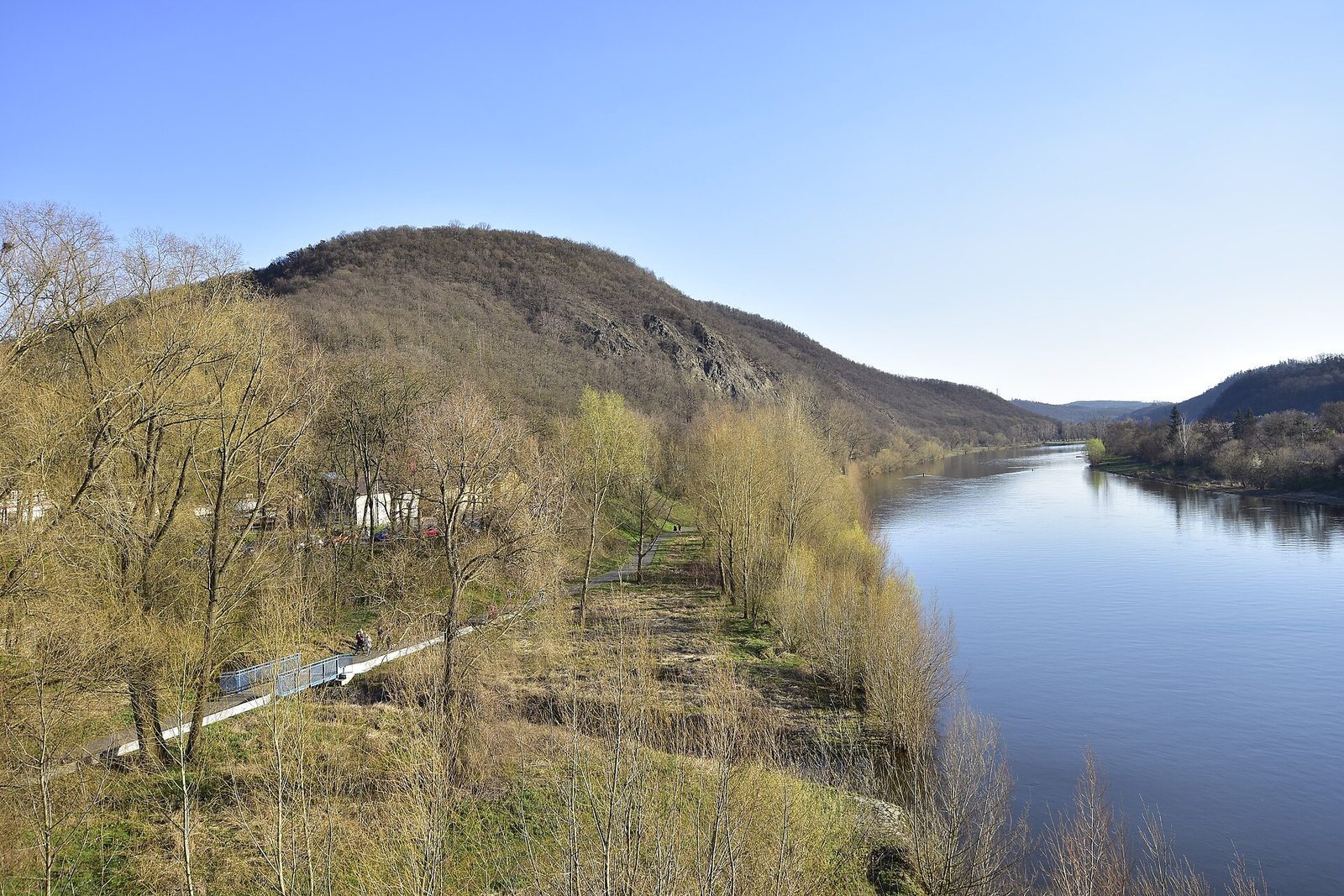
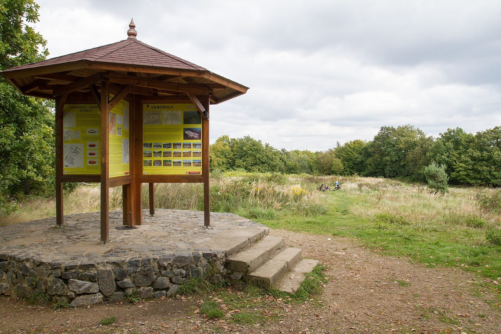
The settlement occupied hills on both sides of the deeply cut Břežanské Valley. Hradiště rises to 391 metres above sea level on the right bank of the Vltava, near its former confluence with the Berounka and opposite Zbraslav. Across the valley, the oppidum extended to Šance; the difference in height between the river and summit reaches about 200 metres. Its fortifications extended for roughly nine kilometres, including those at Šance, and the site covers nearly 200 hectares. The acropolis occupies the highest part of Hradiště, with Balda to the west and U Altánu to the northeast. Outer enclosures lay to the southwest and southeast, while Šance stood across the valley.
Early defenses and the acropolis
Bronze Age defenses
A defensive barrier of upright posts, or palisade, from the middle Bronze Age ran along the southern edge of the acropolis. Later Bronze Age defenses, found in the western part of Gate D, included wolf pits, defensive pits used as obstacles, and a ten-metre-wide open strip. Beyond them, a rock-cut ditch was three metres wide and one metre deep. A level strip of ground, or berm, separated the ditch from an earth bank topped by a palisade. The fortified Štítary settlement covered about 60 hectares, with an entrance to the southeast and an enclosed ritual area on the acropolis.
Hallstatt and early La Tène center
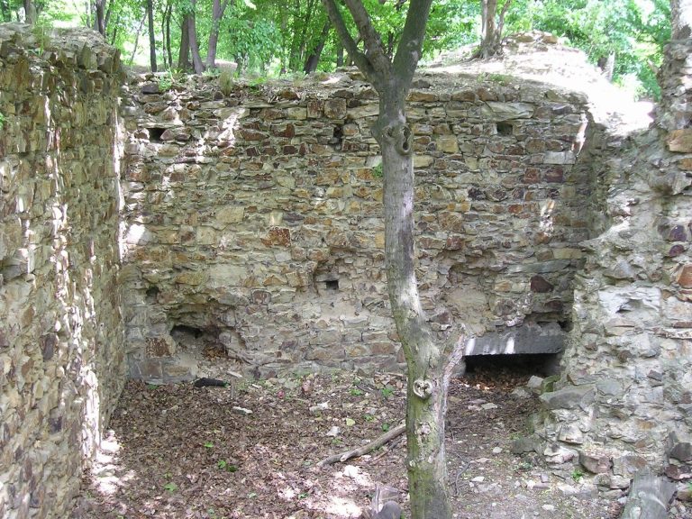
A fortification built around 500 BCE enclosed about 27 hectares. Its central wall was three to five metres wide, with oak posts at the front connected by timber to a wooden rear wall. Stone and earth filled the space between. A ditch protected the entrance, where inward-curving wall ends formed a passage 3.5 metres wide. Posts supporting a bridge divided the passage, which could be closed by gates. The outer enclosure had its own defenses.
In the later Hallstatt period, the fortified area expanded to about 90 hectares, with the outer enclosures bringing the whole area to nearly one square kilometre. The acropolis ritual enclosure measured 30 by 27 metres and was enlarged slightly. An 18-by-9-metre post-supported building stood at its center, and four or five regularly spaced post-built houses have been identified in the same area. In the early La Tène period, the square fortified area of the acropolis grew to about 90 by 80 metres. It contained stone platforms compared in form to Etruscan sacred precincts. The rebuilt wall had a stone face laid without mortar, linked by timber to an inner earth bank, and a palisade along its top.
Late La Tène defenses and entrances
Gate D and its approaches
During the late La Tène period, the settlement grew from about 35 hectares to an estimated 100 to 170 hectares. Five construction stages have been identified in the defenses, especially around Gate D, the main entrance on the southeastern side. Its earliest identified remains date to the second century BCE. A rock-cut ditch below the gate was 12.5 metres deep, and banks of broken stone defended the approach. The defenses curved west at their northern end to protect part of the valley slope as well. In front of the wall, a flat-bottomed ditch reached six metres in width and 1.2 metres in depth; a palisade probably stood in it at the gate. A 1.4-metre berm separated ditch and wall. The stone-faced wall had an inner bank strengthened with timber.
The earliest Gate D wall, built around 175 BCE, used dry-laid stone strengthened with upright posts and horizontal timber grids. Earth ramps gave access to its top, which rose as much as 16 metres above the ditch. Its inward-drawn, pincers-shaped entrance ended in a tower-like wooden gate that may have reached 12 metres in height. Posts divided the passage into two parts. The wall changed in form along the defenses, and its estimated service life of 25 to 30 years suggests that it was rebuilt in later stages. After a fire around 60 BCE, the wall and gate were reconstructed, but a bridge replaced the tower at the end of the passage. In the fifth stage, a steep earth bank topped by a palisade took the place of the more complex earlier construction. The wall burned, was rebuilt in the same form and burned again when Gate D was destroyed.
Other entrances
An approach from the east passed through Gate A and across a broad ditch before reaching Gate D. Gate A was a smaller northeastern entrance toward Břežanské Valley, closed by oak doors. Pottery fragments from the Germanic period and a small cemetery dating to the first half of the tenth century were found nearby. After Gate D was abandoned, access shifted to gates A, B, C and J.
Outer enclosures and settlement interior
Eastern outer enclosure
The first defensive line around the eastern outer enclosure lay about 200 metres from the built-up area of Lhota and survives as a change in the ground profile. An earth bank and a ditch cut into rock formed part of its defenses; excavation found a palisade trench in the ditch. A test trench where a forest path crosses the outer bank revealed an earth rampart, a palisade on its outer side and a rock-cut ditch in front. The line protecting the approach to Gate D curved west at its northern end. Ditches, banks and timber defenses developed through several building stages.
Šance
Šance covers about 15 hectares across Břežanské Valley from Hradiště. Its steep, rocky southern slopes offered natural protection, while a palisade ran along the other sides. The surviving defenses cannot be dated securely. The best-preserved section, at the northwest, consists of a ditch and earth bank. These may have been altered during the Thirty Years’ War, a series of European conflicts fought from 1618 to 1648, or during the siege of Vyšehrad by Emperor Sigismund’s army. Bronze Age pottery fragments have also been found at Šance.
Terraces and compounds
Large artificial terraces, routes and smaller terraces organized the settlement interior. Houses or compounds, enclosed groups of buildings, stood on the smaller terraces, and paths in the outer enclosure were surfaced with brushwood. The largest compound, on the acropolis, covered 5,700 square metres. Excavation in the eastern outer enclosure identified late La Tène buildings and roads leading to gates A and D. About six compounds, each estimated at roughly 50 by 50 metres, have been proposed for the area. Several wells or cisterns and other sunken features of uncertain use were also found.
Production and the surrounding landscape
Craft and farming evidence
Finds from the settlement include remains of a weaving workshop and a forge, kitchen pottery, and imported glass and bronze objects. In the eastern outer enclosure, iron ploughshares and sickles, along with rotary hand querns, small hand-operated mills for grinding grain, indicate farming. Plant remains include flax. Spindle whorls, loom weights and spindles point to textile work, while iron awls were used in leatherworking.
Vegetation and landform
Woodland clearance began as early as the Neolithic and continued during occupation. The timber needed for defenses varied with the intensity of settlement. Erosion, ditches and ramparts reshaped the slopes. After the oppidum’s final abandonment in the early medieval period, woodland returned for a long period; later it was affected by livestock grazing, occasional mowing and tree planting. Before construction, beech and oak-beech woodland covered much of the slopes. Warm-climate oak and hornbeam woodland grew on the site, with oak, wych elm, hornbeam, field maple, birch and Scots pine. The nearby floodplains had narrow willow and poplar margins and broader hardwood woodland dominated by oak, with some wych elm. The southern slopes developed warm oak woodland, while scree woodland grew on the north-facing slope of Břežanské Valley. Cornelian cherry stones were also found.