Comalcalco: An Ancient Maya City in Tabasco, Mexico
Site at a Glance
- Popularity
- High
- Country
- Mexico
- Primary era
- Classical
- Eras represented
- Iron Age, Classical
- Civilizations
- Maya
- Site type
- City
On this page22 sections
History
Comalcalco is an ancient Maya city in Tabasco, Mexico, known in antiquity as Joy Chan, meaning “Encircled Sky.” The Chontal Maya, a Maya people of Tabasco, established a settlement whose earliest occupation dates to around 800 BCE. Comalcalco became an important regional center during the Classic period, a broad phase of ancient Mesoamerican history, especially between about 550 and 900 CE. Its buildings are noted for the extensive use of fired-clay bricks.
Settlement and regional center
Coastal communities that fished and farmed occupied the area by around 800 BCE, and by about 600 BCE the settlement was well organized. Early buildings used earth covered with stucco, a hard plaster coating. From about 250 CE, builders began joining fired-clay bricks with lime-and-sand mortar, placing newer buildings over earlier construction. The city grew as a civic and religious center, a place of burial, and a strategic trading center in the Chontalpa region.
Comalcalco stood beside the former Mezcalapa River, now called the Seco, which connected routes between the Gulf coast, Yucatán, the Usumacinta region, the central highlands, and the northern Gulf coast. Archaeologist George F. Andrews associated the city with cacao distribution because it lay within Tabasco’s principal cacao-producing zone. Clay figurines were made and traded from about 600 to 1000 CE. Similar molds, tools, kilns, figurines, and manufacturing waste point to organized production. Figurines found on Jaina Island, around 350 km away, have clay with the same chemical composition. Those from Comalcalco appear to have served everyday purposes, unlike the funerary objects used on Jaina. Rulers, dwarfs, and jointed figures are more common in the ceremonial center, while figures of women occur more often in residential areas.
People buried their dead beneath house floors or wrapped them for placement in clay urns. Urn burials are associated with the nobility and with offerings that could include figurines, blades, shell, jadeite, and stingray spines. Religious practice included the worship of Chak, associated with rain; Kinich Ahau, the sun; Kisin, death; Ixchel, the Moon; and Ek Chua, commerce. Burning resins in incense burners formed part of ritual observances.
Political change and abandonment
An inscription on Monument VI at Tortuguero says that its ruler, Balam Ahau, captured Comalcalco’s ruler, Ox Balam, on December 22, 649 CE. It characterizes the event as a bloodbath. Afterward, Joy Chan entered Tortuguero’s political sphere and paid tribute to its rulers; Balam Ahau installed his son as the city’s new ruler. Later use at Comalcalco of the B’aakal emblem glyph, a hieroglyphic title associated with a Maya polity, may reflect political subordination or succession. Comalcalco may also have been a satellite or colony of Palenque, a possibility raised by similarities in architecture.
Habitation continued into the Postclassic period, a later broad phase of ancient Mesoamerican history, and the city was abandoned around the end of the first millennium CE. Its decline formed part of the Classic Maya collapse, the decline of many lowland Maya polities toward the end of the Classic period. Proposed contributing factors include drought, flooding, food shortages, popular revolt, disease, and interrupted trade. Severe regional drought has also been suggested as a possible cause. The latest date in Comalcalco’s inscriptions is March 7, 814 CE. A tomb associated with Temple II has evidence of late eighth-century rites connected with rain deities.
Rediscovery and archaeological work
French explorer and archaeologist Désiré Charnay brought Comalcalco to wider attention in 1880. He mapped the mound later called the Great Acropolis, noting the Palace, Temples 4 and 5, and other mounds. He compared the temples with towers at Palenque. In 1892, Pedro Romero Torres began the first excavations, concentrating on the base of the Great Acropolis. His work distinguished earlier earth platforms coated with shell-lime mortar from later brick buildings erected above them.
In 1925, archaeologist Frans Blom and ethnologist Oliver La Farge prepared the first plan of the central area, including the North Plaza, and recorded the Great Acropolis in photographs and lithographs. They uncovered a funerary crypt whose stucco figures gave it the name “Tomb of the Nine Lords of the Night.” Glyphs on the figures referred to members of the retinue of the Divine Lord buried there. Gordon Ekholm and Edwin Litman excavated south of Temple VII in 1956–57, exposing the decorated front of a stepped building. In 1960, Román Piña Chan excavated Temple VI’s south front, recovered architectural sculpture depicting Kinich Ahau and a bearded figure, and closed the exposed vault of the crypt found by Blom and La Farge to protect it.
George F. Andrews and a University of Oregon team made the first topographic plan of the settlement in 1966. From 1972 to 1982, Ponciano Salazar Ortegón led extensive excavation and conservation, including work on temples in the North Plaza and palace buildings in the Great Acropolis. Much of the known collection of decorated bricks was assembled during this period. In 1991, Francisco Cuevas and Mario Pérez-Campa exposed Temple IIIA and consolidated its earlier earth-and-stucco phase; their work also uncovered 14 human burials, seven in large clay urns. Ricardo Armijo directed further excavations during the 1990s.
A funerary offering found in 1998 near the south fronts of Temples II and IIA contained inscribed stingray spines and other inscribed objects. Its text concerns 14 years in the life of the priest Aj Pakal Tahn and refers to ceremonies, self-sacrifice, bloodletting, and rain deities. In 2011, the National Institute of Anthropology and History announced the discovery of 116 burials in three earth mounds at the site’s edge. Another announcement that year concerned a brick fragment, found earlier, interpreted as a second Maya inscription referring to the close of a calendar era on December 21, 2012. That date relates to the Maya Long Count, a calendar that measures elapsed time in units including baktuns, with 13 baktuns forming a major period.
Remains
Setting, construction, and overall plan
The archaeological site occupies a slight rise on the east bank of the Seco River, amid low-lying terrain that was once covered by tropical forest and wetlands. It lies about 2 km west of the modern city of Comalcalco. The wider settlement covers about 7 km², while the principal surveyed area measures 72 hectares and includes 432 identified structures.
Builders used irregular fired-clay bricks, reflecting the regional scarcity of quarried stone. The bricks were joined with mortar made from calcined shells, including oyster shell; the shells may have come from nearby Mecoacán Lagoon. Some bricks were cut from longer sections of clay. Their carved or decorated faces were turned inward, beneath stucco. Earth packed into platforms, sometimes mixed with shell debris, formed the base of earlier buildings. Stucco modeling, once painted red, blue, green, yellow, and black, decorated the structures. Temples included vaulted chambers, and bricks depict roof combs, raised features along the roofline of some Maya buildings.
No single axis organizes the entire site. Instead, buildings form plaza groups with orientations close to the cardinal directions. The three principal groups are the North Plaza, Great Acropolis, and East Acropolis, each with its own arrangement. The ceremonial center includes temples and other ritual buildings, administrative and residential structures, a sweat bath, and a council chamber. Residential compounds around it consist of individual mounds or groups of mounds around plazas; rural homes used perishable materials on raised earth mounds. Clay pipes below the city carried rainwater and waste. On the Great Acropolis, pipes linked with open channels drained buildings and passages.
The North Plaza
Layout
The North Plaza is a rectangular enclosure with its long axis running east to west. Its principal entrance is at the southeast, with narrower passages between buildings at the corners. Three small altars, which remain unexcavated, stand along an east–west line through the plaza’s center. Connected structures form the northern side. Temples III, IIIA, and IIIB occupy much of the southern side, with a gap between IIIA and IIIB leading toward the Great Acropolis. Remains of Temples IIIC and IIID lie at the eastern end.
Temple I
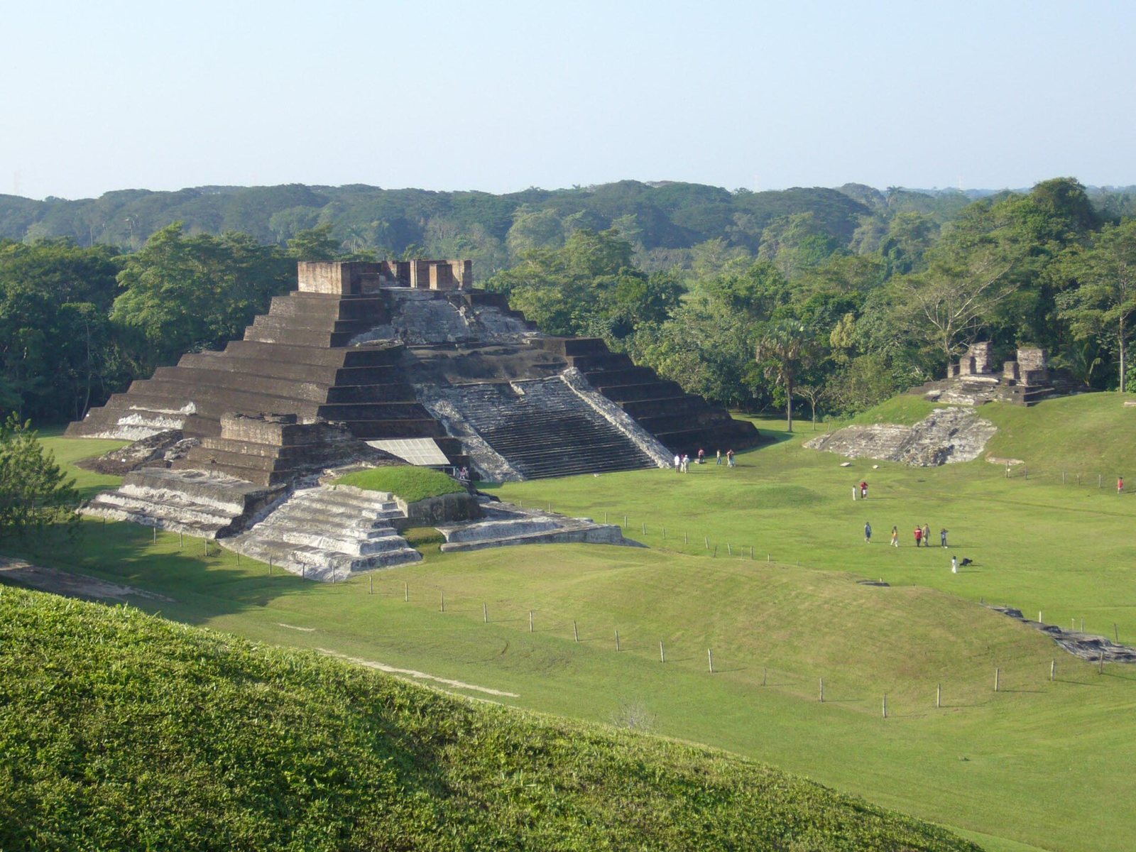
At the western end, Temple I rises about 20 m above the plaza and is the largest building in the group. Its earlier phase has an earth core coated in stucco and a central staircase of 34 steps. Four overlapping stucco layers at the southeast corner of the first platform carry modeled figures. One partly preserved scene shows a person reclining on a bench while another figure pulls that person’s hair; only the latter figure’s arm and legs remain.
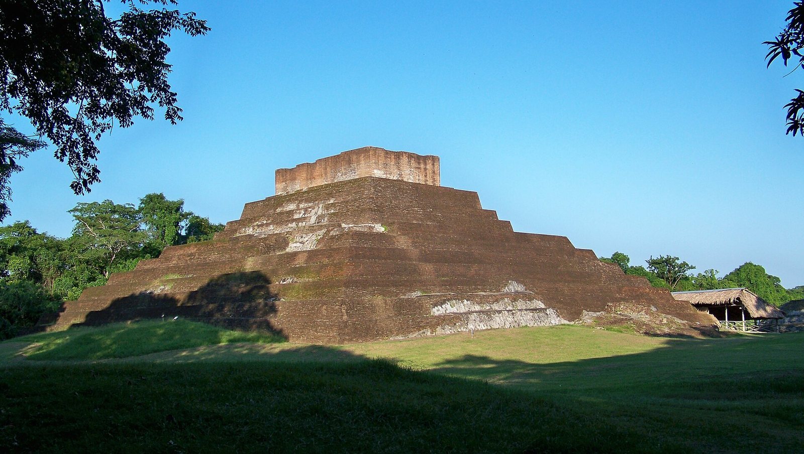
The later structure is a brick pyramid with sloping walls and 12 tiers. A broad stair flanked by walls climbs to the eighth tier, where a wide ledge separates the lower levels from three higher tiers and a much lower upper tier. A narrower stair crosses this upper section, with a basalt skull sculpture above its first steps. The roofless temple at the summit has two long rectangular rooms. The first opens through a portico divided by two rectangular pillars into three entrances, the middle one widest. A single broad doorway leads into the room behind it. At the rear, a low altar and two walls may have supported a roof. The temple roof collapsed, and surviving traces indicate modeled stucco figures on its exterior.
Temple II and the southern buildings
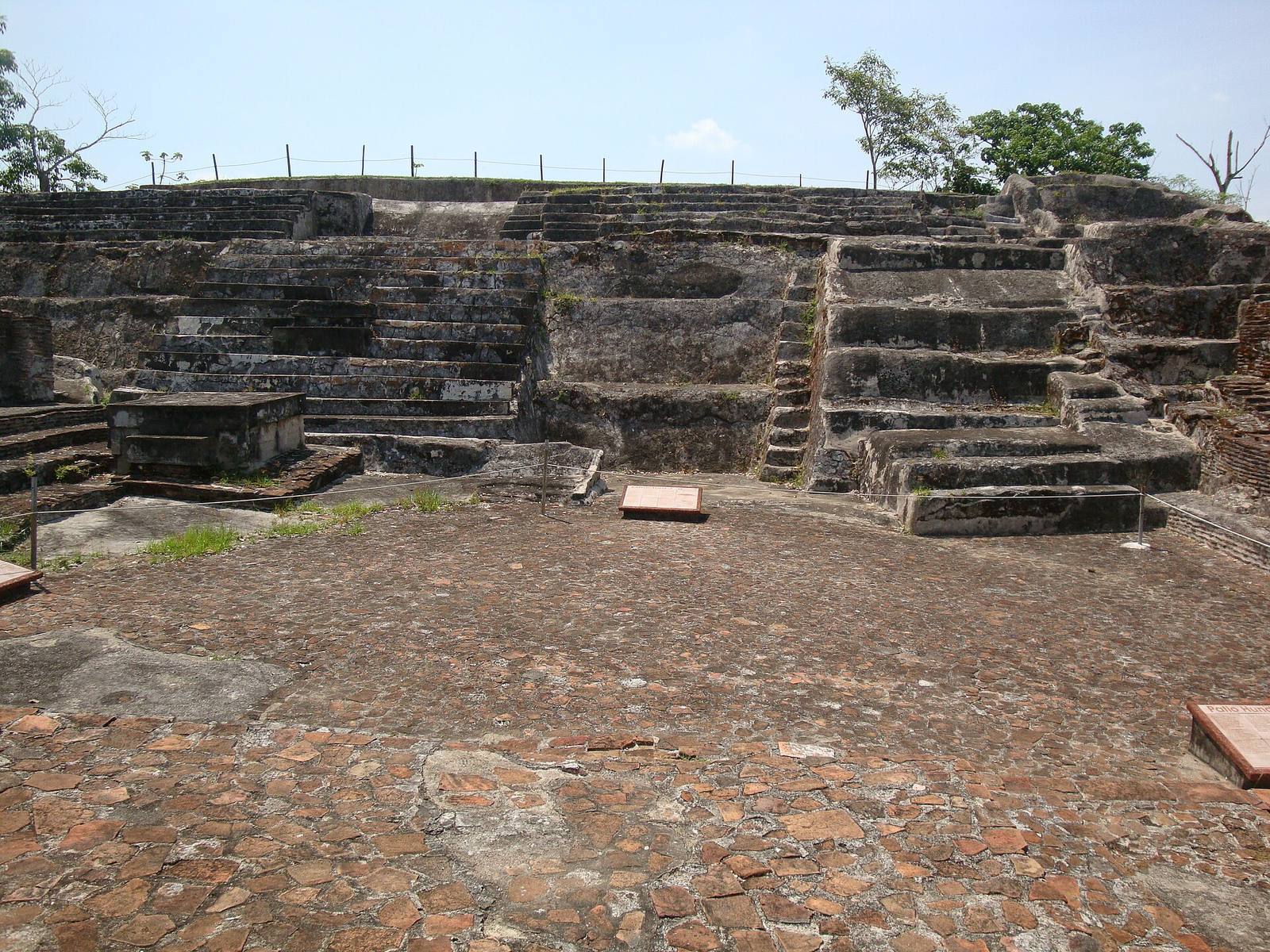
Temple II stands at the northeastern end of the connected northern structures. Its stairway leads to a room with three entrances and then to an inner chamber. The building is badly deteriorated, but the beginning of its main staircase remains visible, divided by a central balustrade. Its earth-packed core has a stucco covering, and fallen bricks on the platform indicate the collapse of the upper part. A later brick terrace, 2.15 m wide, leads to a four-step stair and the temple entrance.
The southern group includes Temples III, IIIA, and IIIB, while the eastern end includes remains of IIIC and IIID. Temple IIIA has an earlier earth core and stucco phase. Other North Plaza buildings preserve successive construction phases. One pyramid began with a front of three sloping tiers and a central staircase, its steps coated in stucco and, in places, brick. A later three-tier phase survives at the southwest corner; the latest brick phase had five tiers. Its staircase led to two stucco-coated brick rooms, a portico and a roofless room with an altar that divided the rear into three parts. Its eastern side joins Temple IIIB.
A separate, partly explored platform of earth and stucco is poorly preserved. Beside its central stair on the east, possible remains of a room, niche, and bench survive. Five floor levels are visible at its northwest corner.
The Great Acropolis
Platform and arrangement
The Great Acropolis is an artificial platform reaching 35 m in height and about 175 m along its eastern base. Its roughly rectangular form runs north to south. Platforms extend west from its northwest and southwest corners, creating a U-shaped complex around three sides of a plaza. Temples, tombs, terraces, and courtyards occupy different levels. Buildings were added over time, and some temples combine a sanctuary above with a vaulted burial chamber within the platform.
The Palace
The Palace stands near the center of the platform. It measures about 80 m long, 8 m wide, and 9 m high, with two parallel galleries running north to south and a main front facing west. The western gallery served as a vestibule, with eight entrances framed by rectangular pilasters. The openings measure between 2.5 and 4 m across and were probably spanned by wooden lintels. An altar stands against the south end wall. Five openings connect this gallery to the eastern one, which contains six rooms, most with rear exits. One room has an altar against its east wall. Four small niches, narrow rectangular openings in the east wall, and traces of red paint remain. The roof has collapsed, while remnants on the central wall indicate a vaulted structure.
The Sunken Patio and neighboring rooms
The Sunken Patio lies south of the Palace and measures 23 by 11 m. Structure 2 bounds it to the north, Structure 3 to the east, the Palace’s rear to the west, and Temple IV to the south. A network of clay pipes beneath the floor joined open channels and drained buildings and passages higher on the acropolis.
Structure 2 consists of two parallel masonry rooms on a raised platform, oriented north to south. Its west-facing portico looks onto a passage connecting it with the Palace, while a short staircase provides northern access toward Structure 4. Red pigment remains on the walls. A niche and dividing walls in the front room may relate to domestic use. Another single-room building, reached from the patio and set on a small platform, had a vaulted roof decorated inside with large modeled human figures; it may have been an elite residence.
Between Structures 1 and 2, two steps descend to a lower enclosure known as the Pond. It connects to a large clay urn with a small hole in its base, through which water flowed into the enclosure. The feature may have served ritual purposes and may also have cooled the surrounding area.
Temple IV
Temple IV stands about 12 m southeast of the Palace, facing west toward a lower plaza. It measures approximately 18.5 m across, 7.5 m deep, and 10 m high. Its platform has superimposed sloping tiers, with two stairways on the north side that meet after a short landing. Fragments on the south front include stucco figures of seated, clothed people and part of a bird’s head holding an object in its beak. A small upper room may have stood above the platform.
A central staircase leads to a two-room temple, with a vestibule divided into three openings by two pilasters and a sanctuary containing an altar against its rear wall. Beneath the temple, a burial chamber was entered through a passage in the center of the platform stair, which later sealed the entrance. The chamber had a brick roof incorporating shell material. A stucco frieze remains above the temple room. Large modeled figures, made from shell-lime mixture over brick cores, decorated the temple’s interior and exterior; some sculptures are displayed in the site museum.
Tombs and Temple IX
The Tomb of the Nine Lords of the Night lies southeast of the Palace. Its chamber measures about 3 m by 3 m and is approximately 2.8 m high. Nine stucco relief figures, originally associated with hieroglyphic inscriptions, appear on the interior walls. The upper temple survives chiefly in the platform and burial chamber.
About 8.5 m west of the Palace’s southern end stands a badly ruined temple facing north. Its remains include a platform, vestibule, sanctuary, and an interior tomb whose entrance was concealed beneath the platform stair. Known as Temple IX, it was built above the Tomb of the Nine Lords of the Night. Stucco figures on the tomb walls are now badly eroded.
Northwest extension
Temple VI, also called the Temple of the Mask, stands on a northwest extension of the Great Acropolis, where Temples VII and VIII are also located. It measures about 15 by 12 m and is 10.5 m high. Its older phase has three earth-built tiers, a central stair with side balustrades, and a solar mask at the base. A later brick phase includes three stepped tiers and an upper temple on a low platform, facing south. The upper building has a vestibule, a sanctuary, and an altar; its rooms may have had Maya vaults. A stucco mask of the sun deity Kinich Ahau was recovered from the central stair.
Temple VII occupies a projecting spur at the northern edge of the Great Acropolis. Its small base supports a north-facing central stair. The summit building had an entrance with three openings leading to a sanctuary and built-in altar. Stucco figures of seated people remain on the upper sloping tiers. West of Temple VI is a building known as the Temple of the Seated Figures, measuring about 17 m across, 15 m wide, and 4.5 m high. Its older phase includes two low sloping tiers and a taller third tier; its north side has three stepped tiers and remains of an altar bearing part of a modeled stucco figure. Temple VIII is a ruined neighboring structure on the same spur.
Southwest Plaza and summit features
The Plaza Suroeste is bounded by the platform carrying Structure 6 to the north, Temple IV to the east, and Structure 5 to the west. Beneath its floor, in front of Temple IV, a multiple burial included crossed bones, debris from obsidian working, and shell and snail objects, possibly linked to a building ritual. Two semicircular stones lie at the middle of Temple IV’s stair. A skull set into Temple I and a stela fragment found near the La Palmera mound are other examples of stone sculpture at the site. Structures 5 and 6 are small, single-room masonry buildings, each less than 10 m², possibly residences of the dominant group; they were decorated with stucco figures.
A structure on the Great Acropolis summit has a stucco scene with bands representing a royal mat, a black vulture’s beak holding a bead, and three seated figures. Animal bones found there were used to make ornaments and musical instruments. These remains have been linked with music, dance, and prayer associated with court and ritual roles.
East Acropolis and peripheral remains
The East Acropolis is a smaller architectural group whose layout follows the cardinal directions, an arrangement that may relate to the North Plaza. Around the central groups, residential remains include individual mounds and clusters organized around one or more plazas.
Peripheral cemetery
Three earth mounds at the site’s edge cover a cemetery area of about 220 m² containing 116 burials more than 1,000 years old. Sixty-six people were placed in urns averaging 35–75 cm in height and 35–80 cm in diameter; another 50 were buried around them. This arrangement may distinguish people of higher status from attendants. Some urn-buried individuals show cranial deformation, filed teeth, and jade inlays. Twenty-eight burials were especially well preserved about 2 m below the surface, resting on shell and covered with lime. Mixed with water, the lime formed a paste that adhered to and protected the bones.
Objects associated with the cemetery include ceramic whistles and rattles shaped as animals and richly dressed people, knives, blades, flint and obsidian-working debris, fragments of metates, or stone grinding tools, more than 70,000 pottery sherds, and a complete dog skeleton. Three sealed kilns stood on a shell layer and may have been used to bake the compacted-earth covering over the burial deposit.
Bricks and figurine production
More than 4,600 decorated bricks have been identified among the remains. Designs include people shown standing, sitting, or walking, in frontal or profile views, as well as animals such as primates, rodents, rabbits, and deer. Other bricks depict humanized animals, masked figures, deity faces, moving skeletons, and stylized creatures. Some show houses and temples with roof combs. Glyphs include calendar signs that pair day names with numerals, sequences of signs, and apparent representations of inscribed monuments. Geometric patterns and designs resembling woven mats or interlaced fibers also occur. Artists used incision, paint, modeling, and added clay; the bricks were recovered from rubble left by collapsed buildings.
The site has also produced clay figurines and molds, tools, pit kilns, and waste from figurine manufacture. Together, these remains provide evidence of local production alongside the use of fired-clay bricks for construction.
Inscribed funerary offering
The offering associated with Aj Pakal Tahn includes stingray spines and shell pendants bearing Maya glyphs. The inscription totals 260 glyphs, of which 80 have been translated, and recounts 14 years of the priest’s life. A small inscribed stingray spine from the offering is displayed in the site museum.