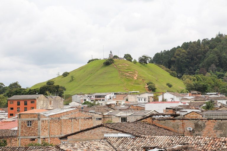
Tierradentro: A Pre-Columbian Funerary Archaeological Complex in Colombia
Site at a Glance
- Rating
- 4.8
- Popularity
- Very Low
- Country
- Colombia
- Primary era
- Medieval
- External website
- Open
- Eras represented
- Medieval
- Civilizations
- Unclassified
- Site type
- Burial
- Remains
- Necropolis
On this page8 sections
History
Tierradentro is an archaeological complex in Inzá, Cauca, Colombia, created by a pre-Columbian agricultural society that occupied the region mainly between about AD 500 and 900. Its ceramics, ornaments, stone sculptures, and funerary traditions share characteristics with the San Agustín cultural tradition, a major pre-Columbian tradition of southwestern Colombia known especially for monumental stone sculpture. Tierradentro is distinguished by its extensive underground tombs and the burial practices associated with them.
Burial traditions and early history
The people of Tierradentro used a two-stage burial system. A primary burial placed the body in a relatively shallow grave with personal possessions and food. After decomposition, the bones were exhumed and transferred collectively to ceramic urns inside monumental underground tombs. This practice connected the treatment of the dead with the construction and decoration of large funerary chambers.
Spanish colonists gave the region the name Tierradentro, meaning “land within.” The high mountains of the Central Cordillera made the area difficult to reach and gave it the appearance of an enclosed interior land. In 1756, the monk Juan de Santa Gertrudis visited the region and produced the earliest known written description of its tombs.
Archaeological investigation and protection
Technical investigation began in 1936, when Alfredo Navia, governor of Cauca and an archaeologist, sent the geologist Georg Bürg to examine the region. The University of Cauca sponsored Bürg’s work from May of that year. He mapped the geology, identified tombs and stone statues known to local farmers and Indigenous inhabitants, excavated several sepulchres, and collected ceramics and stone tools. Some of the ceramics carried traces of coca leaves. Bürg also placed temporary shelters over excavated tombs, cleaned chambers previously explored by treasure hunters, and began creating paths to the monuments.
In June 1936, Colombia’s Ministry of National Education commissioned the archaeologist Gregorio Hernández de Alba to assess Bürg’s work and continue the excavations. His investigations began the systematic study of Tierradentro’s pre-Columbian monuments and extended across many locations, including San Andrés de Pisimbalá, El Aguacate, El Tablón, Vivorá, El Rodeo, Pedregal, Las Tapias, Topa, La Plata, Ricaurte, Cohetando, Belalcázar, Calderas, Avirama Viejo, Togoima, Santa Rosa, El Hato, and El Marne.
Two isolated charcoal dates fall outside the principal chronology of the tombs. Charcoal from a primary burial at Santa Rosa was dated to AD 1630, while charcoal from a funerary urn in a hypogeum was dated to AD 1850. These dates are treated separately from the main archaeological period of Tierradentro.
The National Archaeological Park of Tierradentro was established in 1945 under Colombia’s Ministry of Education. The site became a national monument in the early 1990s, and responsibility later passed to the Colombian Institute of Anthropology and History, or ICANH, Colombia’s national institution for archaeological research and heritage management. Since the 1970s, Mauricio Puerta and Alvaro Chaves have directed cleaning and repair work on damaged tombs and have cleaned the stone statues. Conservation has included pumping water from tombs, reinforcing structures and wall paintings, and improving protective roofs, because humidity weakens the architecture and damages the paintings.
In 1995, UNESCO added Tierradentro to the World Heritage List under criterion (iii), which recognizes rare evidence of a cultural tradition or civilization. The inscription was made together with the archaeological park of San Agustín. Tierradentro is administered as a protected archaeological reserve in the municipalities of Inzá and Belalcázar, in the department of Cauca.
Remains
Tierradentro covers an archaeological area of approximately 388,400 square metres in a rugged mountain region. Its remains are distributed through a triangular system associated with Nevado del Huila and the páramos of Las Casitas, Moras, El Brujo, Las Delicias, and Guanacas. The Páez River crosses the region from north to south, while the Ullucos River and the San Andrés stream are also associated with the archaeological area. Fast-flowing watercourses and the region’s geological formation have cut deep canyons and narrow valleys. Habitation occupied alluvial terraces, while cemeteries were generally placed on flattened hilltops, mountain ridges, and other elevated locations near residential areas.
Archaeological zones and underground tombs
The principal archaeological zones are Alto del Aguacate, Alto de San Andrés, Alto del Duende, Loma de Segovia, and El Tablón. Other documented locations include El Hato, El Marne, El Rodeo, Loma Alta, Belalcázar, and Alto del Grillo. More than one hundred underground tombs, or hypogea, are distributed through these areas. A hypogeum is an underground chamber or tomb reached through a shaft, staircase, or passage. At Tierradentro, these chambers served for collective secondary burials and were given carefully shaped architectural interiors.
Hypogea and burial chambers
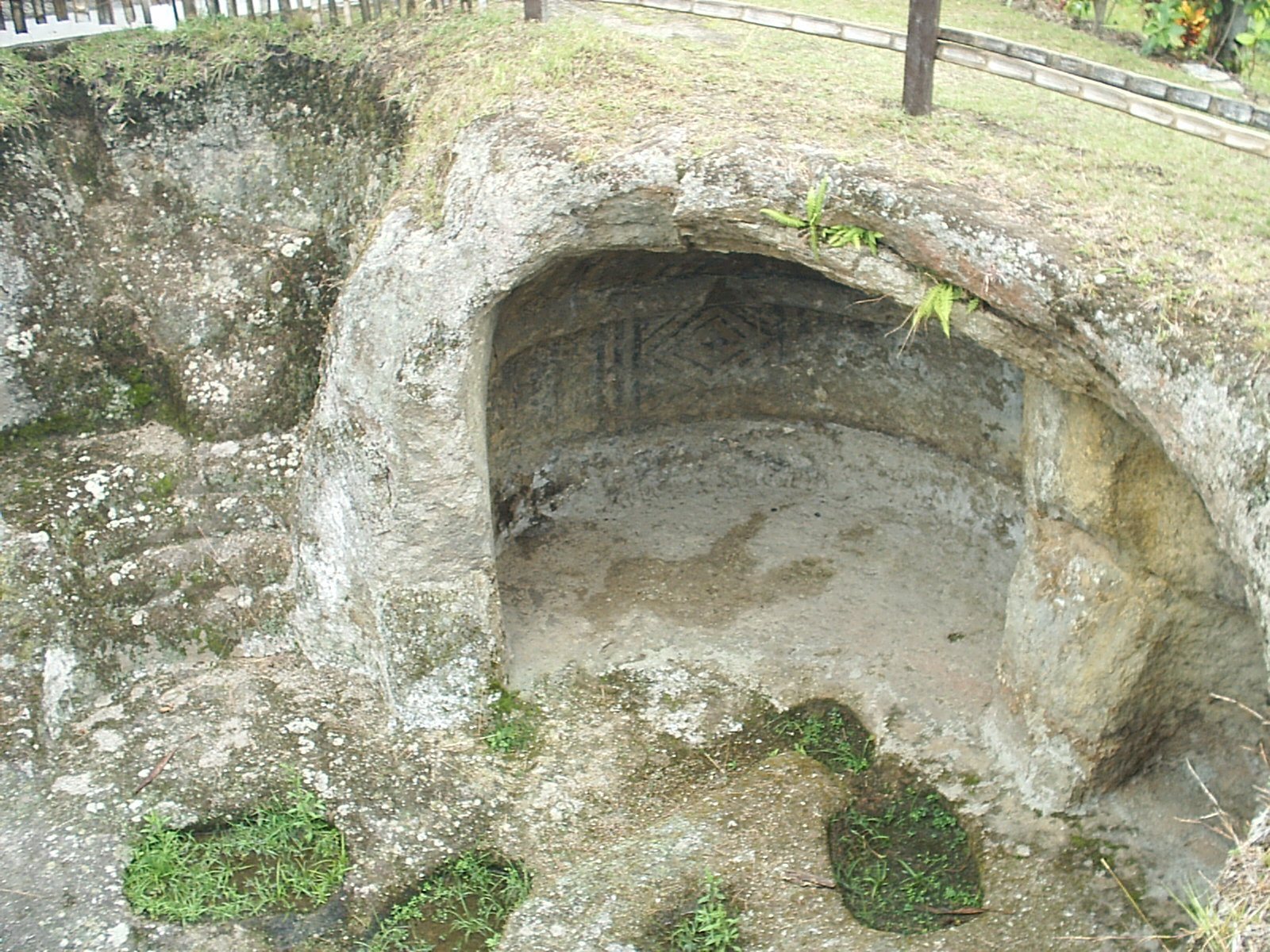
The hypogea were cut beneath hilltops and ridges. A vertical shaft leads down to each burial chamber by a straight, zigzag, or spiral staircase, and some entrances face west. Chambers commonly lie about 5 to 8 metres below the surface, although smaller examples occur at depths of approximately 2.5 to 7 metres. Their plans are generally circular or oval. Smaller chambers measure about 2.5 to 3 metres across, while the largest reach approximately 10 to 12 metres in diameter.
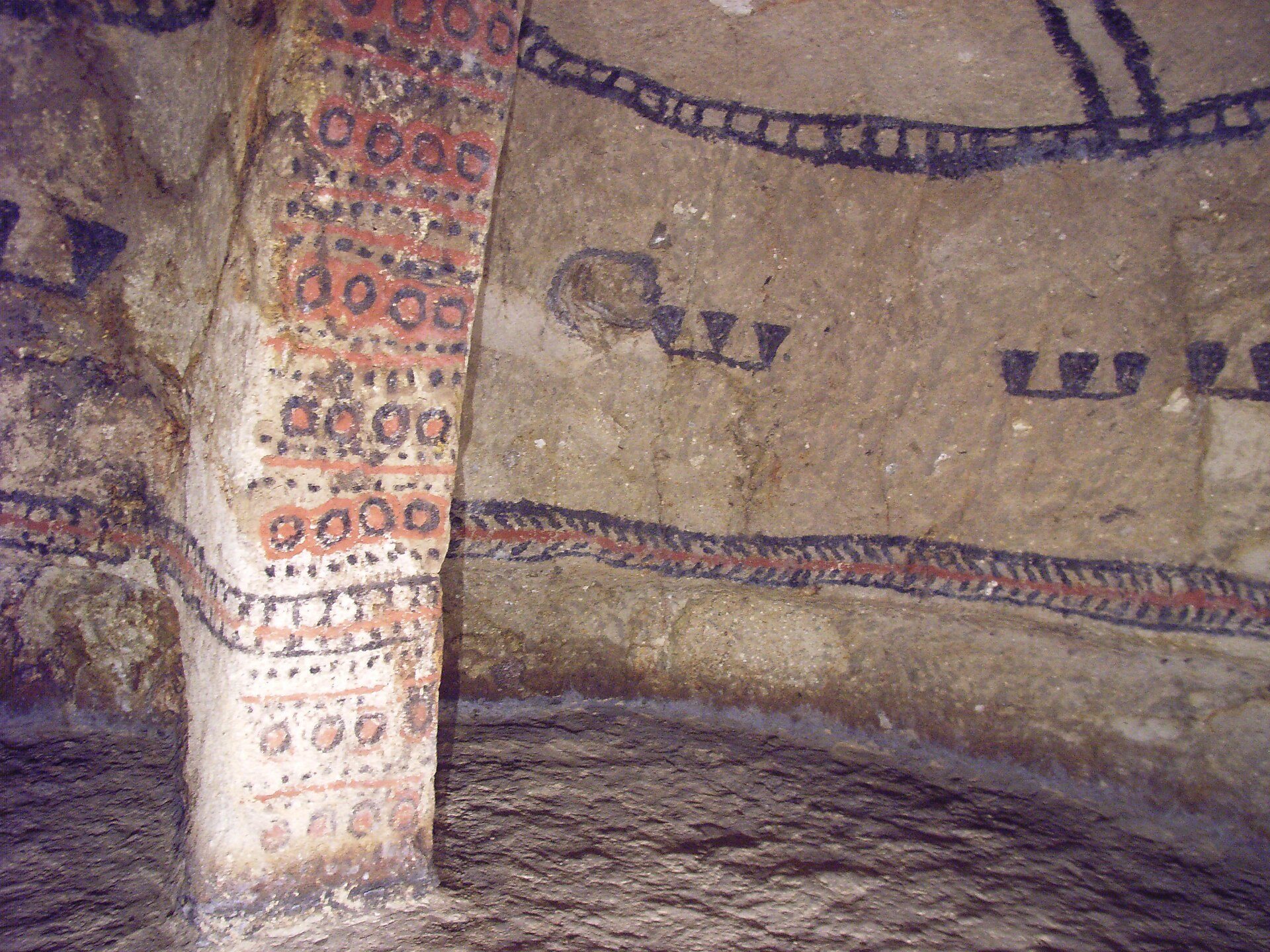
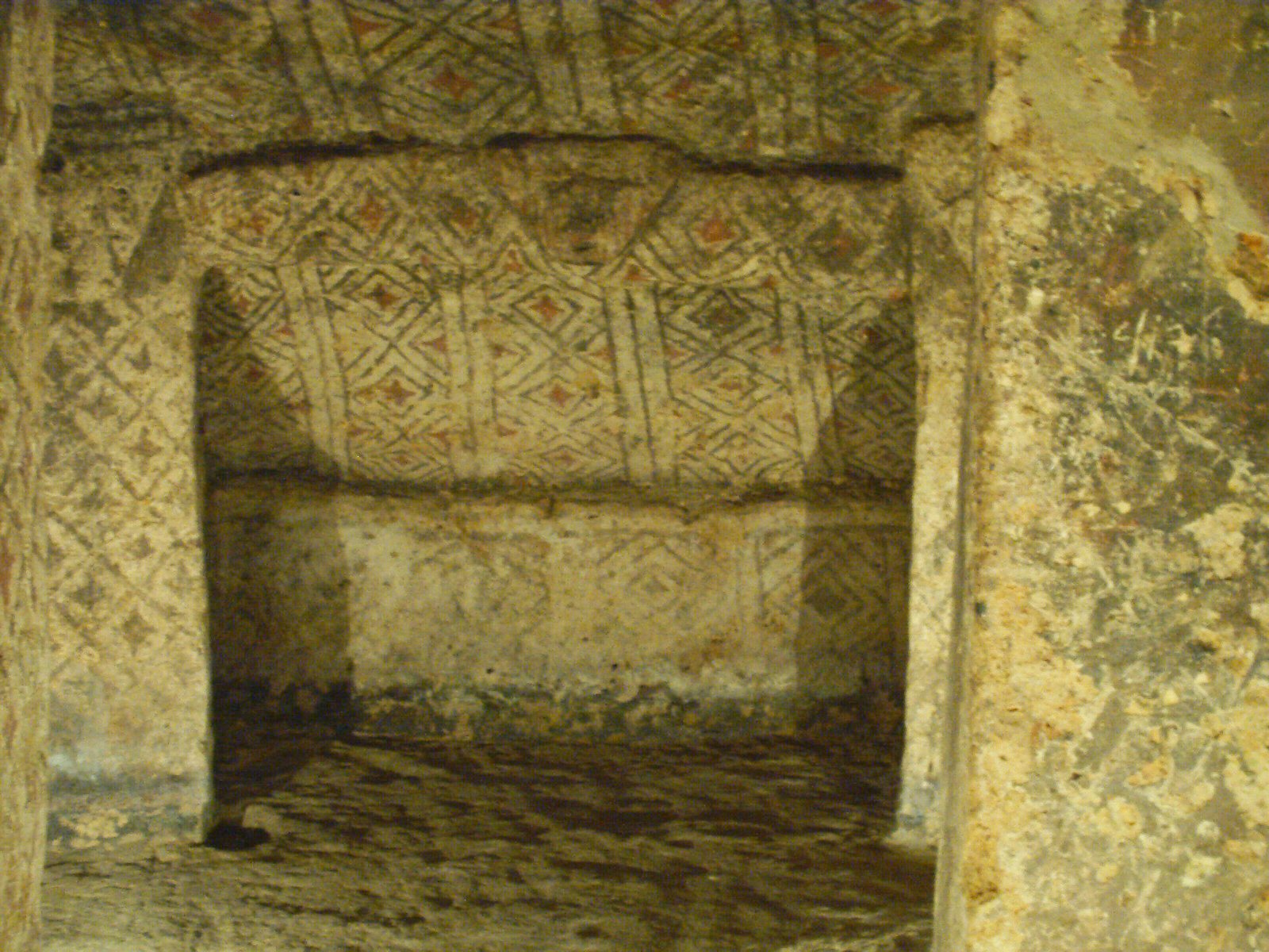
Walls, pillars, and ceilings were carved directly into the bedrock. The chambers contain niches and pilasters, and the largest examples have ceilings supported by two or three pillars. Geometric, human, and animal designs cover these surfaces. Red and black pigments were applied over a white ground, forming patterns and images that include people, lizards, snakes, and centipedes.
Burials and grave goods
Primary-burial graves are relatively shallow and include a small chamber at the side. Excavated contents include metal objects, grinding stones, necklaces, and ceramic vessels. Secondary-burial hypogea contain ceramic urns holding the exhumed bones of one or more individuals. Ceramics recovered during excavation include vessels with traces of coca leaves, while stone tools and limited remains of textiles and pottery also contribute to the archaeological evidence.
Stone statues and protective structures
Stone statues are concentrated particularly at El Tablón and occur in other archaeological zones as well. They form part of the wider material record alongside ceramics and stone tools. Protective structures cover exposed tombs. The earliest shelters, built from bamboo and thatch after the 1936 investigations, were replaced by metal structures when the national park was established in 1945.