Copán: A Maya Royal Capital in Honduras
Site at a Glance
- Rating
- 5
- Popularity
- Very Low
- Country
- Honduras
- Primary era
- Medieval
- Eras represented
- Iron Age, Classical, Medieval
- Civilizations
- Maya
- Site type
- City
On this page17 sections
History
Copán is an ancient Maya archaeological site in Copán Ruinas, western Honduras. The Maya built and developed it as the capital of a powerful kingdom from approximately the fifth to the ninth century AD, during the Classic period of major Maya urban and political development. The valley had supported agriculture for centuries before the earliest known stone architecture, dated to about the ninth century BC. Copán was probably known to the Maya as Oxwitik and stood at the southeastern edge of the Mesoamerican cultural region, where it influenced neighboring centers in western and central Honduras.
Before the Dynasty
Copán was occupied for more than two millennia, from the Early Preclassic through the Postclassic period. An inscription refers to 321 BC, although the meaning of that reference is uncertain. Later texts preserve dates associated with AD 159 and AD 376, as well as the name Foliated Ajaw. These records show that the settlement possessed an established historical tradition before the dynasty that made Copán a major royal capital.
Its position near societies that were not Maya gave Copán a distinctive regional role. The city promoted Mesoamerican cultural practices among local elites and influenced political centers across western and central Honduras. The earliest monumental buildings later incorporated architectural forms associated with Tikal and Teotihuacan, reflecting connections that extended beyond the Copán Valley.
The Founding Dynasty
A new royal dynasty began in AD 426 under K’inich Yax K’uk’ Mo’, who made Copán the capital of a new Maya kingdom. The foundation was connected with Tikal, and Copán remained closely allied with that city. K’inich Yax K’uk’ Mo’ used the title ochk’in kaloomte, meaning “Lord of the West,” and may also have been connected with Caracol. He may have taken power through military conquest and strengthened his position by marrying into the earlier Copán royal family.
The dynasty ruled for approximately four centuries and included sixteen kings, together with a probable claimant to a seventeenth position. K’inich Yax K’uk’ Mo’ died between AD 435 and 437. A tomb found in 1995 beneath Temple 16 contained the richly furnished burial of an elderly man with battle injuries. The remains have been identified with the founder, and bone analysis indicates that he was not originally from Copán.
His son and successor, K’inich Tzu’b Tz’i’, redesigned the urban core, supervised the first version of Copán’s Mesoamerican ballcourt, and built extensively over his father’s palace and tomb. The ceremonies establishing the new dynasty also installed a subordinate ruler at Quiriguá, a neighboring center whose ruler acknowledged Copán’s authority.
Early Dynastic Development
Little is known about Rulers 3 through 6. One was probably a son of K’inich Tzu’b Tz’i’, while the fourth ruler rebuilt Temple 10L-26 and placed a stela and hieroglyphic step there. B’alam Nehn, the seventh ruler, was ruling by AD 504 and described himself as seventh in descent from K’inich Yax K’uk’ Mo’. He also carried out major construction in the Acropolis.
Wil Ohl K’inich became the eighth ruler. Ruler 9 acceded in AD 551 and reigned for less than two years. Moon Jaguar, the tenth ruler, took the throne in May AD 553 and is associated with the Rosalila phase of Temple 16. K’ak’ Chan Yopaat became the eleventh dynastic ruler in AD 578 and reigned for forty-nine years, dying on 5 February 628. His reign brought marked population growth. The two surviving stelae erected during it are the oldest monuments at Copán to survive without being broken or buried.
Monumental Expansion
K’ahk’ Uti’ Witz’ K’awiil succeeded K’ak’ Chan Yopaat sixteen days after his death and ruled from AD 628 to 695. From AD 652 onward, monument construction increased substantially. The king probably sought to assert authority across the valley while making major changes to the city’s architecture. He died on 15 June 695 at the age of seventy-nine and was buried two days later in the Chorcha phase of Temple 26.
Uaxaclajuun Ub’aah K’awiil became the thirteenth ruler in July AD 695. His reign marked the artistic height of Copán’s sculptural tradition but also brought a major political crisis. He defeated and burned the unidentified site of Xkuy in AD 718, installed K’ak’ Tiliw Chan Yopaat as his subordinate at Quiriguá in AD 724, and presented Copán as one of the four most powerful Maya kingdoms, alongside Tikal, Calakmul, and Palenque.
In April AD 738, K’ak’ Tiliw Chan Yopaat captured Uaxaclajuun Ub’aah K’awiil and burned two of Copán’s patron deities. Six days later, the Copán ruler was executed by decapitation at Quiriguá. The circumstances remain uncertain, although the event appears to have been an ambush rather than an open battle. Copán did not visibly retaliate, possibly because Quiriguá was allied with Calakmul.
The defeat ended Copán’s control of the Motagua trade route and probably reduced royal revenues. Major construction stopped, and no new monuments were erected for approximately seventeen years. Building later resumed, but the political balance of the region had changed.
Recovery and Dynastic Strain
K’ak’ Joplaj Chan K’awiil became the fourteenth ruler on 7 June AD 738 and died in January 749. His son, K’ak’ Yipyaj Chan K’awiil, initiated a renewal program. He rebuilt Temple 26, lengthened its Hieroglyphic Stairway, and was probably buried in Temple 11.
Yax Pasaj Chan Yopaat became the sixteenth ruler in June AD 763. He was probably not a direct descendant of his predecessor, and his mother was a noblewoman from Palenque. He built or completed major phases of Temples 11 and 16 and dedicated Altar Q, which presents the succession of Copán’s sixteen rulers. The monument describes the dynasty’s foundation in AD 426–427 and shows K’inich Yax K’uk’ Mo’ transferring power to Yax Pasaj Chan Yopaat.
During the late eighth and early ninth centuries, aristocratic power increased while the population grew beyond the valley’s resources. Living standards declined, local supplies became scarce, and basic necessities had to be imported. A katun was a Maya calendrical period of approximately twenty years, and the king’s participation in the AD 810 katun-ending ceremony was recorded at Quiriguá rather than at Copán.
Ukit Took’, the last known ruler, acceded on 6 February AD 822 and commissioned the unfinished Altar L. Shortage, disease, and weakening political authority accompanied the end of the dynasty. The ceremonial center was eventually abandoned, although the valley remained occupied and monumental stone was reused for domestic platforms during the Postclassic period. Population declined from perhaps more than 20,000 at the city’s height to fewer than 5,000. When the Spanish arrived in the sixteenth century, the ceremonial center had long been abandoned and only a few agricultural settlements remained in the valley.
Rediscovery and Archaeological Work
Copán first entered the colonial record in a letter written by Diego García de Palacio to Philip II on 8 March 1576. Nineteenth-century visitors included Jean-Frédéric Waldeck, Juan Galindo, John Lloyd Stephens, Frederick Catherwood, and Alfred Maudslay. Stephens and Catherwood published descriptions, a map, and detailed drawings in 1841.
Harvard University’s Peabody Museum sponsored expeditions in the late nineteenth and early twentieth centuries, including the excavation of the Hieroglyphic Stairway in 1892–1893. The Carnegie Institution later worked with the Honduran government on research, conservation, and the diversion of the Copán River. A major restoration campaign began in 1935, Harvard-supported research resumed in 1975, and the Copán Archaeological Project began in 1978. Investigations later uncovered Temple Papagayo and Stela 63 in 1988, Rosalila in 1989, the Hunal tomb in 1995, and additional burials and archaeological materials in 2003–2004, 2007, 2008, and 2016.
Excavation beneath the Acropolis revealed successive phases of the royal complex and Early Classic hieroglyphic texts concerning the first dynastic rulers. Mapping and later research have expanded the picture of Copán as a complex regional system with extensive rural settlement, social divisions, literate elites, and changing political uses of writing. After abandonment, the Copán River shifted course and eroded the eastern Acropolis. The river was diverted in the 1930s, and the former channel was filled while the erosion cut was consolidated during the 1990s. Copán became a UNESCO World Heritage Site in 1980 and a Honduran cultural monument in 1982.
Remains
Copán’s central area consists of the Main Group, Cemetery Group, Sepulturas Group, North Group, and other architectural compounds. The Main Group and Cemetery Group form the core, while a sacbe, a raised Maya causeway, connects the Monument Plaza with the Sepulturas Group toward the northeast. The Main Group covers approximately 600 by 300 meters and includes the royal Acropolis, interconnected plazas, the Hieroglyphic Stairway, the Ballcourt, and the Monument Plaza, also known as the Great Plaza. The surveyed central area contained about 1,449 structures per square kilometer, compared with 143 structures per square kilometer across a surveyed area of 24.6 square kilometers.
The Royal Acropolis
The Acropolis consists of the West Court and East Court, enclosed by elevated structures. Its earliest monumental buildings date to the early fifth century AD and were built from stone and adobe over earlier earth-and-cobble structures. Tunnels beneath the complex expose successive construction phases, early hieroglyphic texts, and earlier buildings. Some predynastic earthen structures continued to be expanded during the first century of dynastic rule. The architecture combines Early Classic forms associated with Tikal with a sloping-wall and vertical-panel form called talud-tablero, which was strongly associated with Teotihuacan.
Temple 16
Structure 10L-16, or Temple 16, is a temple pyramid at the highest point of the Acropolis, between the East and West Courts. It faces the West Court and was dedicated to K’inich Yax K’uk’ Mo’. The final building stands over an earlier palace and tomb. Its earliest phase, Hunal, used talud-tablero construction and retained traces of brightly painted murals. K’inich Yax K’uk’ Mo’ was buried in a vaulted crypt beneath it with rich jade offerings.
K’inich Tzu’b Tz’i’ built the Yehnal platform over the tomb and decorated it with red-painted masks of the sun god K’inich Tajal Wayib’. The later Margarita platform enclosed Yehnal. Margarita contained stucco panels showing entwined quetzals and macaws and a richly furnished tomb belonging to an elderly woman known as the Lady in Red, probably the founder’s widow and K’inich Tzu’b Tz’i”s mother. Its upper chamber was later converted for offerings, and the Xukpi Stone was reused there.
The Rosalila phase was built over five earlier versions and survives in unusually complete condition, including its base platform, superstructure, roof comb, and painted stucco decoration. Its imagery places K’inich Yax K’uk’ Mo’ in a mythological scene with Itzamna, a Maya deity associated with creation, knowledge, and the sky, shown in avian form. The decoration also includes anthropomorphic mountains, skeletons, and crocodiles. Exterior vents allowed incense smoke from the shrine to interact with the stucco sculpture. A stone hieroglyphic step carries a dedicatory inscription dated to AD 571.
Rosalila was probably the last Copán structure to use such elaborate stucco, because deforestation reduced the firewood available for producing plaster. Uaxaclajuun Ub’aah K’awiil later enclosed the building beneath a new construction phase. The termination offering included blue-wrapped eccentric flints carved as human and divine profiles.
Structures 10L-11 and 10L-18
Structure 10L-11 stands on the western side of the Acropolis and closes the southern side of the Hieroglyphic Stairway Court. It was built over earlier structures and probably served as the royal palace of Yax Pasaj Chan Yopaat. In AD 769, the ruler placed a temple platform over his predecessor’s tomb and added a two-storey superstructure whose sculpted roof represented the mythological cosmos. Large Pawatun sculptures occupied its northern corners, and four doorways had hieroglyphic panels carved directly into the walls. A carved bench depicting the king’s accession was removed in the nineteenth century and is now in the British Museum.
Structure 10L-18 lies on the southeastern side of the Acropolis. River erosion removed its eastern portion, while its southern stairs lead to an anciently looted vaulted tomb probably belonging to Yax Pasaj Chan Yopaat. Four sculpted panels in the summit shrine show the king performing war dances with spear and shield.
Structures 10L-22 and 10L-25
Structure 10L-22 is a large building on the northern side of the East Court and the best-preserved structure associated with Uaxaclajuun Ub’aah K’awiil. Its interior doorway has a carved frame with Witz mountain masks, while its exterior entrance carries a giant deity mask with stylistic similarities to the Chenes region of Yucatán. The building commemorated the completion of the ruler’s first katun in AD 715. Its hieroglyphic step records the phrase “I completed my katun,” and the structure represents the mountain where maize was created.
Structure 10L-25 stands in the East Court over a rich royal tomb known as Sub-Jaguar. The burial is attributed uncertainly to B’alam Nehn, Ruler 8, or Ruler 9, all of whom ruled during the first half of the sixth century AD.
Temple 26 and the Hieroglyphic Stairway
Structure 10L-26, or Temple 26, projects northward from the Acropolis immediately north of Structure 10L-22. Its successive phases were built by several Copán rulers, beginning with K’inich Yax K’uk’ Mo’ and K’inich Tzu’b Tz’i’ and continuing through the fourth ruler, K’ahk’ Uti’ Witz’ K’awiil, Uaxaclajuun Ub’aah K’awiil, and K’ak’ Yipyaj Chan K’awiil.
The earliest phase, Yax, used inset corners associated with Tikal and the central Petén. The Motmot phase was more elaborate and covered in stucco. Beneath it, the Motmot Capstone covered a Teotihuacan-style burial of a woman accompanied by animal bones, mercury, jade, quartz, and three male human heads. The Papagayo phase was later ritually demolished. Broken sculptural monuments and stone macaw heads from an earlier ballcourt were buried before the Mascarón pyramid was constructed.
The Chorcha phase added a long superstructure with seven entrances at both the front and rear. A tomb beneath it contained an adult male and a sacrificed child, jade ornaments, 44 ceramic vessels, jaguar pelts, spondylus shells, ten paint containers, decayed hieroglyphic books, and twelve ceramic incense burners with human-figure lids. The burial probably belonged to K’ahk’ Uti’ Witz’ K’awiil. Uaxaclajuun Ub’aah K’awiil sealed Chorcha beneath the Esmeralda phase by AD 710. K’ak’ Yipyaj Chan K’awiil later built over Esmeralda, reinstalled and lengthened the Hieroglyphic Stairway, and added five life-size seated ruler statues dressed as Teotihuacan warriors.
The Hieroglyphic Stairway rises along the west side of Temple 26. It is approximately 10 meters wide and 21 meters long, with 62 steps. Stela M and an associated altar stand at its base, while large sculpted figures appear at every twelfth step. Approximately 2,200 glyphs form the longest known Maya hieroglyphic text. The text records dynastic history and was disturbed when the temple facade collapsed. The stairway was first built by Uaxaclajuun Ub’aah K’awiil in AD 710 and reinstalled and extended by K’ak’ Yipyaj Chan K’awiil in AD 755.
Plazas and Monumental Sculpture
The Ballcourt and Monument Plaza
Structure 10L-4 is a platform with four stairways beside the Monument Plaza. The Ballcourt lies immediately north of the Hieroglyphic Stairway Court and south of the Monument Plaza. Uaxaclajuun Ub’aah K’awiil remodeled an earlier court, demolished it, and constructed a third version that was among the largest of the Classic period. Dedicated to the Great Macaw deity, it was flanked by buildings decorated with sixteen mosaic bird sculptures. Its completion was recorded on 6 January AD 738.
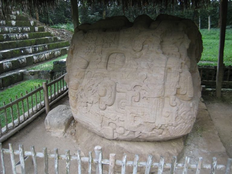
The Monument Plaza contains Copán’s greatest concentration of sculpted monuments. Portrait stelae were generally placed along processional routes in the central plaza and around the Acropolis. Stelae 2 and 3 were erected by K’ahk’ Uti’ Witz’ K’awiil in AD 652, while Stelae 10, 12, 13, and 19 were placed outside the site core in the same year. Stela 4 was erected by Uaxaclajuun Ub’aah K’awiil in the early eighth century. Stela 7, from the reign of K’ak’ Chan Yopaat, commemorated the katun-ending ceremony of AD 613.
Stelae, Altars, and Inscribed Stones
Stela 15, dated to AD 524, records that B’alam Nehn ruled by AD 504. Stela 9 was dedicated by Moon Jaguar in AD 564, while Stela 17 dates to AD 554. Both originally stood in a Classic-period complex at the site of modern Copán Ruinas. Stela 18 bears the name of K’inich Tzu’b Tz’i’ and was erected inside Temple 10L-26.
Stela 63 was dedicated by K’inich Tzu’b Tz’i’ and consists entirely of finely carved hieroglyphic text. It may have been commissioned by K’inich Yax K’uk’ Mo’ and supplemented by his son. The monument repeats the AD 435 date found on the Motmot Capstone. It was deliberately broken with its hieroglyphic step during the ritual destruction of Papagayo and buried in the building.
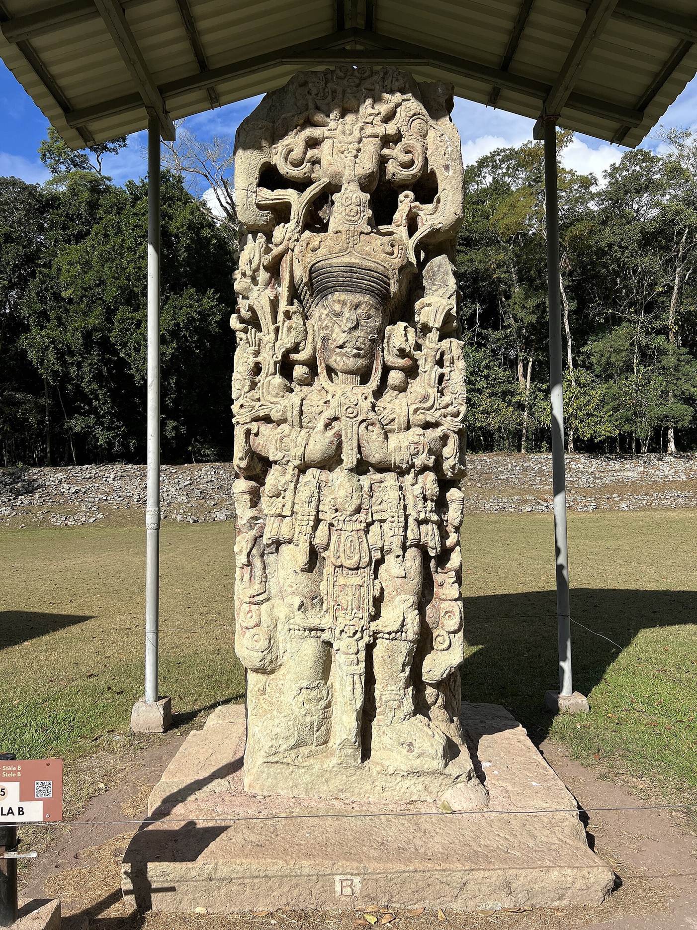
Uaxaclajuun Ub’aah K’awiil erected Stela J in AD 702 at the eastern entrance to the city. Its carved stone roof gives it the form of a symbolic house, and its inscription is interwoven with a complex criss-cross mat design. Stela A, erected in AD 731, places Copán among the four most powerful Maya kingdoms alongside Palenque, Tikal, and Calakmul. Stelae B, C, D, F, and H were also erected during his reign.
Stela M bears a portrait of K’ak’ Yipyaj Chan K’awiil and was erected at the base of the Hieroglyphic Stairway in AD 756. Stela N was dedicated by him in AD 761 at the foot of the stairway to Temple 11. Stela P, dedicated in AD 623 during the reign of K’ak’ Chan Yopaat, was later moved to the West Court of the Acropolis. Its long hieroglyphic text remains incompletely deciphered.
Altar Q, dedicated by Yax Pasaj Chan Yopaat in AD 776, depicts Copán’s first sixteen rulers seated on their name glyphs. The Motmot Capstone shows K’inich Yax K’uk’ Mo’ and K’inich Tzu’b Tz’i’ facing each other within a quatrefoil frame and bears dates corresponding to AD 435 and AD 441. The Xukpi Stone, dated to AD 437, names both rulers and may mention the Teotihuacan general Siyaj K’ak’. Stela 11 originally formed an interior column in Temple 18, the funerary shrine of Yax Pasaj Chan Yopaat. Found broken at the base, it depicts the king as an elderly Maya maize deity, and its text may describe the fall of the Copán dynasty.
Residential and Peripheral Groups
The Sepulturas Group is linked to the Monument Plaza by a sacbe and contains restored structures, elite residences, carved stone benches, and tombs. By about AD 800, approximately fifty buildings stood around seven major courtyards. The House of the Bakabs was a palace associated with a powerful noble during the reign of Yax Pasaj Chan Yopaat. Its exterior was richly sculpted, and its interior contained a carved hieroglyphic bench. Part of the group formed a district inhabited by non-Maya residents from central Honduras who participated in regional trade.
The North Group is a Late Classic compound whose fallen facades preserve hieroglyphic inscriptions and sculpted decoration. The Cemetery Group, immediately south of the Main Group, contains small structures and plazas. River erosion cut through the eastern Acropolis, creating a vertical archaeological profile approximately 37 meters high and 300 meters long. The erosion destroyed at least one courtyard and ten buildings in Group 10L-2, while Structures 10L-19, 20, 20A, and 21 were destroyed after having been recorded by nineteenth-century investigators.