The Forks: Winnipeg’s Historic Cultural Landscape and Meeting Place
Site at a Glance
- Rating
- 4.7
- Popularity
- Low
- Country
- Canada
- Primary era
- Modern
- Eras represented
- Stone Age, Iron Age, Medieval, Modern
- Civilizations
- Unclassified
- Site type
- Civic
- Remains
- Park
On this page26 sections
History
The Forks is a historic cultural landscape at the meeting of the Red and Assiniboine rivers in Winnipeg, Manitoba, Canada. Indigenous peoples used the area for approximately 6,000 years, making it a seasonal camp, ceremonial ground, trading place, migration stop, and later an urban centre. Its long history reflects the changing relationships among Indigenous nations, European newcomers, the fur trade, immigration, railways, and the modern city.
Landscape and Indigenous use
The landscape developed after the retreat of the glacial ice that covered the wider region with several hundred metres of ice around 10,000 years ago. Glacial Lake Agassiz deposited silt across the area, helping form the fertile Red River valley. Vegetation, wildlife, fish, and human settlement increased as the environment changed.
Indigenous groups began using The Forks approximately 6,000 years ago. The site served as a seasonal camp and a place for religious ceremonies and intertribal trade. It also lay along migration routes between the northern forests and the southern plains. Archaeological evidence and historical traditions connect the area with Nakoda or Assiniboine, Cree, Anishinaabe, and Dakota peoples.
Excavations between 1989 and 1994 revealed successive Indigenous camps and evidence of bison hunting, fishing, trade, pottery production, and agriculture. Oral traditions describe peace meetings among several Indigenous nations at The Forks more than 500 years ago. Camp remains associated with these traditions have been radiocarbon-dated to approximately 1285.
The rivers themselves also changed over time. The Assiniboine has followed its modern course for approximately 700 years. Before then, it joined the Red River near the present mouth of the La Salle River, altering the physical setting in which people travelled, camped, and exchanged goods.
Fur trade and colonial expansion
European fur traders reached the area in the eighteenth century, with Assiniboine intermediaries helping conduct trade with local Indigenous peoples. Europeans arrived by canoe in 1738, when Pierre Gaultier de Varennes, sieur de La Vérendrye, a French-Canadian explorer and colonial official, established Fort Rouge. It was the first in a succession of forts and trading posts in the region.
La Vérendrye recorded two Assiniboine camps at the river junction and encountered Cree representatives there in 1738. Fort Rouge was associated with the early French trading presence near The Forks, while documentary evidence places it somewhere in the vicinity of present-day Union Station.
The Forks and nearby Red River settlements became a western administrative and commercial centre for the fur trade. From 1760 to 1821, the Hudson’s Bay Company and the North West Company competed for furs and used the area to store and ship furs and supplies. Their rivalry ended when the two major North American trading companies amalgamated in 1821.
The Hudson’s Bay Company built Upper Fort Garry, enclosing it with stone walls approximately 5 metres high. The fort was demolished in 1880 to allow the further construction of Main Street. The Forks remained a major fur-trade hub until the 1880s, when grain production became western Canada’s principal industry and railways replaced waterways as the main transport system.
Métis history and immigration
Trade, immigration, and relationships between European newcomers and Indigenous women contributed to the growth of the Métis population. The Métis are an Indigenous people whose historical identity developed particularly through relationships between Indigenous communities and European newcomers in the Great Lakes and western Canadian regions. Their population became central to Manitoba’s demographic and political history.
European farms and settlements established north of present-day Winnipeg from 1812 contributed to conflict with local Métis communities. On 19 June 1816, the Battle of Seven Oaks resulted in the deaths of 21 colonists, including the regional governor, and one Métis.
After Manitoba entered Confederation in 1870, immigration from eastern Canada, Europe, Asia, and the United States increased sharply. In 1872, the Canadian government erected two immigration sheds at The Forks. Each was designed to accommodate approximately 400 to 500 people for stays of no more than a week. Overcrowding and poor conditions made the sheds notorious, and railway construction led to their removal in the late 1880s.
Railway transformation
Railway activity dominated The Forks from the late nineteenth century through the early twentieth century. The Northern Pacific and Manitoba Railway established a terminal in 1888. The Canadian Northern Railway, Grand Trunk Pacific Railway, and later Canadian National Railway expanded railway, storage, and freight operations across the site.
Construction of Union Station and the High Line Main Track in 1911 restricted public access to much of The Forks. The railway period also produced buildings and structures that survive within the modern site, including railway stables later incorporated into The Forks Market and the building now known as Johnston Terminal.
Renewal and public use
In 1986, an agreement began the conversion of the former Canadian National East Yards into a nationally significant historic and public site. The Forks Renewal Corporation was incorporated on 24 July 1987 to implement the redevelopment. In 1994, its operations were merged with those of the North Portage Development Corporation to form The Forks North Portage Partnership.
Canadian, Manitoba, and Winnipeg authorities supported the transformation through consultation, planning, and investment. Canadian National transferred most of its land at The Forks in 1988, enabling former railway facilities to become cultural, commercial, recreational, and public spaces.
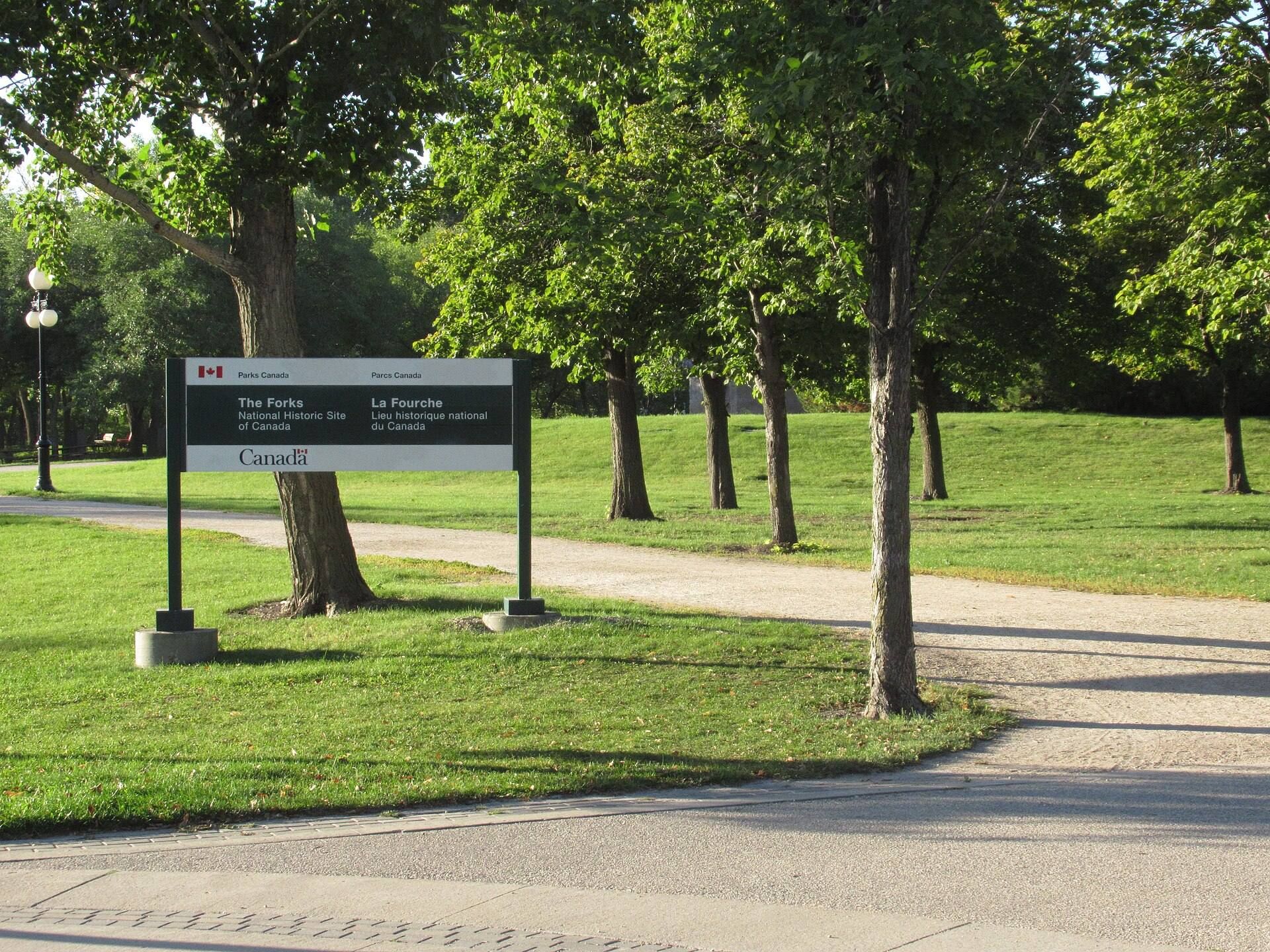
The Forks was designated a National Historic Site of Canada in 1974 because its cultural landscape preserves evidence of approximately 6,000 years of human activity. The revitalized site officially opened in 1989 as The Forks National Historic Site of Canada. The former railway and industrial area became an interpretive park and public gathering place containing restored buildings, new construction, museums, a historic port, recreational facilities, and public landscapes. It remains a major civic and cultural centre of Winnipeg.
Remains
The Forks occupies approximately 5.5 hectares at the junction of the Red and Assiniboine rivers. Its physical landscape combines riverbanks, archaeological deposits, restored railway buildings, new public buildings, paths, gardens, plazas, a port, and recreational areas. Archaeological deposits extend to depths of approximately 6 metres, preserving successive layers beneath later construction and landscape work.
Archaeological landscape
Early camps and material remains
Two hearths, deliberately used fire areas, date to approximately 6,000 years ago and are among the earliest evidence of human occupation at The Forks. Tools and other implements occur with these remains. A camp and trading area approximately 3,000 years old was found about 3 metres below the surface on the north bank of the Assiniboine River.
Excavated materials include animal bones, stone tools, hearths, pottery, harpoons, and projectile points made from materials brought from distant regions, including present-day Texas. A hoe made from a bison shoulder bone reflects the range of activities carried out at the site. Repeated flooding buried camps and artefacts beneath successive deposits of mud, creating layered evidence of long-term occupation.
Pottery and ancient technologies
Pottery from The Forks was made with mould-forming techniques. Earlier pottery traditions elsewhere included coiling clay, while later vessels could imitate woven bags or moulded forms. Differences in pottery styles help distinguish cultural groups represented in the archaeological layers.
Railway buildings and museums
The Forks Market
The Forks Market occupies two former railway stables associated with the competing Grand Trunk Pacific and Great Northern railways. Their horse stalls were joined by a courtyard and bridges, creating the present market complex. The building contains two storeys of vendor space and a six-storey tower with a viewing platform and interpretive panels.
Johnston Terminal
Johnston Terminal is a four-storey building across the courtyard from The Forks Market. The Carter-Halls-Aldinger Company constructed it in 1928 as the National Cartage Building. It served as a Canadian National Railway warehouse and freight-forwarding facility. A substantial addition in 1930 increased its usable area to more than 9,300 square metres. After the building was vacated in 1977, it was adapted for shops, offices, restaurants, and an antique market.
Manitoba Children’s Museum
The Manitoba Children’s Museum occupies the former Kinsmen Building, constructed in 1889 as a railway repair facility. It is described as the oldest surviving train-repair building in Manitoba. The building was restored and expanded for museum use and contains twelve permanent galleries.
Canadian Museum for Human Rights
The Canadian Museum for Human Rights was completed at The Forks in 2014. It rests on more than 500 piles and has a total floor area of approximately 24,155 square metres, including 4,366 square metres of exhibition space. About 1,200 glazed sections cover approximately 35,000 tonnes of concrete.
The museum includes the Theatre of the Broken Glass, an exhibition space devoted to the Holocaust, as well as galleries addressing genocides recognized by Canada. These include the Armenian genocide, the Holodomor in Ukraine, the genocide in Rwanda, and the Srebrenica massacre. The museum site is also archaeologically important for the history of the First Nations.
Union Station and the railway museum
Union Station remains in operation beside The Forks. The adjacent Winnipeg Railway Museum formerly housed the locomotive Countess of Dufferin, identified as the first steam locomotive to enter western Canada. The museum closed on 31 December 2021.
Bridges and commemorative structures
Historic Rail Bridge
The Historic Rail Bridge was built for railway use in 1888. After its railway service ended, it was converted into a lighted crossing for pedestrians, cyclists, and skaters. A mural on its side honours Cree artist Jackson Beardy and the other members of the Indian Group of Seven. Painted in 2006, the mural measures approximately 30 feet wide by 20 feet high.
Esplanade Riel
Esplanade Riel is a pedestrian-only, side-spar cable-stayed bridge across the Red River. In this type of bridge, cables connect the deck directly to towers or pylons, while the principal supporting structure is placed to one side of the deck. Esplanade Riel connects downtown Winnipeg with Saint Boniface and is paired with the Provencher vehicular bridge.
Designed by Guy Préfontaine and Étienne Gaboury, the bridge includes a tower with a semicircular platform, commercial space, and a restaurant. Construction began in 2003, and the bridge opened in summer 2004.
Alloway Arch and Balance of Spirit Within
The Alloway Arch, east of Union Station, was constructed from the facade of the former Alloway and Champion Bank at 362 Main Street. The bank was once described as the largest private bank in western Canada. Nearby stands the approximately 10-tonne granite sculpture Balance of Spirit Within.
Other commemorative works
Two restored turn-of-the-century railway cars stand outside The Forks Market. One is displayed, while the other houses a confectionery business. Wall Through Time, at the western edge of a major North American archaeological find, consists of two bronze shells and a limestone centrepiece. Peace Meeting is a landscaped resting area combining Indigenous and European elements.
Niimaamaa, created in 2018 by KC Adams, Jaimie Isaac, and Val Vint, depicts a pregnant woman in painted steel, copper, and corten metal. Its title is recognized by Cree, Ojibwe, and Métis speakers as meaning “My mother” and expresses themes of motherhood, Mother Earth, and new beginnings.
Flood-level markers on the canopy posts between The Forks Market and Johnston Terminal record the major flood levels of 1826, 1852, 1997, and 1950. Plaques explain the floods represented by the markers. Beside the Inn at the Forks, the Pan Am Games Monument commemorates the governments, companies, and individuals who supported the 1999 Pan American Games in Winnipeg. It also served as the games’ flame cauldron.
Gathering places and public landscapes
Oodena Celebration Circle
Oodena Celebration Circle is a shallow circular amphitheatre between Johnston Terminal, the Manitoba Children’s Museum, and the Red River Riverwalk. Hilderman Thomas Frank Cramm designed it after a 1993 commission. The circle is approximately 60 metres in diameter and 2.5 metres deep. Construction excavated 3 metres of soil and exposed an artefact-rich archaeological layer approximately 3,000 years old.
Oodena contains sculptures, a sundial, interpretive panels, a naked-eye observatory, and a ceremonial fire pit. Eight steel armatures set on cobblestone formations point toward particular constellations. Inscriptions describe associated star legends, while the arrangement marks the equinoxes and solstices. A shadow rod, wind sculpture, and aeolian harp are incorporated into three of the armatures.
Gardens and river landscapes
The Prairie Garden covers approximately 1,900 square metres and contains more than 10,000 plants representing over 150 native species, including 38 prairie species. A public orchard contains 61 fruit trees and as many as 75 fruit-bearing shrubs. An urban garden grows vegetables and herbs.
The Assiniboine Riverwalk follows the Assiniboine bank from beneath Esplanade Riel toward the Manitoba Legislative Building. Spring flooding frequently affects the walkway. It was submerged and inaccessible for part of the summer in 16 of the 21 years between its construction and summer 2011.
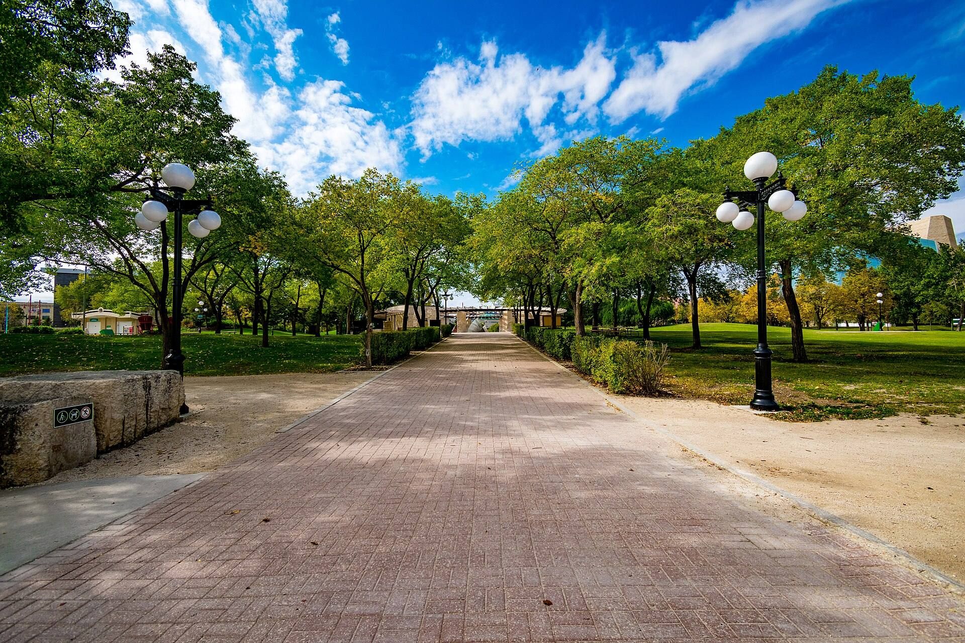
The Broadway Promenade connects Esplanade Riel with Union Station and Broadway. One of its two paths re-establishes the historic Broadway to Provencher Boulevard connection, while the other follows a winding route representing the period before European contact.
Port and recreational spaces
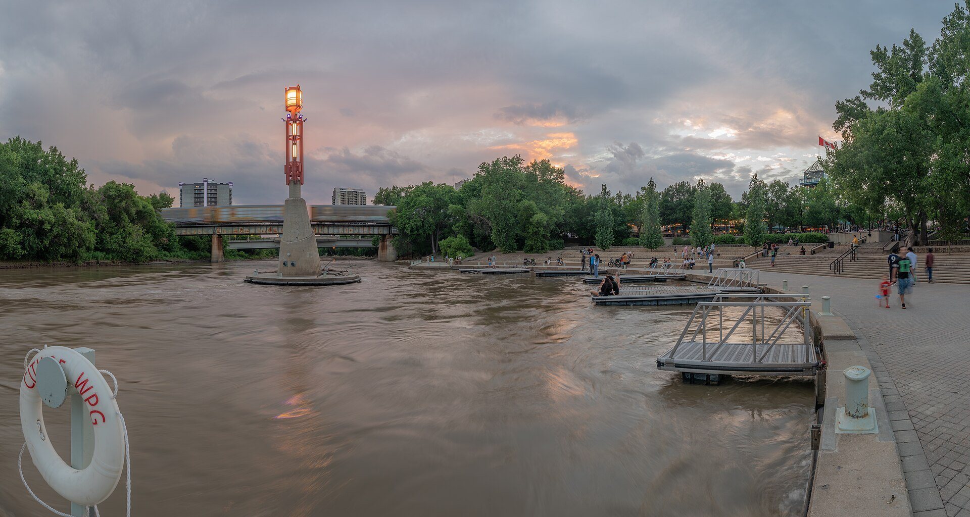
The Forks Historic Port lies along the Assiniboine Riverwalk and provides docking for river vessels. Its floating dock and movable-ramp system allow operation during high-water conditions. The CN Stage is an outdoor performance stage with adjoining green space along the Broadway Promenade, and Festival Park includes a pathway opened in 2004 that connects Esplanade Riel with Union Station.
The winter landscape includes skating rinks, skating trails, walking and skiing routes, snowboarding and toboggan facilities, and warming huts. In 2008, the river skating trail reached approximately 8.54 kilometres, although its length varies with river and ice conditions. The trail lost its Guinness world record in 2013.
The Forks Market Plaza lies between The Forks Market and Johnston Terminal. It contains fountains, canopies, terraces, and open performance areas, together with an artificially cooled winter skating rink beneath a canopy and lights. The skatepark known as The Plaza includes a 30,000-square-foot skate plaza and an 8,500-square-foot bowl complex. Officially opened on 30 June 2006, it incorporates skateable artwork and was designed for skateboarders and cyclists.
Additional modern buildings
The Inn at the Forks is a five-storey hotel with 117 rooms and suites. Completed in May 2004, it includes meeting and reception space, a restaurant, spa, fitness facilities, natural slate flooring, heated floors, and a water wall.