Mungana Archaeological Area: A Mining Town and Industrial Landscape in Queensland
Site at a Glance
- Rating
- 4.8
- Popularity
- Very Low
- Country
- Australia
- Primary era
- Modern
- Eras represented
- Modern
- Civilizations
- British
- Site type
- Economic
- Remains
- Mine
On this page20 sections
History
Mungana Archaeological Area is the remains of a former mining town and industrial landscape at Mungana in Queensland, Australia. Its history began with late nineteenth-century mining and continued through successive periods of private and government ownership, leaving evidence of industry, settlement, transport, livestock handling, and community life in far northern Queensland.
Mining and the Girofla settlement
Mining at Mungana began in 1893–1894, when John Moffat employed 70 men to prospect the Girofla lode, a mineral-bearing deposit. Full-scale operations followed in 1896, with 20 men sinking a shaft, preparing a dam, and establishing a smelter. A calico settlement known as Girofla developed beside the mine and soon had three hotels. By 1897, copper-smelting machinery transferred from Muldiva was operating there, and the population had reached 158.
Girofla principally produced lead and silver, while its smelter also treated ore from the Griffith, Dorothy, Red Dome, and Lady Jane mines. The settlement formed part of a wider mining network associated with nearby Chillagoe. William Atherton had settled and named Chillagoe in 1887 and established a cattle-supplying homestead there the following year. After visiting the district in October 1888, Moffat acquired mineral rights across much of the Chillagoe–Mungana area and developed several related operations, including a smelter at Calcifer in 1894.
Railway development and the new township
Moffat and James Smith Reid reorganised their mining interests through the Chillagoe Proprietary Company and later the Chillagoe Railway and Mines Limited. Passed by late 1897, the Mareeba to Chillagoe Railway Act enabled a private railway network, secured 1,800 acres, or 730 hectares, of mineral leases, waived labour conditions on the mines, and gave the Queensland Government an option to acquire the enterprise after 50 years.
In 1901, Moffat and Reid formed the Mungana (Chillagoe) Mining Company, incorporating the Girofla, Lady Jane, Griffith, and Dorothy mines with their related infrastructure. The railway reached Mungana that year, prompting the township to move from its original position opposite the Girofla mine to a newly surveyed settlement on either side of the railhead. The settlement was formally renamed Mungana. The Girofla smelter closed in 1902 because ore could be carried to the larger smelters at Chillagoe.
Rail access encouraged Mungana’s growth. The town acquired a cricket club, turf club, Progress Association, courthouse, library, and reading room. At its peak in 1920, it contained six hotels, three stores, a bakery, butcher, confectionery shop, draper, post office, church, school, and livery. A cattle-trucking siding and yards established near Mungana in 1901 served producers and cattle stations in the Gulf of Carpentaria and Lower Cape York Peninsula.
Transport, machinery, and mine expansion
Mining operations depended on changing forms of transport. In 1905, the OK Copper Mines Development Syndicate replaced horse transport between Mungana and its mine complex with 400 camels managed by Abdul Wade’s Bourke Carrying Company. Within months, six traction engines replaced the camels because of feeding costs, poisoning, and labour difficulties. The stone railway embankment built for the OK complex in 1902 continued in use in 1913, even after the OK smelter had closed.
The Lady Jane Mine was regarded as promising, and new equipment, including a Babcock boiler, was installed there in 1909. In 1911, the Mungana Mining Company installed a large pumping plant at Girofla to manage groundwater. It included a beam pump with a 39-foot, or 12-metre, sweep, a tandem compound engine with an 18-foot, or 5.5-metre, crankshaft, and a 9-long-ton, or 9.1-tonne, flywheel 18 feet in diameter.
Conflict, mine closures, and government ownership
Mungana gained a reputation as a rough frontier settlement, with frequent fighting and drunkenness associated with its isolation, harsh conditions, and predominantly male population. In October 1901, a miner named Richard Henderson murdered a domestic servant, Hannah Treacy, and then killed himself. He is believed to have been buried in one of at least three reputed graves at the end of Main Street. A formal cemetery was established about two kilometres from the township in the early twentieth century, with the oldest known burial dating from 1904.
An underground fire caused the partial closure of the Lady Jane Mine in 1909 and destroyed considerable payable ore. The Mungana Company entered liquidation by 1914, all the mines closed, and the Lady Jane workings filled with water. The Chillagoe Company later purchased the operation, but the mines remained closed until the Queensland Government acquired them in 1919.
Government ownership produced a short-lived industrial and civic revival. The Girofla and Lady Jane mines reopened, with substantial expenditure on dewatering and timbering. Fred Reid acquired the leases while their future was debated in the Queensland Parliament. When the purchase was settled in 1922, he received a combination of cash and royalties. The powder magazine and detonator shed are believed to belong to this period. The mines closed again in 1926.
The Mungana affair and decline
The government purchase became the subject of the Mungana affair. A 1930 Royal Commission criticised Ted Theodore, William McCormack, Fred Reid, and the Chillagoe mine manager Goddard after McCormack’s shareholding in Mungana Mines Limited came to light and government expenditure exceeded the amounts originally presented for royalties and improvements. Theodore and McCormack were tried but cleared of fraud and conspiracy. The affair ended both political careers.
The Chillagoe smelters finally closed by 1943 as payable ore declined and workers left for military service during the Second World War. Mungana continued as a service centre and cattle railhead, although water shortages became severe. Locomotives supplied the cattle yards’ underground tanks from Smelters Junction, while a collapsed limestone well cleaned out in 1949 failed to provide a dependable supply.
Regular rail services ended in 1958. By 1959, Mungana had declined to a hotel, store, post office, and seven residents. A metal cattle yard was built for road transport in the 1970s, while the former wooden yards became derelict. The township is now abandoned, although some mining leases have been reactivated and a new drive zinc mine was being established as part of the Chillagoe mine project of Atherton Resources Limited in 2016.
Heritage and archaeological significance
The Mungana Archaeological Area was added to the Queensland Heritage Register on 11 December 2008. Its importance includes evidence of mining’s contribution to the development and non-Indigenous settlement of far northern Queensland, the former Mungana railway terminus and township, the Girofla and Lady Jane mines, and the railway partnership connected with the Chillagoe Mineral Field.
The area also has research potential concerning community development, trade, labour, gender, class, health, demographics, industry, entertainment, and the contrasting periods of private and state ownership. Eight distinct zones extend across approximately 6.5 square kilometres. Despite disturbance, the site’s size and isolation have preserved a high degree of overall archaeological integrity. Archaeological evidence indicates that the original Girofla township may have remained in use into the 1930s, even though the official relocation to Mungana occurred in 1901.
Remains
The archaeological area is spread across eight zones containing mining works, railway infrastructure, domestic and commercial properties, public buildings, cattle facilities, burial places, and industrial features. Surviving evidence includes building foundations, boilers, tramlines, culverts, wells, bottle dumps, hotel sites, school and public-venue remains, explosives stores, blasted roads, and artefact deposits in natural depressions.
Township, railway, and cattle facilities
Main township and railway
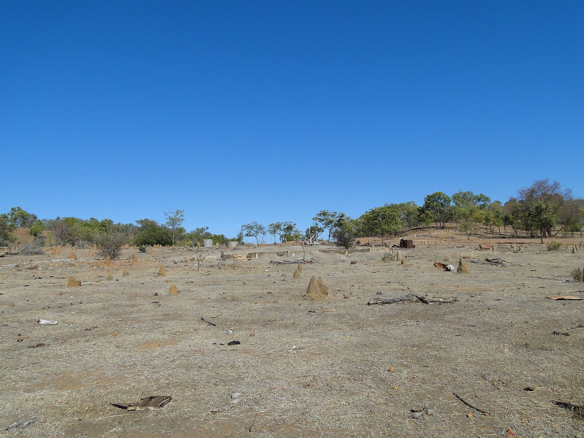
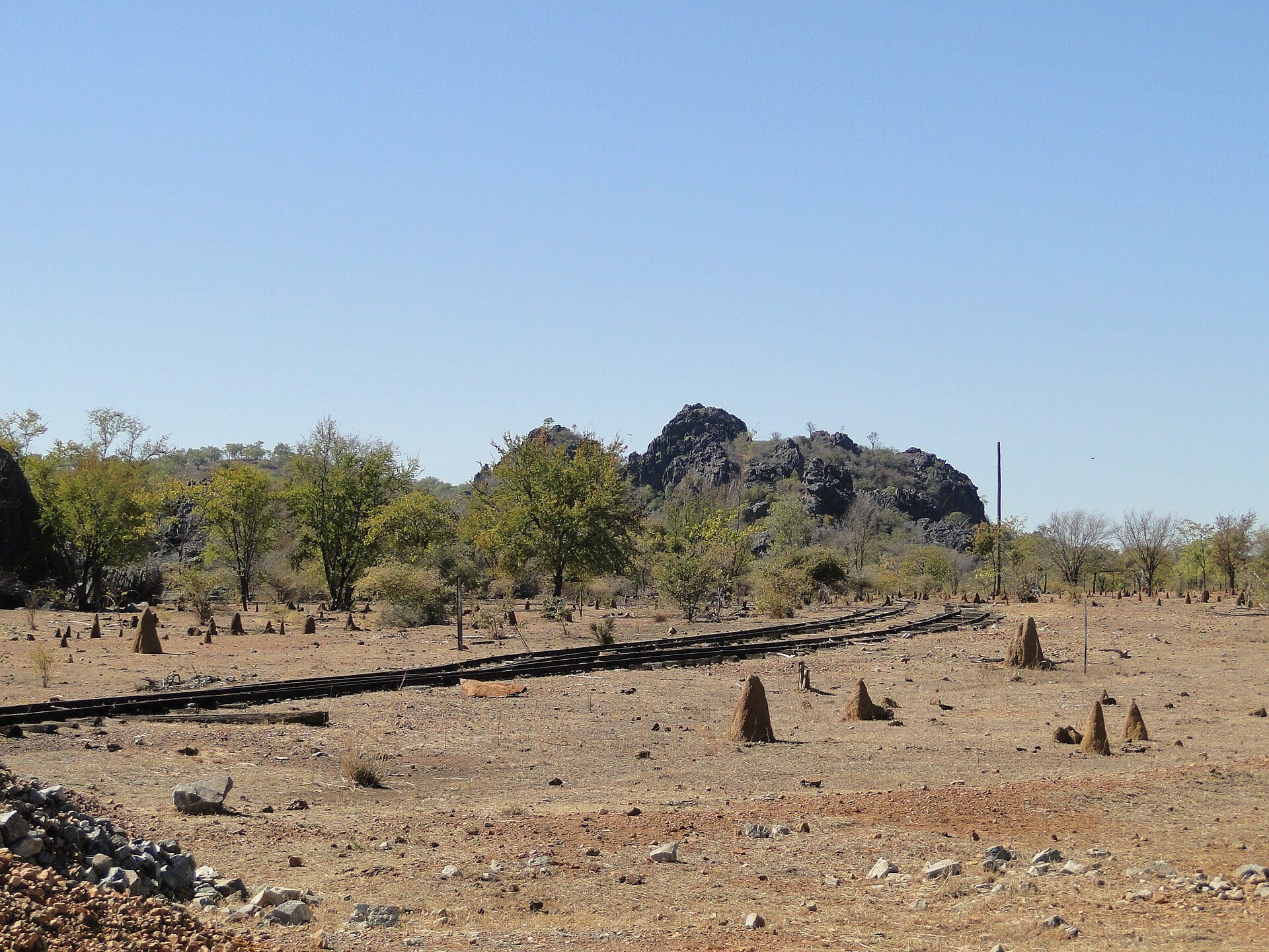
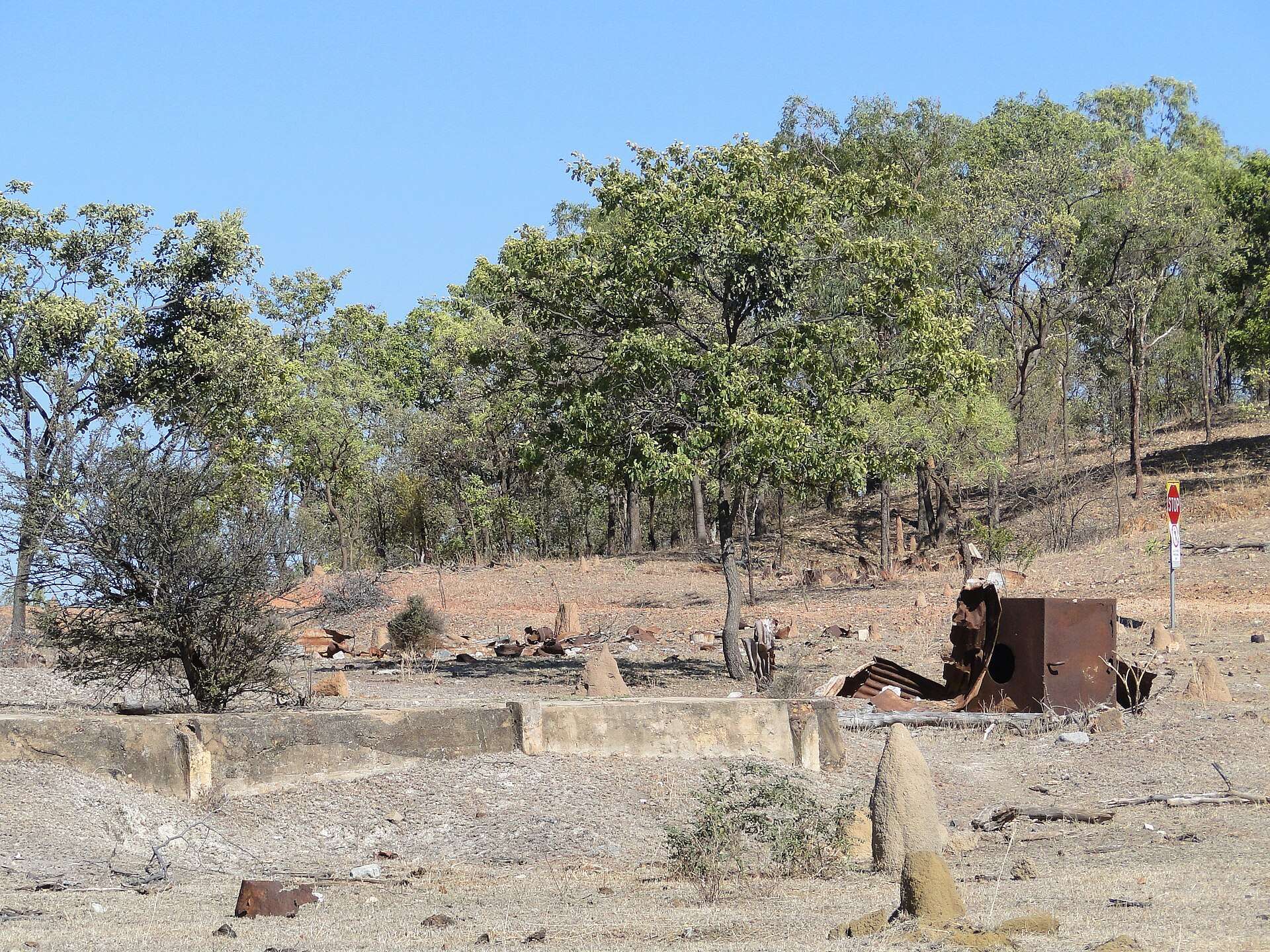
The main township and cattle-yard zone lies south of Burke Developmental Road. It includes the Eclipse Quarry and Lime Kiln, the railway and its embankment, domestic and commercial property remains, the second school, a cattle siding, and cattle yards. A concrete spray race and the slab of a missing building are also present. The railway line remains in place, with a signal light and track-changing lever surviving as reminders of its operation. Tracks beside the cattle yards have been heavily undermined by erosion.
Cattle yards
The yards have suffered termite damage, decay, and fire, but surviving hardwood fencing remains sufficiently solid to show their layout and construction. Their position beside the railway reflects Mungana’s continuing function as a cattle railhead after the mines closed.
Hospital area
The hospital area lies near the top of a hill south of the main township. Concrete drains and wooden posts survive, together with associated objects including bed frames, kerosene tins, and a bath.
Cemetery and early settlement
Mungana Cemetery
The Mungana Cemetery occupies a gazetted reserve north of Burke Developmental Road, away from the main township. A small number of graves have marked headstones, while remnant grave furniture and numerous east–west aligned depressions indicate further burials. A wire-and-post fence and signed entrance gate define the cemetery.
Old Mungana or Girofla Township
The Old Mungana, also called the Girofla Township, lies north of the Lady Jane Mine on the opposite side of the modern road. Features and artefact scatters belong to the early settlement and include ceramics and glass dating from the late nineteenth century to the mid-1930s. These remains preserve evidence of the settlement that preceded the formal relocation to the railway town.
Girofla mining and smelting complex
Girofla Mine
The Girofla Mine lies west of the hospital beside the southern side of the Mungana Branch Railway. Its remains include the main shaft, part of the pump arm, a large brick-and-concrete tank stand, wooden posts, numerous concrete foundations, pipes, and a collapsed riveted-metal chimney. A large limestone karst, a landform shaped by the dissolving of limestone, rises above the shaft where machinery was installed. Mullock heaps, or piles of waste rock from mining, remain nearby. The main shaft is fenced for safety.
Girofla Smelter
The Girofla Smelter stands south of the mine at the foot of a steep ridge. Substantial foundations, a stone wall, slag deposits, and domestic remains survive. Slag is the glassy waste produced during smelting. A ruined dwelling on the hill south of the smelter has a stone foundation platform and thin concrete floor slab. A large adjoining depression probably represents a water soak, while bottle and ceramic fragments are scattered around the dwelling.
Lady Jane Mine
The Lady Jane Mine lies east of the Girofla Smelter beside the southern edge of the modern Red-Dome access road. Its remains include a large fenced shaft, machinery foundations, metal pipes, and a tramway, a light railway for moving materials, with wooden sleepers still in place. Kerosene tins, bricks, and brickwork are scattered through the workings.
Two ruined domestic dwellings lie southwest of the shaft among light artefact scatters. A frangipani tree stands beside the concrete floor of the eastern dwelling, near large U-shaped concrete foundations associated with winding machinery. The mine’s surviving structures and materials show the close relationship between extraction, machinery, transport, and domestic occupation.
Mungana magazines
The Mungana Magazines lie within Chillagoe–Mungana Caves National Park, north of the old township. A magazine is a building used to store explosives or detonators. These two adjacent structures are the only surviving buildings in the archaeological area. The smaller detonator magazine measures 2,040 by 2,100 by 2,270 millimetres, while the larger explosives magazine measures 4,100 by 5,370 by 2,650 millimetres.
Both buildings have corrugated-iron gabled roofs and whitewashed exterior walls made from a single course of hollow blocks believed to have been handmade locally. The explosives magazine’s original roof was missing until a freestanding metal-framed roof was installed in 2000. The buildings stand behind limestone karsts away from the former township. Their access road passes between two karsts and retains scars from blasting and drilling during its construction.