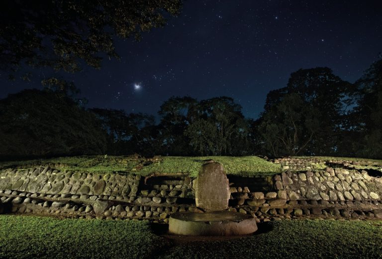
Izapa: A Formative-Period Archaeological Center in Mexico
Site at a Glance
- Rating
- 4.4
- Popularity
- Low
- Country
- Mexico
- Primary era
- Classical
- Eras represented
- Iron Age, Classical, Medieval
- Civilizations
- Unclassified
- Site type
- City
On this page18 sections
History
Izapa is a large archaeological site near Tuxtla Chico in Chiapas, Mexico, developed by peoples of the Mixe-Zoquean and later Maya cultural spheres from about 1500 BCE to 1200 CE. Located near the Izapa River in the Soconusco region, it became a major political, religious, economic, and cultural center during the transition between Olmec-related traditions and early Maya civilization.
Origins and Formative-period expansion
The earliest settlement date remains debated. Early inhabitants belonged to the Mixe-Zoquean cultural sphere, while Maya peoples later occupied the site. The idea that Izapa began as an Olmec trading outpost is hypothetical. Over time, the settlement developed its own political and economic culture, together with distinctive architectural, sculptural, and ceramic traditions.
Izapa became a religious and political center between approximately 850 and 100 BCE. Its main florescence extended broadly from the seventh century BCE to the first century CE, with its greatest power between about 300 BCE and 50 BCE. During that period, it was regarded as a dominant state in southern Mesoamerica, and its population may have approached 10,000 people.
Fertile volcanic soils supported intensive agriculture, especially the cultivation of cacao and rubber. Izapa also participated in trade involving cacao, fruit, and quetzal feathers, while imported ceramics, textiles, and obsidian reached the settlement. Fishing, hunting, and gathering probably supplemented farming and exchange. Its influence grew as major Olmec centers such as La Venta declined.
Political change and later occupation
From approximately 100 CE, Izapa entered a gradual decline, intensified by competition from the city-state of Kaminaljuyu. The area around Group F was abandoned by approximately 250 CE, although occupation continued in other parts of the settlement through the Late Classic and later periods. Izapa was finally depopulated after approximately 1200 CE, although the precise timing of this decline remains debated.
The region was later incorporated into the Aztec Empire and became a tribute-paying province of the Triple Alliance. The Mexica knew the area as Xoconochco. Izapa’s earlier language remains uncertain. It has been identified hypothetically as Tapachultec, an extinct Mixe-Zoquean language, while another proposal connects it with a Mixe language.
Religion, astronomy, and cultural influence
Izapa stands at the center of discussions about the transition from Olmec-related traditions to early Maya civilization. Its art and religious ideas have been interpreted as predecessors of, or influences on, later Maya traditions, although the extent and direction of that influence remain disputed. Religious concepts associated with the site include an ancestral cave, reincarnation, a three-level universe, and a world tree rising from a primordial cave. The tree could appear as intertwined trunks or as a great ceiba supporting the world, with roots linked to subterranean waters and represented by a reptilian or crocodilian head.
Izapan imagery increasingly emphasized reptiles and crocodilians alongside, and in place of, the jaguar-centered imagery associated with the Olmecs. Repeated subjects included twins, pregnancy, the umbilical cord, ancestors, dwarfs, hunchbacks, falling figures, and seated figures. A nocturnal rain deity with a long lip has been interpreted as an early form of Chaac, the Maya rain and storm deity. A broken stele depicts a bearded, bound deity with a trident-like feature in place of the eyes, a figure proposed as a predecessor of certain deities at Tikal.
Izapa is also associated with debate over the origin of the 260-day Mesoamerican calendar. In 1997, Vincent Malmstrom proposed that the calendar originated at Izapa because the site fits the relevant geological and historical conditions better than the previously proposed place of origin. Astronomical interpretations connect the settlement with the Milky Way, the Great Bear, other constellations, and the solstices. Throne 2 was positioned toward the December winter-solstice sun, while Stela 60 has been cited in support of this interpretation. Stela 25 has been interpreted as relating the northern celestial region and the Milky Way near Sagittarius.
Archaeological investigation and conservation
Early archaeological attention centered on Izapa’s large mounds and carved monuments. Carlos A. Culebro first published drawings of the sculptures. Karl Ruppert visited the site in 1938, Matthew Stirling excavated for a week in 1941, and Philip Drucker conducted additional test excavations in 1947.
Between 1961 and 1965, Gareth Lowe directed four excavation seasons for the New World Archaeological Foundation. The project examined the monuments and the construction history of the central plazas, while Eduardo Martínez produced the first detailed site map. Ceramic and radiocarbon evidence assigned most monuments to the Guillén phase, approximately 300 to 50 BCE. Mound 30 was identified as one of the earliest major constructions, first built during the Middle Formative Duende phase around 900 to 850 BCE.
Hernando Gómez Rueda directed four excavation seasons for Mexico’s National Institute of Anthropology and History between 1992 and 1996. This work examined the hydraulic system and monuments. The installations may have distributed water, supported the raising of edible aquatic species, or combined practical and ceremonial functions.
Between 2011 and 2015, the Izapa Regional Settlement Project used lidar, a laser-based method for mapping terrain, together with surface ceramics to investigate the wider settlement. The results indicated that the Formative center was about twice the size shown on the earlier map, while the Classic-period occupation was nearly three times larger. The survey also revealed an E-Group alignment and central terracing that had not appeared on the earlier map. In 2014, Rebecca Mendelsohn directed excavations at the southern edge of the site, producing the first systematic economic data for Izapa and recording changes in construction, burial practices, and ritual activity between 100 BCE and 400 CE, when monument production declined.
The National Institute of Anthropology and History continues research in Groups A, B, and F. Since 1992, exploration, recording, and recovery work has rescued nearly twenty monuments. Several are protected at the site or in the museum at Tapachula. Weathering, fungi, lichens, vegetation, animals, vandalism, theft, intentional destruction, and illegal trafficking continue to affect the monuments. The archaeological land is privately owned and is also used for cacao cultivation and grazing.
Remains
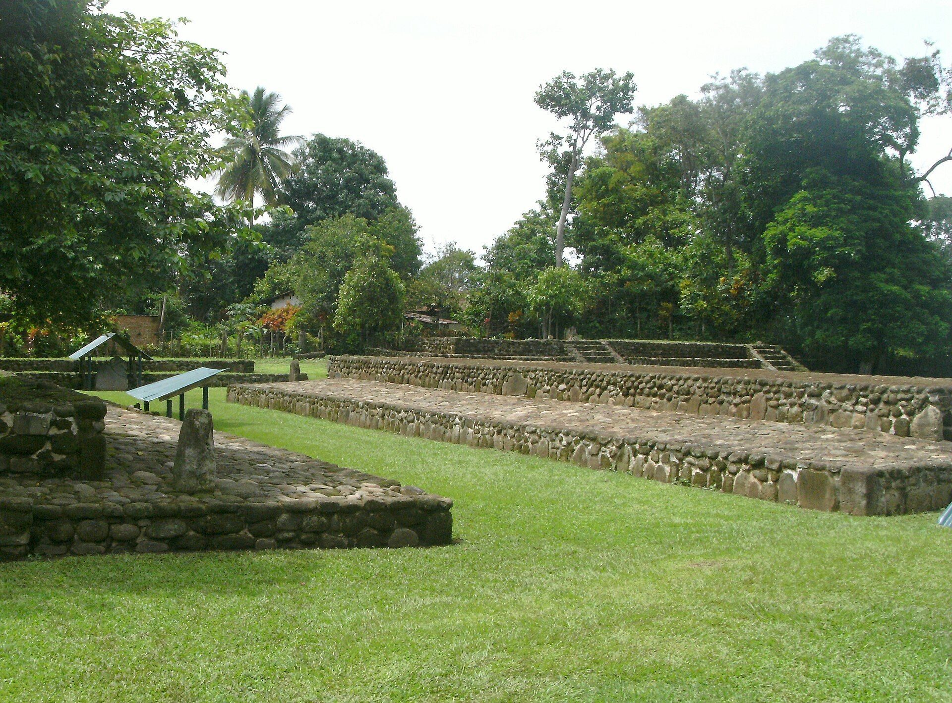
Izapa extends approximately 2 kilometers from north to south across wet, hilly terrain with fertile volcanic soils. Its central area covers about 200 hectares, and the total architectural volume is estimated at approximately 250,000 cubic metres of stone, fill, or masonry. Eight mound groups, conventionally named A through H, organize the settlement. Groups A, B, C, D, E, G, and H surround the central area west of the Izapa River, while Group F lies at the northern end.
The site contains approximately 80 to 130 mounds, although another survey mapped 161. Pyramids, platforms, plazas, sculptured public spaces, 13 large plazas, and two long open areas resembling Mesoamerican ballcourts form the principal architectural landscape. A ballcourt is an open space associated with the Mesoamerican ballgame, but the use of these two areas for that game has not been demonstrated. The groups are arranged around central plazas, and buildings, monuments, stelae, and altars follow recurring planning principles.
Urban plan and central complexes
Izapa’s main axis is displaced from true north by approximately 21 to 27 degrees. The plan is aligned with Volcán Tacaná and has been associated with the December winter-solstice horizon. Volcán Tajumulco lies to the east, while the Izapa and Suchiate rivers form part of the surrounding landscape. The principal entrance was conceived as being to the south, leading northward toward a sacred sector associated with an ancestral homeland. This orientation differs from the more linear plans associated with Olmec centers.
The central temple complex has been described as covering approximately 1 square kilometre, with ten plazas and more than 140 stone sculptures. A large central pyramid was interpreted as a solar and cosmic mountain. The arrangement of plazas and monuments incorporated geometry, repeated measurements, astronomy, and topography.
Early mounds and major groups
Mound 30
Mound 30 in the Group B area was among Izapa’s earliest major constructions. Mound 30A, a stepped pyramid approximately 10 metres high, was used, or probably used, for religious and ceremonial purposes. Its construction history was repeatedly examined during the excavations of the New World Archaeological Foundation.
Mound 60 and Group H
Mound 60 in Group H measures approximately 105 square metres and rises about 22 metres. Other platforms and pyramidal buildings at Izapa also reach approximately 22 metres in height, contributing to the settlement’s substantial architectural volume.
Group A
Group A forms an acropolis, a concentrated complex of elevated or monumental buildings, around a rectangular plaza. Building 58 stands opposite Building 56 and has three stelae in front of it, two with associated altars. Building 66 has six stelae on its platform, five paired with altars. Stelae 5, 7, 25, and 26 stand at one level, Stela 6 occupies the middle position, and Stela 4 stands behind them on a third line.
Group B
Group B has a more complex architectural arrangement than Group A and follows a pronounced north-south organization. Its southern side functioned conceptually as the public face of the complex, while the north represented the sacred ancestral direction. Building 1 is associated with Monolith 2, which combines zoomorphic and human features in a jaguar head with an open mouth containing a human figure and additional serpent-like elements.
Building 47 lies beside the entrance to the main platform. Stelae 11, 12, and 50, each with an associated altar, stand before it. In the plaza before Building 30, Throne 1 consists of a rectangular stone panel laid on stone supports. It faces Stelae 8, 9, and 10 and stands near three monuments made from stone pillars bearing roughly oval blocks. Two other similar thrones were also found.
Stelae, altars, and carved imagery
Izapa has approximately 89 stelae and 61 altars, although other inventories count about 90 stelae, 39 of them retaining carved surfaces, and 252 stone monuments overall. A stela is an upright carved stone monument, while an altar is a separately shaped stone that may stand before it. The stelae developed from relatively crude monumental forms related to Olmec traditions into more elaborate compositions, and they generally taper toward the top.
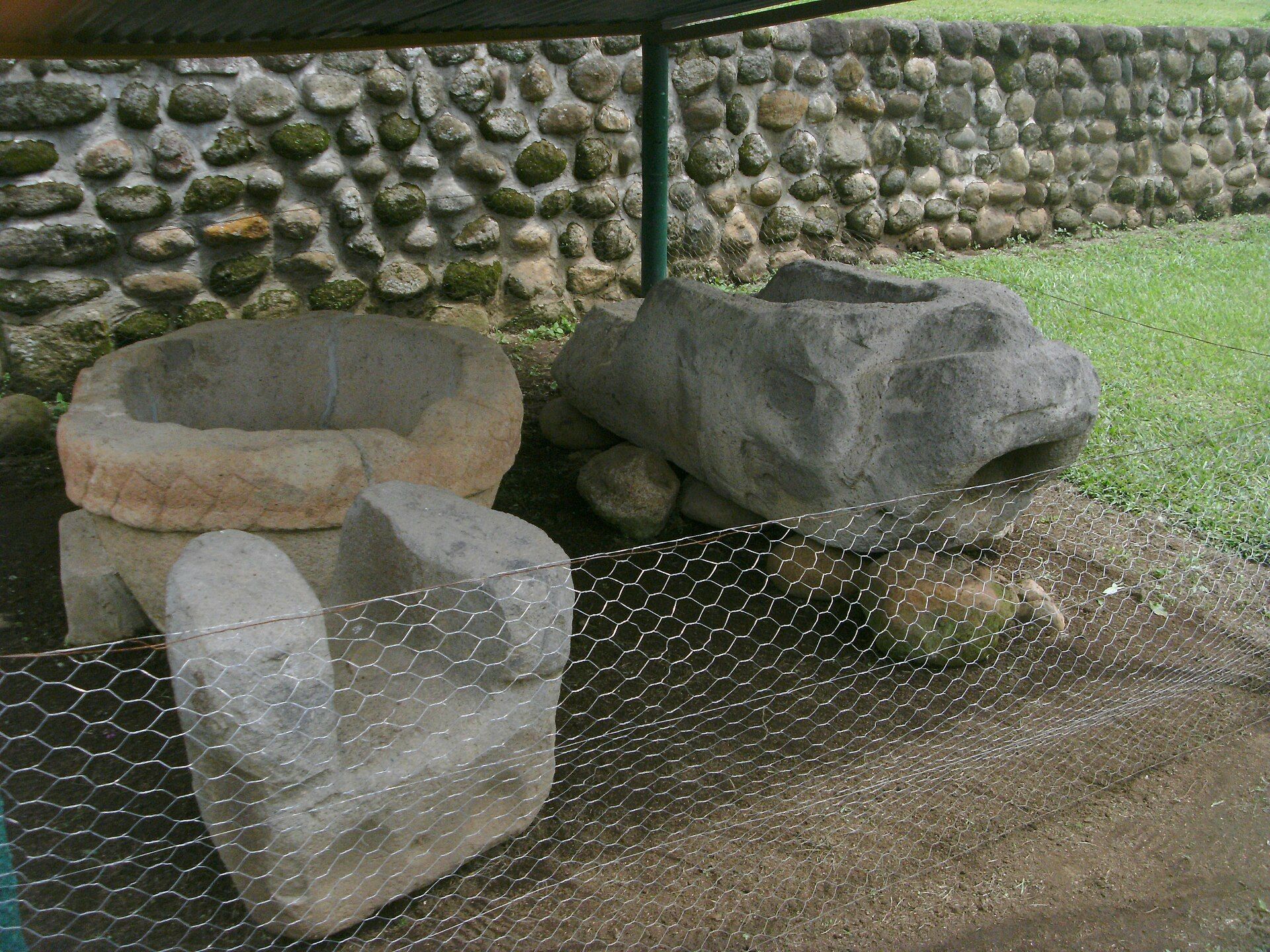
Stelae and altars frequently form coordinated visual and semantic units. Early altars are roughly rounded and flat, while later examples include smooth circular stones resembling tables on broad legs. Some may have served ritual purposes or functioned as astronomical markers. Izapan compositions commonly divide imagery into celestial, terrestrial, and underworld levels. An altar could represent the underworld, while a lower register or a recessed frame resembling a cave could perform a similar visual role.
Stelae 1 to 7
Stela 1, placed with Altar A1 before Building 58, has two pictorial levels. Its main lower scene shows a masked anthropomorphic figure with shell or reptilian forms for legs, a net, a vessel, flowing water, and fish. Above it, a seated figure has a long object extending from the abdomen, interpreted variously as an umbilical cord, rope, or serpent. Altar A1 is an oval stone with relief combining jaguar-like and frog-like features.
Stela 2 uses a recessed relief frame resembling a cave rather than a separate altar. Its scene includes an open jaguar mouth, a fruit-bearing tree with reptilian roots, two human figures, and a large winged figure falling headfirst. Stela 3 and Altar A2 form another visual unit. The stele shows a bat-nosed figure holding an axe-like object, a large serpent emerging between the figure’s legs, astral signs, and a cave containing a head. The altar is shaped as a reptilian head.
Stela 4 stands behind Stela 6 in the Building 56 complex and depicts a standing figure, a descending headfirst figure, signs associated with earth and maize, and imagery interpreted as a descent toward an ancestral or blessed realm. Stela 5 is one of Izapa’s most complex reliefs. A large tree rises from primordial waters inside a cave-like frame, surrounded by about twelve human figures engaged in daily, ritual, or specialist activities. The scene includes an elderly bearded hunchback, a fire, a person holding an obsidian knife, a dwarf or infant, figures carrying a child, a sculptor-like figure, a painter or scribe-like figure, and a jaguar-like being.
Stela 6 with Altar 4 shows a rounded or highly stylized jaguar with an open mouth and forked tongue. A cave sign containing the sign ki appears above the tongue. Stela 7 stands before Altar A3, a circular, flat stone approximately 40 centimetres high and 146 centimetres in diameter. The altar bears a winged bird in relief and rests on a rectangular platform marked with a cave-mouth sign. The bird has been interpreted as a messenger emerging from the underworld.
Stelae 8 to 14
Stela 8 has a rectangular upper panel and a recessed cave-like scene containing a seated person on a bench or throne. The surrounding imagery may represent a reptile, and the scene has been compared with Throne 1 as an association between political authority and a supernatural portal. Stela 9 contains a figure and an infant within a rectangular recessed relief, together with a zoomorphic form resembling a bird.
Stela 10 shows a tree whose roots take the form of a reptilian mouth. A large-bellied figure, interpreted as a pregnant woman, stands with an enlarged umbilical cord and two small twin-like figures holding it. Stela 11 has two pictorial levels within a cave outline formed by a thick, double-headed serpent. Serpents and a jaguar-reptile creature occupy the interior, while the creature receives a descending figure whose hands are bound.
Stela 12 shows a realistically rendered plant, a rectangular cave frame topped by two serpent heads, vegetation, suspended cords, and a jaguar with crocodilian features and water emerging from its mouth. Two twin-like figures sit beside a fire at the bottom of the cave. Stela 14 from Group C presents the world-tree concept through an elongated crocodile-jaguar creature above a cave-like niche containing two facing figures.
Stelae 21 to 28
Stela 21 has a principal scene of decapitation. A victorious figure holds a severed head above the body, while two bearers carry a covered litter containing an observer and a large jaguar appears above it. The scene has been interpreted as a possible historical episode connected with rivalry between related groups.
Stela 23 has an oval form, a cave outline ending in serpent heads, water signs, four droplets, zoomorphic heads, and a headfirst-falling figure marked with astral signs. Stela 24 retains the lower part of a scene with a large standing figure, two braziers, fires, and smaller figures. Its circular Altar 20 bears a cave-mouth panel, a seated person wearing an Olmec-like helmet, and a bird carrying spherical objects.
Stela 25 shows a crocodilian or caiman world tree with a bird in its crown, a serpent around the trunk, another large bird, a staff, a vessel, and a standing human figure. The scene has been associated with the Hero Twins and their conflict with the Principal Bird Deity, figures known from the K’iche’ Maya sacred narrative called the Popol Vuh. It has also been interpreted as a possible map of the night sky. Only part of the relief on Altar 60 before Stela 25 survives, including a detailed cave-mouth or throat sign and part of a seated figure.
Stela 27 stands before the side platform of Building 57. Its upper and lower registers are incorporated into the stele, which shows a tree with a cave-like root, a falling figure, a tall figure with an axe, a seated jaguar, a dwarf, and two seated figures in conversation. A Maya-style numeral ten and a possible speech sign also appear. Stela 28 retains its upper panel and shows a figure interpreted as a changing insect, later identified as a scorpion. Two smooth, table-like altars flank the stele, while a third occupies the usual position directly in front.
Other monuments and sculpture
Stela 50 lacks its standard upper panel and has a seated skeleton on its curved surface. A dwarf in the upper part pulls a looping umbilical cord, an image associated with blood relationship. Other sculptures include a seated jaguar dated approximately 1000 to 400 BCE and a separate figure dated approximately 300 BCE to 250 CE. Simple monuments made from stone spheres placed on columns may represent solar forms.
The public monument assemblage has been described as including 21 stelae, six altars, two thrones, and 13 other sculptures and monuments. Additional fragmentary stelae, smooth altars, petroglyphs, monolithic basins, and well rims are distributed elsewhere across the settlement. Stela 1 is displayed in the National Museum of Anthropology in Mexico City, while Stela 5 is held in the Archaeological Museum of Soconusco in Tapachula. Other Izapa monuments are preserved in the Regional Museum of Soconusco and the National Museum of Anthropology.
Water installations and preservation
Hydraulic features were investigated within the settlement, although their precise functions remain uncertain. Proposed uses include distributing water, raising edible aquatic species, and combining practical and ceremonial purposes. The monuments and architectural remains are exposed to vegetation, biological growth, weathering, animals, vandalism, theft, and illegal trafficking. Protective shelters and the relocation of selected monuments to museums or protected areas form part of the conservation response.