Fortín Navarro: A Spanish Colonial Frontier Post in Argentina
Site at a Glance
- Rating
- 4.5
- Popularity
- Medium
- Country
- Argentina
- Primary era
- Early Modern
- Eras represented
- Early Modern
- Civilizations
- Spanish
- Site type
- Military
- Remains
- Fort
On this page8 sections
History
Fortín Navarro was a Spanish colonial fortified post in Argentina, established beside Navarro Lagoon in the rural district of Navarro during the 18th-century reorganization of the Buenos Aires frontier. First known as Guardia de San Lorenzo, it formed part of the defensive system facing Indigenous incursions and became the origin of the Partido de Navarro.
Formation of the Buenos Aires frontier
Indigenous incursions became increasingly frequent from about 1735. Earlier expeditions had failed because their forces were poorly equipped and lacked sufficient knowledge of the Pampas. Major raids affected Luján and La Matanza in 1740, Luján in 1741, and Cañada de la Cruz and Luján in 1744.
In 1745, field master Juan de San Martín y Gutiérrez placed militia posts at favorable points along the frontier. The system was reorganized again in 1752, when forts and advanced posts were established or planned in the Salto, Luján, and Magdalena sectors. These positions worked with the Blandengues de Buenos Aires, colonial cavalry militia created for frontier defense, patrols, escorts, and responses to Indigenous attacks.
Establishment as Guardia de San Lorenzo
On 30 April 1767, Juan Antonio Martín, commander of the Provincial Dragoons and officer responsible for the Luján frontier, asked Governor Francisco de Paula Bucarelli y Ursúa for authorization to establish a guard post beside Navarro Lagoon. The location offered suitable grazing and was intended to prevent drought-driven dispersal of livestock belonging to the Luján sanctuary while protecting the surrounding countryside.
The post was initially called Guardia de San Lorenzo and was occupied by 16 Blandengues. In 1775, frontier commander Manuel de Pinazo requested that its garrison be raised to 30 permanent men. In December 1777, Viceroy Pedro de Cevallos identified the Guardia de San Lorenzo Navarro as a departure point for patrols toward several frontier lagoons.
A report from 1778 revealed the weakness of the installation. Its enclosure was little more than an inadequate cattle corral, the ditch was only about one-quarter complete and could be crossed on horseback, and its two ranches were badly damaged. The buildings offered protection chiefly from the sun rather than from attack.
Frontier reform and the Fortín de San Lorenzo de Navarro
After abandoning a plan for a general offensive, Viceroy Juan José de Vértiz y Salcedo commissioned Francisco Betbezé to inspect the frontier and propose a new defensive line. Betbezé’s report of 12 April 1779 recommended retaining the existing general positions while regularizing the forts and improving advanced posts, including Navarro. Vértiz approved the plan on 1 June 1779, and a regulation issued on 28 July classified frontier positions as either forts or fortins, the latter being smaller posts used mainly for observation, warning, and communication. Guardia de Navarro was formally designated Fortín de San Lorenzo de Navarro.
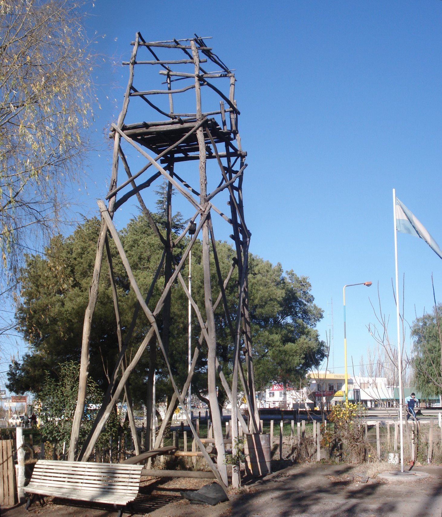
An Indigenous invasion led by Linco Pagni in August 1780 reached Chascomús and Luján and prompted further changes to southern frontier policy. Commander Juan José Sardén proposed strengthening the Blandengues and redistributing them among the principal forts. Smaller fortins such as Navarro served as observation and communications stations.
The new frontier line was completed in 1781. It included Fortín Navarro within a chain of forts and fortins extending about 330 kilometres, with positions generally separated by 70 to 100 kilometres. Larger forts were occupied by Blandengues, while the fortins were assigned 12 militiamen who served for rations rather than wages. Their duties included detecting Indigenous movements, identifying breaches in the line, and maintaining communication between the larger forts.
Settlement and later use
Vértiz’s reforms also encouraged civilian settlement near the defensive posts. An order of 3 October 1780 required residents to live within cannon range of the forts. Another order, issued on 11 March 1781, directed officials to move exposed or landless families, farm laborers, and unemployed wanderers toward them. In 1782, Sardén recommended encouraging families to settle beside the fortin, and the town of Navarro began to form.
On 16 March 1784, a column of 2,800 militiamen and Blandengues commanded by Francisco Balcarce departed from Fortín Navarro for an operation in Indigenous territory. It returned on 16 May to the Guardia de Luján with more than 300 prisoners.
Spanish naturalist and military surveyor Félix de Azara visited Navarro on 22 April 1796 while inspecting frontier guards and fortins. He recorded the fort, the nearby settlement, surrounding farms, livestock, ranches, and the large estate of the procurator Almeida across the lagoon.
By 1797, the local population numbered nearly 100 residents, who requested permission to build a chapel. On 1 January 1798, the Cabildo of Luján established an alcaldía, a local jurisdiction administered by an alcalde, creating the Partido de San Lorenzo de Navarro. Juan Miguel de Leiva became its first Alcalde de Hermandad, a colonial official responsible for rural order and policing.
An Indigenous raid passed about 30 kilometres south of the town in 1807, and another incursion attacked Navarro’s farms in 1824. The fort still existed in 1830, when it appeared on the first plan of the town drawn by Saturnino Salas. The site was declared a provincial historic place under Provincial Law 10,780 in 1989.
Remains
Lagoon setting and early enclosure
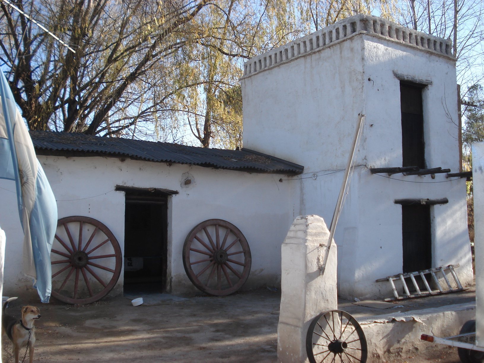
Fortín Navarro stood beside Navarro Lagoon in an area suitable for grazing. In 1796, the lagoon was described as fairly large and somewhat saline, with the settlement, farms, ranches, and livestock distributed nearby. The fort’s early enclosure was made from a palisade, a defensive fence of wooden stakes, combined with a ditch. In 1778, the palisade was so open that a person could pass between some of its stakes. The ditch extended only about one-quarter of its intended length and could be crossed on horseback.
The buildings at that time consisted of a ranch intended for 30 men and a smaller ranch in badly damaged condition. Their limited state reflected the fort’s early role as a lightly equipped frontier post and patrol base. The position served as a departure point for movements toward the surrounding lagoons and as one station in the wider chain of frontier defenses.
Planned defensive improvements
The reforms approved between 1779 and 1781 prescribed a more substantial design for the frontier forts and fortins. The proposed works included strong palisades made from Andubay wood, wide and deep ditches, a portcullis and drawbridge, and bastions, projecting platforms for artillery. The plan also called for enlarged living and service rooms, a small powder magazine, a separate store for arms and ammunition, and an area between the ditch and palisade where horses could be kept.
These measures placed Fortín Navarro within a standardized defensive system rather than treating it as an isolated guard post. Its physical organization was linked to its functions as an observation station, a communications point, and a base for patrols across the frontier landscape.