Mirjan Fort: A Coastal Fortress on the Aganashini River in India
Site at a Glance
- Rating
- 4.3
- Popularity
- High
- Country
- India
- Primary era
- Early Modern
- Eras represented
- Medieval, Early Modern
- Civilizations
- Unclassified
- Site type
- Military
- Remains
- Fort
On this page12 sections
History
Mirjan Fort is a coastal fort in India on a bend of the Aganashini River known as Tadri Creek. Its major building or refurbishment phase is dated by the Archaeological Survey of India to 1608–1640, within the early-modern period, and the fort has been identified as a meeting point of Deccan and Mughal architectural traditions. Its foundation remains disputed, but its history is closely connected with the port of Mirjan and the control of the Kanara coast.
Competing foundations and the Vijayanagara period
One historical tradition attributes the fort’s initial construction to a Nawayath sultanate in the early thirteenth century, after which it became part of the Vijayanagara Empire. The Vijayanagara state was a major South Indian empire whose authority extended across much of the Deccan and the southern peninsula before its defeat at the Battle of Talikota in 1565. Another tradition places the fort’s construction in the sixteenth century and connects it with Rani Chennabhairadevi of Gersoppa. A further account credits Sherif-ul-Mulk, a Bijapur noble and governor of Goa, with building or refurbishing the fort as a first line of defence for Kumta and its fort.
The Archaeological Survey of India assigns a major construction or refurbishment phase to 1608–1640, while other descriptions specifically date refurbishment to 1608. The fort is consequently associated with several ruling powers, including the Vijayanagara rulers, the Bijapur sultans, and the Keladi dynasty. The Bijapur sultanate was a Deccan Muslim kingdom that controlled substantial areas of present-day Karnataka before its absorption into the Mughal Empire in the late seventeenth century.
Rani Chennabhairadevi and the pepper trade
Rani Chennabhairadevi ruled Gersoppa for 54 years under the protection of the Vijayanagara Empire and is said to have lived at Mirjan Fort. She belonged to the Tuluva-Saluva clan and followed Jainism, an Indian religious tradition centred on nonviolence, ascetic discipline, and liberation from rebirth. During her rule, she constructed Jain basadis, which are Jain temples or monastic shrines.
Her territory extended across parts of the Kanara coast and south Goa, with ports including Malpe, Bidnoor, Mirjan, Honnavar, Ankola, and Karwar. Mirjan’s port exported pepper, saltpetre, and betel nut to Surat. The importance of pepper in the region’s commerce led Portuguese chroniclers to call Chennabhairadevi the “Pepper Queen.” After the Vijayanagara defeat at Talikota, she moved from Mirjan Fort to a safer location on an island in the Sharavathi River.
Keladi, Maratha, and British control
The Keladi dynasty, a South Indian ruling house based at Bednur, governed Kanara south of Mirjan. In 1676, Keladi Queen Chennamma captured territory extending to Mirjan. The port continued to appear in historical descriptions under variant names, including Mergan, Midijoy, Mjrgeu, Mergueo, and Mergeo. In 1720, it was described as a minor port exporting pepper, cassia, saltpetre, and wild nutmeg.
The Marathas seized Mirjan Fort in 1757 after political unrest that followed the death of Basappa Naik, the last ruler of Bednur, in 1755. The unrest had followed the murder of his adopted son, Chanbasaviah, after he opposed his adoptive mother’s taking of a paramour. British forces under Major Torriano captured the fort between May 1783 and March 1784 before proceeding to Honnavar.
The British maintained the fort with grant funds until Indian independence in August 1947. Responsibility then passed to the Archaeological Survey of India, the national body responsible for archaeological research, excavation, conservation, and protection at many heritage sites in India. Excavations in 2000–2001 uncovered medieval structures and associated finds within the fort precincts. The same period included repairs to damaged fortifications, removal of collapsed-bastion debris, wall repairs, vegetation clearance, waterproofing of excavated structures, and repointing of joints. The Government of Karnataka controls the ruined fort, which is undergoing some restoration.
Remains
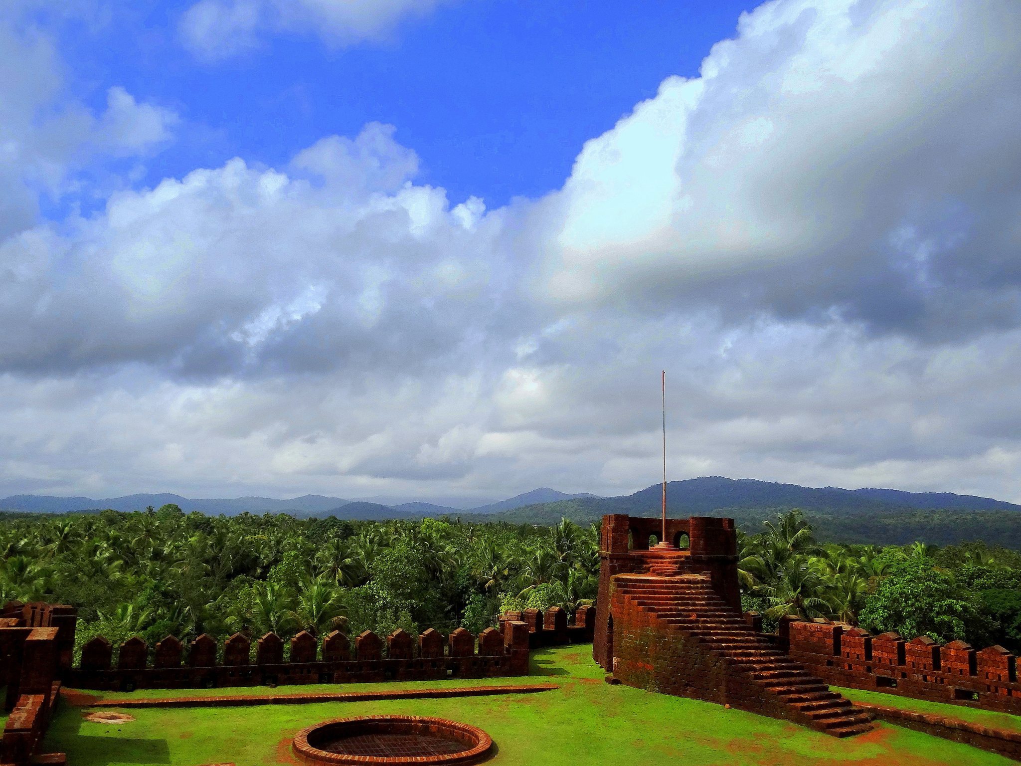
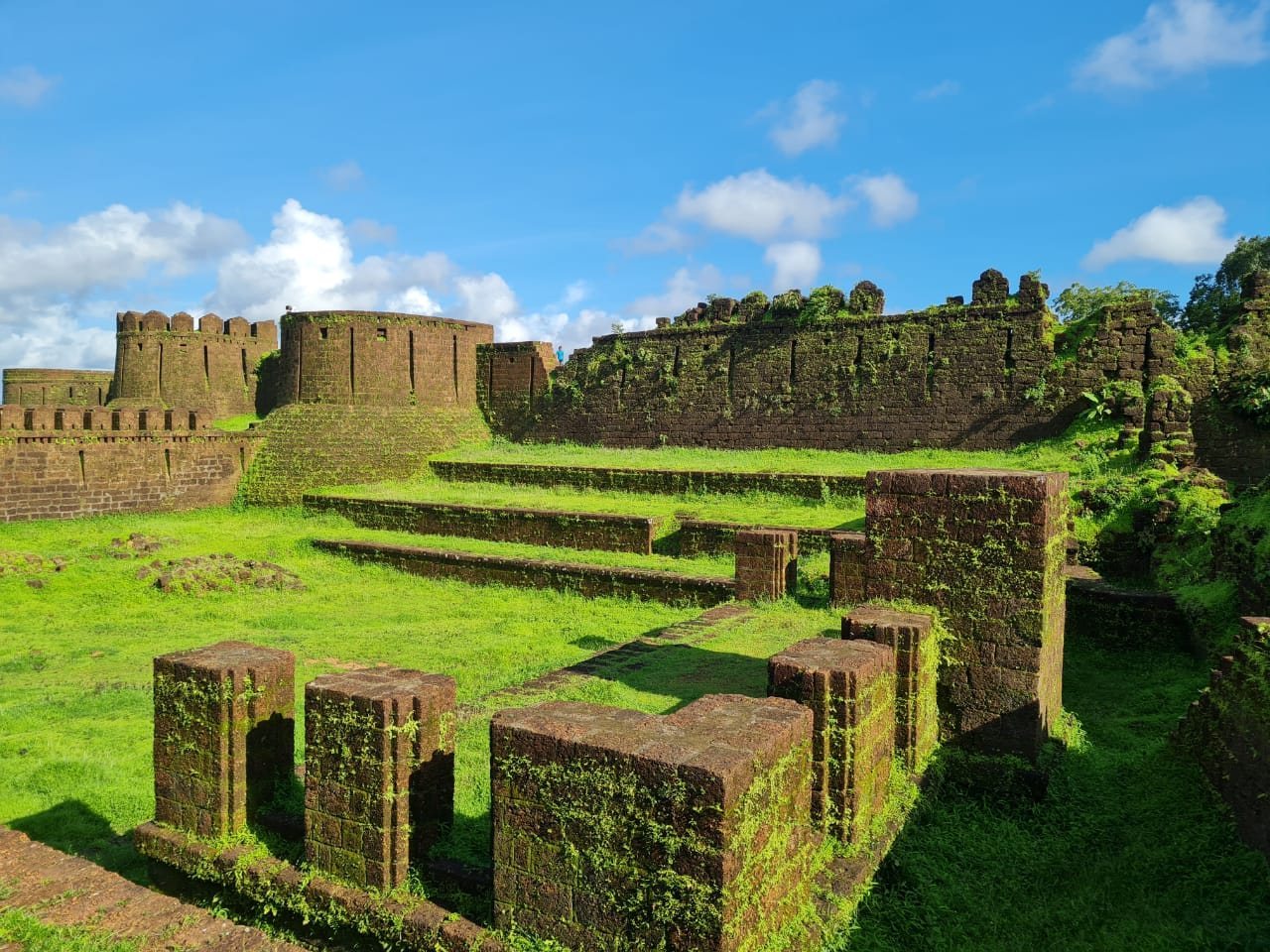
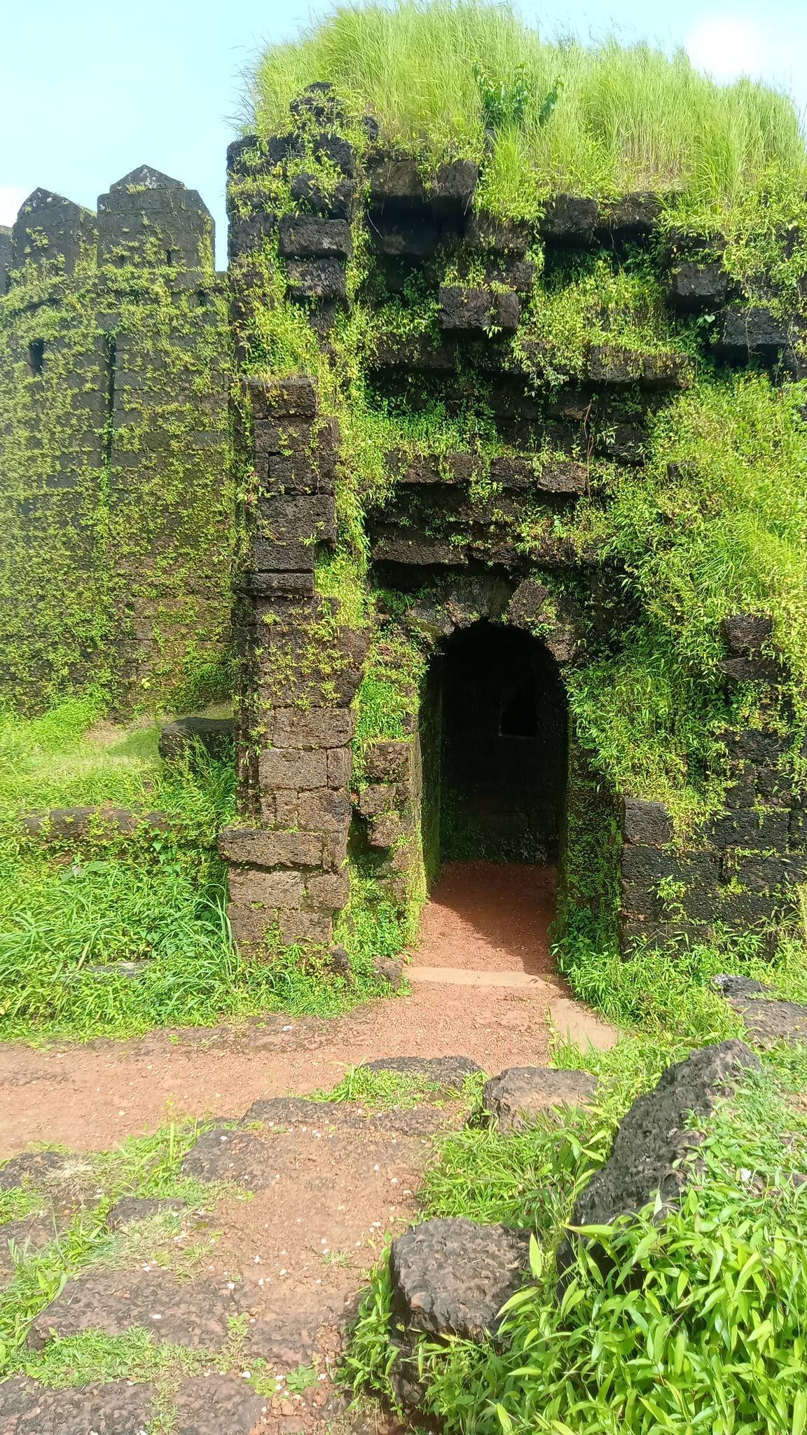
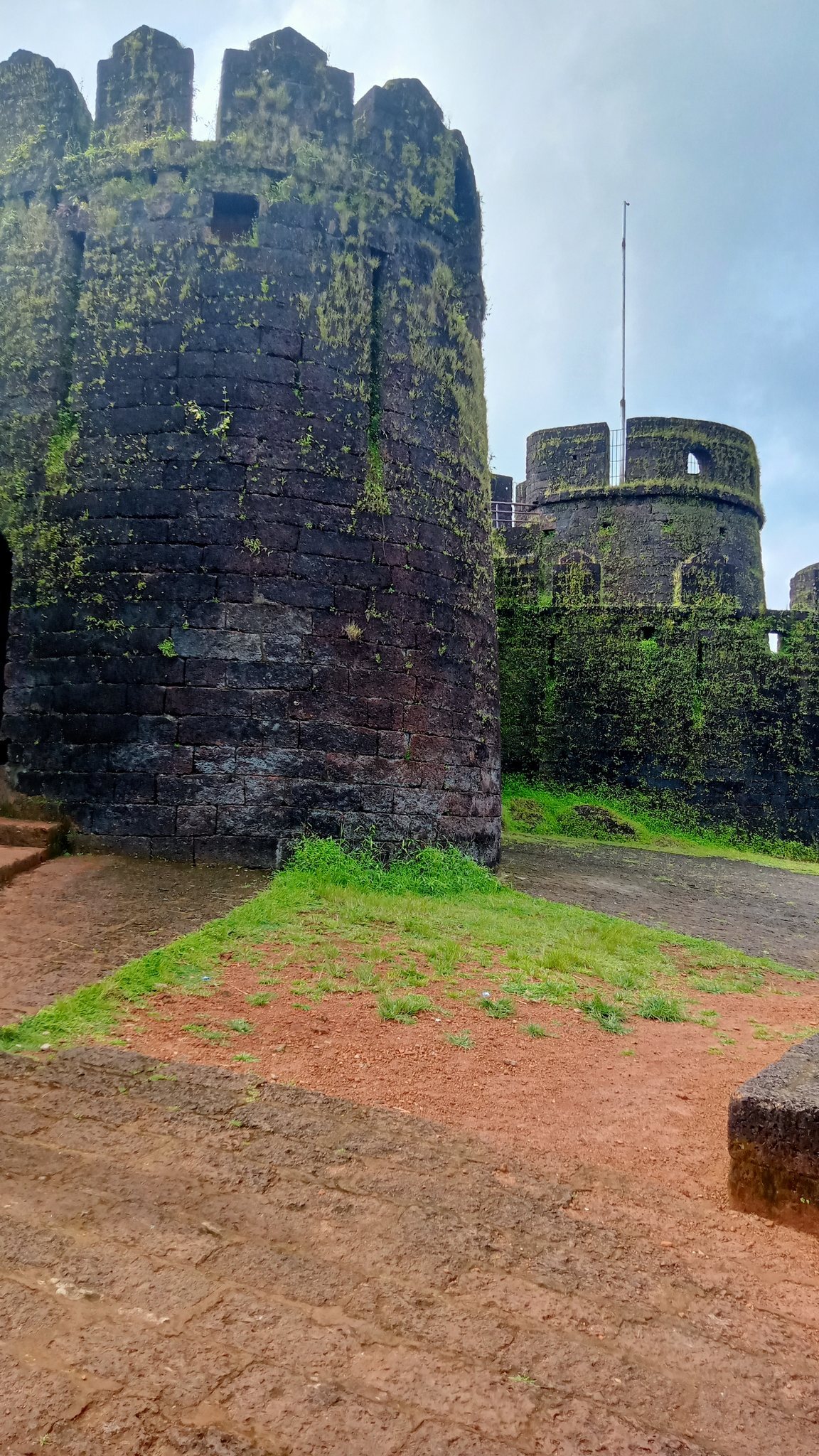
Mirjan Fort occupies about 4.1 hectares beside the Aganashini River, where the river bends into Tadri Creek. It is built mainly of laterite stone and mud. Laterite is an iron-rich tropical soil or stone that can be cut into building blocks in humid regions. High walls, bastions, turrets, and two defensive wall lines enclose the site, while a circular moat once surrounded the fort. Four entrances, consisting of one main entrance and three subsidiary entrances, are approached by broad steps leading into the enclosure.
Defensive works and water systems
Walls, bastions, and entrances
The fort’s defensive structure combines high enclosing walls with projecting bastions and high turrets set on the bastions. A bastion is a projecting fortification that strengthens a wall and allows defenders to cover approaches from different directions. The double-walled arrangement formed the principal defensive system. Restoration of the northern bastion used laterite stones found in the surrounding area, while damaged wall sections were rebuilt with dressed laterite. The joints were repointed with a material described as combination mortar.
Moat, wells, and channels
A circular moat, meaning a ditch or water-filled defensive channel around a fortification, once completely encircled the fort. Numerous wells are linked by access channels that lead towards the moat and continue to canal works beyond the fort’s limits. Excavation also revealed a water tank connected to channels, adding to the evidence for an organized water system within and around the enclosure.
Internal structures and archaeological finds
Medieval structure and court spaces
Excavations in 2000–2001 exposed a medieval U-shaped structure with a cloister around it and an adjoining circular soakage pit. Other ruined remains have been interpreted as including a secret passage, entry doors, a darbar hall, and a marketplace. A darbar hall was a formal audience or court hall used for official gatherings and receptions. Excavated structures received waterproof coatings during the restoration work, helping conserve their surviving fabric.
Coins, weapons, and imported goods
The excavated material included a gold coin minted in 1652. Its inscriptions attribute it to Conde de Sarzedas, the Portuguese viceroy identified on the coin, during the reign of Joao IV, whose rule as king of Portugal began in 1640. Other finds included cannonballs, Chinese porcelain, clay tablets with Islamic inscriptions, seven dumbbells, and 50 iron bullets.
Coins and decorated earthen pots were also attributed to the Sarpamallika dynasty. Together with the Portuguese coin, Chinese porcelain, weapons, and inscribed clay tablets, these objects form part of the archaeological evidence associated with the fort’s long history as a defended coastal settlement and port-linked centre.
Stone images
Stone images of Hindu gods and goddesses are located beneath a large tree within the fort. They form part of the surviving religious material associated with the enclosure and complement the evidence of the varied political and religious histories connected with Mirjan.