Fort Anne: A French and British Fortress in Annapolis Royal, Canada
Site at a Glance
- Rating
- 4.6
- Popularity
- Medium
- Country
- Canada
- Primary era
- Early Modern
- External website
- Open
- Eras represented
- Early Modern, Modern
- Civilizations
- British, French
- Site type
- Military
- Remains
- Fort
On this page20 sections
History
Fort Anne is a historic fortress in Annapolis Royal, Canada, whose principal form was built by the French in the early eighteenth century as a Vauban fortification. The site developed from an earlier Scottish fort established in 1629 and served as the defensive center of Port Royal, the principal settlement and administrative center of French Acadia, and later of Annapolis Royal and Nova Scotia.
Early French and Scottish settlement
Pierre Dugua, Sieur de Mons, recognized the importance of the Port Royal area in 1604. A French fortified settlement built nearby in 1605 was destroyed by a Virginia raid in 1613. French settlement continued in the area, but the fortified habitation was not rebuilt.
On 1 August 1629, Scottish settlers led by Sir William Alexander established the first fort on the present site. Named Charles Fort after Charles I, king of Scotland, the fort was completed within several weeks. Its equipment included eight artillery pieces, a magazine, and the general’s house. Charles Fort served Port Royal, which remained the capital of Acadia and later Nova Scotia for approximately 120 years.
The Treaty of Saint-Germain-en-Laye transferred Charles Fort to France in 1632. The French replaced it with a new earthwork fort by 1643. Control changed between French and English authorities several times during the seventeenth century. In 1713, after the British capture of 1710, the Treaty of Utrecht transferred Port Royal permanently to Great Britain. The town was renamed Annapolis Royal after Queen Anne.
Seventeenth-century contests for Port Royal
During the Acadian Civil War, a struggle between rival French factions in Acadia, Charles de La Tour attacked Port Royal in 1640 and 1643 but failed to take the fort. In 1654, approximately 100 New England volunteers and 200 English soldiers defeated about 130 French defenders. England then occupied Acadia for 16 years, before Port Royal returned to France under the Treaty of Breda in 1667.
The fort faced further attacks during King William’s War, an eighteenth-century conflict over control of Acadia and its fortifications. A major redesign begun in 1689 was abandoned after about two weeks. In May 1690, New England forces led by Sir William Phips captured and plundered Port Royal. Further attacks, including the burning and looting of the settlement, followed in June 1690 and 1693. The Treaty of Ryswick returned the fort to France in 1697.
The Vauban reconstruction and British conquest
Reconstruction began again in 1702 on approximately the footprint of the earlier 1689 project. The work produced a Vauban fortification, an angular system designed to provide overlapping artillery fire and reduce the vulnerability of walls to bombardment. The rebuilt fort resisted a British blockade in July 1704 and repelled attacks in June and August 1707.
During Queen Anne’s War, Major Benjamin Church blockaded Port Royal for 14 days in July 1704 without launching the expected attack. Colonel John March’s siege in June 1707 was repelled by Governor Daniel d’Auger de Subercase, and a second siege under Colonel Francis Wainwright in August lasted 11 days and also failed. On 2 October 1710, after a siege in which approximately 300 French defenders held out, the fort surrendered to a British force of 36 ships and 2,000 troops. A French attempt to recover it in 1711 failed, ending French rule in Acadia.
Eighteenth-century attacks and changing importance
During Father Rale’s War, an eighteenth-century conflict involving French, British, New England, Mi’kmaq, and Maliseet forces, Mi’kmaq and Maliseet fighters attempted to besiege Annapolis Royal in 1722. Lieutenant Governor John Doucett took 22 Mi’kmaq hostages to deter an attack. A raid in 1724 killed two soldiers, wounded four, burned houses, and carried away prisoners.
King George’s War brought four further attacks. Approximately 300 Mi’kmaq warriors led by Le Loutre attacked in July 1744. About 200 Acadians under François Dupont Duvivier attacked in September, and French and Mi’kmaq forces led by Paul Marin de la Malgue attacked in May 1745. French forces under Jean-Baptiste-Nicolas-Roch de Ramezay attacked in 1746. Every attempt failed. The 1746 siege lasted 23 days and ended when naval support expected from the Duc d’Anville expedition did not arrive.
British control lasted from 1713 to 1854. Annapolis Royal remained Nova Scotia’s capital until Halifax replaced it in 1749. In 1755, the fort’s commander directed the deportation of Acadians from the surrounding region. The fort became less important after the fall of Quebec, but it continued to defend the area against American privateers.
During the American Revolutionary War, American privateers attacked Annapolis Royal. The 84th Regiment defeated a raid on 2 October 1778. On 29 August 1781, two privateer schooners looted the undefended town and fort and took two residents hostage before releasing them. In 1780, the permanent garrison had been sent to assist British forces in South Carolina. Although attacks were possible during the War of 1812, none occurred.
End of military service and preservation
When the citadel at Halifax was completed in 1854, the British garrison was transferred there permanently, ending Fort Anne’s active military service. Britain retained ownership until 1883. Most of the remaining buildings were then destroyed or demolished, while the earthworks and several important structures continued to define the site.
The Dominion Parks Branch, predecessor of Parks Canada, acquired the fort in 1917 and initially designated it Fort Anne National Park. In 1920, it became a National Historic Site of Canada under the newly established national historic-sites program. Fort Anne is sometimes described as Canada’s first nationally administered historic site because it was the first property acquired by the federal government for national historical purposes and has remained under Parks Canada administration.
The surviving fort and its associated grounds have been protected as Fort Anne National Historic Site of Canada since 1920. The site is also associated with the oldest military building in Canada, the 1708 powder magazine, and forms part of a wider historic complex that includes the Garrison Cemetery and the Charles Fort National Historic Site. Parks Canada operates a museum in the former British officers’ quarters.
Remains
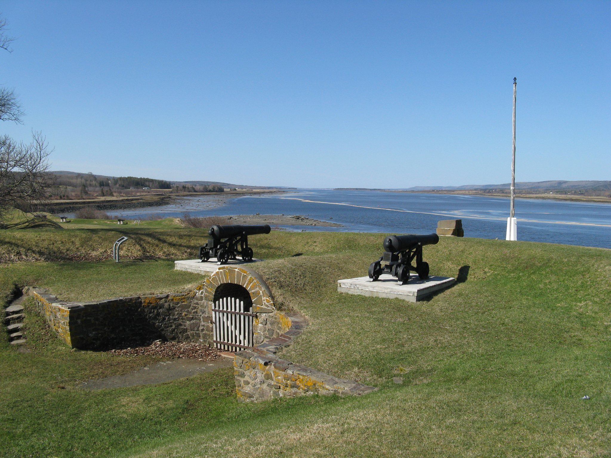
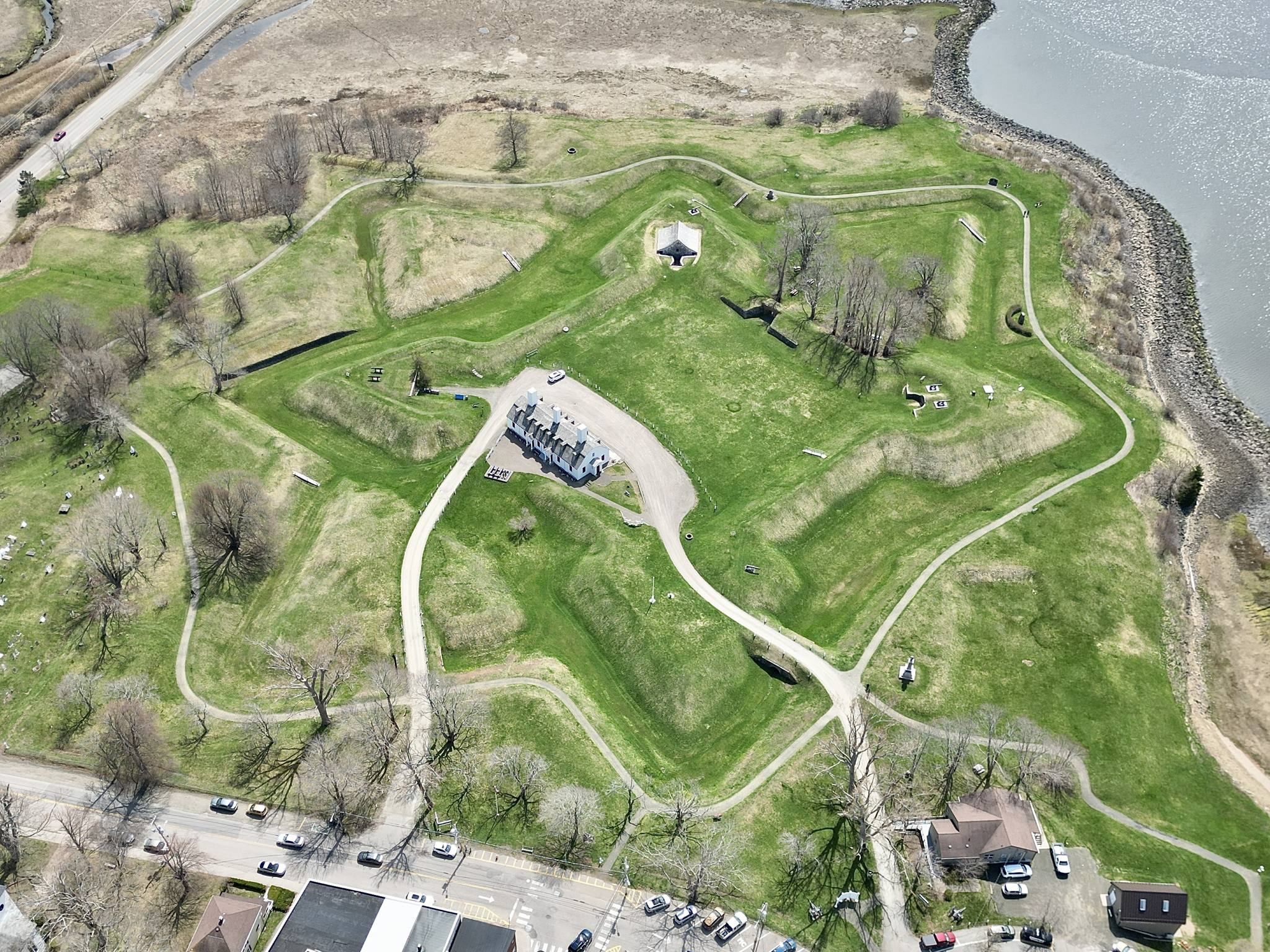
Fort Anne stands at the confluence of the Annapolis River and Allains Creek. These waterways provided natural protection, while nearby agricultural land had previously been developed by the French. Allains Creek was also associated with a traditional Mi’kmaq campsite on a canoe and portage route across southern Nova Scotia. The principal surviving layout consists of the low, star-shaped Vauban earthworks, interior military features, shoreline defenses, later British buildings, and two cemeteries.
French fortifications and interior features
Vauban earthworks
The surviving French fort has a star-shaped plan, gently sloping walls, a low profile, and extensive earthworks. Its angular defenses allowed artillery to engage attackers from different directions while reducing the effects of incoming fire. The soft earth provided mass against impacts and reduced the number of projectiles entering the defenses. The fort’s principal configuration remains largely intact from the reconstruction begun in 1702.
Powder magazine
The underground powder magazine was built in 1708 to store gunpowder and other explosive military supplies. It survives as the oldest military building in Canada and the oldest building administered by Parks Canada. Its position within the earthwork fort formed part of the defensive arrangement created during the French reconstruction.
Wells and parade square
The fort includes a well in the parade square and another in the covert way, a protected route outside the main fortifications. Together with the underground magazine and surrounding earthworks, these features preserve elements of the fort’s internal military organization and water supply.
Sally-port
A nineteenth-century sally-port, a controlled passage through a fortification, forms part of the surviving defenses. It belongs to the later phase of the fort’s military use under British control.
Shoreline defenses and later buildings
Shoreline works
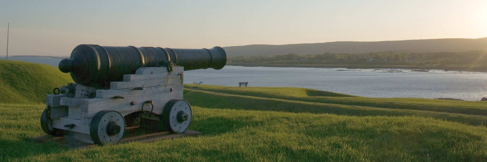
The associated shoreline defenses include cribwork dating from the 1740s, Queen’s Wharf from the same period, and a dry-stone retaining wall built in 1760. These features extended the fort’s defensive and logistical infrastructure toward the water at the junction of the Annapolis River and Allains Creek.
Officers’ quarters
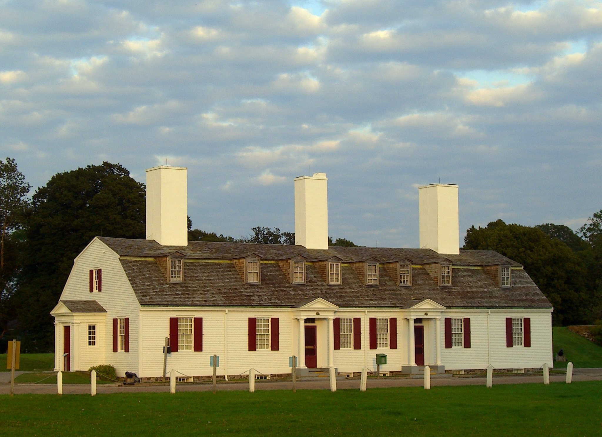
The British officers’ quarters were constructed between 1797 and 1799 on the former site of the lieutenant governor’s house and chapel. The building was reconstructed in 1935 and now contains the Fort Anne museum, whose exhibits address the fort and include historic artifacts from the surrounding area.
Later magazine and wooden tower
A magazine was built in 1790. A wooden tower was erected inside the fort in 1812 and demolished in 1882, reflecting the continued modification of the military site during the British period.
Cemeteries and earlier settlement landscape
Acadian and British cemeteries
The fort complex includes an Acadian cemetery and a British garrison cemetery. Their presence preserves evidence of the communities and military forces associated with the successive French and British periods of the site.
Former Port Royal settlement
The grounds incorporate the site of the former Port Royal settlement, including the former town windmill, the parish-church site, and properties belonging to some of Acadia’s earliest settlers. These properties were expropriated when the large French fortification project was built. The surrounding settlement and street layout were altered to accommodate the project begun in 1689.
Charles Fort site
The earlier Scottish Charles Fort lies beneath the later fort. Its former location forms part of the Charles Fort National Historic Site within the wider historic complex. The later earthworks therefore preserve the position of successive fortifications built by Scottish, French, and British authorities.