Fort Jesus Museum: A Portuguese Coastal Fortress in Mombasa, Kenya
Site at a Glance
- Rating
- 4.4
- Popularity
- High
- Country
- Kenya
- Primary era
- Early Modern
- External website
- Open
- Eras represented
- Early Modern
- Civilizations
- Omani, Portuguese
- Site type
- Military
- Remains
- Fort
On this page16 sections
History
Fort Jesus Museum occupies a Portuguese fortress in Mombasa, Kenya, built between 1593 and 1596 in the sixteenth-century Italian-style tradition of trace fortification. Constructed on Mombasa Island to protect the harbor and Portuguese possessions on the East African coast, Fort Jesus became a major military and commercial center before passing through Portuguese, Omani, British, and Kenyan phases of use.
Portuguese foundation
Portuguese attacks on Mombasa in 1505 and 1528, followed by Kamba incursions and Ottoman raids in 1585 and 1589, demonstrated the need for a stronger coastal defense. In 1591, the king of Portugal authorized a fort on Mombasa Island. Construction began on 11 April 1593 under Giovanni Battista Cairato, an Italian military architect working for the Portuguese Estado da Índia, the administration and military-commercial system that governed Portuguese interests in the Indian Ocean.
The name Jesus reflected the Portuguese fleet’s association with the Order of Christ, a Portuguese military-religious order that succeeded the Templars in Portugal and supported Portuguese maritime expansion. The fort was initially linked to the Portuguese crown under Philip II of Spain, who was also Philip I of Portugal. Its foundation inscription names Mathias d’Albuquerque, viceroy of Portuguese India; Captain Mathieu Mendes de Vasconcellos; Cairato, identified as chief architect of India; and Gaspar Rodrigues, the master builder.
In 1594, a Portuguese trading post was established at Mombasa, which became the most important Portuguese commercial center on this part of the coast. Mendes de Vasconcellos made Mombasa his residence rather than Malindi, further strengthening the settlement’s role in Portuguese coastal administration and trade.
Sieges and changing rule
Fort Jesus remained under Portuguese control until 15 August 1631, when the sultan of Mombasa, Muhammad Yusuf, launched a surprise attack. The garrison and much of the Portuguese population were massacred, including 45 men, 35 women, and 70 children. A Portuguese expedition besieged the fort from 10 January to 19 March 1632, but the attempt was abandoned. Muhammad Yusuf left Mombasa on 16 May 1632 to become a pirate, and Portuguese forces under Captain Pedro Rodrigues Botelho reoccupied the fort on 5 August. Portuguese control continued until December 1698.
Major alterations followed under Governor Francisco de Seixas Cabreira in 1635 and Governor Antonio da Silva de Menezes in 1648. Omani forces attacked Mombasa in February 1661 without assaulting the fort, but a later Omani expedition began a siege on 13 March 1696. Portuguese frigates attempted to break the blockade in September and October 1697, yet both efforts failed. Fort Jesus fell on 13 December 1698, when its garrison had been reduced to a captain, nine soldiers, and a priest. The conquest brought the Zanguebar coast under the rule of the sultans of Oman, whose state expanded its authority along the Swahili coast during the late seventeenth and eighteenth centuries.
Portuguese forces briefly recovered the fort from 16 March 1728 until 26 November 1729 after a garrison mutiny. Omani rule was then restored, with administration by the governor of Mombasa during periods between 1741 and 1747 and between 1747 and 1828. A governor of Mombasa administered the fort from 1828 to 1837. Oman controlled it from 1837 to 1856, followed by the Sultanate of Zanzibar from 1856 to 1895. The Sultanate of Zanzibar was a later Omani-ruled state centered on Zanzibar that controlled Mombasa before the British takeover.
British and Kenyan periods
Britain took possession of Fort Jesus on 1 July 1895, when the British East Africa Protectorate was proclaimed. The fort was used as a prison until 1935 and also served as barracks during the later nineteenth-century period of changing control. During the period of Ottoman dominance, the vaulted passage beneath the cavalier was used to transfer enslaved people to ships. From 1895, the same passage served as an entrance for prisoners sentenced by British authorities.
British authorities protected Fort Jesus, Fort Santo Joseph, and the connecting underground passage in 1929. Fort Jesus became an ancient monument in 1935 and a Kenyan national monument in 1969, together with its surrounding protected area. The fort, moat, and immediate surroundings were added to the UNESCO World Heritage List in 2011 as a cultural property. UNESCO World Heritage status places sites judged to possess outstanding universal value within an international heritage-protection framework.
The fort became a national park in 1958 and a museum open to the public in 1962. The museum building was constructed between 1960 and 1962 with support from the Calouste Gulbenkian Foundation, replacing part of the former British prison cells. Since Kenyan independence on 12 December 1963, the National Museums of Kenya has administered the museum. A malacology unit of Nairobi’s Institute of Primate Research has also been based at the fort to study the health of mollusks collected around Mombasa.
Remains
Fortress layout and construction
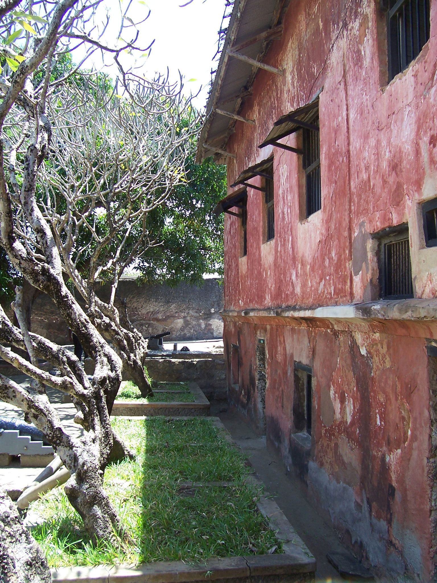
Fort Jesus stands on a coral ridge on the eastern side of Mombasa Island beside the harbor. Its rectangular plan extends approximately 130 by 99 meters and covers about 2.36 hectares. The arrangement was designed so that a small force could defend the position while concealing the limited size of the garrison from an attacker. The fort comprises an elevated cavalier, which served as a keep, a fortified esplanade on the northeast sea-facing side, and four bastions: Santo Felipe, Santo Alberto, Santo Mathias, and Santo Mateus. The design was associated with Renaissance ideas based on human proportions, with the cavalier and bastions compared to a head, arms, and legs when viewed from above.
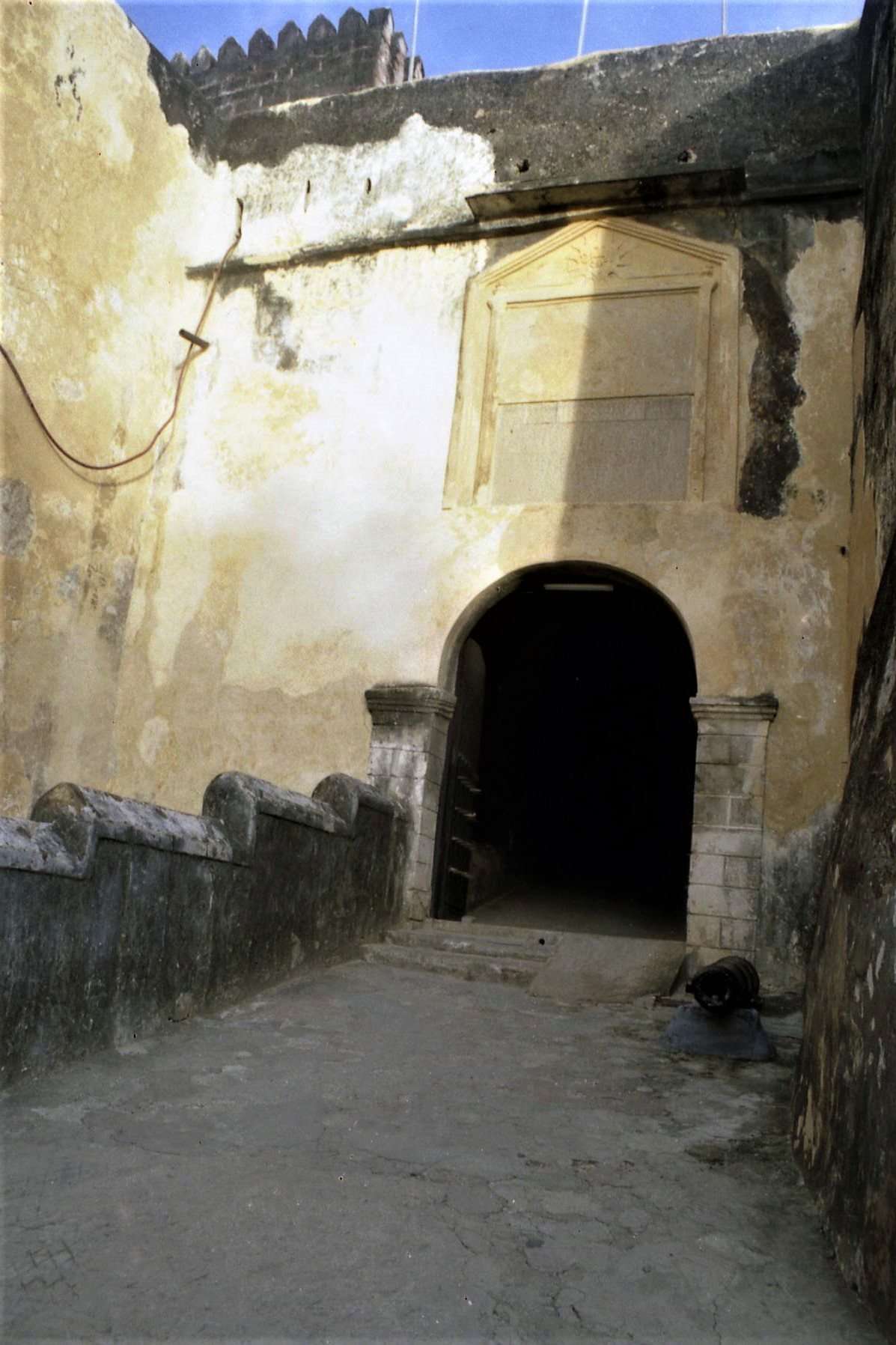
The main entrance lies on the northwest side under the protection of the Santo Mathias bastion. Beneath the cavalier, the Passage of the Arches forms a vaulted route leading to the esplanade. The fort was built from local fossilized coral bonded with lime mortar. Its walls rose about 15 meters and were later raised by a further three meters after Muslim control began. Restoration has used materials corresponding to those employed in the original construction. The landward moat has been filled in, while the walls and towers remain in good condition and much of the original architecture survives.
Interior structures
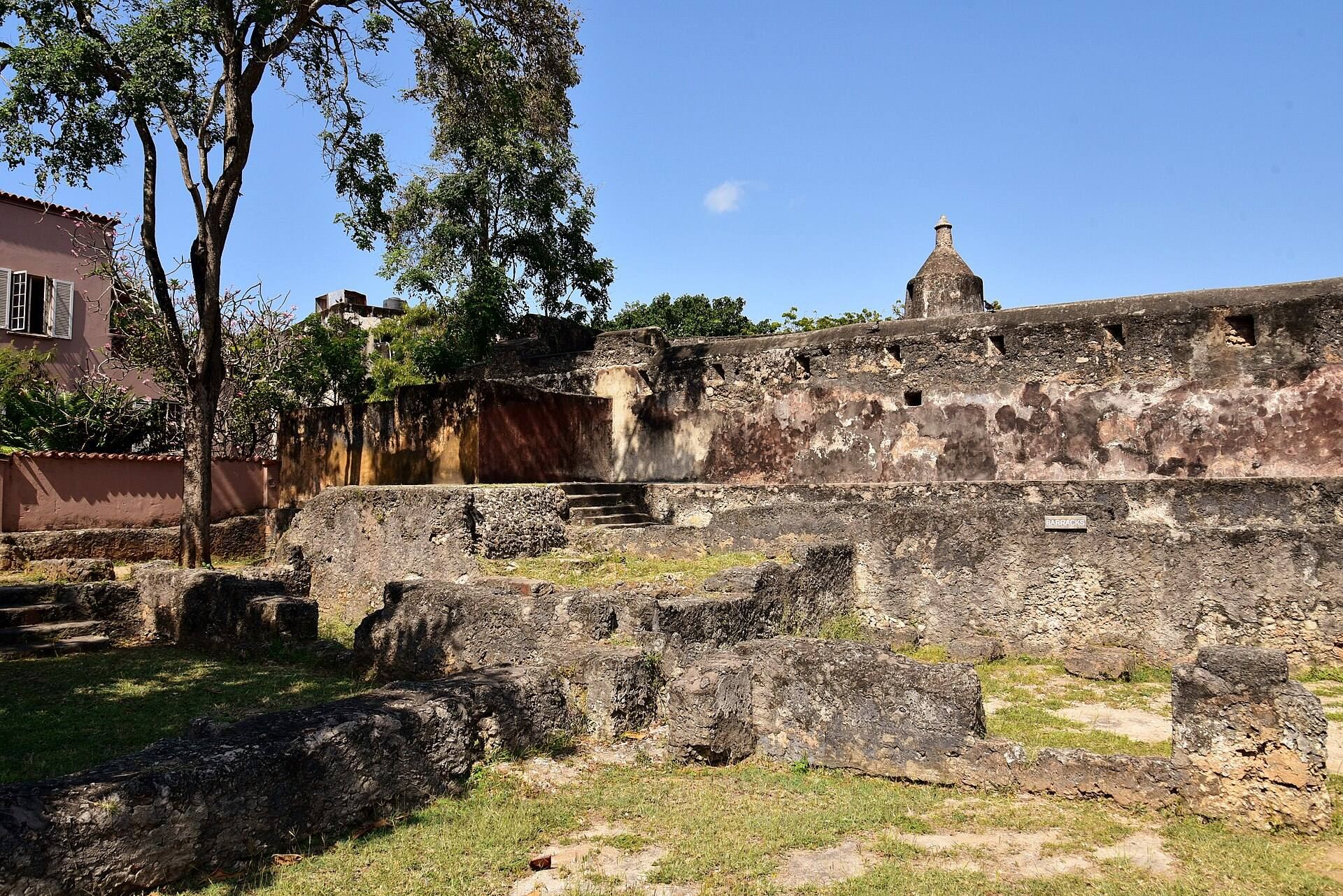
Portuguese chapel
After the Muslim conquest at the end of the seventeenth century, the church was destroyed and a 23-meter-deep well was dug to collect seawater for washing. The ruins of the Portuguese chapel remain in the interior courtyard and are among the better-preserved structures within the fort.
British barracks and museum
The central museum building occupies a more recent structure that formerly served as barracks for the British garrison. Its construction between 1960 and 1962 replaced part of the former British prison cells. A 1990 restoration revealed the undisturbed grave of a Portuguese soldier within one of the walls.
Passage of the Arches
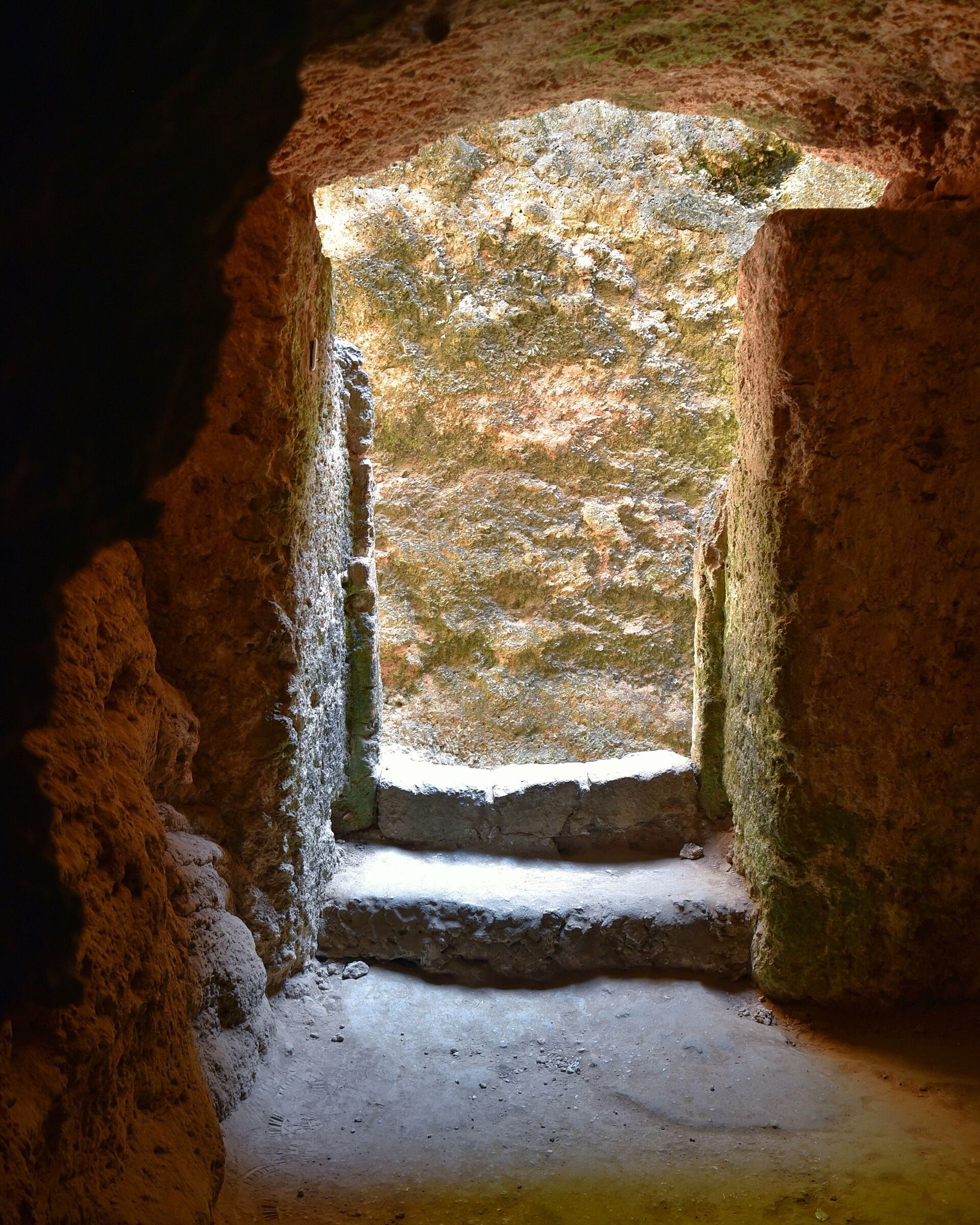
The vaulted Passage of the Arches runs beneath the cavalier between the entrance area and the esplanade. Its later uses reflect the fort’s changing political history. It served in the transfer of enslaved people to ships during the period of Ottoman dominance and became an entrance for prisoners under British authority from 1895.
Inscriptions, graffiti, and collections
The main entrance carries a partially legible Portuguese inscription naming the fortress as Jesus of Mombasa and giving its foundation date as 11 April 1593. It also identifies the viceroy, captain, architect, and master builder involved in the work. Two further inscriptions record renovations and alterations undertaken in 1635 and 1648. A courtyard inscription records Commissioner A. H. Hardinge’s proclamation of the British East Africa Protectorate on 1 July 1895.
Seventeenth-century charcoal graffiti on the platform of the Santo Mateus bastion depict battle scenes and everyday life as represented by Portuguese soldiers. The graffiti were removed from the bastion and are displayed in a museum room. The collections also include ceramics from Africa and India, Chinese porcelain, jars, and other objects associated with the crew of the Portuguese frigate Santo António de Tanna. Other displays contain Arab military equipment, musical instruments, eighteenth- and nineteenth-century naval cannon, and a 105-millimeter cannon from the Imperial German light cruiser SMS Königsberg.
The frigate Santo António de Tanna sank offshore on 20 October 1697. Material from the vessel forms part of the museum’s collections, while the wreck itself was separately designated a national monument in 1977. Cycads with palm-like leaves grow on the northwest glacis, the sloping ground outside a fortification. Some are more than 300 years old and are approximately as old as the fort.
Associated Portuguese defenses
Makupa forts
The Portuguese defensive system around Mombasa included the Makupa forts, each measuring about 15 by 15 meters and containing two towers. Positioned about 120 meters from the main fort, they defended the narrow sandy isthmus linking Mombasa Island to the mainland. The forts were destroyed between 1900 and 1920, and their foundations were found in July 2006.
Fort Santo Joseph
Fort Santo Joseph, also called Nossa Senhora das Mercês, was a horseshoe-shaped fortification about 100 meters from the ruins of the Portuguese Nossa Senhora das Mercês chapel.
Golf Course Fort
The Golf Course Fort, or Kaberas, stood on the grounds of the present Mombasa Golf Club. It was also associated with an Ottoman vessel named Kaberas that bombarded the fortification.
Horse Shoe Fort and Fort of the Anchorage
The very small Horse Shoe Fort survives in well-preserved condition. The Fort of the Anchorage, also called the Round Fort or Hexagonal Fort, has completely disappeared.