Daulatabad Fort: A Medieval Fortified Capital and Hill Fortress
Site at a Glance
- Rating
- 4.5
- Popularity
- Very High
- Country
- India
- Primary era
- Medieval
- External website
- Open
- Eras represented
- Medieval, Early Modern
- Civilizations
- Deccan Sultanates, Delhi Sultanate, Mughal
- Site type
- Military
- Remains
- Citadel
On this page19 sections
History
Daulatabad Fort is a fortified hill city in India, beside the former city of Devagiri in Maharashtra. Occupied since at least 100 BC, the site developed beside an upland settlement that emerged by about the sixth century along caravan routes toward western and southern India. Its surviving form reflects successive construction under the Yadavas, Tughluqs, Bahmanis, Ahmadnagar Nizam Shahis, Mughals, and Marathas.
Early settlement and the Yadava capital
A Jain cave temple at the foot of the hill was enlarged repeatedly and probably remained in use until the eighth or ninth century. During the eighth century, the region came under the Rashtrakuta dynasty. The Rashtrakutas may also have worked on Devagiri hill, although this attribution is uncertain.
In about 1187, Bhillama V, a Seuna ruler also known as a Yadava monarch, established his capital at Devagiri after breaking with the Chalukyas. The Yadavas governed the city until it entered the political sphere of the Delhi Sultanate. Their rule also shaped the hill’s defensive character, including the cutting back of its lower slopes to create steep rock faces.
Delhi Sultanate and the name Daulatabad
Alauddin Khalji, a sultan of the Delhi Sultanate, raided Devagiri in 1296. A second expedition in 1308 made the Yadava ruler Ramachandra a vassal of Delhi, and the city was annexed to the sultanate that year.
In 1327, Sultan Muhammad bin Tughluq renamed Devagiri Daulatabad and ordered the imperial capital to be transferred from Delhi. The proposed strategic reasoning was that Daulatabad lay relatively centrally within the sultanate and offered greater security from attacks approaching from the northwest. The policy included the mass migration of Delhi’s population, but it failed in part because Daulatabad was arid and dry. The capital returned to Delhi in 1334.
Bahmani, Ahmadnagar, Mughal, and Maratha rule
Daulatabad later became part of the Ahmadnagar Sultanate in 1499 and served as its secondary capital until 1636. In 1610, Malik Ambar, an Ethiopian military leader and Ahmadnagar minister, founded the nearby city of Khadki as the sultanate’s capital. Most of the fortifications visible today were built or altered under the Bahmani and Ahmadnagar sultanates.
Under Bahmani rule, Hasan Gangu, also called Ala-ud-Din Bahman Shah, built the Chand Minar around 1350 to commemorate the capture of Daulatabad. The monumental tower was designed as a copy of Delhi’s Qutb Minar, with Iranian architects employed for its construction.
A Mughal governor of the Deccan serving Shah Jahan captured the fortress in 1632–33 and imprisoned an Ahmadnagar prince. Mughal rule brought additional construction and converted the Chini Mahal into a prison. Abul Hasan Qutb Shah of Golconda was reputedly held there. The Maratha Empire captured Daulatabad in 1760.
Decline and heritage status
As military technology changed, particularly after cannon came into wider use, the fortifications became increasingly marginal. The fortress was eventually abandoned, and the former capital city became largely unoccupied, surviving mainly as a village. Daulatabad Fort is recognized in India as a monument of national importance.
Remains
Hilltop and defensive zones
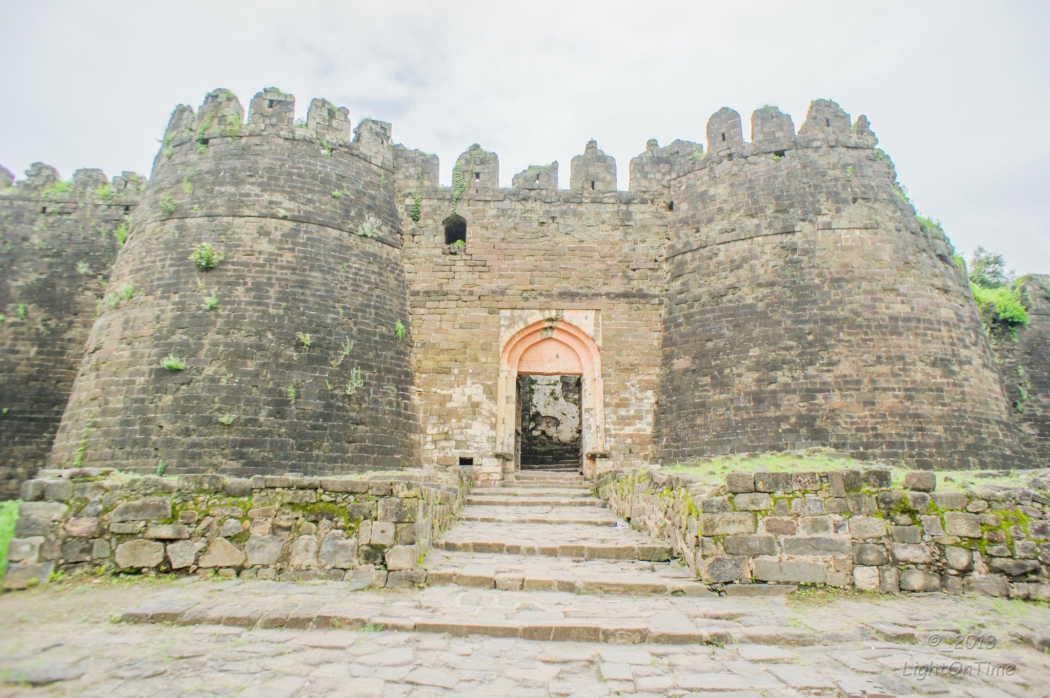
The fortified city occupies a conical hill rising about 200 metres above the surrounding land. The summit reaches approximately 800 metres above sea level, while the plain at the foot lies at about 600 metres. The fortress has a triangular historical plan divided into three defensive zones: Balakot, the innermost fortification on the hill; Kataka, the intermediate enclosure; and Ambarkot, the outer defense surrounding most of the historic city.
The hill itself forms the core of the defensive system. Much of the lower slope was cut into near-vertical faces about 50 metres high, and a moat surrounds the base of Balakot. Further walls extend around the hill and the city, while stairs and passageways were cut directly into the rock. Some of these routes are tunnel-like and readily defensible.
Inner and intermediate fortifications
Balakot
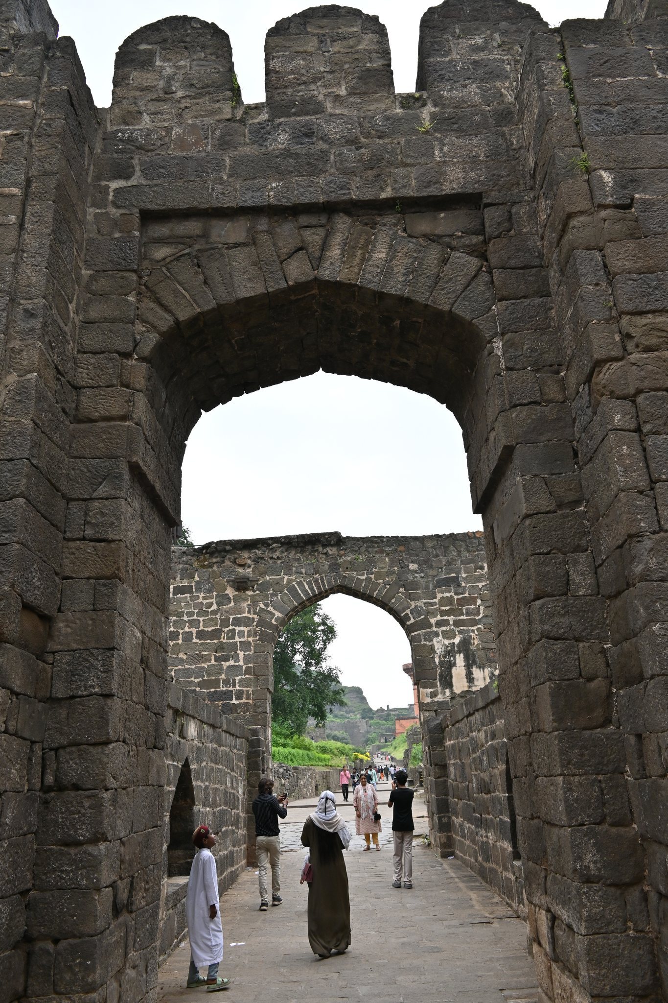
Balakot is the summit fortress, surrounded at its base by a deep moat. Access was restricted to a narrow bridge that allowed no more than two people to pass abreast, followed by a long gallery excavated into the rock. The gallery rises gradually for most of its length, with steep stairs approximately midway. A grating over the upper part of the stairs was intended to act as the hearth for a large fire maintained by the garrison during wartime.
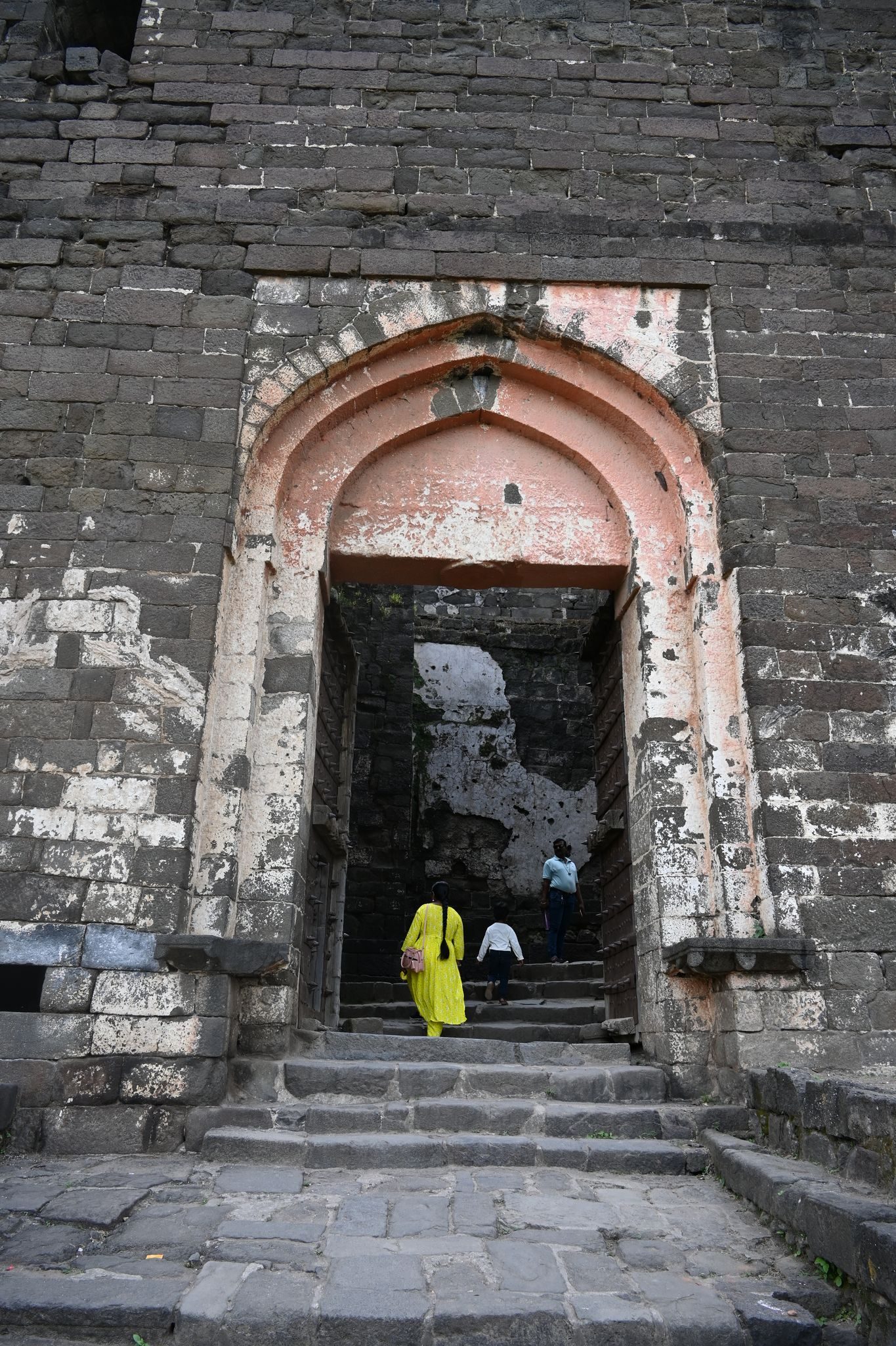
The approach was designed to confuse and delay attackers. It includes a cave entrance, curved walls, false doors, irregular entryways, and a single combined entrance and exit. The gates were not set in parallel, with false gates on the left contrasting with the actual gates on the right. The arrangement was intended to break an invading force’s momentum and draw soldiers into traps. Spikes on the gates were designed to injure war elephants used as battering rams before the introduction of gunpowder.
Kataka
Kataka is a circular intermediate fortification occupying the northern and eastern flanks of the hill. Built as an expansion of Balakot, it has a massive double defensive rampart with bastions, which are projecting structures built into or attached to a defensive wall, and moats. A Mughal-period hammam, or bathhouse, stands just outside its eastern entrance.
Ambarkot
Ambarkot is the outermost enclosure and surrounds most of the historic city. Its elliptical plan extends about two kilometres from north to south, and, like Kataka, it has two defensive walls. The rampart is commonly attributed to Malik Ambar, although it may instead have been built by the Tughluqs. Several historic structures around its walls remain uninvestigated.
Palaces and residential remains
Bahmani and Mughal residences
Balakot contains palatial and residential remains, including a ruined Bahmani royal residence dating from the fifteenth century. Beneath the northern flank is a Mughal palace attributed to Shah Jahan, the Mughal emperor whose reign lasted from 1628 to 1658. The palace consists of two large courts, a western apartment building, and a bathhouse. Another pavilion attributed to Shah Jahan stands below the summit.
Chini Mahal
The Chini Mahal is a palace of the Nizam Shahi period, when the Ahmadnagar Sultanate was ruled by the Nizam Shahis. Its builder is not securely identified, and it may belong to the dynasty’s early phase. The name comes from blue and white tiles set into its facade. The structure now survives in a crumbling condition as a long hall with an entrance on one side. It may originally have been larger before its destruction and conversion into a prison.
Religious and commemorative structures
Jami mosque
The Jami mosque stands within Kataka and dates to 1318. Its construction may have incorporated spolia, meaning reused architectural elements taken from earlier buildings, although that interpretation is uncertain.
Chand Minar
The Chand Minar stands in the Mahakot sector, a short distance from the Jami mosque. A minar is a monumental tower often associated with Islamic religious or commemorative architecture. The tower is exceptionally tall, and its exterior was colored with lapis lazuli and red ocher. A small structure containing a mosque conceals its base.
Jain and Hindu remains
Hindu and Jain temple remains occur across the site. Cave 32 contains niches carved with figures of Jain Tirthankaras, revered spiritual teachers in Jainism. These caves, together with the early Jain temple at the foot of the hill, form part of the religious remains preserved within the fort’s long sequence of construction.
Layers of construction
The fort occupies the entire rocky hill, whose flanks were cut into steep faces and supplemented by a moat. Additional defensive walls stand at the foot of the hill. Across the fortress and former city, surviving fabric represents approximately a thousand years of successive construction and alteration, incorporating Yadava, Tughluq, Bahmani, Ahmadnagar, and Mughal-period work.