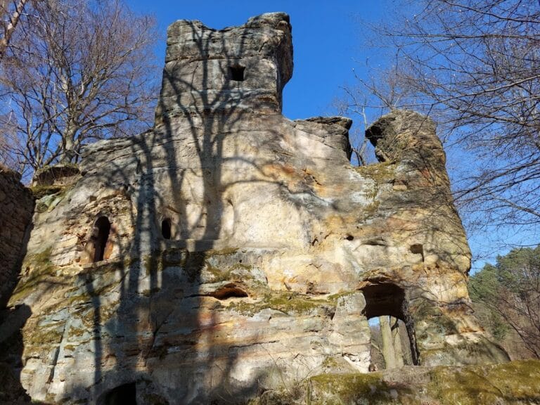
Stohánek: A Historic Rock Castle in the Czech Republic


Visitor Information
Google Rating: 4.8
Popularity: Low
Google Maps: View on Google Maps
Official Website: turistickamapa.cz
Country: Czechia
Civilization: Medieval European
Remains: Military

History
Stohánek is a rock castle located within the municipality of Ralsko-Mimoň in the Czech Republic. It was built during the early 15th century by the Bohemian nobility, specifically the family of Vartenberk.
The castle’s foundation took place between 1427 and 1431 when Beneš (also known as Benedikt) of Vartenberk established Stohánek on lands newly separated from the nearby Děvín estate following his father Petr of Vartenberk’s death. Originally, Stohánek functioned as a modest fortress or outpost connected to the Děvín domain. The castle likely depended on economic support from neighboring villages such as Svébořice, Ploužnice, and Ostrov, suggesting its role in local administration or defense. The earliest written mention of Stohánek appears in records dating from 1431.
In 1440, the estate was reintegrated into the Děvín holdings, although Stohánek probably continued to operate as a distinct administrative unit within the estate. Amid the turbulent times, local tradition associates the castle’s destruction with the 1444 military campaign of the Lusatian Six-City Alliance, an alliance of towns from present-day Germany, into Bohemia. However, there is no direct documentary proof of this event. The last reliable record mentioning Stohánek dates to 1453, naming Janš of Stohánek, who was likely a vassal serving Jan of Vartenberk. By 1544, the castle had vanished from estate inventories, indicating it had been abandoned and fallen out of use sometime during the latter half of the 15th century.
Several centuries later, between 1760 and 1773, the ruins were repurposed as a hermitage. The first resident hermit constructed a wooden dwelling and carved sixteen small niches for paintings depicting the Stations of the Cross along the stairway leading up the rock. In 1768, Johann Wenzel Steinfelder, who took the religious name Brother Jeroným, succeeded the initial hermit but departed after five years due to conduct deemed immoral. Following his departure, the hermitage was dismantled, and the timber salvaged for use in a local house.
During the 19th century, the ruined rock gained literary recognition through the work of Karolina Světlá. In her story “Poslední poustevnice” (“The Last Female Hermit”), she referred to the rock as “Strouhánek,” a name adapted from the German “Strohanke,” reflecting the region’s multilingual heritage.
In the 20th century, the area around Stohánek became part of a military training ground from 1946 until 1991. Soviet soldiers stationed there left visible Cyrillic inscriptions on the rock face. Since 1995, the rock and the surrounding half hectare have been legally protected as a natural monument, ensuring the preservation of its historical and natural character.
Remains
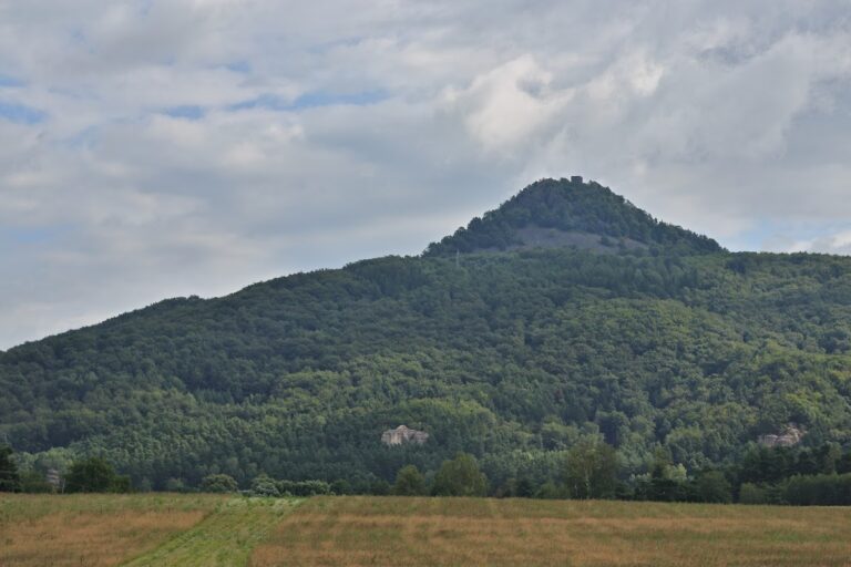
Stohánek is a sandstone rock rising approximately 23 to 25 meters above the surrounding terrain. The fortress built upon it showed no surviving traces of stone or mortar construction, indicating that buildings were primarily wooden. The overall layout consists of a base with a forecourt area and a summit plateau accessible by means of a natural rock fissure.
At the bottom of the rock, there is clear evidence of a forecourt where activities likely took place before ascending. This is demonstrated by a carved niche on the northern side and an eleven-meter-long hollowed space on the eastern flank. These features suggest deliberate shaping of the rock to serve practical needs at ground level, perhaps for storage or shelter.
Access to the summit was originally gained through a fissure in the rock starting about four meters above the ground, which was secured by doors. Physical remains of these defense measures include a carved pocket where a wooden lintel would have rested and a slot designed to hold a bar or bolt, effectively allowing the gate to be locked.
The summit plateau preserves several altered spaces, the most substantial being a rectangular chamber that was used as a chapel during the 18th-century hermitage period. While this chamber was modified in that era, it may have medieval origins linked to the castle’s original occupation. Other carved rooms and a cistern remain, indicating facilities for water storage and shelter within the wooden castle complex.
Archaeological surface finds from the rock and its vicinity include ceramic shards dated between the late 14th and mid-15th centuries, aligning with the documented timeframe of the castle’s use. Some of these ceramic fragments are now curated in the museum in Česká Lípa.
From the 20th century occupation by Soviet troops, Cyrillic inscriptions etched into the sandstone survive to this day. These marks provide a modern historical layer to the site, illustrating its military significance well beyond the medieval period.
Today, the rock is accessible by a hiking trail marked in green that runs from Hamr na Jezeře to the nearby Malý Jelení vrch, connecting further to a red trail leading to Stráž pod Ralskem. A service road with cycle path number 3046 passes along the rock’s eastern base, integrating the site within the local landscape and transportation routes.
Nearby sites