Burg Mark: A Medieval Castle Site in Hamm, Germany


Visitor Information
Google Rating: 4.5
Popularity: Very Low
Google Maps: View on Google Maps
Country: Germany
Civilization: Unclassified
Remains: Military

History
Burg Mark is a medieval castle site located in Mark, now part of the city of Hamm in Germany. It was built by the Counts of Berg-Altena, a noble family active in the region during the late 12th and early 13th centuries.
The origins of Burg Mark can be traced back to the late 1100s, when Friedrich von Berg-Altena acquired the Oberhof Mark estate, likely with permission from Archbishop Philipp I of Cologne. The archbishop had purchased this estate from Rabodo von der Mark around 1169. Soon after, around the year 1200, Friedrich or his son Adolf I von der Mark probably initiated construction of the castle. Adolf I was notable for being the first to use the title “Count of the Mark” from 1202, firmly tying the site to his family’s identity.
Throughout the 13th and 14th centuries, Burg Mark functioned as the main residence of the Counts of the Mark. It played a role in regional political struggles, including disputes over the inheritance of the Altena line and conflicts with neighboring noble houses. The castle was also connected to the founding of the nearby city of Hamm in 1226 by Adolf I, which indicates the strategic and administrative importance of the site during this period.
After 1391, with the merger of the County of the Mark and the County of Cleves, the counts moved their primary residence to the Lower Rhine region. Consequently, Burg Mark’s prominence declined, and in the centuries that followed it passed through various owners, including pledgeholders and ruling families such as the Dukes of Cleves and later Brandenburg after 1609.
By the 17th century, parts of the castle were repurposed, notably serving as a prison in 1616. The turmoil of the Thirty Years’ War (1618–1648) further harmed the site through military occupation and looting. The castle’s condition deteriorated significantly by the late 1500s, and much of its remaining stonework was dismantled in 1772 to supply building materials for barracks in Hamm. These events marked the end of Burg Mark as a functioning stronghold.
In the 20th century, archaeological efforts began to uncover and study the site, first in the 1930s and then more extensively in the 1970s. These investigations revealed the castle’s foundational remains and its layout, confirming the loss of most original structures. Since 1990, the location has been officially protected as an archaeological monument, preserving its historical footprint within a public park.
Remains
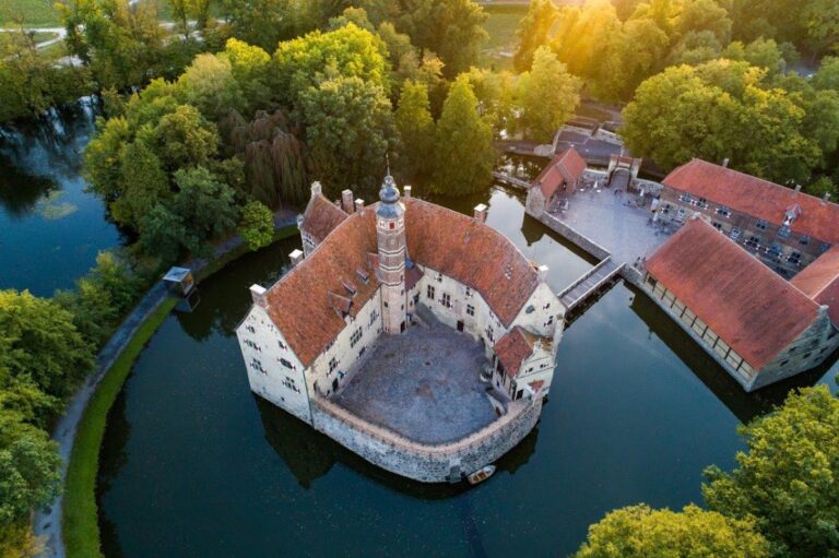
The site of Burg Mark features the remains of a large medieval motte-and-bailey castle, a type of fortification characterized by a raised earth mound or motte topped by a fortified enclosure, accompanied by an outer courtyard known as a bailey. This castle stretched roughly 200 meters in length, combining a circular motte with an outer bailey in an irregular oval shape.
The motte, measuring about 50 to 60 meters across and rising approximately seven meters above the landscape, contained a stone curtain wall between 1.5 and 2 meters thick. This ring-shaped wall enclosed buildings built up against it, with the most prominent being a two-story palas or residential hall situated on the southwest side. The palas measured around 18 by 10 meters and included a vaulted cellar beneath. Access between the floors was provided by wooden staircases and galleries on the exterior walls.
On the eastern side of the motte stood the gatehouse tower, serving as the main entrance. It was roughly 12 by 9.5 meters and was protected by a drawbridge. Another drawbridge guarded the entrance to the outer bailey, which was surrounded by earthworks and a moat (known locally as a Gräfte). Access to the bailey came via a causeway about 200 meters long, crossing the moat with the help of wooden bridges.
Inside the bailey, several buildings supported the castle’s economic functions. A large brick long stable measuring approximately 31 by 7.5 meters provided shelter for horses. Nearby was a chapel dedicated to St. Anthony, a stone structure about 15 by 7.3 meters in size and 24 feet high. Other buildings included tenant houses, barns, and additional stables essential for daily operations.
The castle’s defensive system relied on multiple moats and earthworks connected by ditches fed by the adjacent Ahse and Geithe rivers. These water features enhanced the site’s protection without relying solely on walls.
Materials used for construction varied over time; foundational walls incorporated green marl and limestone rubble mixed with lime mortar, while red and yellow bricks appeared in later construction phases and repairs. The roofs were made of slate and curved tiles known as monk and nun tiles.
Archaeological excavations in the 20th century revealed much about Burg Mark’s layout. Foundation trenches, the vaulted cellar entrance of the palas, and the remains of the curtain wall and gate tower were uncovered. The moat between the motte and bailey was partially re-excavated in 1975, uncovering remnants of a wooden bridge supported by oak piles resting on a stone pier.
Numerous objects from the castle’s active period were discovered on site. These included fragments of local and imported pottery, notably Siegburg stoneware from the 13th to 15th centuries, metal items such as a 13th-century bronze spur, iron arrowheads, and crossbow bolt tips. Architectural fragments found included pieces of a sandstone window mullion and a carved stone likely used as a mortar.
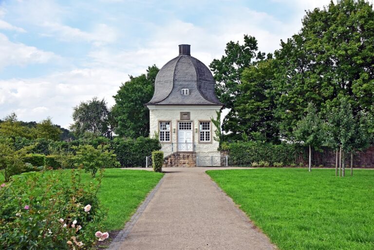
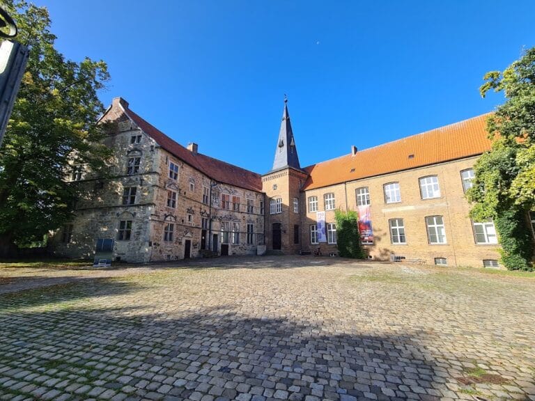
Today, the site preserves its earthworks and foundation remnants within a landscaped park. The outlines of major buildings such as the palas have been marked on the ground to indicate their former positions. Visitors can also see a historic well shaft on the bailey and use the wooden footbridge and stairs that lead to the top of the motte. Although the castle’s stone structures were largely removed in the 18th century, these features represent the largest and best-preserved motte in the region of Westphalia.
Nearby sites